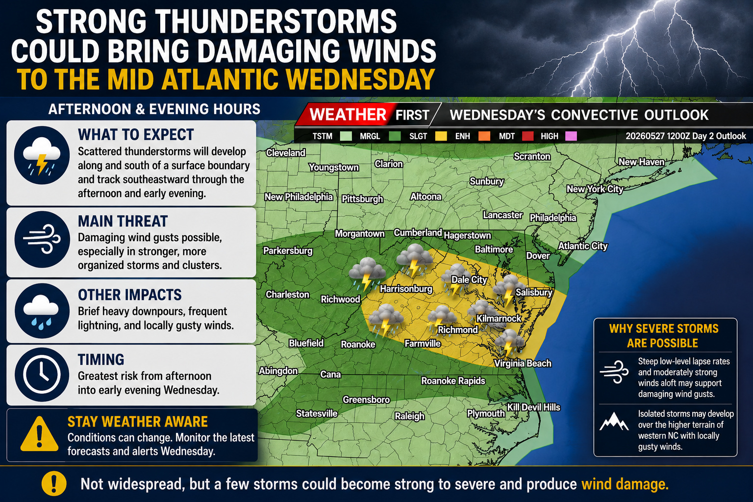

A threat for strong to locally severe thunderstorms is expected to develop across portions of the Mid Atlantic on Wednesday as a potent upper level disturbance tracks across the northeastern United States.
According to the latest forecast discussion from the Storm Prediction Center, a strong shortwave trough moving southeast across Ontario and into the Northeast will help trigger scattered thunderstorms from the Ohio Valley eastward into Maryland, Delaware, and Virginia during the afternoon and evening hours Wednesday.

A warm, humid, and moderately unstable air mass is expected to be in place across much of the region ahead of an approaching surface boundary stretching from the Ohio Valley into the Delmarva Peninsula. As daytime heating develops, scattered thunderstorms are expected to form and organize along and south of the boundary.

The main severe weather threat will be damaging wind gusts, especially within more organized clusters of thunderstorms capable of producing strong downdrafts. Steep low level lapse rates combined with moderately strong winds just above the surface may allow some storms to transfer stronger winds down to ground level.

Across the Delmarva region, the greatest severe weather potential currently appears to be during the afternoon into the early evening hours Wednesday. While widespread severe weather is not expected at this time, isolated storms could become strong enough to produce locally damaging wind gusts and brief heavy downpours.
The threat level and storm coverage will depend heavily on how much instability can develop during the day, which will be influenced by cloud cover and any lingering showers from earlier in the day.
Residents across the Mid Atlantic and Delmarva Peninsula are encouraged to stay weather aware Wednesday afternoon and evening as conditions may become favorable for a few severe thunderstorms capable of producing isolated wind damage.


