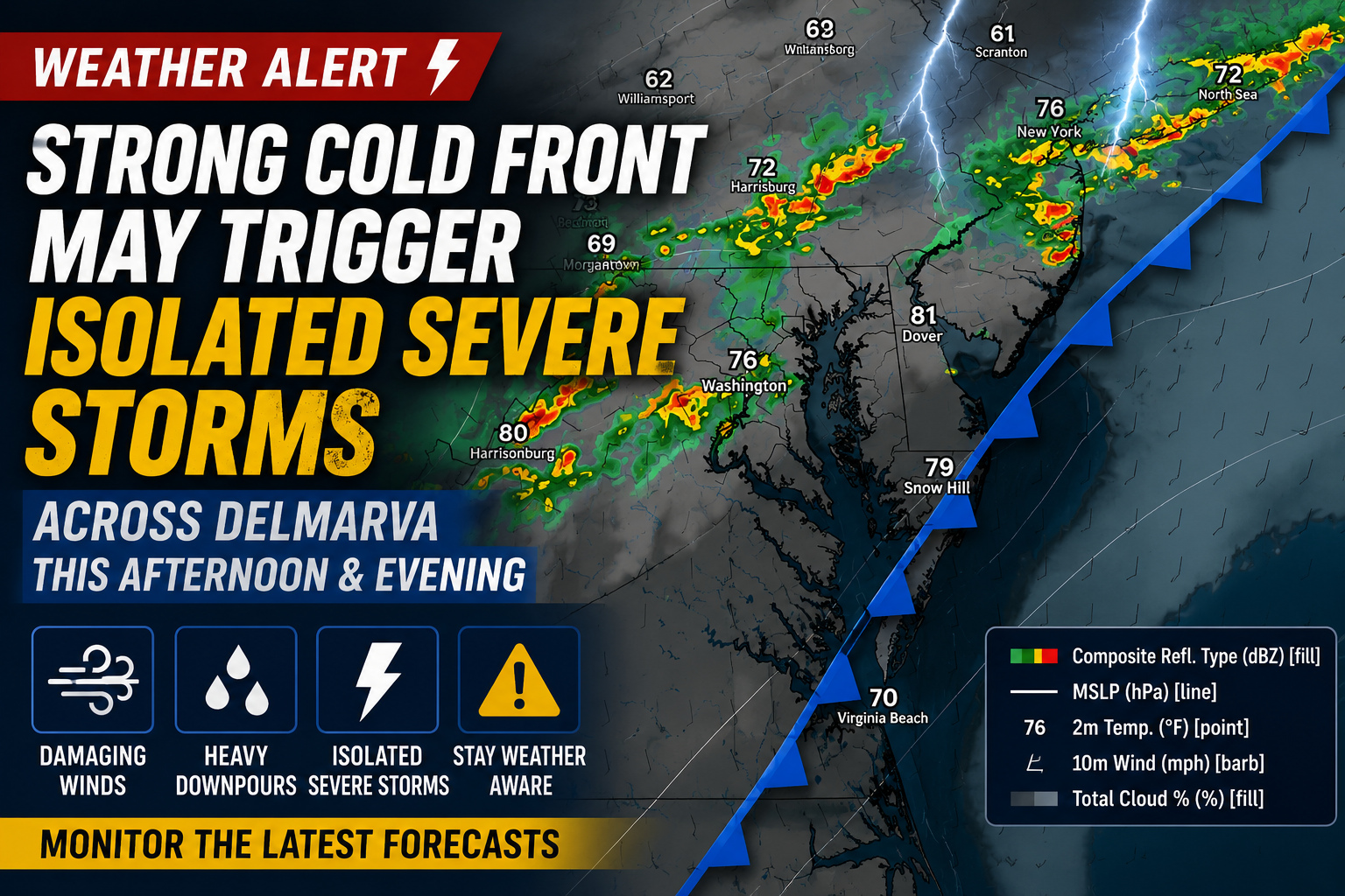
A strong cold front is expected to sweep across the Mid Atlantic and Delmarva region this afternoon and tonight, bringing the threat for showers, thunderstorms, and the potential for isolated severe weather before cooler air gradually settles in later tonight into Thursday.

We are closely monitoring the potential for stronger thunderstorms to develop from the Philadelphia metro southward through southern New Jersey, Delaware, and portions of Maryland’s Eastern Shore during the late afternoon and evening hours. A hot and unstable air mass remains in place ahead of the approaching front, helping fuel thunderstorm development as daytime heating peaks.

While atmospheric wind shear remains somewhat limited across the region, there will still be enough instability and steep low level lapse rates to support isolated stronger storms capable of producing damaging wind gusts. The primary severe weather threat appears to be localized downburst winds, especially with any stronger storm cores that can briefly organize into small clusters or short linear segments.
At this time, confidence in widespread severe weather remains relatively low due to weaker upper level support and marginal storm organization parameters. However, even isolated severe storms can quickly produce strong wind gusts capable of downing small tree limbs, causing isolated power outages, and creating hazardous travel conditions.

Heavy rainfall will also accompany some of the thunderstorms. Most locations are expected to receive between one tenth and one half inch of rain, though localized higher amounts are possible where heavier downpours develop. Atmospheric moisture levels remain elevated, with precipitable water values ranging between 1.5 and 2 inches, allowing storms to efficiently produce torrential rainfall in a short period of time.
Thunderstorm activity should gradually diminish later this evening as the cold front pushes through the region. However, some lingering showers may continue overnight into early Thursday, especially closer to Delmarva where the front is expected to slow down and stall nearby.
We encourage residents across Delmarva to monitor the latest forecasts and remain weather aware through tonight as storms develop and move through the region.


