
DUBAI, United Arab Emirates (AP) — New space-based photography is providing an initial look at the extensive destruction caused by the ongoing conflict with Iran, revealing burning vessels at Iranian harbors and demolished structures at American military installations.
Details about the extent of destruction throughout the Middle East have remained limited, especially regarding damage within secure military compounds, since hostilities commenced on February 28.
The photographs originate from Planet Labs PBC, a San Francisco-based company that supplies imagery to news organizations, including The Associated Press. Planet Labs implements a two-week waiting period before making its images publicly available due to worries that “adversarial actors” might misuse the footage.
Additional high-quality images have been released by rival companies. Other sources, such as the U.S. Geological Survey, have also made available lower-quality imagery that has proven valuable.
American and Israeli forces have been attacking numerous targets, including key leaders, military installations, missile and air defense locations, and positions belonging to the paramilitary Revolutionary Guard along with its volunteer unit, the Basij. Iran has retaliated using drone and missile attacks aimed at Israel and neighboring Gulf Arab countries.
The following examines what can be observed in selected Planet Labs photographs, along with images from other sources.
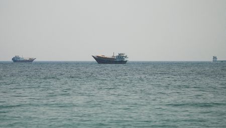
Among the most striking photographs from Planet Labs have emerged from Bandar Abbas, which houses a significant Iranian naval facility adjacent to the vital Strait of Hormuz linking the Persian Gulf with the Arabian Sea.
Pictures captured on March 2 reveal vessels on fire at the harbor. The U.S. military’s Central Command has been focusing on Iran’s naval resources and reports it has destroyed or damaged over 100 Iranian ships during the conflict.
The island nation of Bahrain, which hosts the U.S. Navy’s 5th Fleet, has experienced intense Iranian attacks targeting military bases and petroleum facilities. A March 1 photograph taken by Planet Labs reveals a major structure at the base has been destroyed, along with two radomes — dome-shaped structures protecting radar equipment — presumably from Iranian missile and drone attacks.
The Navy has not provided detailed information about the total damage sustained at the base, though Iran has consistently claimed responsibility for attacking it. Internet videos have also captured incoming fire directed at the facility. During the 12-day conflict in June, Iran struck and demolished a comparable radome at Al Udeid Air Base in Qatar that was used for protected communications.
In Abu Dhabi, the UAE’s capital city, damage is visible at France’s Camp de la Paix naval installation. Space imagery from March 3 displays destruction to two large warehouse-style structures at the site. The facility is located near Zayed Port in Abu Dhabi, and in proximity to its Cultural District housing the Louvre Abu Dhabi and other significant museums, both operational and under development.
The U.S. Geological Survey’s Landsat satellites have also proven essential for identifying large fires. Landsat imagery captured on Monday revealed a blaze at Dubai International Airport following an Iranian drone attack that ignited a fuel truck at the world’s most active airport for international flights, creating a cloud of toxic black smoke.
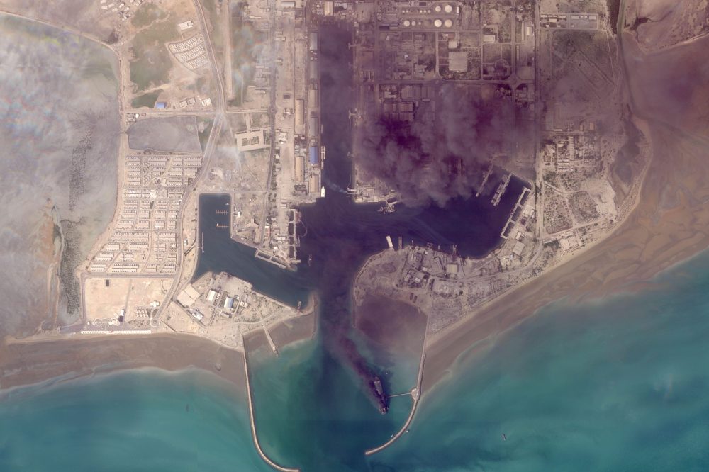
Another fire was observed on Monday at Oman’s southern harbor in Salalah, which was attacked by suspected Iranian drones on March 11, although Tehran has disputed launching them as part of its campaign against Gulf Arab nations. The fire appears to have continued burning since that time.