Residents across the Delmarva Peninsula should closely monitor weather conditions today as a potent storm system moves into the Mid-Atlantic, bringing the threat of severe thunderstorms, damaging winds, isolated tornadoes, and localized flash flooding.

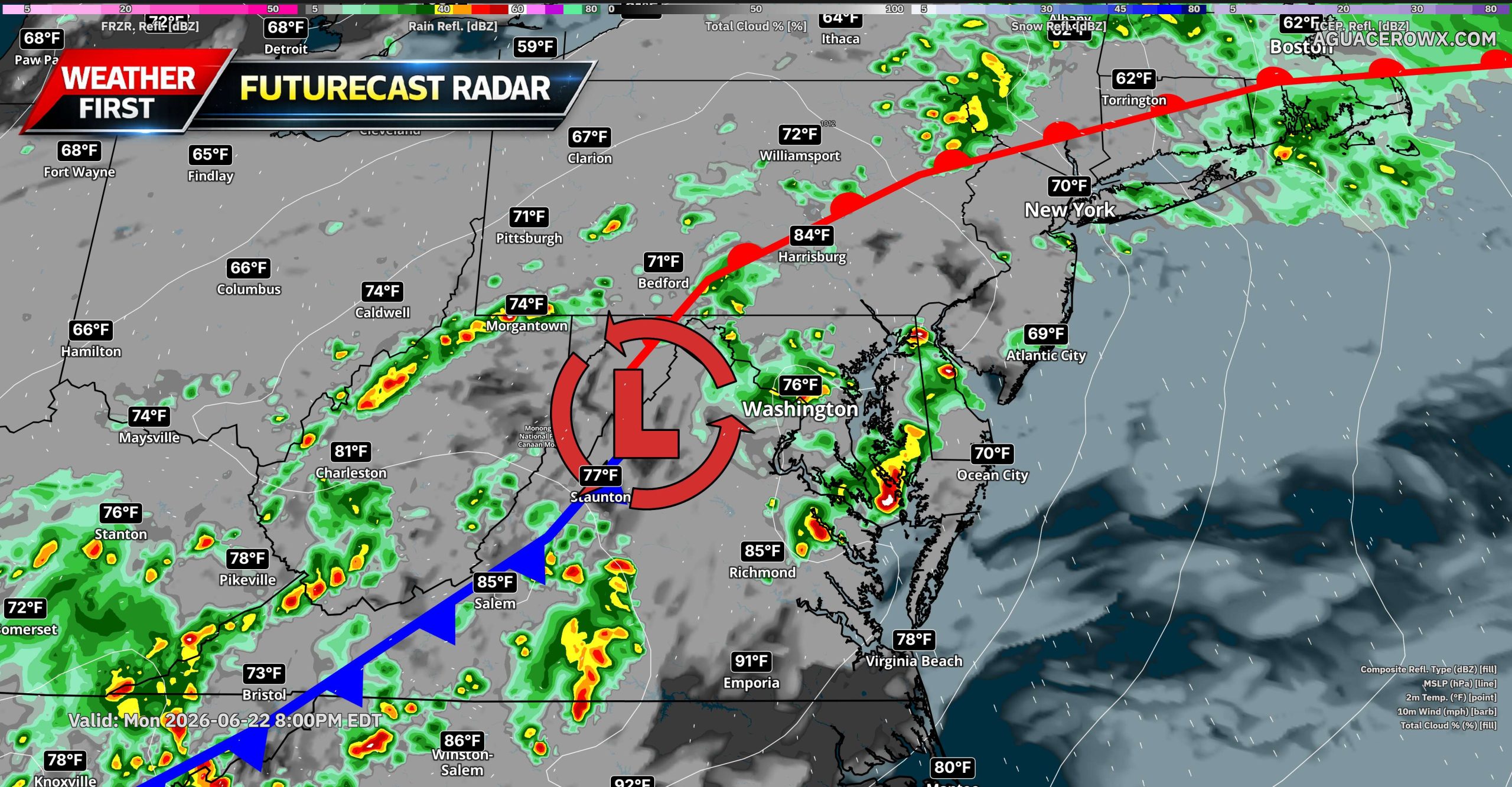
A strengthening area of low pressure will track eastward across Pennsylvania this afternoon before moving toward southern New England tonight. Ahead of the system, a warm front will lift northward through the region while increasing moisture and strengthening winds aloft create a favorable environment for strong to severe thunderstorms.

While extensive cloud cover across portions of the Mid-Atlantic (especially north of the I-95 Corridor) may limit how much instability develops during the day, we believe enough heating combined with strong atmospheric forcing will allow thunderstorms to rapidly intensify by mid to late afternoon.
The primary window for severe weather across Delmarva appears to be between 5 PM and 1AM.

Thunderstorms are expected to develop along a pre-frontal trough and near the advancing warm front before organizing into clusters capable of producing widespread strong wind gusts. Wind damage remains the greatest concern, with some storms potentially producing gusts exceeding 60 mph.

In addition to damaging winds, the atmosphere will feature strong wind shear both near the surface and higher in the atmosphere. This setup could support a few rotating thunderstorms capable of producing isolated tornadoes, especially near the warm front as it lifts north through Maryland, Delaware, New Jersey, and southeastern Pennsylvania.
Large hail is not expected to be widespread but cannot be ruled out in the strongest storms.

Another major concern today will be heavy rainfall and flash flooding. Atmospheric moisture levels are forecast to reach near-record values for late June, with precipitable water values ranging between 1.8 and 2.4 inches. Any thunderstorm will be capable of producing torrential rainfall, with rainfall rates potentially exceeding 1 to 2 inches per hour.
Although the region has been experiencing drought conditions, multiple rounds of thunderstorms and the possibility of storms repeatedly moving over the same areas could quickly overwhelm drainage systems and lead to localized flooding. Urban and poor-drainage locations will be especially vulnerable to flooding issues this evening.
Storms should gradually weaken and move offshore overnight as a cold front pushes through the region.
Conditions improve somewhat on Tuesday, although a secondary cold front may trigger scattered showers and thunderstorms during the afternoon. At this time, Tuesday’s storms are not expected to pose a significant severe weather or flooding threat.


