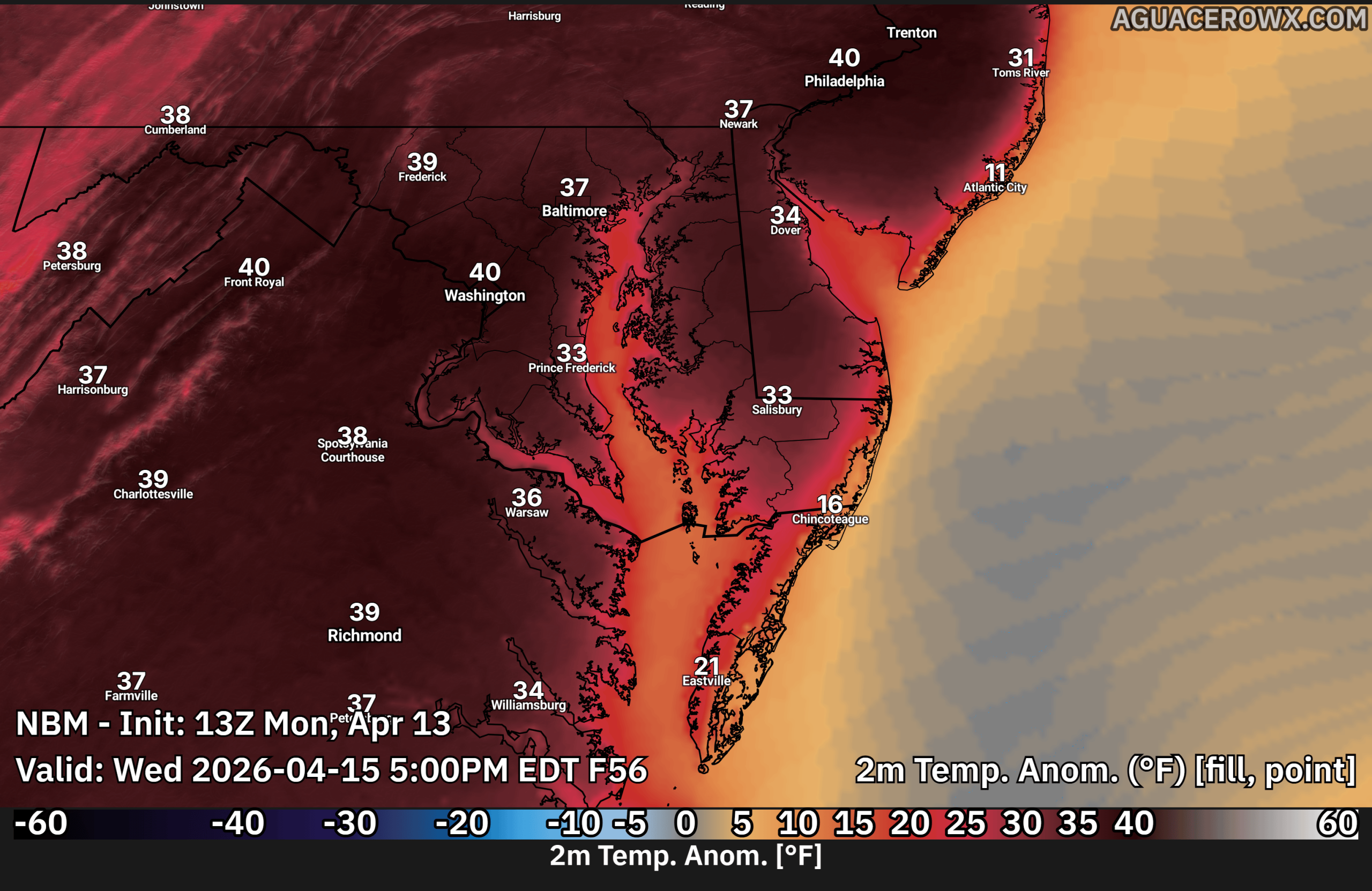

A significant warm-up is underway across the Delmarva region, with the potential for record-breaking temperatures through the middle and end of the week. After a seasonable start, a strong pattern shift will bring much warmer-than-normal conditions, with temperatures running 20 to 30 degrees above average across Delaware and Maryland’s Eastern Shore, as well as nearby coastal areas.

By Tuesday, inland areas such as Salisbury, Cambridge, and Dover are expected to climb into the low to mid 80s, with even hotter conditions arriving Wednesday and possibly Thursday. High temperatures could surge into the upper 80s to near 90 degrees, especially across interior sections of Delmarva. If 90 degrees is reached, it would mark the first 90-degree day of the year, and the first occurrence since early September.
However, as is typical this time of year, coastal communities including Ocean City, Rehoboth Beach, and Lewes will likely remain cooler. The colder Atlantic Ocean waters will help generate a daily sea breeze, keeping temperatures closer to the 60s and 70s along the immediate coastline while inland areas heat up significantly.

This unusually warm pattern is being driven by high pressure anchored over the Atlantic, combined with a warm front lifting well north of the Mid-Atlantic. This setup is allowing a deep layer of warm air to overspread the region, both at the surface and aloft.
Despite a weak cold front expected to pass through late Thursday night into Friday morning, the overall pattern will remain warm. Temperatures heading into the weekend are still forecast to stay well above normal, generally ranging from the upper 70s to mid 80s across much of Delmarva.

In addition to the heat, the region will remain mostly dry, raising concerns about ongoing abnormally dry to drought conditions. While a few weak disturbances may pass to the north between Tuesday and Thursday, only a stray shower or thunderstorm is possible, mainly well north of the region. No widespread or meaningful rainfall is expected, which could allow drought conditions to worsen.
The good news is that fire weather concerns remain limited for now. Although conditions will be warm and dry, light winds and a more humid southwest flow should help prevent rapid fire spread.
Overall, Delmarva is heading into an extended stretch of early summer-like warmth, with the potential for record highs, continued dry conditions, and noticeable differences between inland and coastal temperatures.


