
A powerful line of storms swept across the Delmarva Peninsula late Monday night, producing widespread damaging wind gusts across both Delaware and Maryland. Reports from the National Weather Service show several locations experienced winds over 60 mph, with a few spots nearing hurricane-force strength.
The strongest wind gusts were reported in Kent County, Delaware, where both 1 NE Magnolia and SR1 at Trap Shooters Road measured peak gusts of 73 mph. Winds of that magnitude are capable of bringing down trees, damaging power lines, and causing structural damage.
Other strong reports across Delaware included 68 mph in Bethel, 66 mph at Delaware Airpark, 66 mph at Dover Air Force Base, and 61 mph at Delaware Coastal Airport. Along the coast, Lewes and Dewey Beach both reached 58 mph.
In Maryland, the highest measured gust was 67 mph near Galena in Kent County. Other notable reports included 62 mph near Rock Hall, 61 mph near Queen Anne, and several additional gusts in the 50 to 60 mph range across Caroline, Queen Anne’s, and Talbot counties.
Much of the damage from this event appears to be consistent with straight-line winds, but National Weather Service Meteorologists are also closely examining whether a few embedded tornadoes may have occurred within the line of storms, especially across Kent County, Delaware, and Caroline County, Maryland. These types of quick spin-up tornadoes can develop within a fast-moving squall line and may be difficult to distinguish from damaging thunderstorm winds based on initial reports alone.


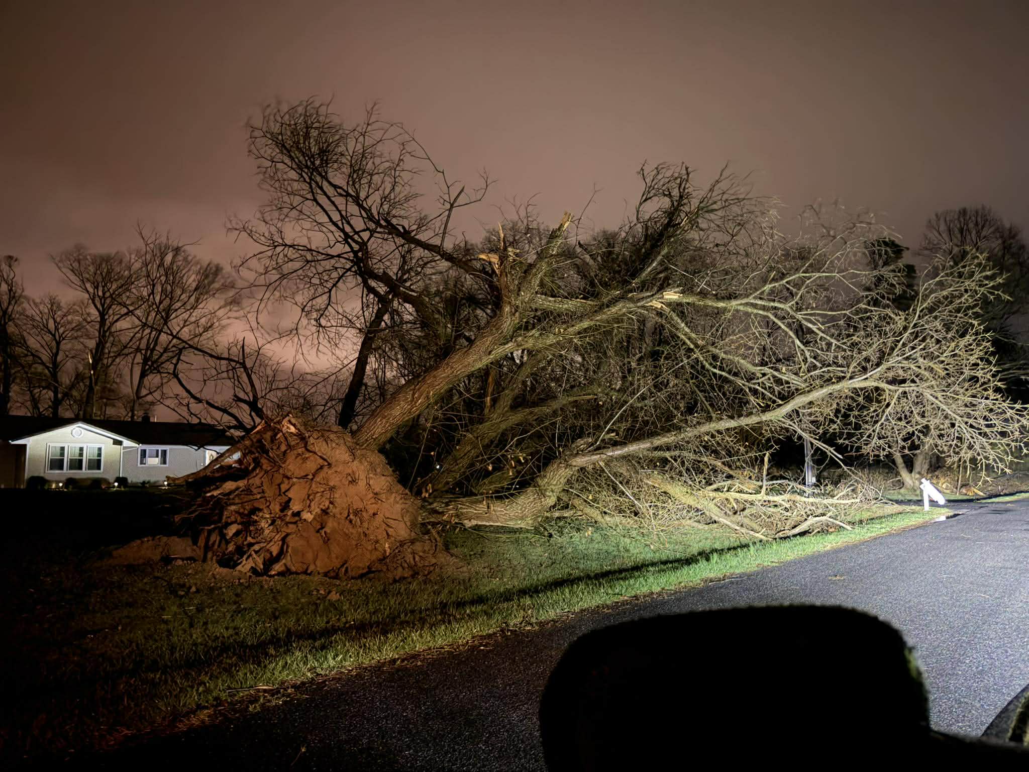
Photos from Alyster Jay & Kyle Guesfeird
At this time, the main damage reports have involved trees down and structural damage, which can occur from either intense straight-line winds or brief tornadoes. Additional storm surveys and damage assessments may be needed to determine whether any tornadoes touched down.
Meteorologically, this event was driven by a strong cold front and a powerful line of thunderstorms that tapped into stronger winds just above the ground and brought them down to the surface. That created a widespread corridor of damaging winds across the region, with many areas experiencing severe thunderstorm-force gusts well above 58 mph.
Even outside the hardest-hit areas, many locations still reported gusts between 40 and 50 mph, adding to hazardous travel conditions and scattered damage concerns overnight.
Residents in Kent and Caroline Counties who experienced storm damage are encouraged to share reports, especially where there may be evidence of concentrated or convergent damage. That information can help determine whether the damage was caused solely by straight-line winds or if embedded tornadoes were involved.