
We are keeping a close eye on a developing area of low pressure expected to form off the East Coast during the middle of the week. While the system bears watching, current indications suggest it will remain far enough offshore to spare the Delmarva Peninsula from any significant impacts.
An upper-level trough currently moving through the Northeast is expected to become more amplified over the next several days. As this occurs, we expect the base of the trough to close off into an upper-level low pressure system somewhere near the North Carolina coast or farther northeast over the Atlantic Ocean.

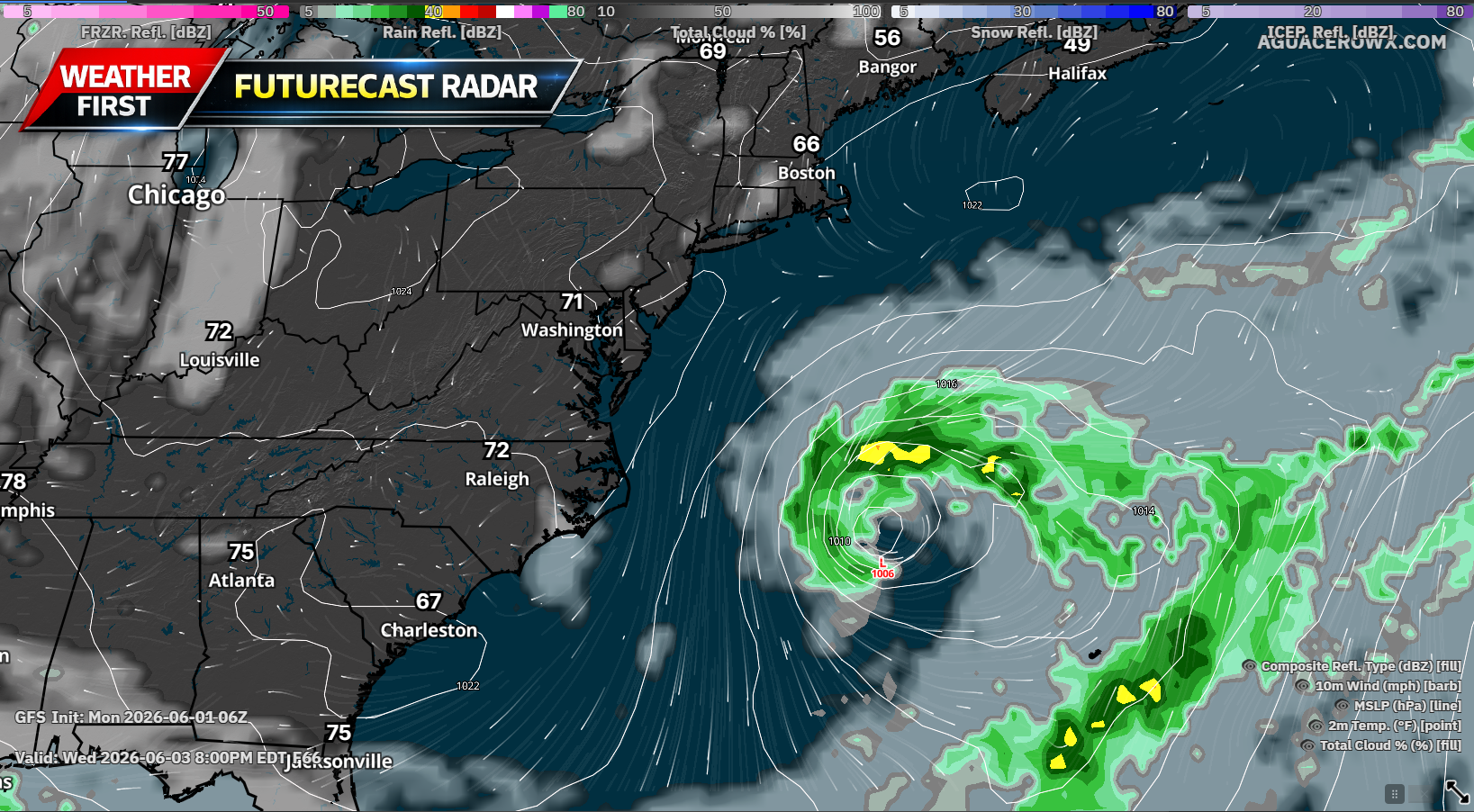
As the upper-level low develops, a corresponding surface low pressure system is expected to form offshore. However, forecast guidance continues to indicate that the storm will remain well east of the Mid-Atlantic coastline.
A large area of high pressure centered over the Great Lakes and Northeast is expected to act as a blocking mechanism, preventing the storm from moving closer to land. Because of this, confidence is increasing that dry weather will continue across Delaware, Maryland’s Eastern Shore, and much of the surrounding region through the end of the workweek.
While rainfall is not expected, the offshore storm could still have a minor influence on local weather. If the low pressure system tracks slightly closer to the coast than currently forecast, northeasterly winds could develop, leading to somewhat cooler temperatures, particularly near the Atlantic beaches and Delaware Bay shoreline.
Despite that possibility, the overall forecast remains favorable with seasonable conditions expected through midweek.

Temperatures are forecast to gradually warm during the second half of the week as high pressure shifts southeastward. Afternoon highs should climb into the 80s by Thursday before potentially reaching the lower 90s across parts of Delmarva on Friday and Saturday.
The warming trend will be driven by a much warmer air mass moving into the Northeast, bringing summerlike conditions back to the region after several days of more comfortable temperatures.
Looking ahead to the weekend, there are some early indications that precipitation chances may begin to increase. However, forecast confidence remains low regarding the timing and coverage of any showers or thunderstorms.
For now, residents can expect several more days of dry weather, plenty of sunshine, and a gradual return to hotter temperatures heading into the first weekend of June.


