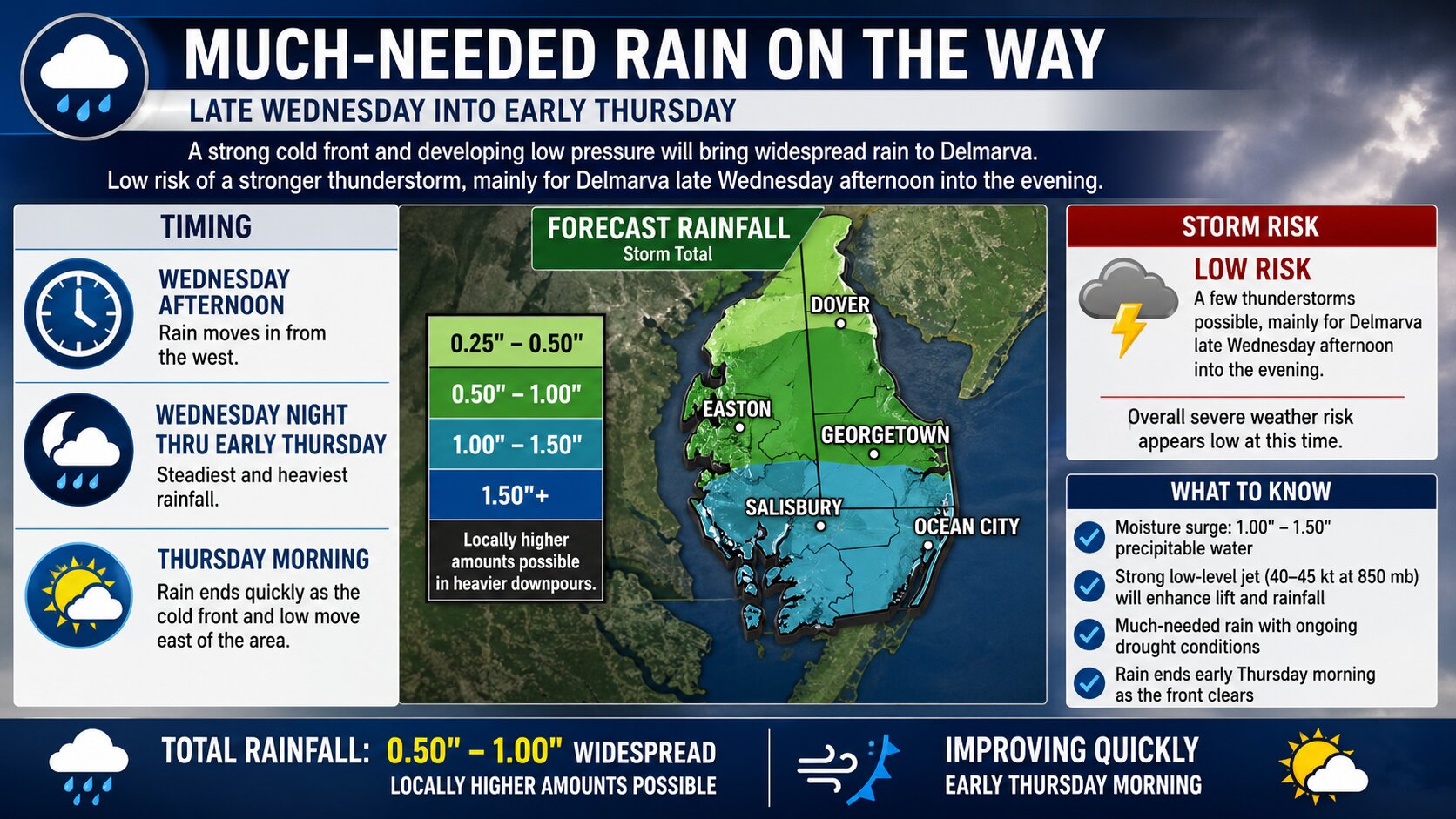

A widespread round of much-needed rainfall is expected to move into the Delmarva region late Wednesday, continuing overnight into early Thursday as a strong cold front pushes through the Mid-Atlantic.
The system is being driven by a robust upper-level trough and developing area of low pressure tracking across the eastern United States. As this setup evolves, a surface low is forecast to develop along the cold front and track near or across the southern half of the region early Thursday morning, enhancing rainfall coverage across Delaware and the Eastern Shore of Maryland.
Rain is expected to begin as early as Wednesday afternoon from west to east, with the steadiest and heaviest rainfall occurring Wednesday night into the pre-dawn hours Thursday.

Atmospheric moisture will be notably elevated ahead of the front, with precipitable water values climbing to around 1.00 to 1.50 inches. In addition, a strengthening low-level jet of 40 to 45 knots at approximately 850 mb will promote strong warm air advection and lift, allowing for periods of moderate to occasionally heavy rain.

While widespread severe weather is not expected, a few embedded thunderstorms cannot be ruled out, particularly across Delmarva late Wednesday afternoon into the evening. Instability remains limited due to expected cloud cover, but if any breaks develop allowing for greater surface heating, a low-end risk for a stronger thunderstorm could emerge given the favorable wind shear in place.


Overall rainfall totals are expected to range between one-half inch and one inch across the region, with locally higher amounts possible where heavier downpours occur.
The rain will be beneficial, especially as much of the region continues to experience longer-term dry conditions and emerging drought concerns. The steady rainfall should help improve soil moisture and reduce ongoing fire weather concerns that have developed in recent weeks.
Conditions will improve quickly early Thursday morning as the cold front and associated low pressure system exit the region, bringing an end to the rain and a return to drier weather.


