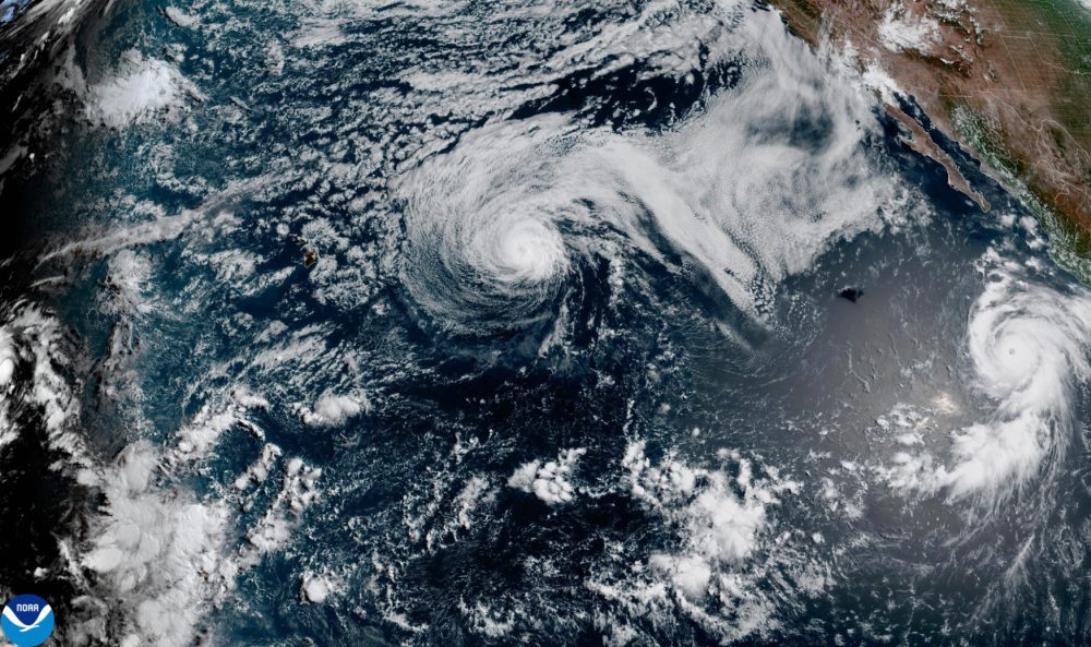

Hurricane Genevieve has intensified into a major storm over the Pacific Ocean, though forecasters say the system is expected to remain well out to sea as it tracks roughly parallel to the Mexican coastline.
The National Hurricane Center in Miami reported that Genevieve was packing maximum sustained winds of 120 mph (195 kph), placing it at Category 3 strength. Any storm reaching Category 3 or above is classified as a major hurricane.
As of the latest update, the storm’s center was positioned approximately 515 miles (825 kilometers) southwest of Manzanillo, moving in a west-northwest direction at 16 mph (26 kph).
No coastal watches or warnings have been issued in connection with Genevieve. However, the hurricane center cautioned on Sunday that large swells generated by the storm — capable of producing what it described as “life-threatening surf and rip current conditions” — were already impacting portions of Mexico’s southwestern coast. Those swells were expected to reach the southern end of the Baja California Peninsula by Sunday night or into Monday.
Forecasters anticipate the storm will continue gaining strength before beginning to weaken around the middle of the week.
Further to the northwest in the Pacific, Hurricane Fausto has dropped in intensity to a Category 1 storm while continuing on a general path toward the Hawaiian Islands. Forecasters expect Fausto to be downgraded to tropical storm status within the next several days, though they noted it could still produce notable surf along parts of Hawaii’s coastline.
Fausto was carrying maximum sustained winds of 85 mph (140 kph) and was situated roughly 910 miles (1,465 kilometers) east of Hilo, moving westward at 14 mph (22 kph).