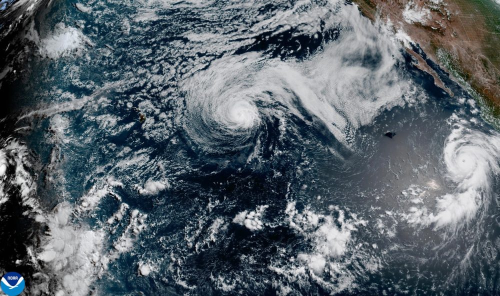

Hurricane Genevieve roared to Category 5 status in the early hours of Monday, making it the first storm of that strength in the East Pacific region in two years, according to forecasters. Despite its power, the storm is forecast to remain well offshore and is not expected to make landfall.
The National Hurricane Center in Miami reported that Genevieve was packing maximum sustained winds of 160 mph (260 kph). The storm’s center was positioned roughly 530 miles (855 kilometers) southwest of Manzanillo, tracking toward the northwest at 13 mph (20 kph).
No coastal watches or warnings have been issued in connection with the storm. However, the hurricane center cautioned that powerful swells generated by Genevieve are already battering portions of Mexico’s southwestern coastline and the Baja California Peninsula, with officials warning of “life-threatening surf and rip current conditions” in those areas.
Forecasters expect Genevieve to begin losing strength starting Tuesday.
Further out in the Pacific Ocean, Hurricane Fausto has dropped in intensity, falling to a Category 1 storm while continuing on a general path toward the Hawaiian Islands. Officials say Fausto is likely to be downgraded to a tropical storm within the next few days, though it may still produce significant wave activity affecting parts of Hawaii.
Fausto’s maximum sustained winds were recorded at 80 mph (130 kph), with the storm located approximately 670 miles (1,080 kilometers) east of Hilo and moving west-northwest at 14 mph (22 kph).