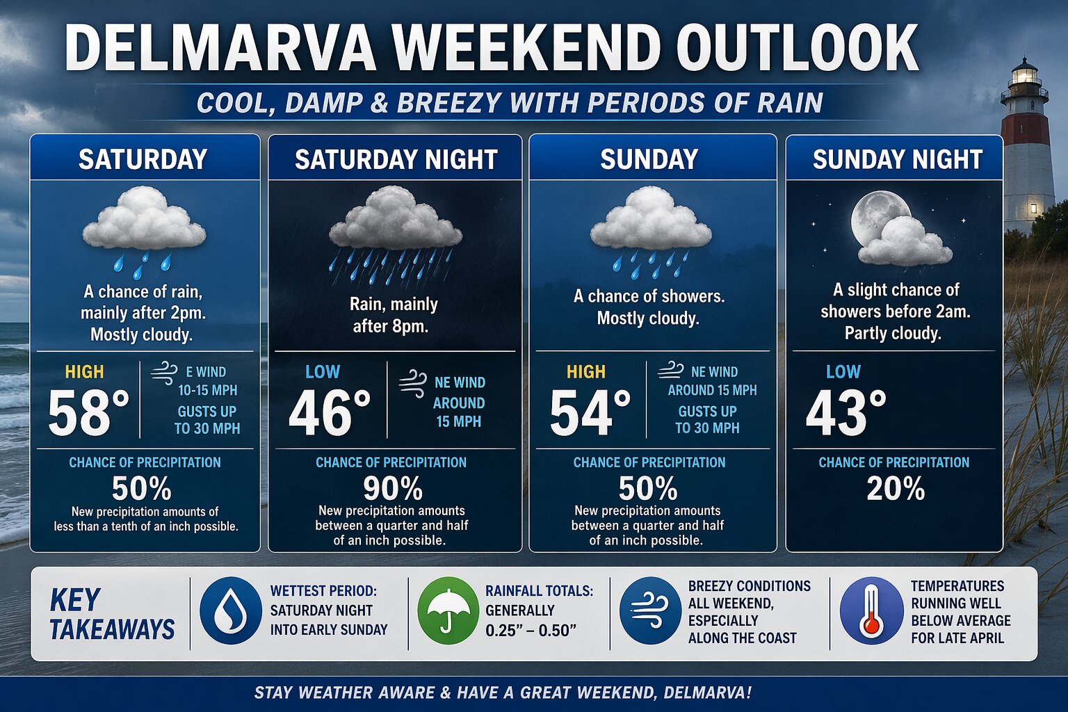

A coastal low pressure system will bring a stretch of cool, damp, and breezy conditions to the Delmarva Peninsula this weekend, with the most impactful weather arriving Saturday night into early Sunday.
Saturday starts off mostly dry, but clouds will thicken through the day ahead of an approaching system. A few showers may begin to develop after 2 PM, though rainfall during the daytime hours looks light and spotty. High temperatures will struggle to reach the upper 50s, with an easterly wind increasing to 10 to 15 mph and gusts pushing up to 30 mph, especially near the coast.
Saturday Night is when conditions deteriorate more noticeably. Steadier rain moves in after 8 PM and continues overnight, with a high likelihood of widespread rainfall. Periods of moderate rain are possible, with totals generally between a quarter and half an inch. Overnight lows will fall into the mid 40s, while a persistent northeast wind around 15 mph keeps conditions raw and chilly.
Sunday remains unsettled, although trends suggest the steadiest rain shifts out of the region. Scattered showers will linger through the day under mostly cloudy skies. It will stay cool, with highs only in the low to mid 50s. Gusty northeast winds continue, with occasional gusts near 30 mph maintaining a brisk feel.
Sunday Night, conditions gradually improve as the system pulls away. A few leftover showers are possible early in the evening, but skies will begin to clear overnight. Lows drop into the lower 40s with lighter winds developing late.


