
As many across the Mid-Atlantic prepare for the Memorial Day holiday weekend, the weather pattern is turning much cooler, wetter, and increasingly unsettled as several rounds of showers and periods of rain are expected from late this week through at least Memorial Day itself.
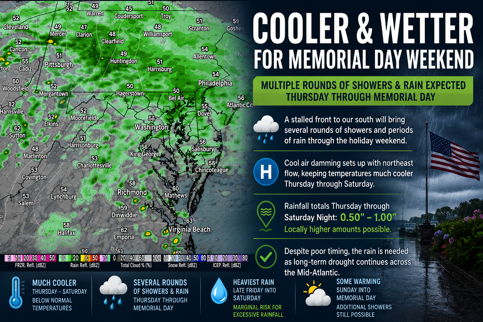
A cold front moving through the region will settle and eventually stall just south of the area heading into the weekend. This stalled boundary will act as a focus for multiple waves of low pressure and disturbances to ride along it, bringing repeated chances for showers and rain across the Mid-Atlantic from Thursday through the holiday weekend.

The wettest period currently appears to be later Friday into Saturday as a more organized area of low pressure develops well to the west of the region. At the same time, high pressure building across the Northeast will wedge cooler marine air southwestward into the Mid-Atlantic, creating a classic cool air damming setup east of the Appalachians. This pattern will help keep skies cloudy, temperatures below normal, and rainfall persistent at times.

We are also monitoring the potential for locally heavy rainfall, especially Saturday, as atmospheric moisture levels rise significantly. Forecast precipitable water values, or PWATs, are expected to climb between 1.50 and 1.90 inches, which is near climatological maximum levels for late May. While widespread flooding is not currently expected, there is at least a marginal risk for excessive rainfall where heavier showers repeatedly move over the same areas.

Rainfall totals from Thursday through Saturday night are forecast to average between one half inch and one inch across much of the region, though localized higher amounts are possible depending on where the heaviest bands of rain develop.
In addition to the wetter weather, temperatures will take a dramatic turn compared to the recent stretch of summerlike warmth. Persistent northeast winds, clouds, and rain will keep daytime highs noticeably cooler Thursday through Saturday, with many areas struggling well below seasonal averages. Some gradual warming is expected Sunday into Memorial Day as the stalled boundary begins to weaken, however the overall weather pattern is expected to remain active with additional showers still possible.
Despite the poor timing for outdoor holiday plans and the unofficial start to summer, the rainfall will provide beneficial moisture to portions of the Mid-Atlantic currently dealing with expanding drought conditions. Several areas across the region, including portions of Delmarva and the central Mid-Atlantic, continue to experience moderate to severe drought according to the latest U.S. Drought Monitor.