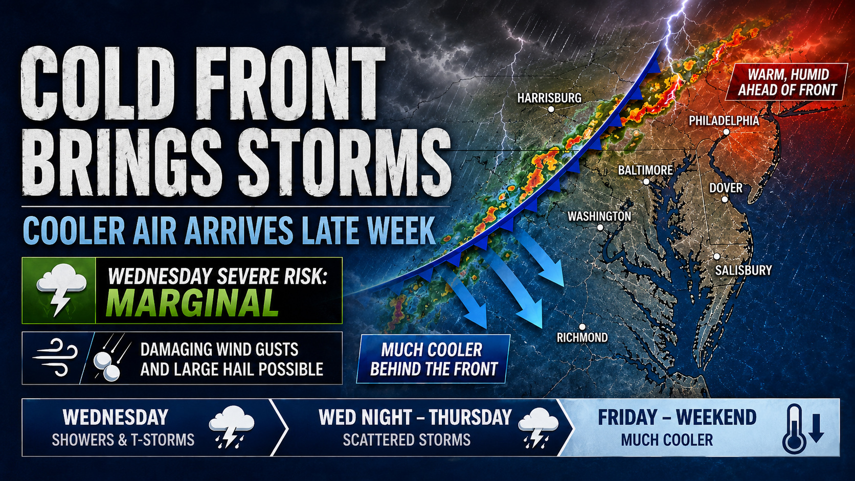
A cold front will move through the region Wednesday into Thursday, bringing showers and thunderstorms followed by a noticeable drop in temperatures by the end of the week.

The front is expected to arrive during the second half of Wednesday and continue through Wednesday night. Ahead of the front, a warm and unstable air mass will remain in place, helping to fuel the development of thunderstorms. While the strongest forcing and wind shear may remain farther north, the environment should still be supportive of some organized storms.

Because of this setup, there is a risk for isolated strong to severe thunderstorms on Wednesday. The Storm Prediction Center has maintained a Marginal Risk for severe weather, which means a few storms could become strong enough to produce damaging wind gusts and large hail.

Rainfall totals from this system are generally expected to stay around a quarter inch or less for many areas. However, any stronger thunderstorms could produce locally higher rainfall amounts, especially with atmospheric moisture levels running fairly high. Some storms may be capable of producing brief heavy downpours.

By Thursday morning, the cold front is expected to settle south of the region, but it may linger nearby through the rest of the day. This could keep scattered showers in the forecast, especially across southeastern areas.
Behind the front, temperatures will turn much cooler by late week, ending the stretch of above normal warmth. The overall pattern looks unsettled heading into Friday and the weekend, with additional chances for showers possible.


