
A strong cold front has pushed through the Delmarva region early this morning, ushering in a much colder and drier air mass that will dominate the weather pattern through the next 24 to 36 hours. In the wake of this frontal passage, temperatures have dropped well below seasonal averages, with afternoon highs today only reaching the mid 40s to mid 50s across much of the region.
Despite the return of sunshine at times, the overall air mass remains cold aloft. This could allow for a few isolated showers to develop, particularly southeast of the I-95 corridor. Any precipitation that does occur will primarily fall as light rain, but given the colder temperatures in the upper levels of the atmosphere, some graupel may mix in briefly.

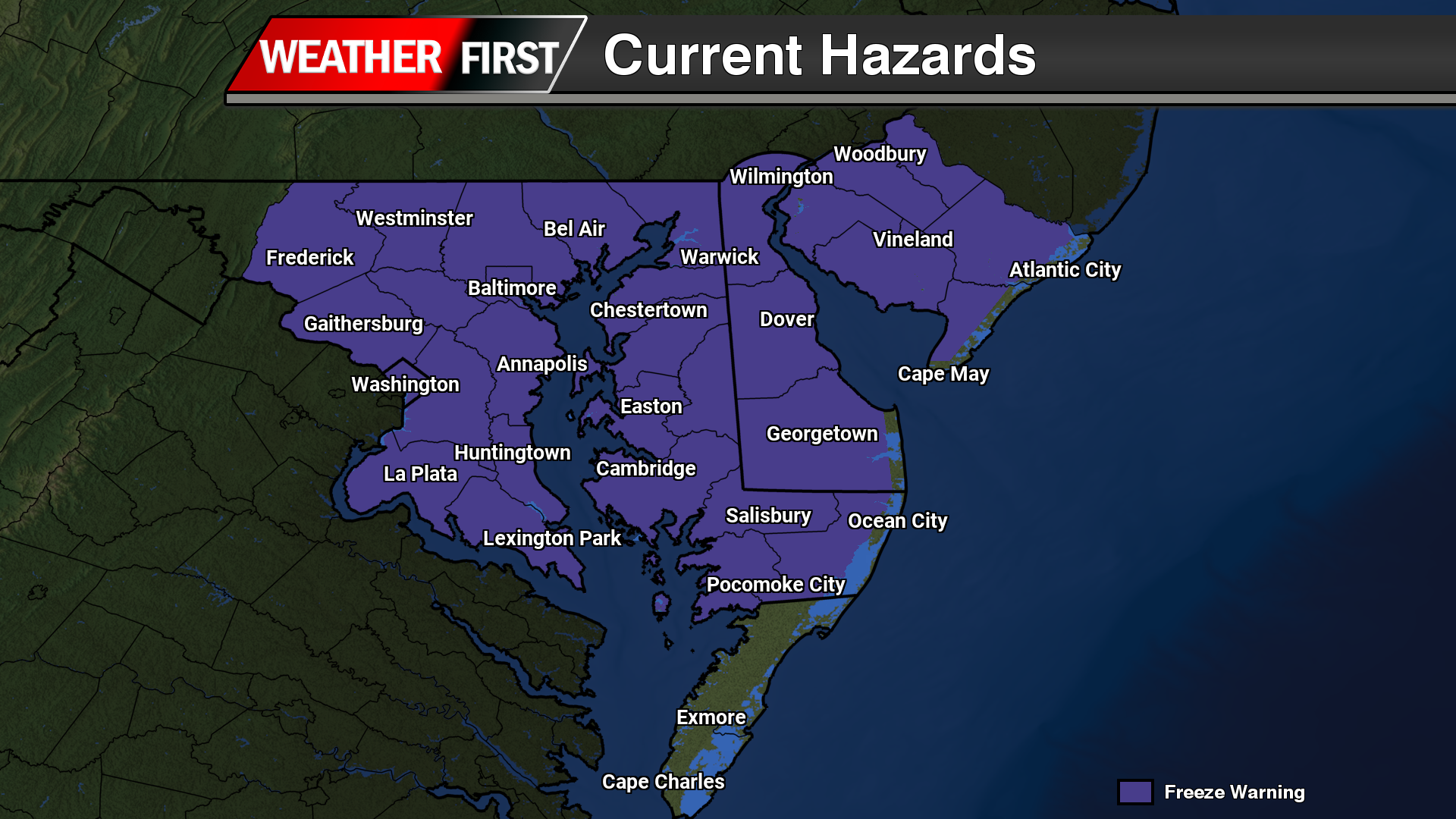
Attention quickly turns to tonight, where conditions become increasingly favorable for a widespread freeze. High pressure building in from the Great Lakes will settle overhead, promoting clear skies and light winds. This setup is ideal for efficient radiational cooling, allowing temperatures to fall rapidly after sunset. Overnight lows are expected to drop into the mid 20s to low 30s inland, with slightly milder readings in the mid to upper 30s closer to the immediate coast.

A Freeze Warning is now in effect for nearly the entire Delmarva region, excluding only coastal locations. This freeze poses a significant concern due to the early start of the growing season, driven by recent record warmth. Many plants, fruit trees, and other sensitive vegetation have already begun to bloom, leaving them particularly vulnerable to damage from sub-freezing temperatures.
While the air mass will be quite dry, which may limit widespread frost formation, the cold temperatures alone are sufficient to cause harm to unprotected vegetation. Residents are strongly encouraged to take precautions, including covering sensitive plants or bringing potted vegetation indoors if possible.
Conditions will gradually moderate heading into the following days, but this brief return to winter-like temperatures serves as a stark reminder of the volatility of early spring weather across the Mid-Atlantic.


