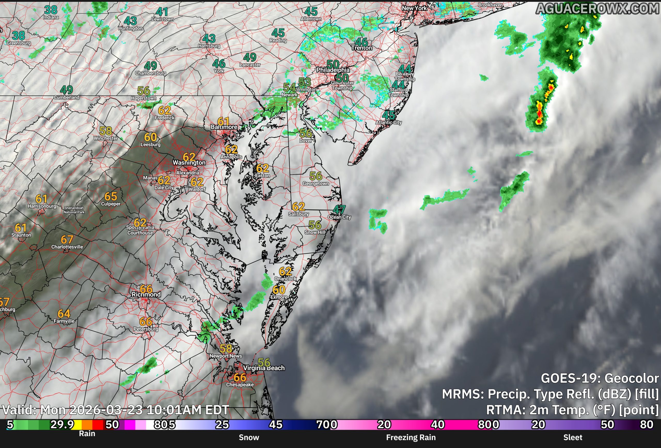
A strong cold front is sweeping across the Delmarva Peninsula this morning, bringing a period of showers followed by a sharp drop in temperatures and increasing winds that will make for a raw and blustery day.

Early this morning, a disorganized but impactful system stretched from eastern Virginia to just off the coast near Cape May, helping to drive a band of steady showers across the region. This rainfall is expected to persist through the early morning hours before gradually tapering off by mid to late morning. However, the unsettled pattern doesn’t end there, as a secondary round of light showers or drizzle may develop around midday into the early afternoon.

Behind the departing system, a strong surge of cold air is quickly moving into the region. Temperatures will likely peak early in the day before steadily falling, dropping into the 40s and low 50s by late morning and afternoon. This cold air advection, combined with thick cloud cover, will create a noticeably colder feel compared to recent days.

In addition to the cooler air, winds will become a major factor. As the pressure gradient tightens between departing low pressure and building high pressure to the west, north to northwest winds will increase to 15 to 20 mph, with gusts reaching 25 to 35 mph throughout the afternoon. These gusty winds will enhance the chilly conditions, making it feel even colder across the peninsula.
Showers should come to an end by mid-afternoon, but skies are expected to remain mostly cloudy for much of the day, reinforcing the cool and damp feel.
Conditions improve tonight as winds gradually diminish and skies begin to clear. Sunshine returns for Tuesday, though temperatures will remain on the cooler side, signaling a quieter but still brisk stretch of weather across Delmarva.