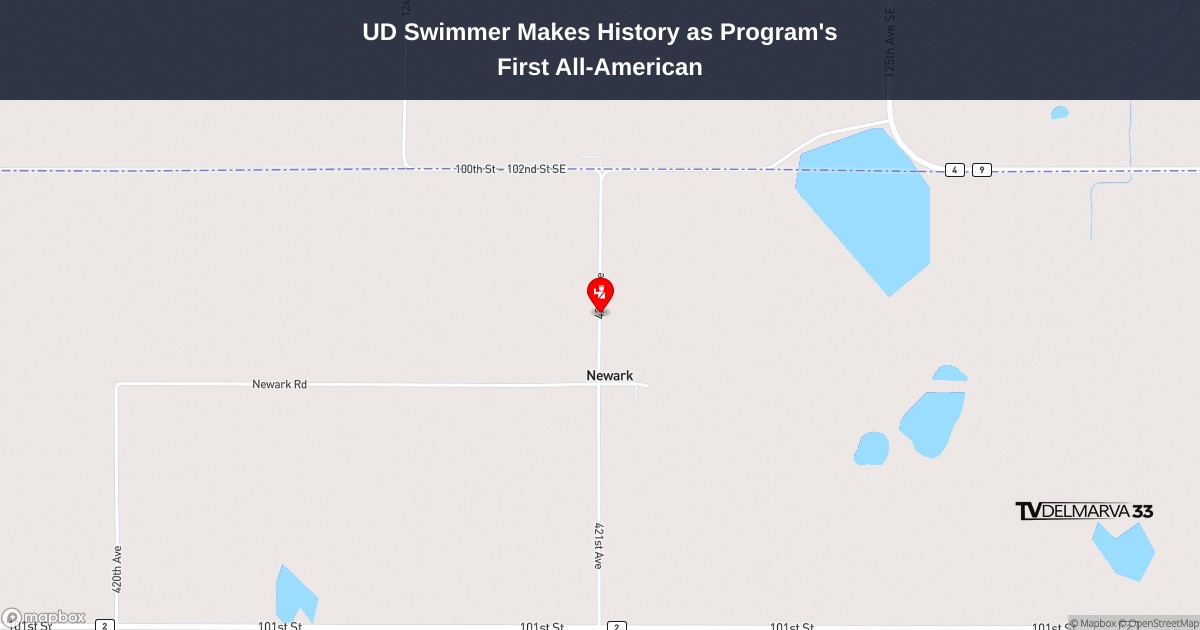
Motorists traveling along Park Avenue (Route 431) should expect delays and plan alternate routes as construction crews continue work that requires intermittent lane restrictions.
The affected stretch runs between Springfield Road (Route 47) and the Lewes Georgetown Highway (Route 9), where drivers may encounter temporary lane closures throughout the day.
According to DelDOT officials, the construction-related lane restrictions will remain in place until 5 PM today. Drivers are advised to use caution when traveling through the work zone and allow extra time for their commute.
The Delaware Department of Transportation continues to monitor traffic conditions in the area and will provide updates as the situation changes.
Motorists should expect delays on Baynard Boulevard today as construction crews conduct paving operations along a busy stretch of roadway.
The Delaware Department of Transportation reports that paving work is currently taking place on Baynard Boulevard in the section running from Shipley Road to Marsh Road (Route 3).
According to DelDOT, the road work is expected to wrap up by 5 PM this afternoon. Drivers are advised to plan alternate routes or allow extra travel time when passing through the area.
Motorists traveling on Crossan Road should expect delays and plan alternate routes as construction crews continue work that requires periodic lane restrictions.
According to the Delaware Department of Transportation, the road work is taking place along the section of Crossan Road that runs from N Star Road to Doe Run Road. The construction activity is causing intermittent lane closures that are scheduled to remain in effect until 5:00 PM today.
Drivers are advised to use caution when traveling through the work zone and to allow extra time for their commute. DelDOT recommends considering alternative routes to avoid potential traffic backups in the area.
SARAJEVO, Bosnia-Herzegovina — Severe weather conditions wreaked havoc across multiple Balkan nations Friday, as powerful winds, heavy precipitation, and snowfall forced educational institutions to shut down and left thousands of residents in the dark.
Weather officials issued emergency alerts for numerous communities throughout northern and northwestern Slovenia after wind gusts peaked at 141 kph (87 mph) in certain locations, according to public broadcaster RTV SLO.
Emergency response teams worked overnight to remove debris and fallen trees that had blocked multiple roadways throughout the affected region.
The power grid took a significant hit, with more than 15,000 residents losing electrical service in impacted zones. RTV SLO documented unusual “wintry” weather patterns, including snowfall in typically milder southern regions of the Alpine country.
Croatia’s capital city of Zagreb experienced destructive winds Thursday afternoon through Friday morning, resulting in downed trees, damaged public transportation infrastructure, and roof damage. Educational officials canceled Friday classes at elementary and high schools due to hazardous conditions.
Local news outlets and social media platforms displayed images of massive trees uprooted throughout Zagreb, with some obstructing traffic lanes and crushing parked vehicles. Wind velocities occasionally spiked to 120 kph (74 mph), according to meteorologist Petra Mikus Jurković.
“Such lasting, strong, stormy wind is not common for the Zagreb area,” she said.
Croatia’s automobile association HAK, which tracks driving conditions and provides roadside assistance, reported multiple vehicle collisions in northwestern regions due to snow and high winds.
Transportation officials in northwestern Bosnia restricted heavy truck traffic because of dangerous snowfall conditions. Local school districts suspended classes indefinitely until weather conditions and power restoration efforts show improvement.
Climate scientists suggest these intense weather events may be connected to broader climate change patterns.
Good morning, Delmarva! We’re starting this Friday with steady rain across the peninsula, and it’s going to be a soggy day ahead. Temperatures will reach 61 degrees this morning, but don’t let that fool you – we’re in for quite a temperature drop as the day progresses, falling to around 50 degrees by afternoon.
The rain will be our main story today with a 90% chance of precipitation and northwest winds picking up between 5-15 mph. We could see between a quarter to half inch of new rainfall, so keep those umbrellas handy and allow extra time for your commute.
Tonight brings relief as the rain tapers off, though there’s still a slight chance of light showers early on. Temperatures will plummet to a chilly 32 degrees – our first freeze potential in a while!
The good news? Saturday looks beautiful! Sunshine returns with a pleasant high of 45 degrees, perfect for getting outside after today’s washout. Saturday night stays mostly clear with lows around 29.
Stay dry today, Delmarva, and enjoy that sunshine tomorrow! I’m your meteorologist reminding you to weather every day well.
ATLANTA – A University of Delaware swimmer has etched his name in the record books after achieving a historic first for the Blue Hens men’s swimming and diving program.
Senior Matvei Namakonov earned All-American status at the NCAA Championships on Thursday, marking the first time any athlete from UD’s men’s swimming and diving team has received this prestigious honor. The achievement also represents the first occasion a Blue Hen swimmer has advanced to an NCAA finals race.
Namakonov delivered what may have been his most determined showing during his four years competing in Newark, rising to the occasion on his final day as a collegiate swimmer. The milestone performance caps off his career with the Blue Hens in memorable fashion.
The historic achievement in Atlanta represents a breakthrough moment for the University of Delaware men’s swimming and diving program, with Namakonov setting a new standard for future Blue Hen swimmers to aspire toward.
Authorities in New Castle County are actively searching for a 67-year-old Newark woman who vanished Thursday afternoon after visiting family members.
Police have activated a Gold Alert for Jill McLaughlin, who disappeared from the Nonantum Drive area in Newark. According to the New Castle County Division of Police, McLaughlin departed from a relative’s home in the 200 block of Nonantum Drive around 4:12 p.m. on Thursday, March 26, 2026.
The missing woman failed to return to her residence, prompting family members to contact authorities. A Gold Alert is typically issued for missing persons who may be vulnerable due to age or other circumstances.
Police are asking anyone with information about McLaughlin’s whereabouts to contact the New Castle County Division of Police immediately.
Delaware State University’s softball squad delivered an impressive performance in their midweek doubleheader, sweeping Thomas Jefferson University in both contests.
The Hornets demonstrated strong offensive and defensive play throughout the twin bill, never allowing their opponents to gain the upper hand in either game. Delaware State’s consistent execution on both sides of the ball proved to be the difference-maker in securing the sweep.
The doubleheader victories add valuable wins to Delaware State’s season record as they continue their campaign. The team’s ability to maintain control from the opening innings through the final outs showcased their preparation and competitive focus.
Delaware State’s softball program continues to build momentum with these decisive wins against Thomas Jefferson, setting a positive tone for upcoming matchups on their schedule.
SALISBURY, Md. – Salisbury University’s baseball squad, currently ranked seventh in the nation, delivered a dominant performance Thursday afternoon, shutting out Stockton University 10-0 in an eight-inning contest at Donnie Williams Sea Gull Baseball Stadium.
The Sea Gulls made quick work of the visiting Ospreys, extending their current winning streak to five consecutive games – tying their longest stretch of victories this season.
The convincing victory showcased Salisbury’s offensive power and pitching prowess as they controlled the game from start to finish, wrapping up the contest in just eight innings due to their commanding lead.
Good evening, Delmarva! We’re tracking an active weather pattern moving through our region tonight and into Friday.
This evening starts mostly cloudy with temperatures holding steady around 57 degrees. However, don’t be surprised if you need to grab an umbrella later tonight! We’re expecting a slight chance of rain showers between midnight and 3am, followed by possible thunderstorms. Southwest winds will be gusty at 15 mph with gusts up to 30 mph, so secure any loose outdoor items. The good news? Rainfall amounts should stay light at less than a tenth of an inch.
Friday brings steady rain with temperatures climbing to 61 degrees, so plan for a wet commute. The weather story takes a dramatic turn Friday night as temperatures plummet to just 33 degrees with light rain likely – that’s quite a temperature swing!
Saturday rebounds beautifully with sunny skies and a more comfortable 47 degrees.
Stay weather-aware tonight and keep that umbrella handy tomorrow. I’m your TV Delmarva meteorologist – stay safe and dry out there!
A group of Delaware State University students has embarked on an international educational adventure, traveling to China for a comprehensive study abroad program.
The immersive learning opportunity provides DSU students with direct exposure to Chinese culture, language, and academic practices through hands-on experiences in the country.
This international exchange program represents Delaware State University’s commitment to providing students with global educational opportunities that expand their academic horizons beyond traditional classroom settings.
The study abroad initiative allows participating students to develop cross-cultural understanding while pursuing their educational goals in an international environment.
Motorists traveling across the Reedy Point Bridge should expect delays today as construction crews conduct work requiring traffic control measures.
The Delaware Department of Transportation reports that a flagging operation is currently in place at the bridge crossing over the Chesapeake and Delaware Canal. The traffic control is scheduled to remain active until 3:30 PM this afternoon.
Drivers are advised to plan for additional travel time and exercise caution when approaching the work zone area.
A vehicle collision has resulted in the closure of the left lane on southbound Interstate 95 at the Christina River Bridge, according to Delaware Department of Transportation officials.
The crash is causing traffic delays for drivers heading south on the major interstate corridor. DelDOT is advising motorists to exercise caution while passing through the affected area and to expect slower travel times.
No additional details about the severity of the accident or potential injuries have been released at this time. Drivers are encouraged to seek alternate routes if possible or allow extra travel time when using this stretch of I-95.
Motorists traveling on Withams Road should plan for potential delays as ongoing construction work is causing periodic lane restrictions through this evening.
The lane closures are affecting traffic along the section of Withams Road that runs from Ingleside Road to Stafford Avenue. Delaware Department of Transportation officials report these restrictions will remain in place until 6PM today.
Drivers are advised to allow extra travel time and consider alternate routes if possible while construction crews complete their work in the area.
The University of Delaware men’s tennis team experienced a setback in their latest competition, falling to Florida Atlantic University in a recent match.
The Blue Hens were unable to overcome their opponents from Florida Atlantic, marking another challenging contest for the Delaware squad this season.
Details about specific match scores and individual player performances were not immediately available following the competition.
NEWARK, Del. – The University of Delaware women’s lacrosse squad pulled off a thrilling comeback victory Thursday afternoon, overcoming a deficit to edge Jacksonville 14-13 at Delaware Stadium.
The Blue Hens dominated the game’s final stretch, outscoring their opponents 7-2 during the last 22 minutes of play to secure the dramatic turnaround win.
The victory keeps Delaware’s perfect record intact in Atlantic Sun Conference play this season, as the team continues its strong campaign on home turf.
The comeback performance showcased the Blue Hens’ resilience and ability to execute under pressure, rallying from behind to claim the narrow one-goal triumph in front of their home crowd.
Delaware transportation officials are planning a controlled burn at a popular nature area in Middletown over the next two weeks.
DelDOT’s Environmental Stewardship team will conduct the prescribed fire at Dove’s Nest, though the specific timing will depend on weather conditions. Officials say they will announce the exact date once it’s determined.
The burn will take place across Dove’s Nest’s 43-acre meadow, which DelDOT maintains as wildlife habitat. The area features diverse wildflowers and indigenous shrubs that benefit from periodic controlled fires.
Prescribed burns are a common land management practice used to maintain healthy ecosystems and prevent dangerous wildfires by reducing accumulated vegetation.
Delaware State University has published their monthly spotlight feature for March 2026, continuing the institution’s regular series that showcases campus happenings and noteworthy developments.
The spotlight series serves as a regular communication tool for the university to share updates with the campus community and broader public about ongoing activities and achievements at the Dover-based institution.
Delaware drivers using a busy stretch of Route 16 in the Milton area are encountering traffic delays today due to ongoing road work operations.
The Delaware Department of Transportation reports that Broadkill Road between Jefferson Road and Coastal Highway (Route 1) is experiencing intermittent flagging operations that will continue until 3 PM.
Motorists should plan for potential delays and consider alternate routes if possible while crews complete their work in the area.
The University of Delaware Blue Hens baseball program is gearing up to host Kennesaw State University for an upcoming three-game Conference USA series at home.
This conference matchup will provide the Blue Hens with an opportunity to compete against fellow CUSA opponents as they work through their regular season schedule.
The series represents part of the ongoing Conference USA competition, with both teams looking to make their mark in league play during the current baseball season.
DOVER — Delaware Governor Matt Meyer has selected six additional members to serve on the state’s LGBTQ+ Commission, bolstering the panel’s capacity to advocate for and represent the community statewide.
The new appointments are designed to enhance the commission’s reach and effectiveness in addressing issues affecting LGBTQ+ Delawareans throughout the First State.
“The Delaware LGBTQ+ Commission plays a critical role in ensuring that all Delawareans are seen, heard, and protected,” Governor Meyer stated. “Now more than ever, it is vital that our state government reflects and supports the diverse communities we serve.”
The six newly appointed commissioners come from various regions across Delaware, bringing diverse perspectives and experiences to the advisory body.
The commission serves as an important voice for LGBTQ+ residents, working to address discrimination and promote inclusive policies at the state level.
Sussex County residents should plan ahead as all government facilities will be shuttered this Friday, April 3, 2026, as the county observes the Good Friday holiday.
Normal business operations at all county offices will resume Monday, April 6, 2026.
CHARLOTTESVILLE, Va. — A 27-year-old professional cornhole competitor who is a quadruple amputee has agreed to return to Maryland to face murder charges after allegedly shooting a passenger in his vehicle following a dispute.
During a brief video court appearance Thursday in Charlottesville, Virginia, Dayton James Webber chose not to fight his transfer back to Maryland. Dressed in a bright green jail uniform, Webber appeared calm throughout the proceedings.
“I am trying to go back to Maryland,” Webber stated during the hearing.
His defense lawyer, Alexander Goodman, refused to provide any statements to the media. Officials have not announced a timeline for Webber’s return to Maryland.
Authorities in Albemarle County took Webber into custody as a fugitive following the deadly incident that occurred Sunday evening in Charles County, Maryland.
ESPN highlighted Webber’s story in 2023 as an inspirational tale, detailing how he participated in dirt bike riding, wrestling, and football before pursuing competitive cornhole. That same year, he contributed an article to the Today show discussing his journey to becoming a professional athlete.
According to police documents, Webber allegedly killed Bradrick Michael Wells, 27, from Waldorf, during an intense disagreement between the two men.
Investigators say after the shooting occurred, Webber stopped his vehicle in La Plata, Maryland, and requested that two backseat passengers assist in removing Wells from the car, as reported by the Charles County Sheriff’s Office. The witnesses declined to help, exited the vehicle, and immediately contacted law enforcement.
Officials report that Webber then drove away with Wells still inside the car. Approximately two hours afterward, a Charlotte Hall resident discovered a body in their yard, roughly 10 miles from the shooting location. Emergency responders arrived and declared Wells deceased at the scene.
Drought conditions continue to hold firm across much of the Mid-Atlantic, with the latest U.S. Drought Monitor outlook showing little overall improvement and ongoing long-term dryness across the region.
A prolonged stretch of below-normal precipitation dating back through the winter months has led to widespread moisture deficits, particularly across portions of Maryland, Delaware, Pennsylvania, and New Jersey. In many areas, 12 to 24 month rainfall deficits exceed several inches, highlighting the long-term nature of this drought.
Across the Mid-Atlantic, streamflows remain well below normal, in some cases falling into the lowest 10th percentile, signaling continued stress on water resources and ecosystems. The drought is being driven by a combination of persistent dry conditions, limited storm systems, and periods of above-normal temperatures, which have accelerated soil moisture loss.
The drought classification system used by the Drought Monitor ranges from Abnormally Dry (D0) to Exceptional Drought (D4), with parts of the broader region experiencing moderate to severe drought conditions (D1–D2), and locally higher in some areas nearby.
Recent rainfall events across parts of the eastern U.S. have brought minor improvements in some nearby regions, but for the Mid-Atlantic, the overall trend remains largely stagnant, with drought coverage and intensity holding steady week-to-week.
Looking ahead, meaningful drought relief will depend on more consistent and widespread precipitation over the coming weeks, especially as the region heads deeper into the spring growing season where water demand increases.
New Castle County police detectives made a significant weapons discovery during what began as a routine traffic enforcement action in Wilmington on Wednesday evening.
Members of the Active Crime Trends Team were patrolling the Governor Printz Boulevard area around 5:42 p.m. on March 25, 2026, when they spotted a white Toyota Camry violating traffic laws. The detectives turned on their emergency equipment and pulled the vehicle over to make contact with the driver.
During the traffic stop, investigators uncovered two illegal firearms – one that had been reported stolen and another ghost gun, which lacks serial numbers that would make it traceable to law enforcement.
The incident highlights ongoing efforts by New Castle County police to remove illegal weapons from local streets through proactive patrol operations in areas experiencing criminal activity.
A brief surge of spring warmth is expected across the Delmarva Peninsula and Maryland’s Eastern Shore today, but a cold front will bring a return to cooler and unsettled conditions heading into Friday.
High pressure positioned offshore near the Canadian Maritimes is continuing to drift out to sea, allowing a strengthening southwest flow to develop across the region. This setup is driving warm air advection, pushing temperatures well above normal for late March. Afternoon highs are expected to climb into the low to mid 70s, running roughly 15 to 20 degrees above average. Skies will remain partly to mostly sunny through much of the day, though increasing cloud cover is expected late as the next system approaches.
That system, an area of low pressure tracking north of the region, will drag a cold front toward Delmarva later this evening. Showers are expected to develop during the evening hours and continue overnight, becoming more widespread across Delaware and the Maryland Eastern Shore. While instability remains limited, a brief rumble of thunder cannot be ruled out, though no severe weather is anticipated.
By Friday morning, the cold front will settle into the region and slow down, becoming nearly stationary across the Delmarva Peninsula for much of the day. This will keep periods of showers lingering, especially across southern New Jersey, Delaware, and the Eastern Shore of Maryland, before gradually tapering later in the day.
Behind the front, a noticeable shift in air mass will occur. Cold air advection will take over, leading to falling temperatures throughout Friday. Morning highs in the upper 50s to low 60s will steadily drop into the upper 40s to low 50s by the afternoon, giving the region a much cooler feel compared to the warmth experienced today.
Residents across Delmarva should take advantage of today’s unseasonably warm conditions, as a return to more typical late-March weather arrives quickly heading into the weekend.
Drivers using Broadkill Road (Route 16) should plan for potential delays as flagging crews are directing traffic in the area today.
The intermittent flagging operation is taking place along the stretch of roadway between Jefferson Road and Coastal Highway (Route 1), according to Delaware Department of Transportation officials.
The traffic control measures are expected to remain in effect until 3 PM today. Motorists are advised to allow extra travel time and exercise caution when approaching the work zone.
Dover law enforcement officials have activated a Gold Alert as they search for a missing teenager who vanished Wednesday morning while heading to school.
Fourteen-year-old Taliyah Crain disappeared after leaving her home on the 100 block of Lakeview Drive around 7:50 a.m. on March 25th. Police report the Dover resident never made it to school and has not returned home, raising serious concerns about her safety.
According to Dover Police Department case number 50-26-9797, all efforts to reach or find Crain have proven unsuccessful. The alert was officially issued at 8:09 p.m. Wednesday evening.
Authorities describe Crain as an African American female standing 5 feet 3 inches tall and weighing approximately 100 pounds. When she was last observed, she was dressed in a black North Face jacket paired with a brown shirt and brown pants.
Anyone with information regarding Taliyah Crain’s location is urged to contact Dover Police immediately at 302-736-7111. Lieutenant Mark Hoffman, the department’s Public Information Officer, is handling media inquiries and can be reached at [email protected].
Two athletes from Salisbury University’s nationally-ranked men’s lacrosse squad have earned prestigious national recognition for their recent performances on the field.
The United States Intercollegiate Lacrosse Association announced Wednesday that Connor Herraiz and Riley Strub have been selected to the USILA Division III Team of the Week. The honor comes following exceptional play during two recent matches for the Sea Gulls’ program.
Salisbury University’s men’s lacrosse team currently holds the fifth position in national rankings. The recognition of Herraiz and Strub highlights the continued excellence of the program and the individual talents contributing to the team’s success this season.
The weekly honor is awarded to standout performers across Division III lacrosse programs nationwide, making the selection a significant achievement for both players and the university’s athletic program.
The Worcester County Fire Training Center will be temporarily shuttered for routine maintenance work over a four-day period in April.
County officials announced that the training facility will be closed starting Friday, April 10th at 8:00 a.m. and will remain unavailable through Monday, April 13th at 8:00 a.m. in 2026.
The closure is scheduled to allow maintenance crews to complete floor waxing throughout the building. The work is part of regular upkeep to maintain the training center’s facilities.
Fire department training activities and other programs normally held at the center will need to be rescheduled during this maintenance period.
Worcester County emergency personnel will participate in a comprehensive training exercise scheduled for Thursday, April 23, 2026, at the county’s Fire Training Center.
The training session is set to begin at 8:00 AM and will continue until 4:30 PM, providing emergency responders with an eight-and-a-half-hour intensive learning opportunity.
The event, organized by county officials, will take place at Worcester County’s dedicated Fire Training Center facility. The training was announced on March 26, 2026, giving emergency services personnel nearly a month to prepare for the educational session.
Further details about the specific training modules or participating departments have not been released at this time.
SMYRNA, Del. — Residents in the Smyrna area should expect to hear emergency warning sirens on Tuesday evening as part of a scheduled safety drill.
State emergency officials, Delaware State Police, and Public Service Enterprise Group Inc. (PSEG) will activate the alert system for the Salem/Hope Creek Nuclear Generating Stations on Tuesday, April 7 at exactly 7:20 p.m.
The routine quarterly examination involves 37 warning sirens positioned throughout Delaware within a 10-mile perimeter of the nuclear facilities.
The Delaware Emergency Management Agency (DEMA) coordinates these regular tests to ensure the alert system functions properly in case of an actual emergency at the nuclear power plants.
Motorists should expect delays on Park Avenue today as construction crews continue work that requires intermittent lane closures.
The affected stretch runs along Park Avenue (Route 431) from Springfield Road (Route 47) to Lewes Georgetown Highway (Route 9), according to DelDOT traffic information.
The lane restrictions are expected to remain active until 5 p.m. this evening. Drivers are advised to allow extra travel time or consider alternate routes when possible.
Delaware Department of Transportation crews are conducting construction work that has resulted in a shoulder closure on northbound Concord Pike (Route 202) today.
The affected area spans from Silverside Road to Righter Parkway, where the shoulder lane has been shut down to accommodate the ongoing work.
According to DelDOT, the shoulder closure is expected to be lifted by 4 PM this afternoon. Motorists traveling through this section of Route 202 should exercise caution and expect potential delays during the construction period.
Drivers traveling on Foulk Road should plan for potential delays as construction crews have temporarily shut down the right lane at the intersection with Annwood Drive.
According to DelDOT traffic reports, the lane restriction will remain active until 3:30 PM today. Motorists are advised to use caution when approaching the work zone and allow extra travel time.
The construction activity is causing traffic to merge into the remaining open lanes in the area.
For Donnie Beson, filling up his classic cars has become increasingly expensive. The 68-year-old from Woodland Park, Colorado, remains loyal to President Donald Trump but believes the Iranian conflict has pulled the commander-in-chief away from domestic priorities.
“Come on, Trump. Worry about us,” Beson expressed. “We’re in a billion-dollar-a-day war. It’s like, ‘Man, you forgot about the other stuff, and you got to take care of that first.’”
While Trump maintains strong Republican loyalty, fresh polling data from The Associated Press-NORC Center for Public Affairs Research suggests the president could face voter frustration during this midterm election cycle if America becomes entangled in an extended Middle Eastern conflict—the very scenario he pledged to prevent.
The survey reveals that while 63% of GOP voters support air attacks on Iranian military installations, just 20% endorse sending American soldiers into combat.
Escalating fuel costs present another challenge for Trump. Oil and gasoline prices have climbed dramatically since hostilities with Iran commenced nearly four weeks ago, creating additional economic strain as many citizens already struggle with basic expenses. The polling shows approximately 60% of Republicans express at least some worry about affording gasoline in coming months, though their concern levels remain below the national average.
Trump’s overall approval rating among Republicans sits at roughly 75%, with 70% backing his Iran strategy.
These numbers align with broader GOP support for Trump’s international policies and his recent intensified approach toward Cuba, where he’s increased efforts to alter the nation’s governing structure.
Many Republican voters maintain significant confidence in the president’s foreign policy judgment. Approximately half express high trust in his military deployment decisions beyond U.S. borders. Similar percentages show strong faith in his interactions with both adversaries and allied nations.
Sharon Fuller, a 68-year-old retired hospital analyst from Ocklawaha, Florida, strongly supports the president and endorses both his overall performance and Iranian military actions.
Despite some war-related doubts, Fuller praised Trump as a “huge patriot” and highlighted her satisfaction with stock market performance during his current term.
“I don’t really agree with the war, but on the other hand, I think it’s a necessity at this point,” she stated.
Republican attitudes differ markedly from broader American sentiment regarding the conflict. Recent Quinnipiac University polling found approximately 80% of registered Republican voters believe the Iranian war will create global security improvements, compared to roughly one-third of all voters.
The AP-NORC survey shows 81% of Republicans consider preventing Iranian nuclear weapons development “extremely” or “very” important, supporting one of Trump’s stated war objectives. However, only about half prioritize replacing Iran’s current government with U.S.-friendly leadership.
Stephen Hauss, a 40-year-old Delaware Agriculture Department employee managing environmental programs in Camden, describes his political philosophy as libertarian-influenced. Though he supported Trump in 2024, the Iranian conflict has shifted his presidential assessment.
“Before the war I was just kind of like, ‘OK, like, I voted for him. I got to give him, like, some benefit of the doubt,’” Hauss explained.
Hauss now opposes American efforts to replace foreign governments, adding, “I don’t think I am on board with this anymore.”
Additional U.S. military involvement could create further complications for Trump. Only about 20% of Republicans support ground troop deployment against Iran, while roughly one-third remain undecided and approximately half oppose such action.
Thomas Sweeney, a 76-year-old retired chemical engineer from Frisco, Texas, voted for Trump in three elections. The Army veteran opposes the current war, which has diminished his presidential opinion.
“I’m not happy. I am frustrated,” Sweeney said. “Soldiers are very, very precious. You just don’t go in there and waste lives.”
Rising energy costs represent another Trump vulnerability, even among party loyalists. About 75% of Republicans consider maintaining low gasoline prices “extremely” or “very” important for U.S. foreign policy, potentially conflicting with their war support.
The Quinnipiac University poll found roughly 30% of registered Republican voters describe recent gasoline prices as creating “very” or “somewhat” serious family hardships.
Persistent high fuel costs could generate additional frustration among Trump supporters who expected the president to reduce everyday expenses.
Fuller, the Florida Republican, ruled out voting Democratic but offered Trump specific guidance.
“I’d like him to see what he can do to get prices down for, quote, the working people and myself now living on a fixed income,” she said.
The AP-NORC poll surveyed 1,150 adults from March 19-23 using NORC’s probability-based AmeriSpeak Panel, designed to represent the U.S. population. The sampling error margin is plus or minus 4 percentage points overall and plus or minus 6.7 percentage points for Republicans.
Good morning, Delmarva! We’re starting Thursday on a beautiful note with mostly sunny skies and pleasant spring weather ahead. Expect a high near 74 degrees with southwest winds picking up to 10-15 mph – perfect weather for any outdoor plans you might have.
However, changes are coming our way tonight. Clouds will increase through the evening hours, and we’ll see rain showers becoming likely as we head into the overnight period with lows dropping to around 55 degrees.
Friday will be a washout across the peninsula, so grab that umbrella! Rain showers are expected throughout the day with cooler temperatures only reaching 63 degrees. The wet weather continues into Friday night, though it may transition to lighter rain as temperatures take a dramatic dive to around 33 degrees – quite the temperature swing from today!
This looks like a classic spring weather pattern with warm conditions giving way to a much cooler, wet system. Enjoy today’s sunshine while we have it, and stay tuned for updates on this weekend’s weather. Stay dry, Delmarva!
What started as one Maryland sailor’s personal ritual decades ago has evolved into a beloved springtime ceremony that brings the boating community together each year.
At the Annapolis Maritime Museum & Park, sailing enthusiasts congregate annually to participate in the quirky sock-burning tradition that signals the unofficial launch of the Chesapeake Bay sailing season. The event involves participants literally setting their winter socks ablaze to symbolically welcome warmer weather and the return to the water.
The celebration includes poetry readings, with Annapolis poet laureate Jefferson Holland delivering his “Ode to the Equinox” before dramatically raising his flaming sock to cheers from the assembled crowd. This unusual maritime custom has become a cherished way for the sailing community to transition from the cold winter months to the promise of spring adventures on the Chesapeake Bay.
The tradition demonstrates how a simple personal gesture by one sailor years ago has grown into a community celebration that connects people through their shared love of sailing and anticipation for the upcoming boating season.
Delaware Department of Transportation crews are conducting construction work that will result in periodic lane restrictions on southbound Route 1 this evening and into the early morning hours.
The affected area spans from Route 36 to Wilkins Road, where drivers can expect intermittent lane closures through 5 AM as work continues.
Motorists traveling this corridor should anticipate possible delays and may want to consider alternative routes during the construction period. DelDOT advises drivers to remain alert and follow posted signs in the work zone.
The Blue Hens softball squad claimed another victory against Villanova University, winning 5-2 in their latest matchup.
This triumph extends Delaware’s winning streak to three games when competing against the Wildcats, demonstrating the team’s consistent performance against this opponent.
The University of Delaware women’s tennis squad experienced a heartbreaking defeat on the road, losing to Navy by the slimmest of margins in a 4-3 decision.
The Blue Hens fought valiantly throughout the match but were unable to secure enough victories to overcome their opponents. The narrow loss demonstrates the competitive level of play between both teams.
Despite the setback, Delaware’s tennis program continues to show promise with strong individual performances from several players during the contest.
The close result highlights the team’s ability to compete at a high level against quality opposition, even though they were unable to come away with the victory on this occasion.
Motorists traveling on Route 896 should expect delays due to ongoing construction work that is causing intermittent lane restrictions between Route 4 and Old Baltimore Pike.
According to DelDOT traffic reports, the lane closures are part of construction activities in the area and are scheduled to remain in effect until 5 AM.
Drivers are advised to plan alternate routes or allow extra travel time when using this stretch of Route 896 during the construction period.
SALISBURY, Md. – Salisbury University’s women’s tennis squad watched their impressive nine-game victory run come to a halt Wednesday afternoon, suffering a 6-1 defeat against Williams College, currently ranked 20th nationally.
The Sea Gulls hosted the Ephs at the SU Outdoor Tennis Center, where their recent hot streak was brought to an end by the visiting team’s strong performance.
The loss marks the first defeat for Salisbury’s women’s tennis program after nearly two weeks of consecutive victories on the court.
SALISBURY, Md. – The Sea Gulls’ remarkable run came to an abrupt halt Wednesday as Salisbury University’s women’s tennis squad suffered a 6-1 defeat against nationally-ranked Williams College, ending their impressive nine-game winning streak.
The match took place Wednesday afternoon at Salisbury University’s Outdoor Tennis Center, where the Sea Gulls faced off against the 20th-ranked Ephs. Despite playing on their home courts, Salisbury was unable to extend their winning streak against the formidable Williams team.
The loss marks the first defeat for the Sea Gulls after an extended period of success on the courts. The team had been riding high with nine consecutive victories before encountering the challenge posed by the nationally-ranked Williams squad.
COLLEGEVILLE, Pa. – Salisbury University’s nationally-ranked baseball squad delivered a dominant performance Wednesday, overwhelming Ursinus College 22-2 in a seven-inning contest at Thomas Field.
The Sea Gulls, currently ranked seventh in the nation, capped off their explosive offensive display by plating 12 runs during their final trip to the plate, turning an already lopsided game into a complete rout against the Bears.
The shortened contest showcased the Sea Gulls’ offensive firepower as they maintained their strong season performance with another convincing road victory in Pennsylvania.
CHESTERTOWN, Md. – Salisbury University’s softball team delivered a commanding performance Wednesday afternoon, completing a doubleheader sweep against Washington College.
The Sea Gulls dominated the opening contest, shutting out their opponents 16-0 in a game that ended after five innings due to the mercy rule. The team followed up that impressive showing with a 13-6 victory in the second matchup of the day.
The midweek sweep showcased Salisbury’s offensive power and pitching depth as they continue their season with momentum from the strong road performance in Chestertown.
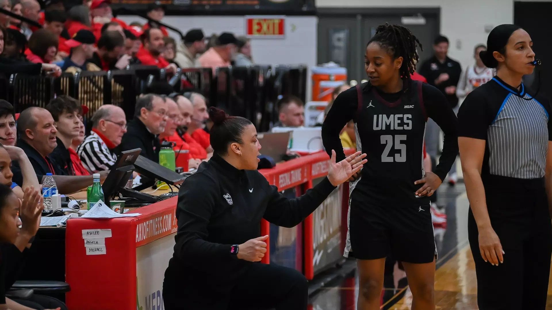
The University of Maryland Eastern Shore Hawks baseball team came up short in their midweek contest against Towson University, despite a standout individual performance from one of their key players.
While the Hawks were unable to secure victory in the matchup, there was a bright spot in the lineup as Jimenez delivered his best offensive showing of the season. The player connected for four hits during the game, marking a personal season-best performance at the plate.
The loss represents a setback for the Hawks as they continue their season, though Jimenez’s exceptional hitting display provides a positive takeaway from an otherwise disappointing result against their opponents.
The Goldey-Beacom College Lightning baseball team put on a dominant display during their road trip to Pennsylvania, overwhelming Lincoln University in both games of a Central Atlantic Collegiate Conference doubleheader.
The Lightning opened the day with an explosive 23-3 win in the first matchup before maintaining their momentum with a commanding 13-3 victory in the nightcap at Lincoln University in Pennsylvania.
The doubleheader sweep showcases the team’s offensive firepower and marks a successful conference road trip for the Wilmington-based college program.
Authorities in New Castle County are actively searching for an elderly Wilmington man who vanished from his home earlier this week.
Police have activated a Gold Alert for James Dwyer, 82, who disappeared from his home on Maple Avenue Wednesday morning. According to the New Castle County Division of Police, Dwyer departed from his residence in the 100 block of Maple Avenue around 9:30 a.m. on March 25, 2026, and has failed to return.
The Gold Alert system is specifically designed to help locate missing adults who may be suffering from cognitive impairments or other conditions that could put them at risk.
Investigators report that following his departure from home, Dwyer made contact with someone, though additional details about this communication have not been released by authorities.
Anyone with information regarding James Dwyer’s whereabouts is urged to contact the New Castle County Division of Police immediately.
The University of Delaware men’s tennis team experienced a setback during their recent road trip, falling to Miami in intercollegiate competition.
The Blue Hens faced a tough challenge against their opponents, ultimately coming up short in the match. The team traveled away from their home courts to compete against Miami in what marked another contest in their ongoing season.
This loss adds to the team’s record as they continue their campaign and look ahead to future matches on their schedule.
SMYRNA, Del. – Delaware residents living near nuclear power facilities will hear emergency warning sirens sound Tuesday evening during a scheduled safety drill.
The Delaware Emergency Management Agency, Delaware State Police, and Public Service Enterprise Group Inc. will perform their routine quarterly evaluation of the Salem/Hope Creek Nuclear Generating Stations’ emergency alert system on Tuesday, April 7 at 7:20 p.m.
The testing will activate 37 warning sirens positioned throughout Delaware within a 10-mile zone surrounding the nuclear power plants.
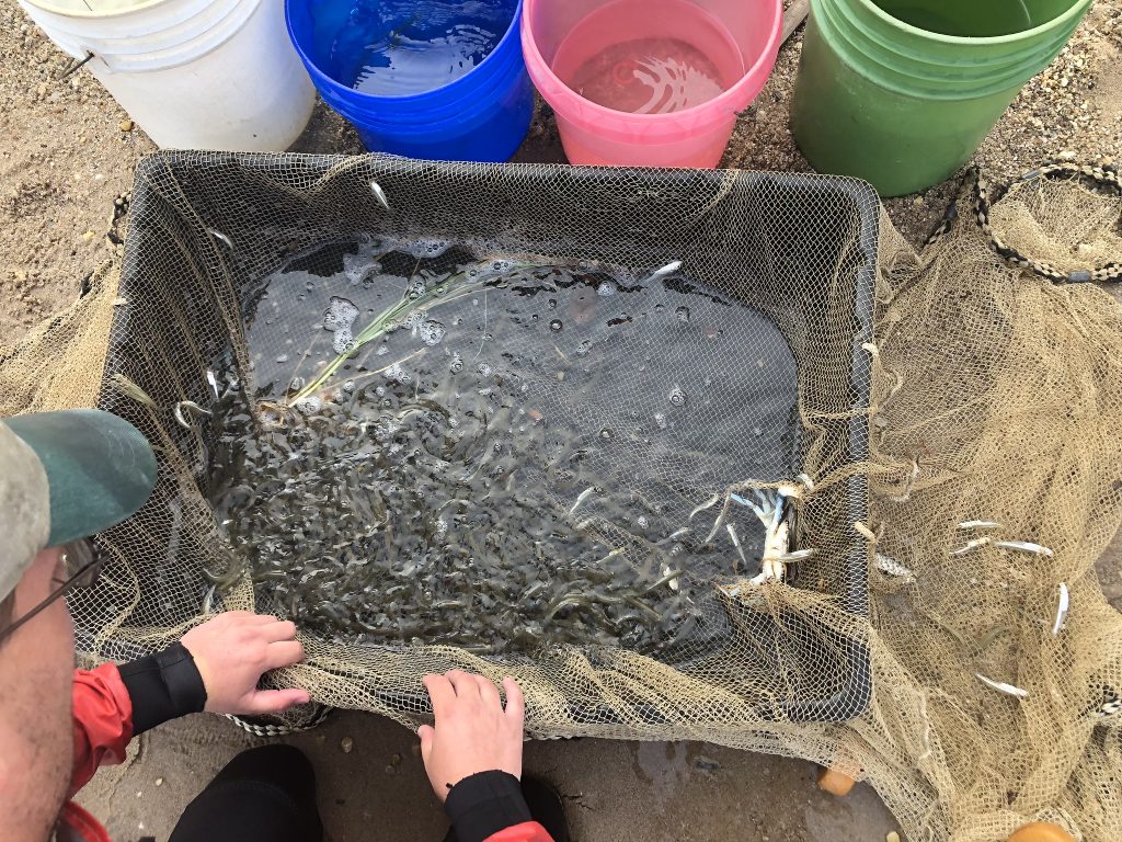
With spring officially here, Maryland fishing enthusiasts are gearing up for the traditional start of trout season. Waters designated as “closure 1” trout management areas in the central and western parts of the state will open for fishing Saturday, March 28 at 6:30 a.m., following recent stocking efforts.
Last Saturday’s Youth Trout Fishing Day proved highly successful, with young anglers like Jack Proctor enjoying memorable outings with family members. The event brought smiles to both children and their proud parents throughout the state.
Weekly Fishing Forecast: March 25-31
As daylight hours extend and temperatures climb, Chesapeake Bay waters continue their gradual warming process, encouraging gamefish to move toward spawning areas. Current buoy readings show main Bay and river mouth surface temperatures holding steady in the mid-40s, while smaller rivers and streams register temperatures around 50 degrees. Protected streams and downwind locations on sunny days often reach the mid-50s, creating ideal conditions for yellow perch as they migrate upstream from winter habitats to prepare for spawning in Maryland waters over the coming weeks.
Most Maryland rivers and streams are experiencing typical flow levels for this time of year. Water clarity remains average throughout most Maryland sections of the Bay and tributary rivers.
Upper Chesapeake Bay Conditions
The lower Susquehanna River and uppermost Bay areas continue experiencing murky water conditions, though most woody debris has now washed ashore. Anglers targeting striped bass in the Susquehanna Flats during catch-and-release season are seeing mixed results. Popular techniques include using large paddletail lures and rattling crankbaits along channel edges. Some fishermen are trying cut bait such as gizzard shad or menhaden, which also attracts large blue catfish that can be harvested. Anglers must use non-offset circle hooks, with 9/0 being an effective size for both large striped bass and blue catfish.
Catch-and-release fishing is permitted within specific upper Bay boundaries: the Susquehanna Flats upstream from a line connecting Sandy Point to Turkey Point, the Susquehanna River downstream from a line linking the Susquehanna State Park boat ramp at Lapidum to Twin Rocks to Tomes Wharf in Port Deposit, and the Northeast River.
Below the dam in the lower Susquehanna River, anglers are finding smallmouth bass and occasional walleye using jigs and crankbaits in fast-moving water over rocky bottoms. Largemouth bass fishing is productive in the Susquehanna Flats as grass beds begin emerging.
Blue catfish are providing excellent fishing opportunities throughout the upper Bay, from the Bay Bridge to Conowingo Dam. Some of the year’s largest blue catfish are currently active in the Bay, with tidal rivers also hosting active populations due to warming temperatures. Most cut baits or scented baits work well on traditional single hook bottom rigs or sliding sinker rigs paired with 8/0 or 9/0 non-offset circle hooks.
White perch anglers have exciting opportunities this week as fish move into tidal spawning rivers. The Bush, Gunpowder, Magothy, Chester, and Sassafras rivers are prime locations, while the Susquehanna River will be productive later due to cold water from Conowingo Dam. Small 1/16-ounce to 1/8-ounce jig heads with lip-hooked minnows or grass shrimp prove most effective.
Middle Bay Report
Striped bass catch-and-release fishing is available in the main middle Bay waters, though tidal rivers remain closed. Bay temperatures are holding in the upper 40s this week. Trolling along steep channel edges is popular, with regulations requiring barbless lure hooks, no stinger hooks, and maximum six lines. Jigging along channel edges or over fish located on depth finders offers exciting action using large soft plastic jigs of six inches or longer.
White perch are moving up the Choptank River and Tuckahoe Creek, with the first males reaching as far upstream as Greensboro and below Hillsboro on the Tuckahoe. Water temperatures measure 58 degrees at Denton and 52 degrees at Cambridge. Effective techniques include small jig heads or shad darts with grass shrimp or small minnows, or bottom rigs baited with grass shrimp, minnows, or bloodworm pieces.
Blue catfish action improves weekly as warmer temperatures activate smaller and medium-sized fish, while catfish exceeding 20 pounds have been active for weeks.
Lower Bay Opportunities
The lower Bay provides some of the week’s best striped bass catch-and-release fishing. Trolling and jigging are both popular methods, with trolling requiring barbless hooks, no stinger hooks, and maximum six lines. Bait fishing requires non-offset circle hooks.
Exciting news comes from District of Columbia waters, where the season’s first hickory shad were caught at Fletchers Landing. Hickory shad have entered Mattawoman Creek, providing enjoyable catch-and-release opportunities using small flashy spoons, shad darts, and colorful flies.
White perch spawning runs are creating excellent fishing this week in the Little Choptank, Nanticoke, Wicomico, Pocomoke, Patuxent, and Potomac rivers. Grass shrimp, small minnows, or bloodworm pieces work best, presented on small jig heads, under bobbers, or on bottom rigs depending on water depth.
Crappie fishing is productive whether targeting white perch with small minnows or fishing specifically for crappie near structure in non-tidal ponds, reservoirs, or tidal rivers. Look for fish around fallen treetops, sunken brush, bridge piers, and marina docks.
Blue catfish provide exciting action in the tidal Potomac, Patuxent, and Nanticoke rivers. These fish are very active, with channel areas offering the best fishing locations. Gizzard shad remains the preferred cut bait, though menhaden, white perch, chicken liver, and various scented baits work well on 8/0 or 9/0 circle hooks with sliding sinker rigs.
Freshwater Fishing Update
March 28 marks the major day for put-and-take trout anglers, as closure 1 trout management waters open at 6:30 a.m. for the traditional season opener. All locations have been stocked for this event, with each site receiving some large trout exceeding 26 inches. Other trout management waters not previously closed remain open. Morning conditions may be chilly, but fair weather is forecast. Powerbait doughballs will be the most popular bait choice, followed by garden worms. Anglers with space can cast small spinners and spoons, while fly fishermen can use nymphs.
Largemouth bass fishing is in full swing as fish feed aggressively to rebuild energy stores lost during winter. Water temperatures generally reach the 50s in most ponds, reservoirs, and upper tidal rivers, creating comfortable conditions for bass at various depths near structure. Effective lures include soft plastics like paddletails, jigs, and rigged creature baits, plus lipless crankbaits, jerkbaits, and spinnerbaits in transitional depths. Largemouth and smallmouth bass fishing remains catch-and-release only until June 16.
Spring offers prime crappie fishing in both tidal and non-tidal waters as fish hold near submerged structure before spawning. Target fallen treetops, sunken wood and brush, bridge piers, and marina docks using small minnows as bait.
Chain pickerel can be found near available structure in both tidal waters and ponds/reservoirs while waters remain cool and summer grass beds are absent. Sunken wood provides key early-season structure. Various lures will attract strikes, but anglers should consider replacing treble hooks or single inline hooks to minimize fish damage.
Atlantic Ocean and Coastal Bays
The Ocean City area is showing signs of life as water temperatures begin warming. Beach anglers await the first black drum arrivals while currently catching clearnose skates and spiny dogfish.
The season’s first flounder have been reported in Virginia back bay areas, suggesting Ocean City’s first flounder catches may occur this weekend. Some striped bass catch-and-release action is happening at the Route 90 Bridge, though fish aren’t meeting the 28-inch minimum size.
Offshore tautog fishing provides the main action, with charter boats finding productive fishing at wreck and reef sites. Anglers commonly catch their four-fish limit of hefty tautog per trip. Maryland’s tautog season continues through May 15, and fish will move into the Ocean City Inlet area as inshore waters warm.
Delaware has received the green light from federal officials to move forward with an ambitious broadband expansion project that will connect thousands of residents and businesses to high-speed internet service.
Governor Matt Meyer, working alongside the Delaware Department of Technology and Information, announced that federal authorities have approved the state’s comprehensive strategy to extend broadband infrastructure throughout underserved communities. The project will utilize nearly $27.8 million in federal funding.
The approved plan targets more than 4,728 locations across Delaware where residents and business owners currently lack access to reliable high-speed internet or have inadequate service. These areas include both completely unserved locations and those with substandard connectivity.
The funding comes through the federal Broadband Equity, Access, and Deployment program, which aims to close the digital divide nationwide by supporting infrastructure improvements in rural and underserved communities.
State officials view this federal approval as a significant step forward in ensuring all Delaware residents have access to the digital resources necessary for education, healthcare, business operations, and staying connected with family and friends.
The Delaware Department of Technology and Information will oversee implementation of the broadband expansion project as it moves into the next phase of development.
Delaware Department of Transportation officials report that the right travel lane on northbound Interstate 95 is currently blocked just beyond the Route 896 interchange.
The lane restriction will remain in place until 3 PM today, according to DelDOT’s traffic incident reporting system.
Drivers traveling north on I-95 through this area should anticipate potential delays and consider using alternate routes if possible. Motorists are advised to merge safely into the left lane when approaching the closure zone.
The University of Delaware women’s lacrosse squad is preparing to kick off a home series this weekend, welcoming Jacksonville and Stetson to campus for a pair of matchups.
The Blue Hens will take the field at home for both contests as they continue their spring campaign. The weekend represents an opportunity for local fans to catch the team in action on their home turf.
Both games are part of the team’s regular season schedule as they work through conference play and preparation for potential postseason opportunities.
A University of Delaware women’s golf team member has earned her first conference recognition of her collegiate career.
Sophomore Kate Roberts received the Energy Transfer Conference USA Women’s Golfer of the Week honor, the league announced Wednesday from its Dallas headquarters.
The weekly recognition marks Roberts’ inaugural conference award and comes following her solid performance during The Nashville Invitational competition.
Roberts’ achievement highlights the continued success of the Blue Hens women’s golf program as the team competes throughout the spring season.
Delaware State Police have released the identity of the pedestrian who was killed in Monday’s deadly hit-and-run incident in Milford. Authorities say the victim was 74-year-old Richard Bielawski, a resident of Harrington.
Investigators with the Delaware State Police Collision Reconstruction Unit are still working to piece together what happened in the fatal crash. Officials are reaching out to the public for help, asking anyone who saw the incident or has relevant information to get in touch with Master Corporal W. Booth at (302) 698-8451. Witnesses can also share details by sending a private message to the Delaware State Police Facebook page or by calling Delaware Crime Stoppers at (800) 847-3333.
For those affected by this tragedy or other crimes, support services are available around the clock. The Delaware State Police Victim Services Unit and Delaware Victim Center provide assistance 24 hours a day through their hotline at 1-800-VICTIM-1 (1-800-842-8461). Those needing help can also reach out via email at [email protected].
LEWES – A major road closure is coming to Sussex County next week as state transportation officials prepare for infrastructure work.
The Delaware Department of Transportation will shut down Old Orchard Road between New Road and Savannah Road from Monday, March 30th until Friday, April 3rd. The five-day closure is needed for crews to install new water lines and complete drainage improvements, weather conditions permitting.
Motorists traveling northbound on Old Orchard Road will need to follow an alternate route: head west on New Road, then south on Nassau Road, continue south on Route 1, turn east on Savannah Road, and finally north on Old Orchard Road to reach their destination.
Drivers coming from the south on Old Orchard Road should take Savannah Road west, then go north on Route 1, continue north on Nassau Road, head east on New Road, and finally south on Old Orchard Road.
The work is part of ongoing infrastructure improvements in the Lewes area.
SALISBURY, Md. – The weekly athletic rankings for Wednesday, March 25th have been published, highlighting three Salisbury University Sea Gulls teams currently making their mark this spring season.
This week’s rankings spotlight includes the university’s women’s lacrosse squad, men’s lacrosse team, and baseball program as they continue their respective campaigns.
The rankings provide a snapshot of how Salisbury’s spring athletic programs are performing as the season progresses into late March.
A group of 17 police officers representing 11 law enforcement agencies throughout Delaware have successfully earned their instructor certifications through a specialized training program.
The Delaware Police Officer Standards and Training Commission announced that these officers completed the POST Approved Instructor Course, which took place from March 16 through March 20, 2026. The training was hosted at the Rehoboth Beach Police Department facilities.
This instructor certification program enables these newly qualified officers to teach and train other law enforcement personnel within their respective departments and across the state’s police agencies.
Drivers in the Hockessin area should prepare for traffic delays as the Delaware Department of Transportation schedules pavement repair work on a busy roadway.
DelDOT officials have announced that Loveville Road will experience lane restrictions between Route 41 Newport Gap Pike and Route 48 Lancaster Pike while crews perform warm mix patching operations.
The roadwork is scheduled for Thursday, April 1st and Friday, April 2nd, with traffic control measures in effect from 8:00 am until 4:00 pm each day. Flaggers will be stationed along the work zone to direct vehicles through the construction area.
Motorists traveling through this section of New Castle County are advised to allow extra time for their commute and consider alternate routes if possible during the scheduled work hours.
Maryland’s Natural Resources Police force has grown by 16 officers following a graduation ceremony that marked the agency’s first new class since November 2023.
The ceremony at Immanuel Baptist Church in Baltimore on Tuesday, March 24, honored eight officers who completed the 67th Basic Recruit Class and eight additional officers who joined through the 66th lateral recruiting class as transfers from other law enforcement departments.
Superintendent Colonel Orlando D. Lilly spoke to the new officers during the ceremony, emphasizing their commitment to public service.
“These officers have dedicated themselves to preparing to serve Maryland’s communities and natural resources,” Col. Lilly said. “As noble representatives of our agency, NRP officers exemplify what it means to serve people with pride while conserving the public lands, waters, fish, and wildlife that we treasure. We are grateful for their commitment and sacrifice as they embark on their service to the state.”
Following speeches from invited guests and keynote speaker Dr. RaShall Brackney, the officers received their oath of office and badges from Col. Lilly.
The new recruits underwent extensive preparation at the Maryland Police and Correctional Training Commissions’ Sykesville facility, completing 39 weeks of comprehensive training and educational programs.
Their curriculum covered Maryland conservation law, criminal procedure, vehicle and traffic regulations, physical fitness, firearms training, wildlife identification, emergency vehicle operations, search and rescue techniques, land navigation, and boating navigation skills.
The newly sworn officers will now begin field assignments in patrol districts throughout Maryland, working alongside veteran officers to complete their hands-on training. Natural Resources Police officers possess full statewide law enforcement powers, including authority over criminal matters, motor vehicle violations, and natural resources regulations across all of Maryland.
Basic Recruit Class 67
Officer Ty A. Bean – Fort Washington, Prince George’s County
Officer Maranda E. Graybill – Union Bridge, Carroll County
Officer Samantha M. Harris – Pasadena, Anne Arundel County
Officer Parker W. Martin – Centreville, Queen Anne’s County
Officer Elizabeth M. Rogers – Essex, Baltimore County
Officer Justin M. Sherman – Reisterstown, Baltimore County
Officer Alexis M. Twigg – Clearville, Bedford County (Pa.)
Officer Sidney D. Vann – Joppa, Harford County
Lateral Class 66
Officer Andrew H. Anderson – Swanton, Garrett County
Officer Benjamin L. Click – Cumberland, Allegany County
Officer Mariah B. Dolan – Oldtown, Allegany County
Officer Alison P. Ferris – Glen Burnie, Anne Arundel County
Officer James A. Koscielski III – Dundalk, Baltimore County
Officer Chad S. Schroyer – Chester, Queen Anne’s County
Officer Bryant D. Simmons – Fishing Creek, Dorchester County
Officer Ryan R. Walker – Ocean City, Worcester County
The Maryland Natural Resources Police has historical significance as the state’s oldest statewide police agency, with origins dating back to 1868, making it among the nation’s earliest state conservation law enforcement organizations.
Relief organizations throughout Hawaii are mobilizing donation efforts as residents work to recover from the most severe flooding the islands have experienced in more than two decades. The catastrophic weather has prompted charitable groups, community aid networks, and foundations to launch fundraising campaigns supporting affected families, agricultural operations, and animal welfare organizations statewide.
The devastation resulted from two separate Kona low pressure systems that struck approximately one week apart, dumping massive amounts of rain onto already saturated ground unable to handle additional water. The flooding destroyed agricultural crops, damaged hundreds of residential properties, impacted multiple educational facilities, and affected one medical facility.
Hawaii Governor Josh Green estimates the combined storm damage may surpass $1 billion, leading him to request major disaster designation from President Donald Trump to secure federal recovery resources.
“These storms have impacted every county in our state and stretched our emergency response capabilities,” Green said in a statement. “This request is about getting our communities the support they need to recover quickly and safely.”
Community members and assistance organizations are working together to help displaced families find temporary shelter, replace lost food supplies, access healthcare services, and remove debris from damaged properties.
“So many families have been displaced, homes have been damaged, and communities are facing immediate needs,” said Hawaiian Council CEO Kuhio Lewis. “The path to recovery begins now — it cannot wait.”
Several organizations are currently accepting financial contributions to support recovery efforts.
The Lahui Foundation is gathering funds for its community assistance programs that distribute essential supplies and direct financial help to North Shore Oahu families. The organization is also coordinating volunteer teams to assist residents with home and neighborhood cleanup efforts. Musician Jack Johnson, who was born on the North Shore, promoted the Lahui Foundation’s efforts through his Instagram account.
Aloha United Way on Oahu has launched its Community Relief Fund to deliver emergency aid to individuals and families while supporting frontline nonprofit organizations. Maui United Way is providing assistance to communities on Maui and neighboring Molokai island. Hawaii Island United Way is gathering contributions for Big Island households, requesting donors specify their contributions are intended for flood recovery efforts.
The Hawaiian Council, an organization focused on Native Hawaiian development, created the Kako’o Oahu program to assist residents with housing stability programs, financial support, and additional future services. The organization is providing matching funds up to $200,000 for donations received.
The Hawaii Community Foundation has activated its Stronger Hawaii Fund to distribute resources throughout the state for emergency response, recovery operations, and future preparedness efforts.
Maui Rapid Response is utilizing collected funds to provide community aid to underserved populations on Maui and Molokai, including homeless individuals and regions temporarily isolated by floodwaters.
GoFundMe has established a centralized location featuring verified fundraising campaigns for Hawaii flood victims.
Help Maui Rise is maintaining a database of donation opportunities for directly affected individuals, with community member verification, according to the organization.
The Hawaiian Humane Society on Oahu is conducting operations in flooded areas and supplying pet food and materials to displaced families. They are accepting monetary contributions and updating their Amazon wishlist based on current needs. Maui Humane Society is collecting donations to assist remote communities like Hana, which was temporarily isolated from aid due to damaged roads, and Molokai island.
Hawaii Farmers Union Foundation established the Hawaii Flood Response Fund to help agricultural producers throughout the state recover, rebuild, and restore Hawaii’s local food production system, according to the organization. Agriculture Stewardship Hawaii reports that estimated farm damages statewide have already exceeded $15 million.
Healthy Mothers Healthy Babies Coalition of Hawaii and Hawaii H.O.M.E Project have deployed mobile medical units on Oahu’s North Shore, collaborating with partners including Direct Relief, which is helping distribute water purification equipment, antibiotics, insect repellent, tetanus vaccinations, and other essential medical supplies.
Delaware Department of Transportation officials are reporting a lane closure on northbound Interstate 95 that is impacting traffic flow in the area.
The right lane is currently blocked on I-95 North immediately beyond the Route 896 interchange, according to DelDOT’s traffic incident reporting system.
Motorists traveling northbound on I-95 through this section should expect potential delays and are advised to move to the left lane when approaching the area.
DelDOT has not provided information about the cause of the closure or an estimated time for reopening the affected lane.
Motorists traveling on Main Street, also known as Route 299, are experiencing traffic delays due to ongoing construction work that has forced the closure of one southbound lane.
The affected stretch runs between Front Street and Old Corbitt Road, where crews are working on construction activities that require the lane restriction.
According to DelDOT traffic information, the southbound lane closure is scheduled to remain in effect until 4 PM today.
Drivers are advised to plan for potential delays and consider alternate routes if possible while traveling through this area during the construction period.
Agricultural workers from across Delaware gathered at Pratt Farm Lodge on March 18 for the Delaware Farm Bureau’s ninth annual safety conference, organized by the Promotion and Engagement Committee. Conference Chair June Unruh welcomed participants by expressing gratitude for their commitment to agricultural safety and introduced her “three P’s” safety philosophy: prevent what can be prevented, make safety a priority, and safeguard your valuable assets. The day featured educational sessions on tick prevention, animal handling techniques, fire extinguisher operation, and emergency response planning.
DNREC Tick Biologist Ashley Kennedy led a session on tick-related risks and prevention strategies throughout Delaware. Kennedy explained that the state’s tick surveillance program operates continuously, monitoring and testing specimens while offering identification resources for residents. She identified four tick species of greatest concern: the Longhorned Tick, American Dog Tick, Lone Star Tick, and Blacklegged Tick. Kennedy pointed out that alpha-gal syndrome is linked to the Lone Star Tick, while Lyme disease and other infections can be transmitted by the Blacklegged Tick, also called the deer tick. Additional tick safety resources are available at www.de.gov/ticks.
University of Delaware Cooperative Extension’s Kent County Director Susan Garey presented strategies for safe animal handling practices. Garey stressed the need to stay composed and quiet when working with livestock, explaining that animals have limited depth perception and blind areas that make them susceptible to being frightened by quick movements. She noted that flight zones differ based on how domesticated the animals are. Garey warned attendees to avoid turning away from male animals, which tend to display more aggressive behavior. Her presentation concluded with advice to “plan, prepare, and always be aware.” Information about UD Cooperative Extension is available at www.udel.edu/academics/colleges/canr/cooperative-extension.
Delaware State Fire School Field Instructor Chuck Snyder conducted training on proper fire extinguisher usage. He outlined the five extinguisher categories:
A – Ordinary Combustibles
B – Flammable Liquids
C – Electrical Equipment
D – Combustible Metals
K – Cooking Media (greases, fats, oils)
Snyder conducted practical training using a fire extinguisher simulator. He instructed participants to position themselves with the wind at their backs, maintain a distance of six to ten feet from flames, remove the safety pin, direct the nozzle toward the fire’s base, gently press the handle, and move side to side until flames are completely out. Snyder emphasized the importance of annual extinguisher inspections and mentioned that metal units can be recharged. More details are available at www.statefireschool.delaware.gov.
Todd Givler from Nationwide presented the company’s Farm Risk Ready initiative, focusing on risk assessment and emergency planning for agricultural operations. Givler emphasized the value of considering “what if?” scenarios to enhance preparedness, revealing that 65% of individuals lack formal emergency protocols and instead adopt a reactive “wait and see” mindset. He noted that established emergency plans can also improve insurance coverage by showing reduced risk levels. Participants were urged to evaluate their current preparedness and take preventive measures. Farm Risk Ready information is available at www.nationwide.com/lc/resources/farm-and-agribusiness/articles/farm-risk-ready.
Delaware Department of Agriculture’s Pesticide Program Manager and Sussex County Inspector Jimmy Hughes presented information on pesticide safety and management. Hughes detailed the certification process for becoming a Certified Pesticide Applicator and reviewed continuing education requirements for maintaining credentials. He covered essential safety measures including proper handling procedures and application planning. Attendees earned one certification renewal credit by participating in his session. The DDA Pesticide Management Program information can be found at www.de.gov/pesticides.
“It is very important to stay informed and work smart; don’t learn the hard way,” Unruh said as she praised attendees for prioritizing safety education. “Keep a safety checklist in your head, and learn it, use it, and share it.”
Those seeking information about DEFB’s Safety Conference or Promotion and Engagement Committee can contact Assistant Executive Director and Marketing Coordinator Mikayla Paul at [email protected], 302-697-3183, or www.defb.org.
Goldey-Beacom College’s track and field programs celebrated a stellar weekend of competition, earning four weekly recognitions from the Central Atlantic Collegiate Conference.
The Lightning’s exceptional performances across both men’s and women’s track and field events resulted in multiple athletes receiving conference honors for their achievements during weekend competition.
The awards highlight the continued success of Goldey-Beacom’s track and field programs within the CACC, demonstrating the strength and depth of the Lightning’s athletic talent this season.
The University of Maryland Eastern Shore women’s golf team secured an eleventh-place finish at the William & Mary Tribe Invitational held at Kingsmill Resort.
The Hawks competed in the multi-day tournament alongside other collegiate teams in the invitational event hosted by the College of William & Mary.
The tournament took place at the Kingsmill Resort golf course, where UMES golfers faced challenging conditions throughout the competition.
This finish represents another competitive showing for the Hawks women’s golf program as they continue their season schedule against regional opponents.
Motorists traveling on northbound Route 9 are facing a complete road closure at the Reedy Point Bridge as inspection crews conduct necessary bridge maintenance work.
Delaware Department of Transportation officials have shut down the northbound lanes to allow for thorough structural inspections of the bridge. The closure began earlier today and is scheduled to continue until 4 PM this afternoon.
Drivers are advised to seek alternate routes and expect delays in the area. The southbound lanes of Route 9 remain unaffected by the inspection work.
DelDOT has not indicated whether the closure may extend beyond the 4 PM timeframe, but motorists should check traffic conditions before traveling through the area.
Ocean City, MD – The Town of Ocean City announced March 25, 2026 that it is now reviewing grant requests for complimentary plants aimed at enhancing local environmental efforts.
Property owners have two options available through the municipal program. The first provides Beach District vegetation specifically designated for secondary dune restoration projects. The second option supplies pollinator garden plants designed to help residents establish new gardens or expand existing ones on properties that are not directly beachfront.
Municipal officials indicated they will approve a restricted number of applications within each plant grant category due to limited availability.
High pressure currently positioned off the Northeast coast will continue to influence the Delmarva region through today, delivering dry conditions and a gradual warming trend. As this system shifts offshore tonight, a return flow will develop, allowing temperatures to climb closer to seasonal averages today and well above normal by Thursday.
Expect increasing cloud cover through the day, but temperatures will still respond nicely. Highs this afternoon will reach the mid to upper 50s across Delmarva, followed by a much warmer day on Thursday with highs surging into the upper 60s to near 70 degrees.
This brief stretch of mild weather will be interrupted by an approaching cold front tied to a low pressure system tracking through the Great Lakes into eastern Canada. Rain showers will begin to move into the region Thursday evening, initially across western areas, before spreading southeastward overnight into Friday morning. Rainfall totals are expected to range between a quarter to a half inch.
There is also a slight chance for a rumble of thunder as modest elevated instability develops along the front, though severe weather is not expected at this time.
Winds will become a factor as well. A breezy southwest wind develops Thursday ahead of the front, with gusts increasing to 25 to 35 mph. Behind the front, winds shift to the northwest on Friday, maintaining gusty conditions and ushering in a much cooler air mass.
Temperatures will actually fall through the day on Friday due to strong cold air advection, setting the stage for a chilly start to the weekend. Highs on Saturday will struggle to reach the 50s across Delmarva.
Looking ahead, conditions improve by Sunday as high pressure builds back into the region. Skies will remain dry, and temperatures will moderate closer to seasonal norms.
The New Castle County Police Academy has announced the completion of training for its 54th recruit class, with six new officers ready to begin their law enforcement careers.
The graduating officers who will be joining the New Castle County Police Department include Abdulla Abdulla, Madison Arnold, Christopher Berry Jr., Nicholas Classie, Rachel Craine, and Jackson Dean.
The graduation ceremony marks the successful completion of police academy training for these new recruits, who will now begin serving the New Castle County community as sworn law enforcement officers.
Motorists traveling on North Main Street should expect periodic delays today as construction crews continue their work in the area.
According to DelDOT, flagging operations are being conducted intermittently on the southbound lanes of North Main Street between West Glenwood Avenue and Providence Drive. The traffic control measures are scheduled to remain in place until 3 PM this afternoon.
Drivers are advised to allow extra travel time when using this route and to exercise caution when approaching the construction zone.
Delaware Department of Transportation officials have implemented a lane closure on southbound Route 1 at Hudson Road due to construction activities.
The right lane of Coastal Highway heading south has been blocked off to traffic, with the restriction expected to last until 6:30 PM this evening.
Motorists traveling in the area should anticipate potential delays and consider alternate routes if possible. DelDOT advises drivers to exercise caution when approaching the work zone and to merge safely into the remaining open lanes.
Motorists traveling through Dover will need to find alternate routes or expect significant delays on Frederica Road today.
Delaware Department of Transportation crews are conducting construction work that has forced the closure of the southbound lane on Frederica Road. The affected stretch runs from Market Street to East David Street.
The lane restriction is scheduled to remain in place until 4 PM today. Drivers are advised to allow extra travel time or consider using alternate routes to avoid the construction zone.
DelDOT continues to monitor the situation and will reopen the lane once work is completed safely.
Good morning, Delmarva! We’re looking at a pleasant spring day ahead with partly sunny skies and temperatures climbing to a comfortable 57 degrees. Light southerly winds up to 10 mph will keep things feeling nice and mild – perfect weather for getting outside and enjoying the midweek break.
Tonight, expect mostly cloudy skies as temperatures dip to around 44 degrees. It’s a great evening for a light jacket if you’re heading out.
Looking ahead to Thursday, we’ve got some really nice weather in store! Partly sunny skies will help push temperatures up to a lovely 71 degrees – feeling much more like spring should! However, keep an eye on Thursday night as clouds increase and rain showers become likely with lows around 60 degrees. You might want to grab that umbrella before heading out Friday morning.
Overall, it’s shaping up to be a beautiful couple of days here on the peninsula. Enjoy the mild conditions today and that warmup tomorrow! Stay weather-aware, Delmarva, and have a wonderful Wednesday!
Recovery teams on Tuesday started assessing destruction caused by an unexpected heavy rainfall that unleashed rushing floodwaters through a residential area close to Honolulu’s city center — marking the most recent episode in a string of severe weather and flooding events that have battered Hawaii during the past two weeks.
The assessment comes as communities work to recover from what has been described as a photo gallery documenting the flooding damage, compiled by Associated Press photographers.
President Trump has launched a comprehensive effort to transform the nation’s cultural and historical institutions, targeting what he describes as “anti-American ideology” at museums, national parks, and monuments across the country.
Through executive orders and administrative actions, his administration has dismantled exhibits about slavery, brought back Confederate monuments, and implemented other changes that civil rights organizations warn could undo decades of progress in acknowledging America’s complex history.
In March 2025, just weeks into his presidency, Trump issued an executive order specifically aimed at what he characterized as the proliferation of “anti-American ideology” within the Smithsonian Institution. The directive called for eliminating such content from the renowned museum and research network, which serves as a cornerstone for displaying American history and culture.
The same order instructed the Interior Department to restore federal parks, monuments and memorials that had been “removed or changed in the last years to perpetuate a false revision of history.”
Trump’s positions on race and history became clear in previous statements. Last August, he criticized on social media what he termed an overemphasis on “how bad slavery was.” During a January interview with the New York Times, when questioned about policies stemming from the Civil Rights Act of 1964, he claimed civil rights protections disadvantaged white Americans.
The NAACP, America’s oldest and largest civil rights organization, condemned Trump’s statements as preparation for rolling back social advancement. Black Lives Matter, the racial justice movement, argued his comments revealed an intent to minimize slavery’s horrors.
In response to Trump’s March 2025 directive, the Interior Department announced a comprehensive examination of interpretive materials at all national parks. These informational plaques and displays that explain historical sites and events are now subject to administrative review as the Trump team works to reshape public spaces and cultural institutions.
National Park Service personnel subsequently removed a slavery exhibit on January 22 from a Philadelphia historical location where George Washington previously resided. The display had included information about Washington’s ownership of enslaved individuals. By mid-February, a federal judge in Pennsylvania mandated that the National Park Service restore the slavery exhibit, which the agency did.
According to The Washington Post, federal officials have also directed national parks to eliminate numerous signs and displays addressing slavery and the historical mistreatment of Native Americans by European settlers.
Civil rights advocates argue these actions diminish recognition of crucial periods in American history. “Stripping enslaved people’s stories from museum exhibits, monuments, and digital archives is not neutrality — it is erasure,” the NAACP stated.
The National Park Service announced last August its intention to restore a statue of Confederate General Albert Pike that protesters had toppled and damaged in 2020 during demonstrations following George Floyd’s death.
On March 18, the Trump administration revealed plans to display in Washington a statue of Caesar Rodney, who signed the Declaration of Independence but also owned enslaved people. This statue had been removed from Delaware in 2020 during racial justice demonstrations.
Trump announced on March 22 that the White House had installed a statue of Italian explorer Christopher Columbus on its grounds. This statue reconstructed one that protesters had thrown into Baltimore’s harbor in 2020, challenging heroic depictions of Columbus that they argued minimized or ignored his brutal treatment of indigenous Americans.
Trump severely criticized the Smithsonian through social media last year, threatening it would face the same scrutiny as colleges and universities whose funding was jeopardized for policies that angered his administration.
The 180-year-old Smithsonian, encompassing 21 museums, galleries and the National Zoo, receives most funding from Congress but maintains independence in its operations and decisions.
The White House initiated an internal examination of several Smithsonian museums last year, stating it would evaluate the tone and historical perspective of exhibition materials, websites, educational resources and digital content. The Smithsonian responded that it would participate “constructively.”
Trump appointed himself as Kennedy Center chairman and populated its board with supporters last year. In December, the board voted to rename the institution the Donald J. Trump and the John F. Kennedy Memorial Center for the Performing Arts. Trump had previously denounced the center as excessively liberal.
Numerous organizations and performers have since distanced themselves from the center, citing the Republican leader’s control. Democrats have pointed out that Congress established the center’s name, arguing Trump’s rebranding lacks legal authority. The Kennedy family condemned the renaming as damaging to the assassinated president’s memory.
On February 1, Trump announced plans to shut down the center for two years beginning in July for renovations.
Last April, the Trump administration declared the Environmental Protection Agency would eliminate a small museum at its headquarters documenting the agency’s history, citing budget reductions.
In May, Trump criticized Kim Sajet, who directed the National Portrait Gallery in Washington, labeling her as biased. She announced her resignation the following month. Late last year, the White House dismissed several National Council on the Humanities members.
On the international stage, Trump has pulled the United States from dozens of global and United Nations organizations, including cultural and refugee agencies, claiming they provide no benefit to America.
The University of Maryland Eastern Shore women’s basketball team wrapped up their groundbreaking season Monday night, falling to Youngstown State in the second round of the Women’s National Invitation Tournament.
The Hawks’ elimination marks the end of what will be remembered as a transformative year for the program, which achieved unprecedented success both in regular season play and by earning their inaugural postseason tournament berth.
UMES made program history this season by securing more victories than any previous team in school history while also claiming their first-ever invitation to postseason competition through the WNIT.
The team’s journey to the second round represented a significant milestone for Eastern Shore basketball, as they became the first Hawks squad to compete beyond the regular season and conference tournaments.
Head coach Fred Willis guided the team through this banner season, helping establish new standards for the program’s future aspirations.
Though their postseason run came to a close against Youngstown State, the Hawks have set a new foundation for continued growth and success in the years ahead.
Drivers traveling north on Route 1 should expect delays near the Route 14 overpass as construction crews continue their work through the evening hours.
The Delaware Department of Transportation has blocked off the right lane in the northbound direction at the Route 14 overpass location. Officials say the lane restriction is necessary to accommodate ongoing construction activities in the area.
The lane closure is scheduled to remain active until midnight tonight, after which normal traffic patterns should resume.
Motorists are advised to allow extra travel time and use caution when passing through the construction zone. Drivers should merge safely into the left lane when approaching the work area.
Motorists traveling on Route 1 will encounter periodic lane restrictions as construction work continues along a stretch of the highway.
The Delaware Department of Transportation reports that drivers should expect intermittent lane closures between Northeast Front Street and Beaver Dam Road. These temporary restrictions will remain in place until 5 AM.
Commuters are advised to allow extra travel time and use caution when driving through the construction zone. Workers will be present in the area during the closure period.
While the murky waters of the Chesapeake Bay may look empty from the surface, Maryland’s Department of Natural Resources routinely uses specialized techniques to study the aquatic life thriving beneath.
In fall 2025 during Maryland Science Week, DNR scientists joined with Huntingtown High School’s AP environmental science students and researchers from the Smithsonian Environmental Research Center at Reed Education Center to showcase how marine biologists collect information about Bay wildlife through seine net sampling.
The students got hands-on experience with this research technique while learning how human development, especially the building of impermeable surfaces like roadways and parking areas, affects aquatic habitats. Scientists explained that locations with 10% or greater impervious coverage can harm fish environments by decreasing water quality and oxygen levels.
Watching from the research center’s shoreline, the group observed as the team used a 100-foot-long, 4-foot-deep beach seine net in the Rhode River. The crew first walked into the water to stretch the net across a broad area, then slowly moved closer together, concentrating the marine life into an increasingly smaller space before finally gathering the entire net and transferring it to a water-filled container on land.
These sampling methods have proven valuable for marine biologists studying fish populations in shallow coastal areas. The department employs seine net research for numerous yearly and ongoing scientific projects. Using various mesh dimensions and study locations, these surveys can target specific fish types for detailed examination or gather important population data.
Multiple DNR seine studies receive funding from the Sport Fish Restoration Fund. Revenue from fishing licenses, equipment, boats, and marine fuel supports DNR’s fish conservation programs. Anglers can buy fishing licenses online through MD Outdoors or at authorized dealer locations.
Estuarine Fish Community Sampling Study
Every summer, DNR marine biologists from the Fisheries Ecosystem Assessment Division deploy beach seine nets 130 times across various sites in the shallow tributary waters of Chesapeake Bay. Captured fish are sorted by age group, tallied, and select species undergo measurement. Water quality measurements are also recorded.
Scientists analyze this information to evaluate nursery and mature habitats for recreationally significant fish species. The survey examines striped bass, yellow perch, white perch, alewife, blueback herring, American shad, hickory shad, spot, Atlantic menhaden, bay anchovy, spottail shiner, silvery minnow, and gizzard shad. During 2025, the survey’s beach seines collected 50 different species, including freshwater varieties like largemouth bass, chain pickerel, and black crappie, plus saltwater species such as bluefish, black drum, and northern puffer.
Juvenile Striped Bass Survey
Striped bass, known locally as rockfish, serve as Maryland’s official state fish. These fish hold recreational and commercial significance from Maine through North Carolina, with the Chesapeake Bay functioning as the main breeding area for the Atlantic Coast population.
DNR has operated the Maryland Juvenile Striped Bass Survey continuously since 1954, making it among America’s longest-running fish population studies. Throughout its history, researchers have collected over 100 fish species during this survey. The study evaluates striped bass breeding success from the prior year while documenting the relative numbers of other fish species observed in summer seine nets. Tracking young fish populations over time helps scientists forecast future adult fish numbers as these juveniles mature.
DNR researchers use seine nets at 22 sites across Maryland’s Chesapeake Bay waters, repeating the process at each location to improve sample reliability. These locations and techniques stay constant annually, enabling scientists to develop yearly comparisons of young fish populations over time.
Recent survey findings have raised concerns. Researchers have documented persistently low counts of striped bass under one year old when compared to the seven-year survey average. While the adult breeding population of striped bass remains healthy, the data collected from counting hundreds of two-inch juvenile striped bass each summer serves as an early indicator that population numbers could drop in upcoming years.
Shad Restoration
Maryland DNR has pursued American and hickory shad restoration in Chesapeake Bay waters since the late 1990s. To gauge these restoration efforts’ effectiveness, scientists perform haul seine surveys each year from late summer through early fall. The seine nets used in this research are launched from boats because of deep waters and sometimes unreachable shorelines along the Choptank River and Patapsco River sampling areas.
At ten sites, one end of a 200-foot net is brought ashore by a researcher in the water, while the opposite end is pulled in a circular pattern by a colleague in a small vessel. A research team manually pulls in the remaining net until fish become trapped in a net pocket. Scientists tally fish by species and gather shad samples for additional laboratory examination. Survey information helps calculate wild population estimates, larval death rates, and evaluate stocking program success.
DNR’s fish stocking programs have successfully restored hickory shad populations in both the Patuxent and Choptank rivers. Nevertheless, survey data indicates that insufficient spawning adults continue to present a major obstacle to population expansion in other waterways.
Coastal Bays Seine Surveys
Along Maryland’s Eastern Shore ocean coastline, Assawoman, Isle of Wight, Sinepuxent, Newport, and Chincoteague Bays sit protected behind Assateague Island and Ocean City. Approximately 175 square miles of Maryland’s coastal region drains into these bay systems. Below the surface, these environments function as nursery areas for species including summer flounder, black sea bass, weakfish, spot, croaker, menhaden, American eels, and bluefish.
Twice yearly in June and September, the Coastal Fisheries Program performs 38 seine net deployments using a 100-foot-long, 6-foot-deep bag seine with 0.25-inch mesh, floating buoy line, and weighted bottom rope in the coastal bay waters. Researchers identify and measure the first 20 specimens of each fish species and blue crabs encountered.
Plant life and invertebrates, including jellyfish, are also recorded. Submerged Aquatic Vegetation serves as critical habitat that young fish require for shelter and food sources. The department started SAV bed sampling in 2012, with standardized methods beginning in 2015. These surveys measure water temperature and pH levels to create comprehensive data about Maryland’s Coastal Bays conditions.
Information gathered from this survey supports various applications, including fish population assessments, federal reporting requirements, and academic research. This data offers insights into fish community composition and population levels in Maryland’s coastal bays, helping guide management decisions that safeguard these specialized environments where fish live and reproduce. For instance, tautog population data led the department to work toward including the juvenile index in the next Atlantic States Marine Fisheries Commission benchmark population assessment.
Since beginning in 1972, the survey has documented over 130 adult and juvenile fish species, 26 mollusk varieties, and 11 types of macroalgae. The most recent published survey findings showed that coastal bay fishery stability differs among species. Generally, finfish represented the most numerous group captured in both the seine survey and the related trawling component of this research.
SALISBURY, Md. – Salisbury University’s highly-ranked men’s lacrosse squad experienced a disappointing defeat on Tuesday, losing 14-10 to Williams College at Sea Gull Stadium.
The loss brought an end to the Sea Gulls’ impressive four-game winning streak and marked a tough afternoon for the fifth-ranked team on their home turf.
Despite entering the matchup with strong momentum from their recent victories, Salisbury was unable to maintain their winning ways against the visiting Ephs in what proved to be a high-scoring affair.
HONOLULU (AP) — Assessment teams started examining flood damage Tuesday following an unexpected deluge that turned streets into rushing rivers in a Honolulu-area neighborhood — marking another chapter in two weeks of devastating storms that have battered Hawaii.
Communities along Oahu’s North Shore, renowned for world-class surfing waves, were still recovering from Hawaii’s most destructive flooding in 20 years when Monday’s storm dumped inches of rainfall on the island’s southern region. Muddy brown waters cascaded down Manoa Valley streets just miles from downtown Honolulu, carrying away vehicles and inundating large sections of the community.
“I was shocked to see how much flash flooding there was in my area,” said resident Andrew Phomsouvanh, who captured footage of roadways transformed into rushing waterways. “The water just keeps coming.”
Natalie Aczon had stepped into a pharmacy Monday to collect her mother’s prescription. Within 15 minutes of leaving the store, water was thundering down the road beside the shopping plaza.
“People came running out from Longs and one of the guys actually said, ‘That’s my white car.’ And it had elevated,” she said.
Monday’s intense rainfall caught even National Weather Service forecasters by surprise. While they anticipated that remaining instability from a strong winter weather system known as a “Kona low” might produce additional precipitation, their computer models struggle to predict moisture levels in such systems, explained forecaster Cole Evans.
“When you think it’s over it’s not quite over,” he said Tuesday.
The storm system produced rainfall rates of 2 to 4 inches per hour in a very concentrated area: A measurement station in the valley’s upper reaches recorded 6 inches of rain, while the nearby airport received barely one-hundredth of an inch.
Evans reported the Kona low was shifting eastward and shouldn’t create additional intense rainfall like Monday’s event. Weather officials issued a flash flood warning for eastern Maui.
No fatalities or major injuries were immediately reported, though officials confirmed hundreds of North Shore homes sustained damage from the previous week’s flooding, which occurred when heavy rains saturated ground already soaked from an earlier winter storm.
Rescue teams saved more than 230 individuals. The floodwaters displaced homes from their foundations, swept vehicles from parking areas, and coated walls, floors, and countertops with thick red volcanic sediment.
Emergency evacuation orders affected 5,500 residents north of Honolulu, with some people escaping on surfboards through waist-deep and chest-high waters.
Agricultural operations statewide reported damage exceeding $9.4 million as of Monday, based on assessments by Agriculture Stewardship Hawaii, the Hawaii Farm Bureau, and partner organizations.
Prior to Monday’s storm, Gov. Josh Green estimated total storm costs could exceed $1 billion, encompassing damage to aviation facilities, educational institutions, transportation infrastructure, residential properties, and a Maui medical facility in Kula. He characterized it as the state’s most severe flooding event since 2004, when Manoa floods submerged homes and a University of Hawaii library.
Green’s administration announced Tuesday that a federal major disaster declaration request had been submitted to the Trump administration.
Molly Pierce, representing the Oahu Emergency Management Agency, noted that alongside volunteers and government workers conducting cleanup operations, a private contractor had begun collecting, organizing, and hauling away massive debris accumulations.
She described the weather pattern as “extremely unusual” while expressing cautious hope Tuesday that the rainfall was finally subsiding.
“Most of us have not seen something that just keeps going like this,” Pierce said. “We feel like we keep getting punched down. But we’ll keep getting back up.”
Climate scientists indicate that intense and frequent heavy rainfall events in Hawaii have become more common due to human-driven climate change.
SALISBURY, Md. – In a dramatic finish at Donnie Williams Sea Gull Baseball Stadium, Salisbury University’s seventh-ranked baseball squad claimed a thrilling 7-6 victory over Gwynedd Mercy on Tuesday afternoon.
The Sea Gulls secured the win in walk-off fashion when Mike Delgaudio stepped up as a pinch-hitter and was struck by a pitch with the bases loaded, forcing home the winning run against the Griffins.
The nail-biting conclusion capped off what proved to be a closely contested matchup between the two teams, with Salisbury managing to edge out their opponents by a single run in front of their home crowd.
The University of Delaware women’s golf squad captured their second tournament championship of the season after securing a commanding five-stroke victory at The National Invitational in Hermitage, Tennessee.
The Blue Hens dominated the competition at Hermitage Golf Course, with three team members earning spots among the top finishers. Kate Roberts finished as the individual runner-up, while teammates Hyunji Kim and Marissa Malosh shared third place honors.
Delaware posted a combined three-round total of 882 strokes, finishing 18-over par on the challenging 6,186-yard, par-72 course. The tournament, which was hosted by Lipscomb University, featured 16 competing teams.
The victory continues a strong season for the Fightin’ Blue Hens women’s golf program, marking their second tournament title this year.
FORT MYERS, Fla. – The University of Delaware men’s tennis squad launched their spring break road trip on a winning note, delivering a shutout victory against Florida Gulf Coast University with a final score of 4-0 on Tuesday.
The Blue Hens dominated the match in Fort Myers, Florida, demonstrating strong performance across all competing positions to secure the comprehensive victory over their hosts.
The shutout result marks a successful beginning to Delaware’s spring break competition schedule as the team continues their season away from home.
The University of Maryland Eastern Shore softball squad demonstrated resilience on the diamond, mounting a dramatic comeback in the final frame to earn a doubleheader split against Hampton University.
Facing the possibility of being swept on the road, the Hawks delivered when the pressure was highest, manufacturing crucial offensive production in the seventh inning of the nightcap to secure the victory.
The late-game heroics prevented what could have been a disappointing road trip, as UME managed to salvage one win from the twin bill despite dropping the opening contest.
The Hawks’ ability to come through with timely hitting in high-leverage situations proved to be the difference maker, allowing the team to return home with momentum intact after the competitive series.
Drivers using Route 16 in the Broadkill Road area should plan for potential delays this afternoon as Delaware Department of Transportation crews continue work operations in the vicinity.
The intermittent flagging activity is taking place along Broadkill Road between Jefferson Road and Coastal Highway (Route 1), with operations scheduled to wrap up by 3PM today.
Motorists are advised to allow extra travel time when using this stretch of roadway and to follow all traffic control devices and flagging personnel instructions for safe passage through the work zone.
Good evening, Delmarva! We’re seeing a pleasant spring pattern settling in across our region tonight and into the rest of the week.
Tonight, expect mostly cloudy skies with temperatures dipping to a comfortable 34 degrees. Winds will be light and variable from the south at 0 to 5 mph, making for a calm evening across the peninsula.
Wednesday brings much brighter conditions as we’ll see partly sunny skies with temperatures climbing to a delightful 56 degrees – perfect weather for getting outside and enjoying the spring season! Wednesday night stays mild with mostly cloudy skies and lows around 46 degrees.
Looking ahead to Thursday, we’re in for a real treat with partly sunny skies and temperatures soaring to 70 degrees! It’s shaping up to be a beautiful day to spend time outdoors, whether you’re in Salisbury, Dover, or anywhere in between.
Overall, it’s a fantastic stretch of spring weather with no rain or storms in sight. Enjoy the warming trend, Delmarva – spring is definitely in the air! I’m your meteorologist wishing you a wonderful evening.
The University of Delaware softball program has announced their upcoming schedule featuring matchups against two opponents in the coming days.
The Blue Hens are preparing to welcome Villanova to their home field for what promises to be an exciting in-state rivalry contest. Following the home game, the team will pack their bags for a road trip to face Liberty University.
The dual schedule gives Delaware fans a chance to see their team in action at home before the Blue Hens test themselves in away game conditions. Both contests will be important as the team continues their season campaign.
Each spring, boating enthusiasts in Annapolis, Maryland participate in an unusual ritual to welcome the return of warmer weather – they ceremonially burn their socks. This quirky annual tradition serves as the unofficial launch of the Chesapeake Bay’s sailing season.
The springtime ceremony brings together the maritime community as they bid farewell to the cold winter months by sacrificing their footwear in a celebratory bonfire, signaling their readiness to return to the waters of the Chesapeake.
Delaware Department of Transportation officials are alerting drivers about a construction-related lane restriction on a busy stretch of Route 9.
The left shoulder is currently closed to traffic on northbound Route 9, also known as River Road, in the area between Hamburg Road and Federal School Lane. The closure is due to ongoing construction work in the area.
According to DelDOT, the shoulder restriction will remain in place until 5 PM today. Drivers are advised to use caution when traveling through the work zone and to expect possible delays during peak travel times.
Motorists should consider alternate routes or allow extra travel time when heading through this section of Route 9 until the construction work is completed later this afternoon.
WILLIAMSBURG, Va. – The Blue Hens men’s golf squad wrapped up their competition at the Golden Horseshoe Invitational with an eighth-place finish among 12 participating teams. The University of Delaware golfers posted a combined three-round total of 886 strokes, finishing 34 shots over par.
William & Mary served as the host institution for the tournament, which took place over two days with three rounds of competition. The challenging Golden Horseshoe Golf Club provided the venue, featuring a par-71 layout that stretches 6,817 yards.
Motorists traveling through the Bethany Beach area should plan alternate routes as a portion of South Williams Street remains blocked to traffic for utility maintenance.
The affected roadway spans from Bethany Road to Lighthouse Road, creating a detour situation for drivers who regularly use this route. Delaware Department of Transportation officials have not provided a timeline for when the street will reopen to normal traffic flow.
Drivers are encouraged to seek alternative paths while crews complete the necessary utility infrastructure work in the area.
Two Georgetown residents are facing serious felony drug charges after Delaware State Police executed a search warrant at a residence on East North Street last week.
Authorities arrested 24-year-old Jahlier Pettyjohn and 35-year-old Gabriella Tambourelli on March 20, 2026, following a coordinated operation by multiple law enforcement agencies. The Sussex County Drug Unit, Sussex County Governor’s Task Force, Delaware State Police Special Operations Response Team, and Georgetown Police Department all participated in the warrant execution at the 200 block of East North Street.
The investigation targeted Pettyjohn for allegedly selling illegal drugs from the residence. When officers arrived to execute the warrant, Pettyjohn attempted to escape through a window but was immediately apprehended. Tambourelli was found inside the home and taken into custody without resistance. A child was present in the residence during the operation.
Investigators recovered significant quantities of illegal substances and drug-related materials during their search of the suspects, home, and property. The seized items included:
• Approximately 12.02 grams of heroin • Approximately 7.94 grams of crack cocaine • Approximately 2.74 grams of cocaine • 7 Actavis pills (Buprenorphine Hydrochloride) • 43 Suboxone films • Digital scales • Mason jar with cocaine residue • Pyrex measuring cup with white powdery residue • Microwave with cocaine residue • Drug paraphernalia • $809.00 in suspected drug proceeds
Officers transported Pettyjohn to Troop 4, where he received multiple charges before being arraigned at Justice of the Peace Court 2. He was then committed to Sussex Correctional Institution with a $34,000 secured bond.
Pettyjohn’s charges include: • Manufacture, Deliver, Possession with Intent to Deliver a Controlled Substance, Tier 3 (Felony) • Manufacture, Deliver, Possession with Intent to Deliver a Controlled Substance (Felony) • Possession of a Controlled Substance, Tier 3 (Felony) • Possession of a Controlled Substance, Tier 1 (Felony) • Unlawful to Knowingly Operate or Attempt to Operate a Clandestine Laboratory (Felony) • Conspiracy 2nd Degree (Felony) • Endangering the Welfare of a Child by Committing a Drug Offense with Child in the Dwelling • Resisting Arrest • Possession of Drug Paraphernalia – 2 counts
Tambourelli was also processed at Troop 4 and appeared before Justice of the Peace Court 2. She was released on a $17,000 unsecured bond.
Her charges include: • Unlawful to Knowingly Operate or Attempt to Operate a Clandestine Laboratory (Felony) • Maintaining a Drug Property (Felony) • Conspiracy 2nd Degree (Felony) • Endangering the Welfare of a Child by Committing a Drug Offense with Child in the Dwelling • Possession of Drug Paraphernalia – 2 counts • Possess, Consume a Controlled or Counterfeit Substance except Human Growth Hormone without a Prescription – 4 counts
Delaware’s tourism officials have launched a brand new travel guide, marking the first comprehensive update to the state’s promotional publication in four years.
The Delaware Tourism Office announced the release of the refreshed Visit Delaware Travel Guide, which replaces the previous version that had been in circulation since 2020. The updated publication showcases current photography throughout its pages and provides revised information about local attractions and businesses across the First State.
Officials say the new guide incorporates narrative-style content that spotlights the distinctive individuals and destinations that give Delaware its character. The publication aims to help visitors discover what sets the state apart from other travel destinations.
The comprehensive resource includes current contact information and details for tourism-related businesses and points of interest throughout Delaware.