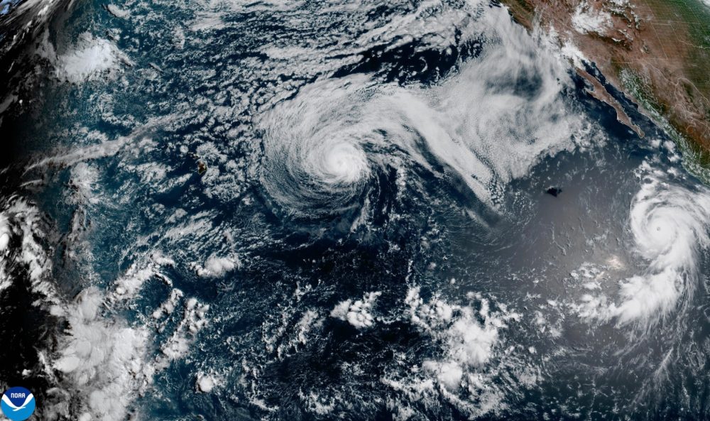

Two storm systems are active simultaneously in the Pacific Ocean, with Hurricane Genevieve roaring far from shore and a weakening Tropical Storm Fausto generating dangerous surf near Hawaii, according to the National Hurricane Center in Miami.
Genevieve has been classified as a Category 4 hurricane after briefly climbing to Category 5 strength early Monday — making it the first Category 5 storm in the East Pacific region in two years. The storm is now packing maximum sustained winds of 140 mph (220 kph).
As of early Tuesday, Genevieve’s center was positioned roughly 515 miles (830 kilometers) southwest of the southern tip of the Baja California peninsula, moving northwest at about 10 mph (17 kph). Forecasters expect the storm to remain well out to sea on a track running roughly parallel to the Mexican coastline.
No coastal watches or warnings have been issued, but the hurricane center cautioned that ocean swells generated by Genevieve are already reaching parts of Mexico’s southwestern coast and the Baja California peninsula, creating what forecasters described as potentially “life-threatening surf and rip current conditions.” Genevieve is expected to fluctuate in strength before gradually weakening later this week.
Further northwest in the Pacific, former Hurricane Fausto has dropped to tropical storm status as it continues moving in the general direction of the Hawaiian Islands. Forecasters believe Fausto will pass to the north of Hawaii, but are advising residents to continue monitoring the storm’s track for any potential impacts.
Fausto is currently carrying maximum sustained winds of 65 mph (100 kph) and was centered approximately 340 miles (545 kilometers) east-northeast of Hilo, Hawaii, traveling west-northwest at 15 mph (24 kph). Large surf and powerful currents are already building along east-facing shorelines across the Hawaiian Islands.