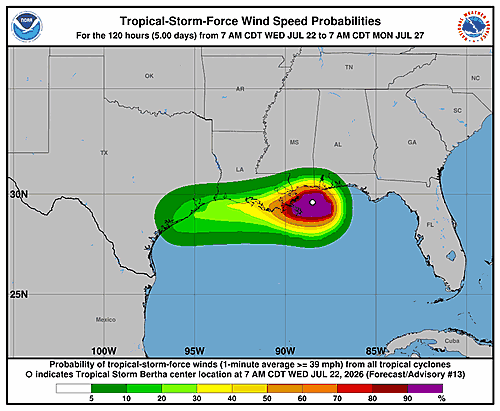

Tropical Storm Bertha is bearing down on the coast of southeastern Louisiana, with forecasters tracking its center as it moves closer to landfall.
As of 1:00 PM Central Daylight Time on Wednesday, July 22, Bertha’s center was positioned near coordinates 29.9 degrees north latitude and 89.1 degrees west longitude. The storm was moving in a west-northwest direction at approximately 7 miles per hour.
The storm’s minimum central pressure was recorded at 1,000 millibars, with maximum sustained winds reaching about 45 miles per hour.
Tropical storm conditions have been spreading westward throughout the area currently under a tropical storm warning. Residents in and around southeastern Louisiana are urged to monitor the latest updates from weather officials as the storm continues to advance toward the coastline.