
Remote U.S. territories in the Pacific are bracing for impact as Super Typhoon Sinlaku, Earth’s most powerful storm this year, approaches with devastating force.
The National Weather Service announced Monday that Sinlaku is projected to strike the Northern Mariana Islands on Tuesday, delivering catastrophic winds, torrential rainfall, and severe flooding to the region.
Guam, home to critical U.S. military bases, faces the threat of damaging winds starting Monday and remains under a tropical storm warning. Weekend advisories from the U.S. Coast Guard alerted residents to prepare for flooding and dangerous wind conditions.
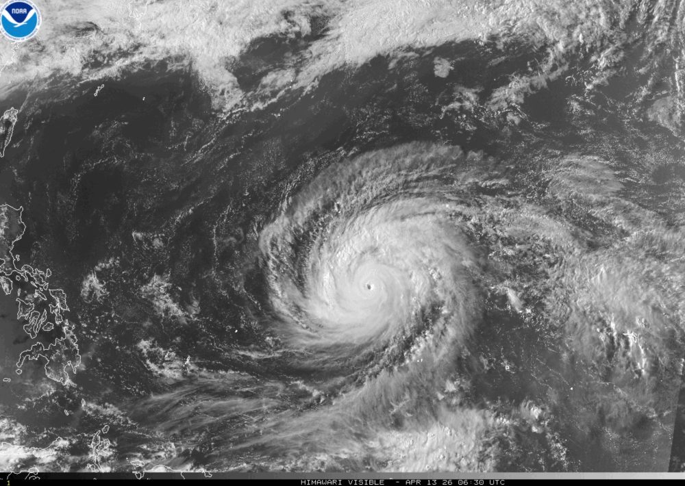
As of Monday, this record-breaking typhoon was generating continuous winds of 173 mph as it moved toward Rota, Tinian, and Saipan, data from the Joint Typhoon Warning Center shows.
Though forecasters predict some weakening in coming days, Sinlaku is still anticipated to pass through the island chain as either a Category 4 or 5 storm.
Military leadership in Guam has instructed service members to make storm preparations and remain in secure locations. The territory is still recovering from Typhoon Mawar, which left residents without electricity for extended periods in 2023.
On Saturday, President Donald Trump granted emergency disaster status to both Guam and the Northern Mariana Islands, unlocking federal resources for emergency response efforts.
Super typhoons represent the most formidable tropical weather systems that develop in the northwestern Pacific, Earth’s breeding ground for the planet’s most violent storms.
These massive weather events, tracked by the Joint Typhoon Warning Center based in Guam, match the intensity of Atlantic Category 4 or 5 hurricanes, featuring winds that exceed 150 mph. Since the warning center began using this classification in 1947, more than 300 super typhoons have been documented.