
A devastating 7.8 magnitude earthquake struck the southern Philippines during the early morning hours Monday, damaging structures in a major coastal city and prompting tsunami alerts across multiple regional coastlines.
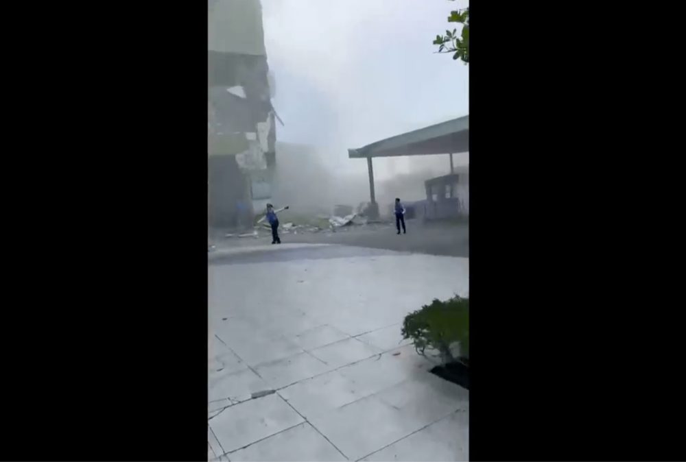
Authorities immediately issued evacuation orders for residents to seek higher ground. No casualties have been confirmed at this time, though officials remain uncertain whether anyone was trapped or hurt when a small structure collapsed in General Santos city. This coastal community, home to over 700,000 residents, serves as a major commercial center on Mindanao island and is recognized for its tuna processing operations.
According to the Philippine Institute of Volcanology and Seismology, the earthquake’s center was located 13 kilometers (8 miles) southwest of General Santos at a depth of 10 kilometers (6.2 miles). The tremor occurred at 7:37 a.m.
The Pacific Tsunami Warning Center announced that tsunami waves reaching up to 3 meters (10 feet) could potentially impact certain Philippine coastlines. Indonesia and Malaysia faced the possibility of waves up to 1 meter (3 feet) along some of their shores.
“We advise people to evacuate to higher grounds or go further inland,” warned Teresito Bacolcol, the head of the Philippine institute, addressing those in coastal communities.
Minor sea level changes were anticipated in Taiwan, Japan, Guam, Papua New Guinea and various island nations and territories throughout the western Pacific. However, the PTWC confirmed no danger existed for Hawaii.
Manila’s DZRH radio station confirmed that the small commercial structure housing its regional office experienced partial collapse, with staff members quickly evacuating to the ground level without sustaining injuries. Officials remained unsure whether others might be trapped within the debris of the four-story office structure, as the earthquake occurred prior to standard business hours.
The tremors were also experienced by residents in north-central Indonesia, where tsunami waves measuring up to 18 centimeters (7 inches) were documented along certain shores of North Sulawesi and North Maluku provinces.
The U.S. Geological Survey reported subsequent aftershocks reaching magnitudes up to 6.5. Their measurements placed the initial earthquake at 55 kilometers (34 miles) in depth. Different agencies commonly report varying measurements immediately following seismic events.
As one of the globe’s most disaster-susceptible nations, the Philippines frequently experiences earthquakes and volcanic activity because of its position along the Pacific “Ring of Fire,” a chain of seismic fault lines surrounding the ocean. The island nation also endures approximately 20 typhoons and tropical storms annually.