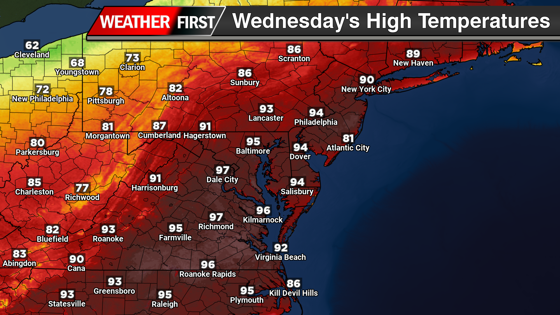
A stretch of unusually intense early season heat is expected to grip the Delmarva Peninsula and much of the Mid Atlantic through Wednesday, with temperatures running 10 to 20 degrees above average for mid May. Several locations could challenge daily and even monthly record highs as a strong upper level ridge and offshore Bermuda high pressure combine to deliver a prolonged period of summer-like warmth.

High temperatures across inland portions of Delaware, Maryland’s Eastern Shore, and surrounding inland areas are expected to climb into the upper 80s to middle 90s each afternoon through Wednesday. Tuesday currently appears to be the hottest day of the stretch, with widespread mid 90s anticipated across much of the region. Overnight temperatures will also remain exceptionally warm for this time of year, only falling into the mid 60s to lower 70s, which could challenge warm minimum temperature records for May 19th.

The pattern responsible for the heat features a large dome of high pressure in the upper atmosphere anchored over the East Coast through Tuesday before gradually weakening and shifting offshore Wednesday. At the surface, Bermuda high pressure positioned offshore is maintaining a persistent southerly to southwesterly flow, transporting much warmer air northward into the region.
While inland communities are expected to experience the most intense heat, coastal locations will see somewhat cooler conditions due to the influence of the Atlantic Ocean and developing sea breezes. Areas closer to the Delaware beaches and immediate coastline may remain in the 70s to middle 80s during the afternoon before temperatures gradually cool later in the day as marine air pushes inland.
Humidity levels are not expected to become excessively tropical, but dewpoints in the low to middle 60s will still create uncomfortable conditions given the lack of recent heat acclimation. Heat index values are forecast to remain close to actual air temperatures, meaning many inland areas will feel well into the 90s during the afternoon hours.

Heat Advisories have been issued for portions of the urban corridor as temperatures and heat indices approach early season warning criteria. Wilmington and parts of New Castle County may avoid the most intense heat at times due to cooling bay breeze influences.

The weather pattern will remain mostly dry through Tuesday with abundant sunshine and only a very isolated chance for a late day shower or thunderstorm well inland. By Wednesday, an approaching cold front may begin to introduce additional cloud cover and scattered showers or thunderstorms, which could slightly limit how hot temperatures become. Even so, temperatures are still expected to remain well above normal and near record territory, especially southeast of the Interstate 95 corridor where sunshine may persist longest.
Relief from the heat is expected to arrive late Wednesday into Thursday as the cold front moves through the region. Temperatures should gradually return closer to seasonal averages heading into the latter half of the week and next weekend.