
When Tom and Diane Peterman relocated to their retirement home on the shores of Black Lake in Michigan 14 years ago, they tried to purchase flood insurance — only to be told it wasn’t an option. John Solum’s family had been assured their 1940s cabin in the same area wasn’t situated in a flood zone when they bought it.
Then this spring, historic flooding swept across northern Michigan — striking some areas harder than anyone could recall — submerging homes, pushing dams dangerously close to failure, and destroying roadways. Dozens of counties were placed under a state of emergency.
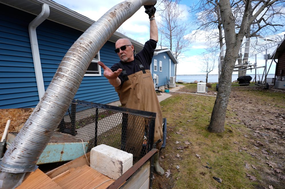
Water levels at Black Lake rose so dramatically that chunks of floating ice tore apart decks and smashed through windows.
“We’ve never seen anything like that. Never,” said Solum, who noted he had dealt with flooding frequently while living in Houston. Knee-deep floodwater forced his family to gut the interior of their cabin, removing flooring, drywall, furniture, bedding, and appliances.
Across the state, thousands of residents were left financially exposed after record-breaking April rainfall compounded an already record-setting March snowfall. Adding to the hardship, many people had no idea they were at risk — even as precipitation levels in the region had been climbing for years.
Experts say what happened in Michigan reflects a vulnerability that exists throughout the country: flood plain maps simply don’t cover every area. Furthermore, the federal government’s approach to mapping is widely considered outdated and fails to account for the true risks posed by climate change and increasingly extreme weather.
The Federal Emergency Management Agency is responsible for developing and maintaining maps that identify flood plains, determine who must carry flood insurance, and help communities with planning. However, FEMA has not created maps for many less-populated regions — including some Michigan counties that saw flooding unlike anything in recorded history.
Black Lake, for instance, sits across two counties. Cheboygan County has a FEMA flood plain map from 2012, while most of Presque Isle County has never been mapped at all. The area is a popular destination for summer visitors and retirees, dotted with small cabins and larger homes.
There’s another significant problem: FEMA’s maps focus on the risk of rivers, streams, and other waterways overflowing their banks. They don’t account for flooding caused purely by heavy rainfall overwhelming stormwater systems in cities or inundating rural communities where water has nowhere to drain.
First Street, a company that studies the financial consequences of climate change, found more than twice as many properties nationwide face significant flood risk when rainfall data is factored in and when the entire country — including smaller waterways FEMA doesn’t map — is included in the analysis. In Michigan alone, that figure jumped to four times the number identified by FEMA.
“I couldn’t believe it when we first started building our model how different we were from FEMA,” said Jeremy Porter, chief economist at First Street, who argues that federal maps are “missing a whole source of flooding.”
While FEMA does use additional rainfall data to help calculate insurance rates, it remains unclear whether the agency plans to incorporate that data into its actual flood plain maps, experts said.
A federal watchdog agency, the General Accounting Office, raised concerns five years ago that FEMA’s flood hazard maps failed to reflect the best available climate science or account for heavy rainfall events.
FEMA declined a request for an interview but issued a statement saying that 95% of the U.S. population lives in areas that have been mapped, and that those maps are “snapshots in time.” The agency did not address whether this year’s flooding makes mapping rural areas more urgent, or whether it is revising its mapping methods.
Michigan’s flooding this spring was “truly a monumental flood” that in many locations surpassed what is known as a 100-year flood event — meaning it has a 1% chance of happening in any given year — according to Matthew Occhipinti, the state’s National Flood Insurance Program coordinator.
But experts caution this was no random anomaly. A warmer atmosphere retains more moisture for extended periods, which can unleash heavy rain or snow when conditions align. This spring, an “extraordinarily warm” Gulf of Mexico set the conditions for both heavy snow and rain across the upper Midwest, explained Richard Rood, a climate scientist at the University of Michigan.
A major March snowstorm dropped between two and four feet of snow across northern Michigan. Then record April rains created more runoff than rivers, dams, and drainage systems could manage.
“We call these storms historic; that is only true compared to the past,” said Rood, noting that Michigan and neighboring Wisconsin recorded their wettest March 1 through April 15 period ever. “I think it is more appropriate to consider it typical of the climate of the future.”
That’s exactly why updating flood maps and improving community preparedness is so critical, experts said.
“You should never be lulled into complacency that, ‘Oh geez we just had the big flood so we’re good for another 100 years or another 500 years,’” said Chad Berginnis, executive director of the Association of State Floodplain Managers. “Mother Nature does not obey statistical averages.”
FEMA has been working to update older flood plain maps — some of which are decades old — but has made little headway in creating new ones for rural areas where development may occur, despite a congressional mandate passed in 2012, Berginnis said. The agency has historically focused on the most populated and highest-risk areas, which is understandable given budget limitations, but the result is that roughly two-thirds of the country’s streams, rivers, and coastlines remain unmapped.
His organization estimates it would cost between $4 billion and $12 billion to comprehensively map the entire nation, but FEMA has never received sufficient funding to accomplish that goal.
Flood plain managers are now worried the agency could fall even further behind because of significant staffing cuts under the Trump administration. FEMA lost close to 20% of its total workforce in 2025, according to a General Accounting Office report — including roughly 25% of its most experienced permanent staff, said Christopher Currie, who conducts audits of FEMA for the GAO.
“We’re very concerned,” said Currie, who noted that FEMA was already chronically understaffed before the current administration’s second term began. The agency would now have to pull resources away from programs like mapping in order to respond to multiple disasters simultaneously.
Even beyond the mapping gaps, getting accurate flood risk information to communities remains a significant challenge. Communities must enroll in the National Flood Insurance Program before their residents can purchase policies backed by FEMA and sold through private insurers. But many communities — including several hundred in Michigan, according to Occhipinti — have never joined the program.
Communities can participate even without a flood plain map, but experts say those that haven’t enrolled may never have experienced serious flooding before, or simply don’t understand how the insurance program works. They may also not realize their flood risk is elevated if they rely on FEMA’s National Risk Index, a separate tool that assigns a single score for a community’s overall natural disaster risk. That index assumes there is no flood risk if no flood plain map exists for the area, Berginnis explained.
That means a community with a seemingly low risk score could actually face significant flood danger — a situation that “gives people the absolute wrong sense of security,” he said.
Even participating in the insurance program doesn’t guarantee homeowners receive accurate guidance. Diane Peterman, who had to evacuate when floodwater filled her crawlspace, said she attempted to buy flood insurance on three separate occasions but was turned away each time — despite her township’s participation in the National Flood Insurance Program.
“They said, ‘You’re not in a flood zone’ and I said, ‘But I live on a lake,’” Peterman recalled. She later discovered that her neighbor did have flood insurance.
In Michigan, an average flood insurance policy runs about $1,000 for $250,000 in coverage, though rates vary considerably depending on factors like home value and location, Occhipinti said. Private flood insurance is available from some companies, though it remains uncommon.
Berginnis urged homeowners and communities to look beyond what FEMA provides when assessing their flood risk.
“FEMA flood maps should always be the beginning of the journey and not the end,” he said. “Maybe states and communities need to step up and lead a little bit more.”


