Category: News

  • Major Winter Storm Brings Blizzard Conditions to Northeast Region

    Major Winter Storm Brings Blizzard Conditions to Northeast Region

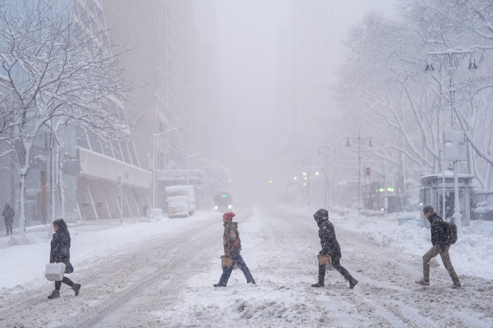
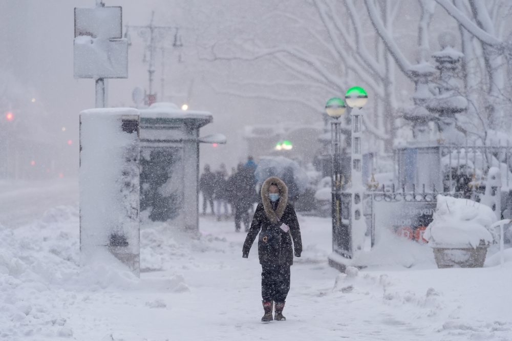
    A powerful winter storm is wreaking havoc across the Northeast, forcing millions of residents from New York City through New England to remain indoors as authorities enforce travel restrictions and issue blizzard alerts throughout Monday.

    The storm has been dumping snow at an aggressive pace of 2 to 3 inches per hour since early Monday morning, stretching from New York state up through Massachusetts. Multiple locations have already received more than 12 inches of accumulation since Sunday, accompanied by wind gusts exceeding 30 miles per hour that have created dangerous visibility conditions.

    Air travel has been severely disrupted, with flight tracking service FlightAware reporting over 5,000 cancelled flights nationwide for Monday. The bulk of these cancellations have affected airports in New York, New Jersey, and Boston.

    Meteorologists are describing this weather event as a “classic bomb cyclone/nor’easter off the Northeast coast.” This scientific term refers to storms that experience bombogenesis – a phenomenon where atmospheric pressure plummets by at least 24 millibars within a 24-hour period, according to the U.S. National Oceanic and Atmospheric Administration. The rapid pressure drop creates exceptionally strong storms that can generate severe precipitation, hurricane-force winds, and conditions leading to widespread power failures and fallen trees.

    These rapidly intensifying weather systems typically form during autumn and winter months when Arctic air masses move southward and collide with warmer atmospheric conditions.

    Transportation systems have ground to a halt in affected areas. Public transit services have been suspended in multiple cities, and food delivery company DoorDash halted operations in New York City overnight due to safety concerns.

    “The combination of heavy snowfall and strong winds will continue to produce blizzard conditions along the Northeastern Seaboard,” weather officials stated Monday. “Sharply reduced visibility will make travel extremely treacherous across these areas.”

    The National Weather Service has described current travel conditions as “nearly impossible” due to the combination of heavy precipitation and powerful winds creating whiteout scenarios.

    Emergency alerts have been issued from Maryland northward to Maine. New York City residents received urgent mobile phone notifications Sunday evening announcing a prohibition on non-emergency vehicle travel through Monday afternoon due to “dangerous blizzard conditions.” Similar travel restrictions have been implemented in Rhode Island and New Jersey.

    Snowfall totals across the region include 22.5 inches at Long Island MacArthur Airport, approximately 15 inches in Manhattan’s Central Park, around 18 inches in Newark, New Jersey, and 17 inches each in New London, Connecticut, and North Kingstown, Rhode Island.
  • Severe Blizzard Conditions Expected to Ease Along East Coast Monday

    Severe Blizzard Conditions Expected to Ease Along East Coast Monday

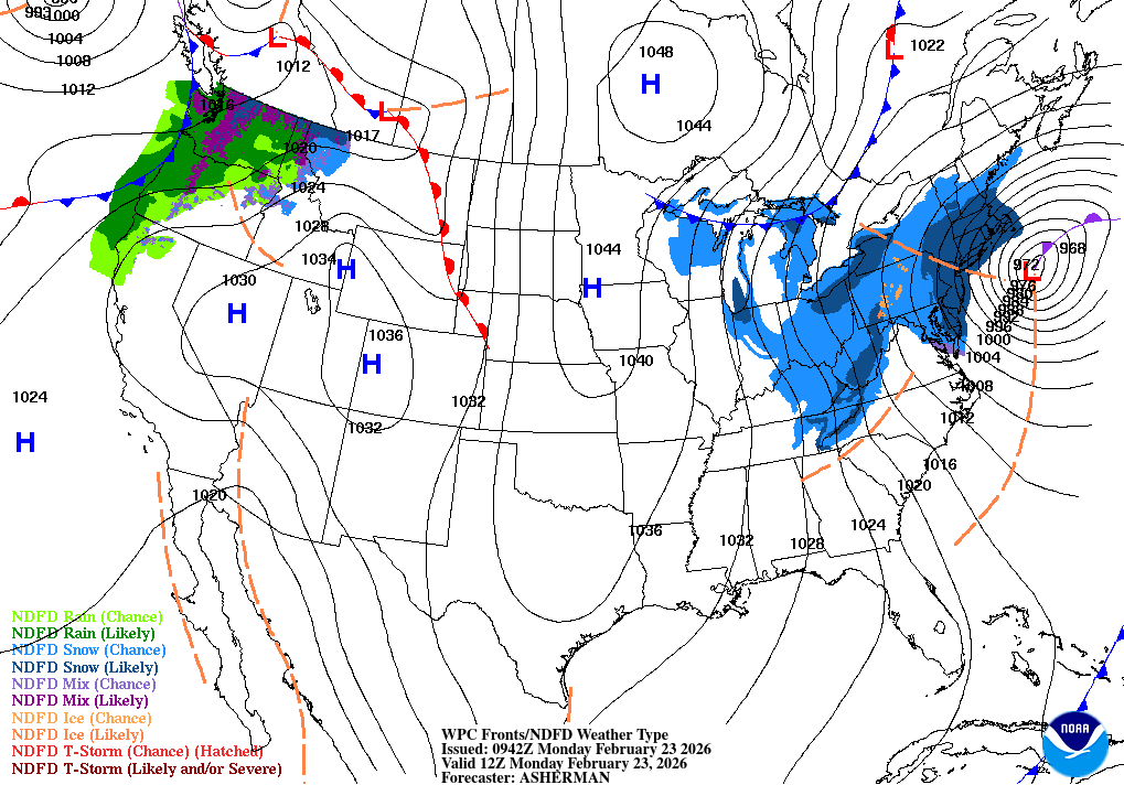
    Severe winter weather battering the mid-Atlantic and northern East Coast regions is expected to diminish Monday evening as a major storm system moves northeast toward Canada’s Maritime provinces. The powerful weather system has brought blizzard conditions to coastal areas from the Carolinas through New England.
    Simultaneously, the Pacific Northwest will experience continued unsettled conditions through Wednesday, with precipitation in the form of rain and snow affecting areas from central California northward and extending into the northern Rocky Mountain region. Weather forecasters indicate that storm systems originating over the Pacific Ocean will continue moving eastward across the continental United States in the coming days.

  • Major Winter Storm Grounds Nearly 5,500 Flights Across Northeast

    Major Winter Storm Grounds Nearly 5,500 Flights Across Northeast

    Aviation operations ground to a halt throughout the northeastern United States on Monday as a severe winter storm delivered heavy snowfall and fierce winds to the region.

    Flight disruptions mounted rapidly during Monday morning hours. By approximately 9:30 a.m. Eastern Time, close to 5,500 flights traveling to or from the United States had been cancelled, data from FlightAware showed. Additional hundreds of flights faced delays.

    John F. Kennedy International Airport and LaGuardia Airport in New York experienced the most significant number of cancellations on Monday, with airports in Boston, Newark, New Jersey, and Philadelphia following close behind.

    Weather officials described driving conditions as “extremely treacherous” and “nearly impossible” throughout the areas most severely impacted by the winter weather system.

    The storm’s effects extended well beyond aviation disruptions, as millions of residents remained confined to their homes under mandatory travel restrictions during blizzard warnings. Sunday evening brought emergency alerts to mobile phones throughout New York City, announcing a prohibition on non-essential street travel lasting until Monday at noon due to “dangerous blizzard conditions.” Both Rhode Island and New Jersey enacted comparable travel limitations.

  • Salisbury University Sea Gulls Announce 2026 C2C Basketball Tournament Details

    Salisbury University Sea Gulls Announce 2026 C2C Basketball Tournament Details

    Salisbury University’s Sea Gulls women’s basketball program has announced details for the 2026 Coast-to-Coast Women’s Basketball Championship tournament.

    The championship event is set to take place during the 2025-26 basketball season, with Salisbury University’s team expected to compete in this significant collegiate tournament.

    Additional tournament specifics and scheduling information will be made available as the championship approaches. The Sea Gulls basketball program continues to prepare for what promises to be an exciting competitive season.

  • Ocean City Crews Battle Heavy Snow, Clear Roads After Major Storm

    Ocean City Crews Battle Heavy Snow, Clear Roads After Major Storm

    Ocean City, Maryland workers are tackling the aftermath of a significant winter storm that dumped more than a foot of snow across the coastal community overnight on February 23, 2026.

    Municipal Public Works teams have joined forces with Maryland State Highway Administration personnel to salt and plow roadways across the resort town following the heavy snowfall that left over 12 inches of accumulation.

    City officials are cautioning residents that driving conditions remain dangerous and are advising people to limit unnecessary travel as crews continue their snow removal operations throughout the area.

  • Rehoboth Beach Issues Emergency Water and Travel Restrictions During Storm

    Rehoboth Beach Issues Emergency Water and Travel Restrictions During Storm

    City officials in Rehoboth Beach are urging residents to drastically reduce water consumption following an electrical outage that has knocked out power to the municipal wastewater treatment plant. Residents are being asked to avoid using toilets and minimize all water usage while repair teams work around the clock to restore electrical service and prevent potential system failures.

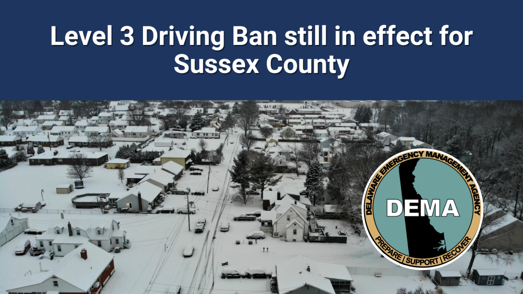
    Meanwhile, Sussex County officials have implemented the most severe travel restriction, a Level 3 driving ban, advising all motorists to stay home and avoid roadways. Municipal work teams are deployed across Rehoboth Beach addressing storm-related damage and hazards.

    City representatives say they will provide regular updates as weather conditions and infrastructure situations evolve, thanking the community for their understanding and cooperation during what officials describe as a highly destructive weather event.

  • Kent County Driving Ban Continues, New Castle County Restrictions Stay in Place

    Kent County Driving Ban Continues, New Castle County Restrictions Stay in Place

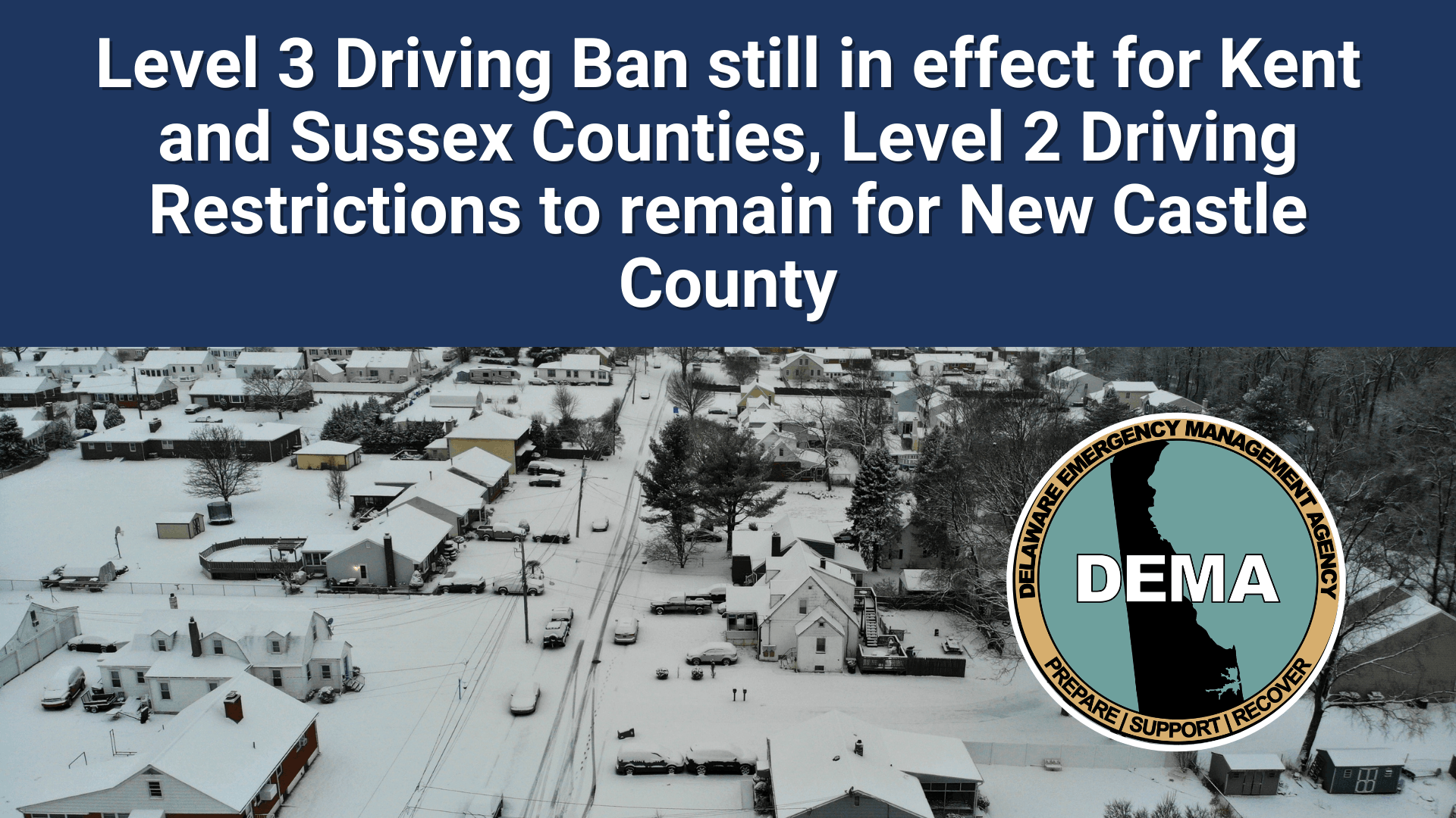
    SMYRNA, Del. – State officials announced that Kent County will continue operating under a level 3 driving ban, while New Castle County maintains its level 2 driving restrictions until conditions improve.

    Delaware transportation authorities are extending these emergency driving measures due to hazardous roadway conditions throughout both counties. The restrictions are designed to protect emergency personnel and essential workers by reducing non-critical vehicle traffic during dangerous weather conditions.

    Officials have not provided a timeline for when these driving limitations will be lifted, stating they will remain active until road safety improves sufficiently to allow normal traffic patterns to resume.

  • Your Delmarva Forecast: Monday, February 23rd

    Your Delmarva Forecast: Monday, February 23rd

    Good morning, Delmarva! Bundle up because we’re dealing with a significant winter weather event today. Heavy snow and blowing snow will dominate our Monday, with the most intense conditions expected through mid-morning. We’ll see periods of heavy snow mixed with blowing and drifting snow as northwest winds howl at 15 to 25 mph, gusting up to 40 mph. Snow accumulations of 5 to 9 inches are possible by day’s end, so please avoid unnecessary travel and give yourself extra time if you must be on the roads. Temperatures will struggle to reach 37 degrees despite the cloud cover. Tonight, those strong winds will gradually calm down, with areas of blowing snow tapering off and skies becoming mostly cloudy. We’ll drop to a chilly 22 degrees. Tuesday brings much better news! We’ll see mostly sunny skies return with temperatures climbing to a more seasonable 35 degrees. However, another light snow chance arrives Tuesday night as clouds increase. Stay safe out there, Delmarva, and keep those snow shovels handy! I’m tracking your forecast and will keep you updated.
  • BLIZZARD WARNING: Extreme Weather Threatens Delmarva Through Tonight

    BLIZZARD WARNING: Extreme Weather Threatens Delmarva Through Tonight

    A Blizzard Warning remains in effect across northern Delmarva until 6 PM tonight, bringing dangerous travel conditions and potentially life-threatening weather to the region. The National Weather Service issued the extreme weather alert early this morning for New Castle and Kent Counties in Delaware, along with Caroline, Queen Anne’s, and Talbot Counties in Maryland. An additional 3 inches of snow is expected, combined with wind gusts reaching 40 mph. “This is creating blizzard conditions with significantly reduced visibility due to blowing snow,” meteorologists warn. The hazardous conditions are already impacting Monday morning commutes and will continue through the evening rush hour. Officials are urging residents to restrict travel to emergencies only. If you absolutely must travel, pack a winter survival kit and stay with your vehicle if you become stranded. Road conditions are deteriorating rapidly across the affected areas. For real-time road conditions, dial 511. The Blizzard Warning expires at 6 PM tonight, but hazardous travel conditions may persist even after the warning ends. Stay with TV Delmarva for continuing coverage of this dangerous winter storm affecting our community.
  • Blizzard Warning in Effect for Sussex County and Delaware Beaches Through 6 PM

    Blizzard Warning in Effect for Sussex County and Delaware Beaches Through 6 PM

    Dangerous blizzard conditions are battering southern Delaware this morning, prompting the National Weather Service to issue an extreme weather warning through 6 PM tonight. Inland Sussex County and the Delaware beaches are experiencing the brunt of the storm, with an additional 2 to 4 inches of snow expected and wind gusts reaching up to 45 mph. The combination of heavy snow and fierce winds is creating widespread blowing snow that’s drastically reducing visibility across the region. Commuters face treacherous conditions for both the morning and evening rush hours, with slippery roads reported throughout the warning area. Strong winds also pose a threat to trees and power lines, with the potential for downed branches and possible outages. Officials are urging residents to restrict travel to emergencies only. If you must venture out, carry a winter survival kit and stay with your vehicle if you become stranded. For the latest road conditions, dial 5-1-1. The blizzard warning, issued by the National Weather Service Mount Holly office at 6:36 AM, remains in effect until 6 PM this evening. Residents should continue monitoring weather updates and avoid unnecessary travel until conditions improve.
  • National Weather Service Issues Blizzard Alert for Delaware Region

    National Weather Service Issues Blizzard Alert for Delaware Region

    Weather officials have issued a blizzard warning for the Delaware region, alerting residents to prepare for severe winter conditions throughout the day.

    The National Weather Service office in Mount Holly, New Jersey issued the warning at 6:36 AM on February 23rd, with the alert scheduled to remain active until 6:00 PM the same evening.

    Residents across the First State should take necessary precautions and stay updated on changing weather conditions as the storm system moves through the area.

  • National Weather Service Issues Blizzard Warning for Region

    National Weather Service Issues Blizzard Warning for Region

    Weather officials have issued a blizzard warning for the Delmarva region, alerting residents to prepare for dangerous winter conditions.

    The National Weather Service office in Mount Holly, New Jersey activated the warning at 6:36 this morning on February 23rd. The alert will remain in effect until 6:00 this evening.

    Residents should take necessary precautions and avoid unnecessary travel during the warning period. The blizzard conditions pose significant risks to public safety and transportation.

    Local authorities recommend staying indoors and monitoring weather updates throughout the day as conditions develop.

  • Sussex County Roads Remain Closed Under Level 3 Driving Ban

    Sussex County Roads Remain Closed Under Level 3 Driving Ban

    Emergency management officials in Sussex County are continuing to warn drivers to avoid traveling on area roadways as hazardous conditions persist across the region.

    The Delaware Emergency Management Agency along with Sussex County Emergency Management announced that the Level 3 driving ban remains active throughout Sussex County due to impassable road conditions.

    Officials say the state-issued travel restriction will continue to protect emergency personnel and essential workers by reducing unnecessary vehicle traffic during the ongoing situation.

    Authorities are strongly advising residents to remain home and avoid all non-essential trips until road conditions improve and the ban is lifted.

  • Coastal Flood Advisory in Effect Across Delaware Through This Evening

    Coastal Flood Advisory in Effect Across Delaware Through This Evening

    Delaware residents in coastal and low-lying areas should prepare for minor flooding today as a Coastal Flood Advisory remains in effect until 5 PM. The National Weather Service warns that up to six inches of water could accumulate above ground level in vulnerable areas near shorelines and tidal waterways across Kent County, Inland Sussex County, and Delaware’s beaches. The flooding is expected to impact the most vulnerable roads in coastal and bayside communities, as well as areas along inland tidal waterways. Some roads may experience partial or complete closures as conditions worsen throughout the day. Officials are particularly concerned about this afternoon’s high tide, which could bring moderate coastal flooding to localized areas along back bays. Minor tidal flooding may continue into tonight’s high tide cycle. ‘Do not drive your vehicle through flood waters,’ weather service officials warn. ‘The water may be deeper than you think, putting you in danger and potentially causing costly vehicle damage.’ Residents are advised not to park vehicles in flood-prone locations and to avoid traveling through affected areas when possible. The advisory expires at 5 PM today, though minor flooding could linger into the evening hours. Stay with TV Delmarva for continued weather updates throughout the day.
  • Weather Service Issues Coastal Flood Advisory for Delaware Shore

    Weather Service Issues Coastal Flood Advisory for Delaware Shore

    Delaware coastal communities are under a flood advisory issued by the National Weather Service office in Mount Holly, New Jersey, beginning Friday morning at 4:46 AM and continuing through 5:00 PM.

    The weather service is alerting residents along the Delaware coast to expect possible flooding in vulnerable low-lying areas during high tide cycles throughout the day.

    Local authorities recommend that residents in flood-prone coastal zones take necessary precautions and monitor conditions closely during the advisory period.

  • Coastal Flood Advisory Expires as Water Levels Recede in New Castle and Salem Counties

    Coastal Flood Advisory Expires as Water Levels Recede in New Castle and Salem Counties

    Good news for residents in New Castle County, Delaware, and Salem County, New Jersey – the Coastal Flood Advisory that was issued early this morning has officially expired as of 5:00 AM. The National Weather Service Mount Holly issued the advisory at 3:52 AM, but quickly determined that high tide had already passed and water levels were decreasing across the affected coastal areas. The minor flooding threat that prompted the initial alert has now subsided. While this particular advisory has ended, residents in low-lying and flood-prone areas should remain vigilant during future high tide cycles. Coastal flooding can develop quickly and create hazardous driving conditions, especially in areas with poor drainage. The National Weather Service continues to monitor conditions along the Delaware Bay and coastal regions. No additional flooding is expected at this time, and normal tidal conditions are forecast to continue. For the latest weather updates and alerts affecting the Delmarva Peninsula, stay tuned to TV Delmarva and visit our website. We’ll continue monitoring any developing weather conditions that could impact our viewing area.
  • Coastal Flood Warning: Up to 2 Feet of Water Expected Across Delaware Coast

    Coastal Flood Warning: Up to 2 Feet of Water Expected Across Delaware Coast

    Residents across Kent County, Inland Sussex, and Delaware’s beaches are urged to take immediate precautions as a Coastal Flood Warning remains in effect until 5 AM Monday morning. The National Weather Service is forecasting one to two feet of water inundation above ground level in low-lying areas near shorelines and tidal waterways. Widespread roadway flooding is expected in coastal and bayside communities, with many roads becoming impassable. Vulnerable structures may also begin experiencing damage. ‘This level of flooding creates dangerous driving conditions throughout our coastal communities,’ said TV Delmarva meteorologist. Emergency management officials are closely monitoring the situation as back-bay flooding may persist through Tuesday morning’s high tide. Residents should avoid driving through flood waters, as water depths can be deceiving and lead to vehicle damage or dangerous situations. Those in affected areas should follow guidance from local emergency management officials and stay updated on changing conditions. The warning, issued by the National Weather Service Mount Holly office at 3:52 AM, is set to expire at 5 AM Monday. However, additional flooding is possible with Monday afternoon’s high tide, and further extensions may be necessary. Stay with TV Delmarva for continuing coverage of this developing weather situation.
  • National Weather Service Issues Brief Coastal Flood Warning for Delaware Shore

    National Weather Service Issues Brief Coastal Flood Warning for Delaware Shore

    Delaware’s coastal communities were placed under a brief flood warning early Friday morning as weather officials monitored potentially dangerous conditions along the shore.

    The National Weather Service office in Mount Holly, New Jersey issued the coastal flood warning at 3:52 AM on February 23rd, with the advisory remaining active until 5:00 AM EST the same day.

    The short-duration warning covered Delaware’s oceanfront and bayside areas where flooding conditions were expected to develop during the early morning hours.

    Weather officials from the Mount Holly office, which provides forecasts and warnings for the Delaware region, issued the alert to give residents advance notice of the potential flooding threat.

  • EXTREME: Blizzard Warning Continues Across Southern Delaware Until 6 PM

    EXTREME: Blizzard Warning Continues Across Southern Delaware Until 6 PM

    A major winter storm continues to pummel southern Delaware this morning, prompting the National Weather Service to maintain a Blizzard Warning for Delaware Beaches and Inland Sussex County until 6 PM today. The region is experiencing dangerous blizzard conditions with an additional 4 to 10 inches of snow expected on top of what has already fallen. Wind gusts are reaching up to 60 mph, creating whiteout conditions and making travel extremely hazardous. Snowfall rates of 1 to 3 inches per hour are continuing through the morning, with some areas seeing rates exceeding 2 inches per hour. The heavy, wet snow is sticking to trees and power lines, causing scattered tree damage and power outages across the region. Record-breaking snowfall totals are possible. Officials are urging residents to restrict travel to emergencies only. The dangerous conditions are impacting both the Monday morning and evening commutes, with widespread blowing snow significantly reducing visibility. If you must travel, carry a winter survival kit and stay with your vehicle if stranded. For the latest road conditions, call 511. The Blizzard Warning remains in effect until 6 PM this evening. Stay indoors and avoid unnecessary travel until conditions improve.
  • EXTREME: Blizzard Warning Continues Across Delmarva with Record-Breaking Snowfall Possible

    EXTREME: Blizzard Warning Continues Across Delmarva with Record-Breaking Snowfall Possible

    A major winter storm continues to pummel the Delmarva Peninsula this morning, with blizzard conditions expected to persist through 6 PM today. The National Weather Service has issued an extreme blizzard warning for New Castle and Kent Counties in Delaware, along with Caroline, Queen Anne’s, and Talbot Counties in Maryland. Heavy, wet snow is falling at rates of 1 to 3 inches per hour, with some areas potentially seeing more than 2 inches hourly. An additional 3 to 7 inches of snow accumulation is forecast, with record-breaking totals possible across the region. Wind gusts reaching 45 mph are creating dangerous blowing snow conditions and significantly reducing visibility. The heavy, wet snow is already sticking to trees and power lines, causing scattered tree damage and power outages throughout the affected areas. These hazardous conditions are severely impacting both morning and evening commutes. Officials strongly urge residents to restrict travel to emergencies only. If you must travel, carry a winter survival kit and stay with your vehicle if stranded. For the latest road conditions, dial 5-1-1. The blizzard warning remains in effect until 6 PM this evening. Stay with TV Delmarva for continuing coverage of this major winter storm.

  • National Weather Service Issues Blizzard Warning for Delaware Through Evening

    National Weather Service Issues Blizzard Warning for Delaware Through Evening

    Delaware residents are facing dangerous blizzard conditions today as the National Weather Service Mount Holly office issued a blizzard warning that took effect at 2:39 AM this morning.

    The warning will remain active through 6:00 PM this evening, with meteorologists cautioning residents about hazardous winter weather conditions across the region.

    Local authorities are urging residents to avoid unnecessary travel and to take proper precautions during the severe weather event.

  • National Weather Service Issues Blizzard Warning for Delaware Through Evening

    National Weather Service Issues Blizzard Warning for Delaware Through Evening

    Weather officials have issued a blizzard warning for Delaware and surrounding areas, alerting residents to dangerous winter conditions expected to persist throughout the day.

    The National Weather Service office in Mount Holly, New Jersey activated the warning at 2:39 AM this morning, with the alert remaining in effect until 6:00 PM today.

    Residents across the Delmarva Peninsula should prepare for severe winter weather conditions and take necessary precautions for travel and outdoor activities during the warning period.

  • National Weather Service Issues Special Weather Alert for Delaware Area

    National Weather Service Issues Special Weather Alert for Delaware Area

    Weather forecasters from the National Weather Service Mount Holly office released a special weather statement for Delaware and surrounding areas at 2:02 AM on Saturday, February 23rd.

    The alert was distributed through the agency’s official notification system to keep residents informed about current meteorological conditions affecting the region.

    Local residents are encouraged to monitor weather updates and take appropriate precautions as conditions warrant. The Mount Holly office serves as the primary weather forecasting center for Delaware and the broader Mid-Atlantic region.

    Further details about specific weather conditions and any recommended actions will be provided as additional information becomes available from meteorologists.

  • Supreme Court Tariff Ruling Creates Financial Uncertainty for Markets

    Supreme Court Tariff Ruling Creates Financial Uncertainty for Markets

    Financial markets are grappling with unexpected turbulence following the Supreme Court’s decision to overturn President Donald Trump’s tariff policies, creating fresh uncertainty rather than the stability many had hoped for.

    The high court’s ruling has opened the door to potential refunds that could drain approximately $170 billion from federal coffers, while Trump’s swift implementation of substitute tariffs has already triggered tensions with European partners and added confusion to America’s trade strategy.

    Currency markets reflected the instability Monday as the dollar weakened against safe-haven currencies including the Swiss franc and Japanese yen. Treasury bond markets have struggled to assess the implications for government finances and future inflation trends.

    Market observers note that while Trump’s new tariffs appear lower and may reduce immediate price pressures, the Court’s limitation of presidential authority creates unpredictable consequences for both markets and the broader economy.

    “Uncertainty is back, and given the latest muscle-flexing by European leaders, the risk of escalation is now higher than it was a year ago,” ING analysts said in a note.

    The Treasury bond market faces particular challenges from potential litigation seeking tariff refunds, which could tie up courts for months. Revenue from existing tariffs has exceeded $175 billion, representing a small portion of total federal revenues projected above $5 trillion, but still significant enough to require additional government borrowing.

    Dan Siluk, head of global short-duration and liquidity at Janus Henderson, warned that refunds would necessitate increased debt issuance. “At the margin, that raises the risk of further steepening pressure at the long end of the curve, particularly if refund-related issuance coincides with already elevated borrowing needs and ongoing QT (quantitative tightening),” he explained.

    Ten-year Treasury yields edged up to 4.1% Friday, though they remain below mid-2025 peaks above 4.5%, supported by cooling inflation data and anticipation of Federal Reserve rate reductions. Monday’s Asian trading showed futures-implied yields slightly lower at 4.05%.

    “Markets are currently focused on the short-term impact – namely, lower inflation and interest rates falling more quickly,” observed Alberto Conca, chief investment officer at LFG+ZEST in Lugano, Switzerland. “I think that’s rather short-sighted, though, because it increases an already enormous deficit, and yield curves ought to steepen more significantly given that the U.S. government’s finances are, effectively, out of control.”

    The Congressional Budget Office had projected Trump’s original tariffs would generate roughly $300 billion yearly over the coming decade for the world’s largest economy.

    Trump’s 15% replacement tariff carries a 150-day time limit, with unclear details about timing and scope of implementation. Previous rates varied significantly, with Britain and Australia facing 10% levies while many Asian nations encountered higher charges.

    “The bond market faces the biggest concern,” stated Gene Goldman, chief investment officer at Cetera Investment Management, pointing to increased debt issuance if the government must process refunds while funding other spending initiatives.

    However, market reactions have remained relatively muted, with some analysts believing lasting damage can be prevented. Morgan Stanley researchers suggest debt markets won’t be overly concerned about fiscal deficits, expecting Trump to find tariff alternatives and any additional funding to utilize shorter-term Treasury bills.

    The ruling may also prevent Trump from delivering promised $2,000 tariff dividend payments to Americans, which would have contributed to inflationary pressures.

    Nevertheless, another cycle of policy and revenue uncertainty has begun. The dollar extended its decline, losing about 0.4% against the euro Monday, marking nearly 12% in losses since Trump’s second term started in early 2025.

    Future market direction depends on how traders interpret the ongoing disruption. Barclays analysts suggest the Supreme Court decision demonstrates effective governmental checks and balances, potentially reducing risk premiums on U.S. assets and currency.

    Other market watchers remain focused on inflation implications. “When you have this much liquidity and lowering of tariffs this all fuels growth and causes rates to rise,” said Eddie Ghabour, CEO at Key Advisors Wealth Management in Delaware. “These things can also cause inflation to accelerate in the months to come. I think the bond market is sniffing this out.”

  • Fallen Tree Blocks Tobacco Road Near Fox Hole Road Intersection

    Fallen Tree Blocks Tobacco Road Near Fox Hole Road Intersection

    A fallen tree has prompted authorities to shut down Tobacco Road near its intersection with Fox Hole Road, according to the Delaware Department of Transportation.

    The roadway remains impassable as crews work to remove the tree blocking traffic flow in the area.

    Motorists are advised to seek alternate routes while DelDOT personnel address the obstruction. No timeline has been provided for when the road will reopen to normal traffic.

  • Tree Blocks Route 36 at Staytonville Road in Delaware

    Tree Blocks Route 36 at Staytonville Road in Delaware

    Delaware Route 36 remains blocked to traffic at Staytonville Road after a tree fell across the roadway.

    The Delaware Department of Transportation reports the road closure is in effect while crews work to remove the fallen tree and reopen the route to normal traffic flow.

    Drivers traveling in the area are advised to use alternative routes until the roadway can be cleared and reopened.

  • Route 36 Blocked at Staytonville Road After Tree Falls Across Roadway

    Route 36 Blocked at Staytonville Road After Tree Falls Across Roadway

    Delaware Route 36 remains impassable at Staytonville Road following a tree that toppled across the roadway, according to DelDOT officials.

    The roadway obstruction is forcing drivers to seek alternative routes while transportation crews respond to remove the fallen tree and restore normal traffic flow.

    DelDOT has not provided an estimated timeline for when the roadway will reopen to vehicles.

  • Major Winter Storm Forces School Closures, Travel Chaos Across Northeast

    Major Winter Storm Forces School Closures, Travel Chaos Across Northeast

    A massive winter storm is wreaking havoc across the northeastern United States, forcing students to stay home Monday as educational institutions shut down and transportation systems scramble to adjust to emergency protocols amid warnings of dangerous conditions.

    The severe weather system has created widespread travel chaos from Washington D.C. through New England, with airlines grounding thousands of flights while authorities strongly advise residents to avoid roadways. Mail and package delivery services will also face significant delays due to the harsh winter conditions, according to postal officials.

    New York City’s public school system, the country’s biggest, announced a complete closure of all campus facilities Monday, canceling both in-person classes and extracurricular activities without offering virtual learning alternatives.

    Mayor Zohran Mamdani issued an emergency declaration and banned non-essential vehicles from city streets starting Sunday evening through Monday midday, explaining that snow removal equipment and emergency responders required clear access as precipitation intensified. The metropolitan area is experiencing its first blizzard alert since 2017.

    Municipal buildings will remain closed to the public, while non-critical city workers have been authorized to work from home. “I’m urging every New Yorker to please stay home,” Mamdani stated.

    New York Governor Kathy Hochul mobilized 100 National Guard personnel to provide assistance in Long Island, New York City, and the Lower Hudson Valley regions, which are anticipated to experience the most severe snowfall and coastal wind impacts. The severe weather also prompted the closure of the United Nations headquarters facility in Manhattan Monday.

    Weather forecasters predict certain northeastern regions could receive as much as 24 inches of snow, while wind speeds may reach 70 mph, creating significant risks for downed trees and electrical outages, the Department of Homeland Security reported.

    In a Sunday briefing, the department confirmed that despite current funding interruptions, the Federal Emergency Management Agency continues its disaster response operations without disruption, including personnel deployment, emergency coordination, and vital assistance for disaster victims, with public safety and property protection remaining primary concerns.

    Previous reports indicated that President Donald Trump’s administration had directed FEMA to halt the deployment of hundreds of relief workers to disaster zones nationwide during the DHS shutdown.

    Massachusetts Governor Maura Healey issued an emergency proclamation and instructed state employees to remain home. Connecticut prohibited commercial trucks from controlled-access roadways Sunday evening, making exceptions only for emergency and essential supply deliveries.

    New Jersey Governor Mikie Sherrill announced a statewide emergency beginning Sunday at noon and emphasized the storm’s severity to residents. “People need to take this very seriously,” she told CNN.

    Aviation suffered immediate impacts, with flight tracking services showing over 5,000 Monday flights already grounded. Industry analysts noted that more than 25,000 flights were originally scheduled to depart U.S. airports Monday, with Tuesday cancellations also increasing, particularly at major northeastern hubs.

    NJ TRANSIT ceased bus, light rail, and accessibility services Sunday evening and discontinued all rail operations by Sunday night, with service restoration dependent on improved conditions.

    Throughout New England, the Rhode Island Public Transit Authority announced complete service suspension, including specialized transportation programs, from Sunday night through Monday, stating they would only announce resumption plans when weather conditions permit.

  • Fallen Tree Blocks Sand Hill Road in Georgetown Area

    Fallen Tree Blocks Sand Hill Road in Georgetown Area

    Motorists in the Georgetown area will need to find alternate routes as a portion of Sand Hill Road remains blocked by a fallen tree.

    Delaware Department of Transportation officials have shut down Sand Hill Road between East Redden Road and Donovan Road after the tree came down across the travel lanes.

    DelDOT crews are working to clear the obstruction and reopen the roadway to normal traffic flow. No timeline has been provided for when the road closure will be lifted.

    Drivers are advised to seek alternative routes and expect potential delays in the area until the tree removal is completed.

  • Fallen Tree Blocks Sandtown Road Near Amsterdam Road

    Fallen Tree Blocks Sandtown Road Near Amsterdam Road

    Traffic is being rerouted on Sandtown Road after a tree fell and blocked the roadway near Amsterdam Road.

    Delaware Department of Transportation officials report the road closure is necessary while crews work to remove the fallen tree and clear the path for vehicles.

    Drivers traveling through the area should expect delays and plan alternative routes until the obstruction can be safely cleared and normal traffic flow restored.

  • Fallen Tree Blocks Park Brown Road Near Fox Hunters Road

    Fallen Tree Blocks Park Brown Road Near Fox Hunters Road

    A fallen tree has forced authorities to shut down Park Brown Road near Fox Hunters Road, creating a traffic obstruction for local drivers.

    The Delaware Department of Transportation reported the road closure due to the tree blocking the travel lanes. Crews are working to remove the debris and restore normal traffic flow to the area.

    Motorists are advised to seek alternate routes while cleanup efforts continue. DelDOT has not provided an estimated time for when the roadway will fully reopen.

  • Fallen Tree Blocks Double Bridges Road in Delaware

    Fallen Tree Blocks Double Bridges Road in Delaware

    A fallen tree has forced Delaware transportation officials to shut down a section of Double Bridges Road, blocking traffic between Old Church Cemetery Road and Camp Barnes Road.

    The Delaware Department of Transportation reported the road closure due to the tree obstruction in the travel lanes. Crews are working to remove the debris and restore normal traffic flow to the area.

    Motorists are advised to seek alternate routes while the cleanup operation is underway. DelDOT has not provided an estimated time for when the roadway will reopen to traffic.

  • Fallen Tree Blocks Kenton Road Near Wimbledon Drive

    Fallen Tree Blocks Kenton Road Near Wimbledon Drive

    A fallen tree has completely blocked traffic on Kenton Road, prompting authorities to close the roadway to all vehicles.

    The Delaware Department of Transportation reports the tree came down on Kenton Road in the area between Wimbledon Drive and West Denneys Road, making the road impassable.

    Motorists are advised to avoid the area and use alternative routes until crews can remove the tree and reopen the roadway. No timeline has been provided for when the closure will be lifted.

  • Fallen Tree Forces Road Closure on Jebb Road Near Oak Point School

    Fallen Tree Forces Road Closure on Jebb Road Near Oak Point School

    Motorists will need to find alternate routes after a fallen tree blocked Jebb Road near Oak Point School Road, prompting officials to shut down the roadway.

    The Delaware Department of Transportation reported the closure due to the tree obstruction across the travel lanes. Crews are working to clear the debris and reopen the road to normal traffic flow.

    Drivers are advised to use alternative routes until the roadway reopens. No timeline has been provided for when the tree removal will be completed.

  • Fallen Tree Blocks Holland Glade Road at Rustic Acres Lane

    Fallen Tree Blocks Holland Glade Road at Rustic Acres Lane

    A fallen tree has forced authorities to shut down Holland Glade Road at Rustic Acres Lane, blocking traffic in both directions.

    The Delaware Department of Transportation reports the roadway remains impassable due to the tree obstruction. Drivers traveling through the area should seek alternative routes until crews can remove the debris and reopen the road.

    No timeline has been provided for when the intersection will be cleared and traffic can resume normal flow.

  • Route 13 Southbound Blocked at Route 42 Following Vehicle Accident

    Route 13 Southbound Blocked at Route 42 Following Vehicle Accident

    Southbound traffic on US Route 13 has come to a complete halt at Route 42 following a vehicle collision that occurred earlier today.

    The Delaware Department of Transportation is reporting the roadway closure as emergency responders and cleanup crews work at the accident scene. Motorists traveling in the area are being advised to seek alternate routes until the roadway can be reopened.

    DelDOT has not yet provided details about the severity of the crash or an estimated timeline for when normal traffic flow will resume on this busy corridor.

    Drivers should expect delays and plan extra travel time if their route typically includes this section of US Route 13 southbound.

  • Traffic Alert: Route 113 Northbound Shut Down After Collision Near Wood Branch Road

    Traffic Alert: Route 113 Northbound Shut Down After Collision Near Wood Branch Road

    A traffic accident has forced authorities to completely shut down the northbound lanes of US Route 113 at Wood Branch Road, according to the Delaware Department of Transportation.

    The roadway closure is currently in effect as emergency responders work at the crash scene. DelDOT has not yet provided details about the nature of the collision or when the highway might reopen to traffic.

    Motorists traveling northbound on Route 113 should expect significant delays and are advised to seek alternate routes until further notice.

  • National Weather Service Issues Special Weather Alert for Delmarva Region

    National Weather Service Issues Special Weather Alert for Delmarva Region

    The National Weather Service office in Mount Holly, New Jersey has issued a special weather statement affecting the Delmarva Peninsula region.

    The weather alert was released on Friday, February 22nd at 10:31 PM Eastern Standard Time, providing residents with important information about current atmospheric conditions in the area.

    Local residents are advised to monitor weather conditions and stay tuned to TV Delmarva for the latest updates on any developing weather situations that may impact travel or daily activities across Delaware and the surrounding region.

  • Statewide Driving Restrictions Take Effect Tonight at 10 PM

    Statewide Driving Restrictions Take Effect Tonight at 10 PM

    Delaware officials have announced statewide driving restrictions that will begin tonight at 10 PM as severe weather threatens the First State.

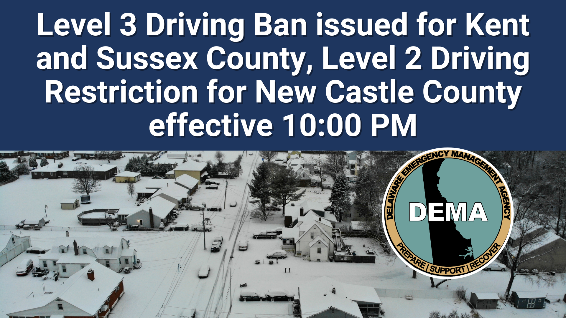
    Governor Matthew Meyer declared a Level 3 driving ban for Kent and Sussex counties, the most restrictive level that prohibits nearly all vehicle travel. Meanwhile, New Castle County will operate under Level 2 driving restrictions, which allow limited travel for essential purposes only.

    State officials implemented these emergency measures to protect both emergency response teams and essential workers who must remain on the roads during hazardous weather conditions. The restrictions aim to reduce unnecessary vehicle traffic while dangerous conditions persist across Delaware.

    The driving bans will continue until weather conditions improve and roads become safe for regular travel. Residents are urged to avoid all non-essential trips during this period to help keep Delaware’s roadways clear for emergency vehicles and critical personnel.

  • Delaware State Track Team Enters MEAC Indoor Championships with High Hopes

    Delaware State Track Team Enters MEAC Indoor Championships with High Hopes

    VIRGINIA BEACH, Va. — Delaware State University’s track and field program has arrived at the 2026 Mid-Eastern Athletic Conference Indoor Track & Field Championships, ready to compete for conference titles.

    The championship competition began Sunday morning at Virginia Beach Sports Center, bringing together talented student-athletes from MEAC schools across the region. Competitors are now focused on achieving their championship aspirations during this premier indoor track event.

    The Hornets enter the meet looking to build on their season’s preparation as they face off against conference rivals in various track and field disciplines throughout the championship weekend.

  • DSU Track Team Heads to MEAC Championships in Virginia Beach

    DSU Track Team Heads to MEAC Championships in Virginia Beach

    VIRGINIA BEACH, Va. — Delaware State University’s track and field athletes are ready to compete as the 2026 Mid-Eastern Athletic Conference Indoor Track & Field Championships kicked off Sunday morning.

    The championship meet is taking place at the Virginia Beach Sports Center, where competitors from universities throughout the MEAC are vying for conference titles and individual honors.

    The Hornets enter the competition looking to build on their recent performances as they face off against conference rivals in various track and field events over the weekend.

  • Fallen Tree Forces Closure of Beebe Road in Sussex County

    Fallen Tree Forces Closure of Beebe Road in Sussex County

    Sussex County motorists will need to find alternate routes after a fallen tree forced the complete closure of a busy stretch of Beebe Road.

    Delaware Department of Transportation officials report that Beebe Road is currently impassable between Woodyard Road and Beaver Pond Road due to the downed tree blocking the roadway.

    Drivers are advised to seek alternative routes while crews work to clear the obstruction and reopen the road to traffic. DelDOT has not provided an estimated time for when the roadway will be cleared.

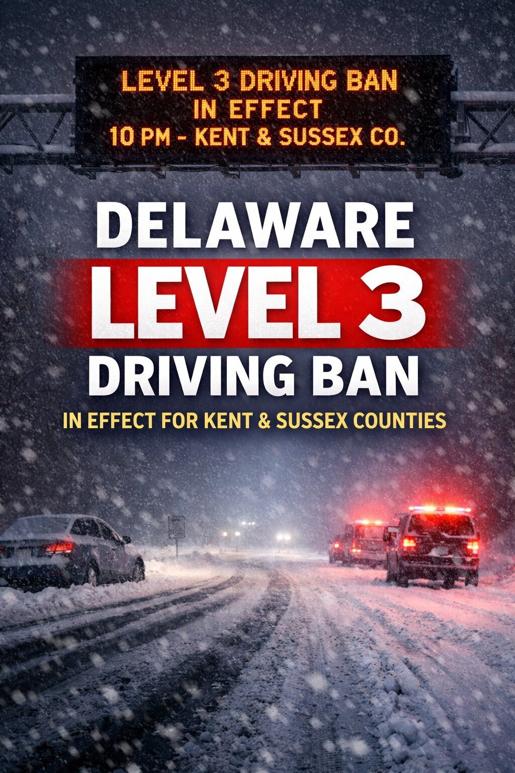
  • A Level 3 Driving Ban will take effect at 10 p.m. tonight for Kent and Sussex counties as a powerful winter storm continues to impact southern Delaware.

    A Level 3 Driving Ban will take effect at 10 p.m. tonight for Kent and Sussex counties as a powerful winter storm continues to impact southern Delaware.

    Governor Matthew Meyer announced the restriction Sunday evening in coordination with the Delaware Emergency Management Agency and the Delaware Department of Transportation, citing dangerous road conditions caused by heavy snowfall, strong winds, and blowing snow.

    The Level 3 ban applies to all roadways in Kent County and Sussex County and will remain in effect until further notice.

    Under a Level 3 Driving Ban, all nonessential travel is prohibited. Only authorized emergency personnel, first responders, essential workers, public utility crews, and snow removal operators are permitted on the roads. Officials say the restriction is necessary to protect public safety and allow crews to clear highways and respond to emergencies without interference.

    State officials warned that travel conditions have deteriorated rapidly this evening as snowfall rates increased and wind gusts intensified. Blowing and drifting snow is reducing visibility and creating hazardous driving conditions across much of southern Delaware.

    The Level 3 ban is the highest tier in Delaware’s winter weather travel restriction system. Earlier in the day, the state had issued lower level driving restrictions before conditions worsened.

    Motorists who violate the ban may be subject to penalties under Delaware law.

    Residents are urged to remain indoors, avoid unnecessary travel, and monitor official updates from state agencies. Officials say conditions will continue to be evaluated overnight, and any changes to the driving ban will be announced as road conditions improve.

  • Fallen Tree Blocks Savannah Road Between Rudd Road and Treatment Plant Lane

    Fallen Tree Blocks Savannah Road Between Rudd Road and Treatment Plant Lane

    Motorists will need to find alternate routes along a section of Savannah Road where a fallen tree has made the roadway impassable.

    Delaware Department of Transportation officials report that Savannah Road is currently blocked between Rudd Road and Treatment Plant Lane due to the tree obstruction.

    Drivers are advised to use alternative routes until crews can remove the tree and reopen the roadway to normal traffic flow.

  • EXTREME: Blizzard Warning in Effect as Major Winter Storm Pounds Delmarva

    EXTREME: Blizzard Warning in Effect as Major Winter Storm Pounds Delmarva

    A dangerous blizzard is battering the northern Delmarva Peninsula tonight, with the National Weather Service issuing an extreme-level warning that remains in effect until 6 PM Monday. The major winter storm is expected to dump an additional 8 to 12 inches of heavy, wet snow across New Castle and Kent Counties in Delaware, plus Caroline, Queen Anne’s, and Talbot Counties in Maryland. Snow is falling at rates of 1 to 2 inches per hour, with some areas potentially seeing more than 2 inches per hour overnight. Winds gusting up to 45 mph are creating blizzard conditions with significantly reduced visibility from blowing snow. The heavy, wet snow is already sticking to trees and power lines, causing scattered tree damage and power outages across the region. Officials are urging residents to restrict travel to emergencies only, as conditions will remain hazardous through both Monday morning and evening commutes. Record-breaking snowfall totals are possible in some areas. If you must travel, carry a winter survival kit and stay with your vehicle if stranded. For the latest road conditions, dial 511. Stay with TV Delmarva for continued weather updates as this historic storm continues to impact our region.
  • Fallen Tree Blocks Cedar Neck Road at Shockley Road Intersection

    Fallen Tree Blocks Cedar Neck Road at Shockley Road Intersection

    Traffic is being detoured around a section of Cedar Neck Road after a tree fell and blocked the roadway at the Shockley Road intersection.

    Delaware Department of Transportation officials have shut down the affected area while crews work to remove the fallen tree and restore normal traffic flow.

    Drivers are encouraged to seek alternative routes and expect delays in the vicinity until the roadway can be safely reopened.

    No timeline has been provided for when the road closure will be lifted.

  • Traffic Alert: Crash Shuts Down Lanes on Longridge Road at Holletts Corner

    Traffic Alert: Crash Shuts Down Lanes on Longridge Road at Holletts Corner

    A traffic accident has forced authorities to close lanes at the intersection of Longridge Road and Holletts Corner Road, according to Delaware Department of Transportation officials.

    The crash is causing delays for drivers traveling through the area, and motorists are advised to seek alternative routes while emergency crews and transportation officials work to clear the scene.

    DelDOT has not yet released details about the severity of the accident or an estimated timeline for when normal traffic flow will resume.

    Drivers should exercise caution when traveling through the area and allow extra time for their commute until the roadway fully reopens.

  • Fallen Tree Forces Road Closure on Woodpecker Road Near Green Briar

    Fallen Tree Forces Road Closure on Woodpecker Road Near Green Briar

    Delaware transportation officials have blocked off a portion of Woodpecker Road after a tree fell across the roadway.

    The Delaware Department of Transportation reports the closure affects Woodpecker Road in the vicinity of its intersection with Green Briar Road. Motorists are advised to find alternate routes while crews work to clear the obstruction.

    No timeline has been provided for when the roadway will reopen to traffic.

  • Traffic Alert: Crash Blocks Lane on I-95 South Near Naamans Road

    Traffic Alert: Crash Blocks Lane on I-95 South Near Naamans Road

    Delaware drivers are facing traffic delays on southbound Interstate 95 near Naamans Road following a vehicle collision that has shut down the right lane.

    According to DelDOT traffic officials, the crash has blocked one lane of traffic, creating potential slowdowns for commuters and travelers in the area.

    Motorists are advised to exercise caution when driving through the affected zone and should consider alternate routes if possible to avoid congestion.

    The duration of the lane closure has not been determined, and drivers should check traffic conditions before heading out.

  • EXTREME: Blizzard Warning Extended Through Monday Evening for Sussex County and Delaware Beaches

    EXTREME: Blizzard Warning Extended Through Monday Evening for Sussex County and Delaware Beaches

    A dangerous blizzard is battering the Delmarva Peninsula tonight, with extreme conditions expected to continue through Monday evening at 6 PM. The National Weather Service has issued a Blizzard Warning for Delaware’s beaches and inland Sussex County, warning residents of life-threatening travel conditions. An additional 8 to 12 inches of heavy, wet snow is forecast, with snowfall rates potentially exceeding 2 inches per hour. Wind gusts up to 55 mph will create whiteout conditions and significant snow drifts. The storm threatens to break snowfall records across the region. “This is a major winter storm that will make travel very difficult to impossible,” according to the National Weather Service. The heavy, wet snow is already sticking to trees and power lines, causing scattered power outages and tree damage throughout Sussex County. Officials are urging residents to restrict travel to emergencies only. Both Monday morning and evening commutes will be severely impacted by hazardous conditions. If you must travel, carry a winter survival kit and stay with your vehicle if stranded. For the latest road conditions, dial 511. The Blizzard Warning remains in effect until 6 PM Monday evening. Stay with TV Delmarva for continued coverage of this developing weather emergency.
  • National Weather Service Issues Blizzard Warning for Delaware Region

    National Weather Service Issues Blizzard Warning for Delaware Region

    Delaware residents are under a blizzard warning issued by the National Weather Service’s Mount Holly, New Jersey office on February 22nd at 9:41 PM Eastern Standard Time.

    The severe weather alert remains in effect through February 23rd until 6:00 PM EST, indicating dangerous winter storm conditions are expected or already occurring across the region.

    Blizzard warnings are issued when sustained winds or frequent gusts of 35 mph or greater are expected along with considerable falling or blowing snow, reducing visibility to less than a quarter mile for three hours or more.

    Residents should prepare for hazardous travel conditions and potential power outages during this weather event. The National Weather Service advises avoiding unnecessary travel while the warning remains active.

  • National Weather Service Issues Blizzard Warning for Delmarva Region

    National Weather Service Issues Blizzard Warning for Delmarva Region

    The National Weather Service office in Mount Holly, New Jersey has issued a blizzard warning for the Delmarva Peninsula region that went into effect at 9:41 PM on February 22nd and will remain active until 6:00 PM on February 23rd.

    This weather alert indicates that severe winter storm conditions are expected to impact Delaware and surrounding areas of the Eastern Shore during this period.

    Residents throughout the Delmarva region should take necessary precautions and prepare for hazardous travel conditions and potential power outages during the warning period.

    The warning was officially issued through the National Weather Service’s alert system and covers areas under the jurisdiction of the Mount Holly forecast office.

  • Power Line Damage Forces Road Closure on Barkers Landing Road

    Power Line Damage Forces Road Closure on Barkers Landing Road

    Delaware transportation officials have temporarily shut down a portion of Barkers Landing Road after utility poles and electrical wires came down across the roadway.

    The affected area spans from Trap Shooters Road to Ponderosa Drive, with motorists being advised to find alternate routes while crews work to clear the hazardous conditions.

    DelDOT has not provided an estimated timeline for when the roadway will reopen to normal traffic flow.

  • Traffic Alert: Two Lanes Blocked on I-95 North at Brandywine Creek Bridge

    Traffic Alert: Two Lanes Blocked on I-95 North at Brandywine Creek Bridge

    Motorists traveling on northbound Interstate 95 are facing significant delays this morning due to a vehicle collision at the Brandywine Creek Bridge.

    According to the Delaware Department of Transportation, the accident has forced officials to close the two left lanes of traffic in the northbound direction. The lane restrictions are expected to remain in place while emergency crews work to clear the scene.

    Drivers are advised to seek alternate routes or expect extended travel times through the area. DelDOT continues to monitor the situation and will provide updates as conditions change.

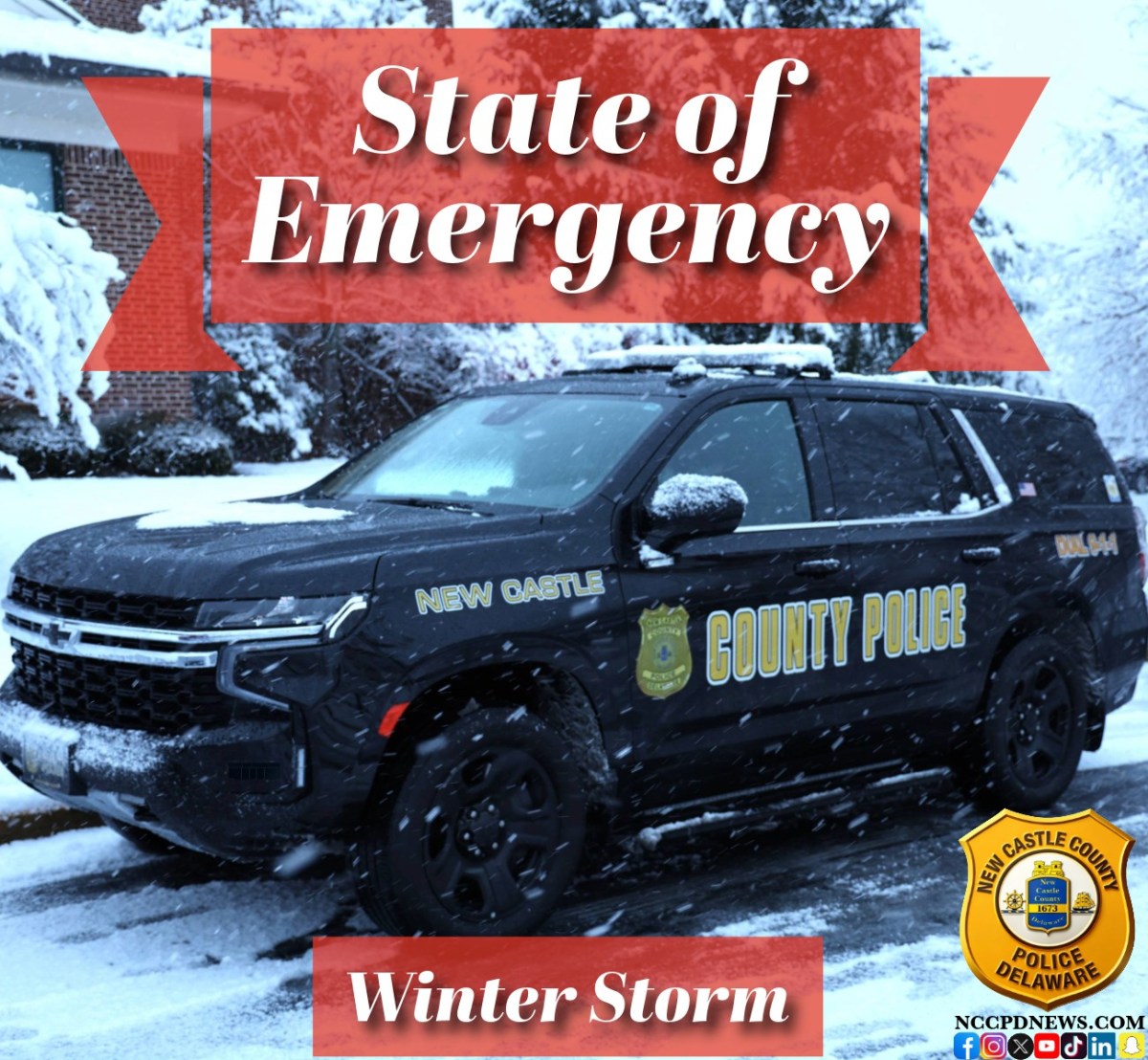
  • Level 2 Driving Restriction Issued for Delaware Amid Winter Storm

    Level 2 Driving Restriction Issued for Delaware Amid Winter Storm

    Level 2 Driving Restriction Issued for Delaware Amid Winter Storm

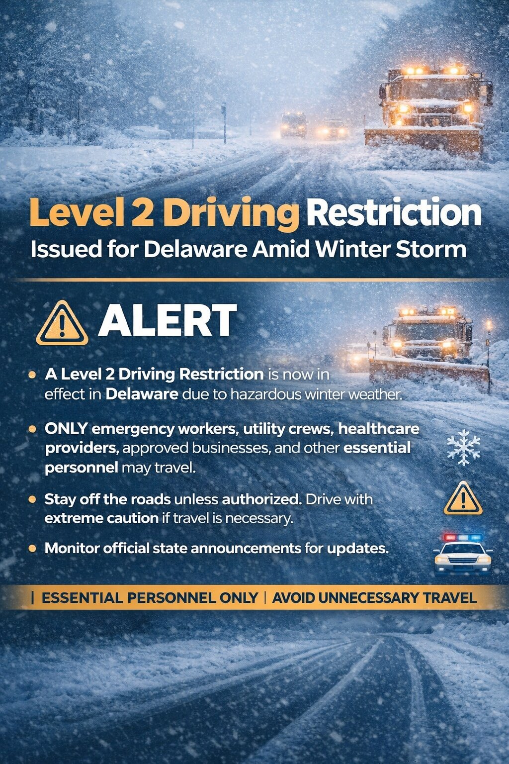
    A Level 2 Driving Restriction is now in effect across the state of Delaware as hazardous winter weather continues to impact road conditions statewide.

    Under a Level 2 restriction, travel on Delaware roadways is limited to essential personnel only. This includes emergency workers, public utility crews, healthcare providers including hospital staff, public and private snow removal operators, private sector food and fuel delivery services, and industries, companies, or organizations that have been granted a waiver. Businesses facing critical continuity or operational concerns may also qualify under the restriction.

    State officials say the decision was made due to deteriorating road conditions caused by heavy snow, blowing snow, and reduced visibility. With snow continuing to fall and winds increasing, travel has become increasingly dangerous, especially on secondary roads and untreated surfaces.

    Officials strongly urge residents to stay off the roads unless they fall into one of the approved categories. Limiting traffic allows plow crews and emergency responders to operate more safely and efficiently during the height of the storm.

    Drivers who are authorized to travel should use extreme caution, expect snow-covered and icy roads, and be prepared for rapidly changing conditions.

    There is also the potential for further upgrades if conditions continue to worsen.

    Residents are encouraged to monitor official state announcements for updates and to follow all guidance from local and state authorities as the winter storm unfolds.

  • Traffic Lights Out in Smyrna Due to Power Outage – Drive Carefully

    Traffic Lights Out in Smyrna Due to Power Outage – Drive Carefully

    Drivers passing through Smyrna need to be extra vigilant today as a power outage has knocked out several traffic lights throughout the area.

    The Delaware Department of Transportation is alerting the public about the signal failures, which are creating potentially hazardous conditions for both motorists and pedestrians.

    When traffic signals are not functioning, drivers should treat intersections as four-way stops, coming to a complete stop and yielding to traffic that arrived first.

    DelDOT has not provided an estimated time for when the signals will be restored, as repairs depend on when power is returned to the affected areas.

    Residents and commuters should plan for delays and consider alternate routes if possible while crews work to resolve the electrical issues.

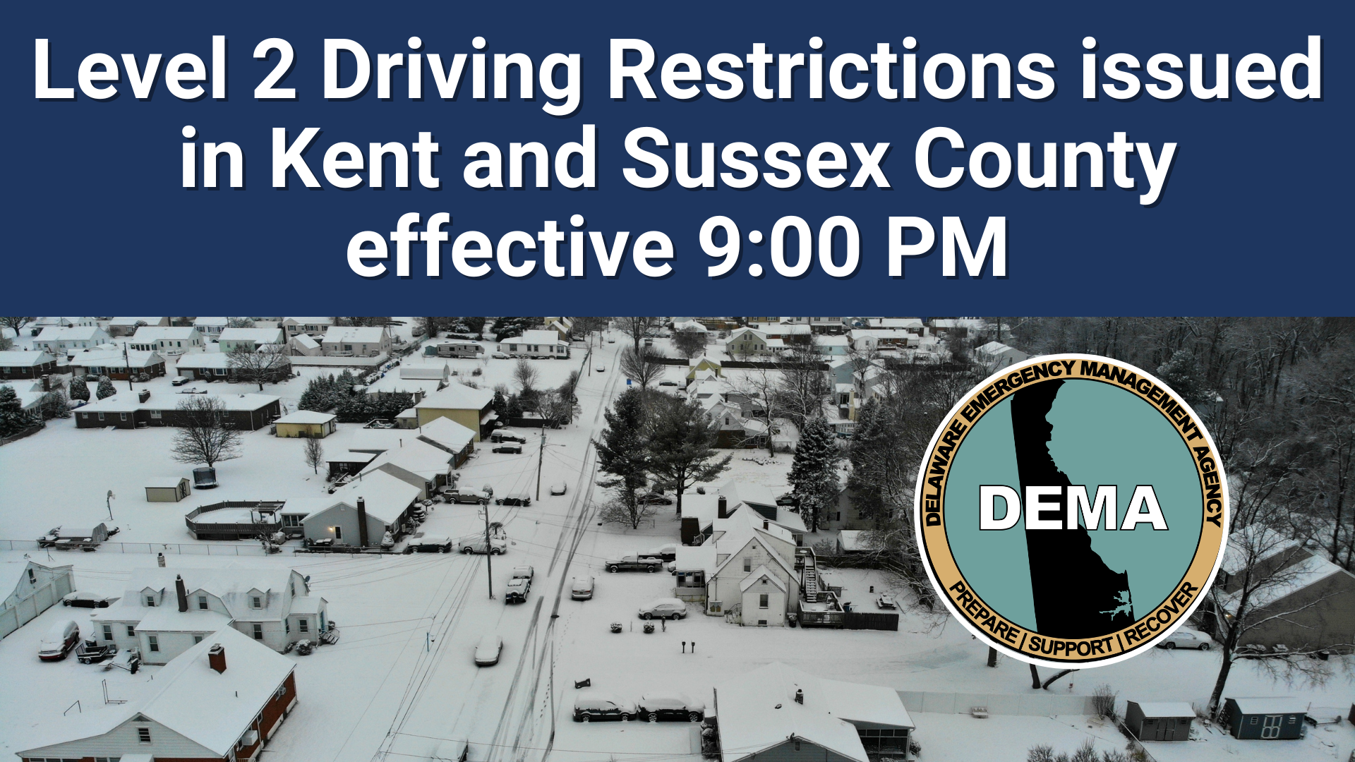
  • Kent, Sussex Counties Under Level 2 Driving Ban Starting 9 PM Tonight

    Kent, Sussex Counties Under Level 2 Driving Ban Starting 9 PM Tonight

    Delaware Governor Matthew Meyer announced a Level 2 driving restriction for Kent and Sussex counties that takes effect tonight at 9:00 p.m., with no end time specified.

    The state-imposed travel limitations are designed to protect emergency personnel and other critical drivers by reducing unnecessary vehicle traffic during hazardous weather conditions and dangerous roadway situations.

    Officials have not indicated when the driving restrictions will be lifted, stating they will remain active until further notice.

  • Delaware State Offices Shutting Down Monday Due to Severe Weather

    Delaware State Offices Shutting Down Monday Due to Severe Weather

    Delaware state government operations will come to a halt Monday as officials announce the closure of all state offices throughout New Castle, Kent, and Sussex counties on February 23, 2026.

    The shutdown will affect normal business operations from 8 a.m. through 4:30 p.m. as severe weather conditions pose safety concerns for state workers and the public.

    Workers classified as non-essential have been instructed to stay home during the closure period. However, personnel previously identified as critical for emergency weather response will continue reporting to their assigned posts as planned.

    The statewide closure affects government facilities in all three Delaware counties as officials prioritize public safety during the anticipated severe weather event.

  • Traffic Lights Out in Milford Due to Power Outage, Drivers Urged to Use Caution

    Traffic Lights Out in Milford Due to Power Outage, Drivers Urged to Use Caution

    Drivers heading through Milford are being warned to exercise extreme caution after a power outage knocked out multiple traffic signals throughout the city.

    The Delaware Department of Transportation is alerting motorists that several intersections now have non-functioning traffic lights, creating potentially dangerous driving conditions.

    When approaching intersections with dark or malfunctioning signals, drivers should treat them as four-way stops, coming to a complete stop and yielding to traffic that arrived first.

    DelDOT has not provided an estimated time for when the signals will be restored to normal operation.

  • Cambridge City Offices Shut Down, Waste Pickup Suspended

    Cambridge City Offices Shut Down, Waste Pickup Suspended

    The City of Cambridge has temporarily shuttered all municipal offices and halted waste collection services, according to a civic alert issued by city officials.

    City residents will need to hold onto their trash and recycling until further notice, as collection crews are not operating during this closure period.

    All city administrative offices remain closed to the public during this time, affecting various municipal services and operations.

    Officials have not provided a specific timeline for when normal city operations and trash pickup schedules will return. Residents are encouraged to check the city’s official communications channels for updates on service restoration.

  • Coastal Flood Advisory: Minor Tidal Flooding Expected Tonight in New Castle County

    Coastal Flood Advisory: Minor Tidal Flooding Expected Tonight in New Castle County

    Residents in New Castle County, Delaware and Salem County, New Jersey should prepare for minor tidal flooding tonight as the National Weather Service has issued a Coastal Flood Advisory effective from midnight until 4:00 AM Monday morning. Up to six inches of water above ground level is expected in low-lying areas near shorelines and tidal waterways. The flooding will primarily affect the most vulnerable roadways along tidal areas, with some partial or full road closures possible. Officials warn that additional tidal flooding may occur through Monday night’s high tide cycle, so residents should remain vigilant beyond the initial advisory period. For your safety, do not attempt to drive through flooded roadways – the water may be deeper than it appears and can cause serious vehicle damage or put you in danger. Avoid parking in areas prone to tidal flooding. While this is considered minor flooding, it’s important to take precautions and avoid affected areas when possible. The advisory expires at 4:00 AM Monday, but conditions should be monitored throughout the day. For the latest water level information and flood impacts, residents can visit the National Water Prediction Service online. Stay with TV Delmarva for continued coverage of local weather conditions.
  • Coastal Flood Warning: Up to 2 Feet of Water Expected Across Delaware Through Monday Morning

    Coastal Flood Warning: Up to 2 Feet of Water Expected Across Delaware Through Monday Morning

    Residents across Kent County, Inland Sussex, and Delaware’s beaches are urged to prepare for significant coastal flooding as water levels are expected to rise one to two feet above ground level through 5 AM Monday morning. The National Weather Service issued the Coastal Flood Warning Saturday evening, warning that widespread roadway flooding will make many roads impassable in coastal and bayside communities, as well as areas along inland tidal waterways. Vulnerable structures may begin to experience damage. The flooding threat doesn’t end Monday morning. Weather officials say minor to moderate coastal flooding is likely to continue with Monday afternoon’s high tide, and back-bay flooding could linger until Tuesday morning’s high tide. Authorities are reminding residents never to drive through flood waters, as the depth can be deceiving and vehicles can be swept away or severely damaged. Local emergency management officials urge residents in affected areas to monitor conditions closely and be prepared to take action to protect life and property. The warning remains in effect until 5 AM Monday, but additional extensions are expected as conditions develop. For real-time water level information, residents can visit the National Water Prediction Service online.
  • Weather Service Issues Coastal Flooding Alert for Delaware Shore

    Weather Service Issues Coastal Flooding Alert for Delaware Shore

    Weather officials have issued a coastal flood advisory for Delaware’s coastal regions, warning residents of potential flooding conditions along the shoreline.

    The National Weather Service office in Mount Holly, New Jersey issued the advisory Thursday evening at 6:40 PM, with the warning remaining active until 4:00 AM Friday morning.

    Coastal areas of Delaware may experience minor to moderate flooding during this timeframe, particularly during high tide cycles. Residents and visitors in affected areas should exercise caution when traveling near waterfront locations and low-lying coastal roads.

    The weather service advises drivers to avoid flooded roadways and reminds the public that it only takes a small amount of moving water to sweep away a vehicle.

  • National Weather Service Issues Coastal Flooding Alert for Delaware Shore

    National Weather Service Issues Coastal Flooding Alert for Delaware Shore

    The National Weather Service office in Mount Holly, New Jersey has issued a coastal flood warning for Delaware’s coastal regions, effective from Thursday, February 22 at 6:40 PM through Friday, February 23 at 5:00 AM.

    Delaware residents along the coast should prepare for potential flooding conditions during this timeframe. The warning covers areas most susceptible to coastal flooding during high tide cycles and adverse weather conditions.

    Local authorities recommend that residents in flood-prone coastal areas take necessary precautions and avoid driving through flooded roadways. Property owners near the shoreline should secure loose items and be prepared for possible water intrusion.

    The weather service will continue monitoring conditions and may extend or modify the warning as circumstances change.

  • Salisbury University Women’s Tennis Defeats Catholic 4-1 in Singles-Dominated Match

    Salisbury University Women’s Tennis Defeats Catholic 4-1 in Singles-Dominated Match

    SALISBURY, Md. – Salisbury University’s women’s tennis squad dominated individual competition to claim a convincing 4-1 triumph against Catholic University’s Cardinals during Sunday’s match at the Sea Gulls’ Indoor Tennis Center.

    The Sea Gulls showcased their depth in individual play, with their top singles competitors leading the charge in the afternoon victory. The match highlighted Salisbury’s competitive strength in head-to-head matchups against the visiting Cardinals.

    Sunday’s win adds another victory to Salisbury University’s tennis program as the team continues its season at their home indoor facility in Maryland’s Eastern Shore region.

  • Traffic Alert: Two Left Lanes Shut Down on I-95 North After Churchmans Road Crash

    Traffic Alert: Two Left Lanes Shut Down on I-95 North After Churchmans Road Crash

    A traffic accident is causing significant delays for drivers on northbound Interstate 95 near Churchmans Road, with two left lanes currently blocked to traffic.

    According to Delaware Department of Transportation officials, the crash has shut down the two leftmost lanes of I-95 North in the Churchmans Road vicinity. Emergency crews are on scene working to clear the accident.

    Drivers traveling through the area should anticipate delays and may want to consider using alternate routes until the roadway is fully reopened. DelDOT has not yet provided an estimated time for when normal traffic flow will resume.

  • Delaware Blue Hens Baseball Wraps Up Road Series Against Top-Ranked Mississippi State

    Delaware Blue Hens Baseball Wraps Up Road Series Against Top-Ranked Mississippi State

    The University of Delaware Blue Hens baseball squad wrapped up their demanding road trip this weekend, completing a series against the nationally-ranked Mississippi State Bulldogs in Starkville.

    The Blue Hens took on the fourth-ranked Bulldogs in what proved to be a challenging test for the Delaware program. The series provided valuable experience for the team as they faced one of the top collegiate baseball programs in the country.

    Player Elias Conway was among the Blue Hens who competed in the high-level matchup against Mississippi State’s formidable lineup.

    The road series against such a highly-ranked opponent offers the Delaware baseball program important exposure and competition as they continue their season. Facing teams of Mississippi State’s caliber provides crucial development opportunities for the Blue Hens players and coaching staff.

  • UD Women’s Golf Team Ties for Fifth in Georgia Spring Season Opener

    UD Women’s Golf Team Ties for Fifth in Georgia Spring Season Opener

    EATONTON, Ga. – The University of Delaware’s women’s golf squad kicked off their spring campaign with a respectable showing at the Reynolds Lake Oconee Invitational in Georgia this weekend.
    The Fightin’ Blue Hens secured a tie for fifth place among a competitive field of 15 teams at the tournament, which was hosted by Mercer University. Delaware finished the three-day competition with a combined team score of 899, putting them 35 strokes over par.

    The Blue Hens competed on the challenging Great Waters course at Reynolds Lake Oconee, which measures 6,107 yards and plays to a par of 72. The spring opener provided Delaware’s golfers with their first competitive action of the new season as they work toward upcoming conference play.

  • Delaware State Softball Announces Series Cancellation with Oakland

    Delaware State Softball Announces Series Cancellation with Oakland

    The Delaware State University Hornets softball program has made an adjustment to their upcoming game schedule, officials announced.

    The university has called off their planned series matchup against Oakland University, according to the athletics department.
    No additional details were provided regarding the reason for the cancellation or whether makeup games will be scheduled.

  • Massive Winter Storm Brings Blizzard Conditions to Northeast Region

    A powerful winter storm is pummeling the Northeast region, prompting officials to issue blizzard warnings as communities brace for potentially historic snowfall amounts.

    The storm system is expected to dump significant snow accumulations across a wide swath of the region, with forecasters predicting that areas from New Jersey up through Massachusetts could receive as much as 2 feet of snow before the system moves out.

    New York City officials are taking the threat seriously, with the mayor stating that the city had not “seen a storm like this in a decade.”

    Transportation systems are already feeling the impact, with snow beginning to accumulate on roadways and affecting rail services. Images from the storm show the New Jersey Light Rail continuing operations despite heavy snowfall at stations like Port Imperial in Weehawken.

    Residents throughout the affected region are being urged to prepare for dangerous travel conditions and potential power outages as the storm system continues to intensify.

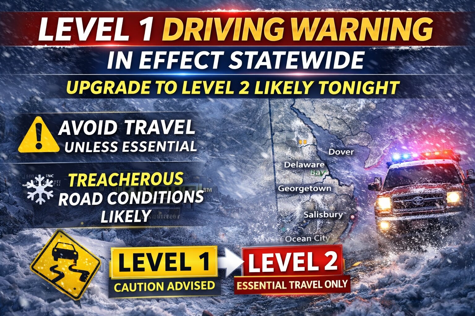
  • Delaware Under Level 1 Driving Warning; Upgrade to Level 2 Likely Tonight

    Delaware Under Level 1 Driving Warning; Upgrade to Level 2 Likely Tonight

    Delaware officials have issued a statewide Level 1 Driving Warning as a powerful winter storm continues to bring heavy snow, strong winds, and deteriorating road conditions across the First State.

    The warning urges motorists to use extreme caution and avoid travel unless absolutely necessary. Under a Level 1 Driving Warning, drivers are strongly encouraged to stay off the roads unless travel is essential for safety, health, or critical business reasons.

    State leaders say road conditions are expected to worsen through the evening as snowfall intensifies and winds increase, leading to reduced visibility, slick surfaces, and drifting snow. Emergency management officials warn that conditions could become increasingly hazardous overnight.

    Authorities are also cautioning that an upgrade to a Level 2 Driving Restriction is possible later tonight if road conditions continue to deteriorate. A Level 2 restriction would limit travel to essential personnel only, including emergency responders, healthcare workers, and critical infrastructure employees.

    The Delaware Emergency Management Agency continues coordinating response efforts statewide, and officials are urging residents to monitor updates closely.

    Drivers are advised to slow down, allow extra distance between vehicles, and check the latest road conditions before traveling. Residents are also encouraged to prepare for possible power outages and ensure they have necessary supplies on hand.

    Officials emphasize that staying off the roads during the height of the storm will help keep emergency routes clear and ensure public safety as conditions worsen.

  • Traffic Alert: I-95 South Lane Blocked Near Naamans Road Following Vehicle Accident

    Traffic Alert: I-95 South Lane Blocked Near Naamans Road Following Vehicle Accident

    Motorists traveling on southbound Interstate 95 are experiencing delays this morning after a vehicle accident forced authorities to shut down the right lane just beyond the Naamans Road interchange.

    The Delaware Department of Transportation confirmed the lane closure through their traffic incident reporting system, advising drivers to expect slower travel times in the area.

    Officials have not yet released details about the severity of the crash or whether anyone sustained injuries in the collision.

    Drivers are encouraged to use caution when passing through the area and consider alternate routes if possible to avoid potential backups.

  • Emergency Utility Repairs Force Road Closure on Chaplains Chapel Road

    Emergency Utility Repairs Force Road Closure on Chaplains Chapel Road

    Delaware Department of Transportation officials have announced the temporary closure of Chaplains Chapel Road as emergency utility crews work to address infrastructure issues in the area.

    The roadway is currently impassable for all traffic between the intersections of Deer Forest Road and Russell Road while repair teams complete their work.

    Drivers who regularly use this route are advised to seek alternative paths and allow extra travel time until the emergency maintenance is finished and normal traffic flow can resume.

    DelDOT has not provided an estimated timeline for when the road will reopen to vehicular traffic.

  • New Castle Man Charged After Suspicious Bank Incident with Fake Gun

    New Castle Man Charged After Suspicious Bank Incident with Fake Gun

    Delaware State Police have taken a 28-year-old New Castle resident into custody following a suspicious incident at a local credit union over the weekend.

    Marcus McClain was charged with attempted robbery after an incident that unfolded Saturday morning, February 21, 2026, around 10:50 a.m. at Dover Federal Credit Union on Pulaski Highway in New Castle. Authorities responded after the financial institution’s alarm system was triggered.

    According to police reports, McClain walked into the credit union wearing a face mask and gloves. When bank staff asked him to remove the face covering, he initially refused their requests. While McClain eventually took off the mask, he kept the gloves on and walked up to a bank teller, where he wrote down a monetary amount on paper.

    The situation escalated when McClain could not produce proper identification or provide an account number. The teller grew suspicious of McClain’s behavior, alerted other employees, and ultimately triggered the bank’s alarm system.

    Officers found McClain still inside the building when they arrived and took him into custody without any resistance. A search revealed McClain was carrying a concealed black pellet gun designed to look like a Colt Python Revolver in his waistband.

    The case was handed over to Troop 2’s Criminal Investigations Unit for further review. Investigators determined that McClain never displayed the fake weapon during the incident, was not an account holder at the credit union, and no money was stolen.

    Following his arrest, McClain was transported to Troop 2 headquarters where he faced formal charges. Justice of the Peace Court 11 arraigned him before he was transferred to Howard R. Young Correctional Institution. His bail was set at $65,000 cash.

    The charges against McClain include:

    • Attempted Robbery First Degree (Felony)
    • Wearing a Disguise During the Commission of a Felony (Felony)

  • Governor Issues Statewide Driving Advisory Amid Emergency Declaration

    Governor Issues Statewide Driving Advisory Amid Emergency Declaration

    Delaware Governor Matthew Meyer has declared a Level 1 Driving Warning across all of Delaware, taking effect immediately as part of the ongoing State of Emergency declaration.

    The statewide driving advisory will continue indefinitely, according to state officials. Authorities warn that more severe driving restrictions could be implemented if roadway conditions continue to deteriorate throughout the evening hours.

    The driving warning advises motorists to exercise extreme caution while traveling on Delaware roads and to avoid unnecessary trips during the emergency conditions.

  • Blizzard Warning Issued for Ocean City Through Monday Evening

    Blizzard Warning Issued for Ocean City Through Monday Evening

    The National Weather Service office in Wakefield, Virginia has issued a blizzard warning for Ocean City, Maryland, which remains in effect through Monday evening, February 23, 2026.

    The popular resort destination is preparing for dangerous winter weather conditions, including significant snowfall accumulations, powerful wind gusts, and severely limited visibility caused by blowing and drifting snow.

    Weather officials are warning residents and any remaining visitors in the area to take the storm seriously as conditions are expected to deteriorate rapidly.

  • Traffic Alert: Route 13 Southbound Lane Blocked Near Hopkins Cemetery Road

    Traffic Alert: Route 13 Southbound Lane Blocked Near Hopkins Cemetery Road

    Delaware transportation officials report that a traffic accident has resulted in the closure of one lane along a busy stretch of US Route 13.

    The collision occurred on southbound Route 13 near Hopkins Cemetery Road, prompting authorities to block off the right travel lane to traffic. DelDOT crews are currently responding to the scene.

    Drivers traveling through the area should anticipate potential delays and may want to seek alternative routes until the roadway can be fully reopened.

    This is a developing situation and TV Delmarva will provide updates as more information becomes available.

  • Anti-Trump Republicans Gather in Maryland, Warn of Democracy Threats

    Anti-Trump Republicans Gather in Maryland, Warn of Democracy Threats

    NATIONAL HARBOR, Md. — Republican dissidents and former party members convened near the nation’s capital this weekend, repeatedly cautioning that President Donald Trump and his congressional supporters are damaging America’s democratic foundations.

    One ex-lawmaker characterized Trump’s party as a “cult that embraces authoritarianism.” A well-known conservative author called Trumpism a threat to the nation’s existence. A former Army general, his voice trembling with feeling, referenced post-World War II Germany as a model for America’s eventual recovery from the Trump era.

    Whether anyone is paying attention remains questionable.

    The primary meeting space at this year’s sixth Principles First gathering on Saturday and Sunday was barely half occupied. Organizers arranged approximately 750 seats in a venue capable of accommodating several thousand attendees, yet many remained vacant. No sitting Republican office holders took part in the weekend’s activities.

    This represents what’s left of the GOP’s Never Trump faction — a group of Republicans, ex-Republicans and independents who united as Trump gained control of the party. They continue to exist as political outcasts, uncomfortable with Democrats while repulsed by the president’s rejection of traditional Republican principles like free markets and smaller government.

    John McDowell, a 69-year-old lifelong Republican until Trump’s rise, admitted the shrinking movement has essentially no influence within his former party.

    “It’s just a fact. We’re losing good people,” McDowell explained. The former Hill aide and California county GOP official added, “The party is becoming more and more MAGA-fied.”

    White House representative Abigail Jackson rejected the criticism from what she termed “a bunch of deranged has-been politicians.”

    “The only people who will pay attention to this event are the journalists who are forced to cover it,” Jackson stated.

    Nearly all attendees at the National Harbor, Maryland hotel expressed hope for Democratic wins in November’s midterm contests. Among the few Democrats present was Conor Lamb, a former Pennsylvania congressman who lost his party’s Senate primary to John Fetterman in 2022.

    Even amid serious worries, some cautious hope emerged in the partially filled auditorium and quiet hotel corridors.

    Multiple attendees applauded last week’s Supreme Court ruling that blocked Trump’s trade tariffs — economic weapons he’s used without legislative consent to pressure nations worldwide. Trump declared he would impose new tariffs regardless of the court decision.

    Former New Jersey Governor Chris Christie, once a Trump advisor, pointed to recent AP-NORC survey data indicating one in four Republicans nationally disapprove of Trump’s performance.

    “It’s like any show that’s on TV for a long time — the ratings start to go down. And the ratings are going down,” Christie observed. “I am willing to bet you that by next February, this room is going to be twice the size of what it is now. After the midterms, you watch.”

    Former Trump supporter Rich Logis, sporting a red “I left MAGA hat,” anticipates “an electoral revolt against MAGA” in the midterms.

    “I think there’s a shift in our country right now,” Logis said. “It happens slowly.”

    Logis promoted support groups for relatives and friends of Trump followers at a booth outside the main hall. Close by, someone sold books about escaping cult environments.

    From the stage, former Republican Representative Joe Walsh urged Trump opponents not to minimize the danger the president represents to America.

    “He’s everything our founders feared. Say it. Believe it,” Walsh declared. He described his former party as “an authoritarian-embracing cult” and “a threat to everything I love.”

    Retired General Mark Hertling, former commander of U.S. Army forces in Europe, said international partners “haunt” him by questioning “whether American institutions ever can be trusted again.”

    “Our nation’s institutions have been shaken. Our alliances have been strained. Our credibility has been damaged. And our nation’s values have been cast aside,” Hertling stated. He recommended America examine Germany’s post-Nazi reconstruction as a blueprint for repairing Trump-related damage.

    The country’s healing process, he said with a breaking voice, would require years of dedicated effort to achieve.

    Bill Kristol, a veteran of past Republican administrations who co-founded the Weekly Standard publication, labeled Trump and his GOP congressional allies “an existential threat” to America. However, he expressed optimism about November’s elections.

    Kristol predicted Democrats are “almost certain to win the House,” “could possibly win the Senate,” and maintain “a good chance to win the presidency” in 2028.

    Brittany Martinez, who leads host organization Principles First, attempted an upbeat message despite explaining why she couldn’t continue working as a Republican congressional staffer.

    “I hope that Republicans continue to wake up,” Martinez said. “I do think that those folks exist. And I hope that they exist in greater numbers.”

  • Emergency Declaration Active as Blizzard Warning Continues Through Monday

    Emergency Declaration Active as Blizzard Warning Continues Through Monday

    Delaware remains under an emergency declaration as hazardous blizzard conditions are expected to continue impacting the region through Monday.

    Officials are warning residents that travel restrictions could be put in place as weather conditions worsen throughout the area. Authorities are strongly encouraging people to stay home and avoid any trips that are not absolutely necessary.

    Emergency management officials are advising residents to make preparations now and to reach out to elderly or vulnerable neighbors who might require help during the severe weather event.

    Residents are encouraged to monitor official emergency management channels and trusted news sources for the latest updates as the dangerous weather situation continues to develop.

  • Lewes Issues Latest Winter Storm Updates This Afternoon

    Lewes Issues Latest Winter Storm Updates This Afternoon

    Officials in Lewes provided their latest winter weather briefing this afternoon as storm conditions affect the coastal Delaware community.

    The municipal government issued its most recent storm-related information at 3:00 p.m. today, February 22, 2026, keeping residents informed about developing weather conditions in the area.

    City administrators continue monitoring the situation and plan to release additional updates as circumstances warrant throughout the remainder of the storm event.

  • Major Northeast Blizzard Prompts Emergency Declarations, Flight Cancellations

    Major Northeast Blizzard Prompts Emergency Declarations, Flight Cancellations

    Governors throughout the Northeast have declared states of emergency as a powerful winter storm threatens to blanket the region with up to two feet of snow and dangerous winds.

    The severe weather system prompted emergency declarations in New York, New Jersey, Connecticut, and Massachusetts, with officials implementing widespread travel restrictions for non-essential trips. Air travel has been severely disrupted, with more than 15,000 flights experiencing delays by Sunday afternoon and over 3,500 flights completely canceled. The heaviest impact hit major airports including JFK, La Guardia, and Newark.

    New York City Mayor Zohran Mamdani implemented strict traffic restrictions, shuttering city streets to all non-essential vehicles, bicycles, and scooters from 9 p.m. Sunday through 12 p.m. Monday. The city also announced the closure of all school buildings during the storm.

    Connecticut Governor Ned Lamont followed suit with his own transportation restrictions, prohibiting commercial vehicles from using state highways beginning at 5 p.m. Sunday. Meanwhile, Massachusetts Governor Maura Healey not only declared an emergency but also called up to 200 National Guard personnel to assist with storm response. The Bay State also implemented its own non-essential travel ban starting Sunday evening.

    New York Governor Kathy Hochul deployed 100 National Guard members to assist areas expected to be hardest hit, including Long Island, New York City, and the Lower Hudson Valley region.

  • Wicomico County Declares Emergency Ahead of Winter Storm

    Wicomico County Declares Emergency Ahead of Winter Storm

    Wicomico County leadership activated emergency protocols Sunday afternoon as severe winter weather approaches the Eastern Shore region.

    County officials implemented the emergency declaration at 2:30 p.m. on February 22, 2026, positioning local resources ahead of the anticipated storm system.

    The emergency status enables county departments to coordinate response efforts and deploy necessary resources to address weather-related challenges that may impact residents and infrastructure.

    Government facilities will remain closed on February 23, 2026, as part of the emergency response measures.

  • Coastal Flood Advisory: Minor Tidal Flooding Expected Overnight in New Castle County

    Coastal Flood Advisory: Minor Tidal Flooding Expected Overnight in New Castle County

    Residents in New Castle County, Delaware should prepare for minor coastal flooding beginning at midnight tonight through 4 AM Monday morning. The National Weather Service has issued a Coastal Flood Advisory warning of up to six inches of water above ground level in low-lying areas near shorelines and tidal waterways. Salem County, New Jersey is also included in this advisory. The flooding is expected to impact the most vulnerable roads along tidal waterways, with some partial or full road closures possible. Officials warn that additional tidal flooding could occur through Monday night’s high tide cycle. “Minor tidal flooding often results in some road closures, usually affecting the most vulnerable roadways,” according to the National Weather Service. Safety officials strongly advise residents not to park vehicles in flood-prone areas and never attempt to drive through flood waters. The water depth can be deceiving and may cause significant vehicle damage or put drivers in danger. The Coastal Flood Advisory remains in effect until 4 AM Monday morning. Residents can monitor water levels and flood impacts for local tide gauges by visiting the National Water Prediction Service website. Stay with TV Delmarva for continuing weather updates throughout the weekend.
  • Coastal Flood Warning: Up to 2 Feet of Water Expected Across Delaware Tonight

    Coastal Flood Warning: Up to 2 Feet of Water Expected Across Delaware Tonight

    Residents across Kent County, Inland Sussex, and Delaware’s beaches need to prepare for significant flooding tonight as the National Weather Service issued a Coastal Flood Warning effective from 9 PM tonight through 5 AM Monday morning. The weather service is forecasting one to two feet of water above ground level in low-lying areas near shorelines and tidal waterways. This flooding will cause widespread road closures in coastal and bayside communities, with many routes becoming completely impassable. “Some damage to vulnerable structures may begin to occur,” according to the National Weather Service Mount Holly office. “Some locations may become isolated by the flood waters.” The flooding threat doesn’t end Monday morning. Additional minor to moderate coastal flooding is likely with Monday afternoon’s high tide, and back-bay flooding could persist through Tuesday morning. Safety officials stress: never drive through flood waters. The water may be deeper than it appears, putting you in danger and potentially damaging your vehicle. Residents should follow recommendations from local emergency management officials and stay informed as conditions develop. The Coastal Flood Warning remains in effect until 5 AM Monday morning, though extensions are possible depending on conditions.
  • Rehoboth Beach Bans Parking on Main Roads Starting Sunday Night for Snow

    Rehoboth Beach Bans Parking on Main Roads Starting Sunday Night for Snow

    Contact: Brooke Thaler, Communications Department, 302-227-6181, ext. 522

    City officials in Rehoboth Beach have announced emergency snow route restrictions starting Sunday evening as a winter storm approaches the coastal community with expected snowfall accumulation.

    The City Manager has authorized the activation of special weather emergency routes designed to keep critical roadways clear for safe passage, effective snow clearing operations, and unimpeded access for first responders throughout the winter weather event.

    All vehicles must be removed from Rehoboth Avenue, Bayard Avenue, and State Road by 7:00 PM on Sunday, February 22nd. The parking ban will continue until municipal snow clearing crews finish their work.

    City officials have outlined specific requirements while the emergency declaration is active:

    • No vehicles may park on either side of Rehoboth Ave., Bayard Ave., or State Road
    • Cars left in restricted areas will receive citations and be towed with all costs charged to owners
    • Property owners should utilize private driveways or find off-street parking spaces
    • All motorists must give right-of-way to snow plows and emergency response vehicles
    • Blocking or interfering with snow removal crews is strictly forbidden
    • Citizens are asked to ensure fire hydrants remain clear and reachable

    Should the Governor implement county-wide driving limitations for Sussex County, complete information is available at: SnowDEDrivingRestrictions.pdf

    For emergency situations, dial 911. Non-urgent matters can be reported to 302-227-2577.

  • Cambridge Reports Sewer Overflow During Thursday’s Heavy Rain

    Cambridge Reports Sewer Overflow During Thursday’s Heavy Rain

    Cambridge officials are alerting residents about a sanitary sewer overflow that took place Thursday afternoon during periods of intense rainfall.

    The Cambridge Department of Public Services issued the public notification following regulations under COMAR 26.08.10.08, stating that the sewer overflow incident happened on February 20, 2025.

    According to the department, the overflow lasted approximately four and a half hours, beginning at 11:00 am and continuing until 3:30 pm. Officials attributed the incident to the heavy rain that impacted the area during that timeframe.

  • Weather Service Issues Coastal Flooding Alert for Delmarva Through Friday Morning

    Weather Service Issues Coastal Flooding Alert for Delmarva Through Friday Morning

    Weather officials have issued a coastal flood advisory for the Delmarva Peninsula that began Thursday afternoon at 1:02 PM and will continue until 4:00 AM Friday morning.

    The National Weather Service office in Mount Holly, New Jersey issued the alert on February 22nd, warning residents of potential tidal flooding along coastal areas throughout the advisory period.

    Local residents in flood-prone areas should monitor conditions and take necessary precautions during high tide cycles while the advisory remains active.

  • National Weather Service Issues Coastal Flood Warning for Delaware Shore

    National Weather Service Issues Coastal Flood Warning for Delaware Shore

    Delaware coastal areas are under a flood warning issued by the National Weather Service Mount Holly office on Thursday afternoon.

    The warning went into effect at 1:02 PM on February 22nd and will remain active until 5:00 AM on February 23rd.

    Residents and visitors along Delaware’s coastline should prepare for potential flooding conditions during this timeframe.

    The National Weather Service typically issues coastal flood warnings when conditions are expected to cause significant flooding that poses a threat to life and property in low-lying coastal areas.

  • EXTREME: Blizzard Warning in Effect as Major Winter Storm Brings Up to 17 Inches of Snow to Delmarva

    EXTREME: Blizzard Warning in Effect as Major Winter Storm Brings Up to 17 Inches of Snow to Delmarva

    A dangerous blizzard is barreling toward the Delmarva Peninsula, prompting the National Weather Service to issue an Extreme Blizzard Warning through Monday evening at 6 PM. The major winter storm will dump between 11 and 17 inches of snow across New Castle and Kent Counties in Delaware, along with Caroline, Queen Anne’s, and Talbot Counties in Maryland. Wind gusts up to 45 mph will create whiteout conditions and significant snow drifts. Rain will transition to heavy snow this afternoon and evening, with the most severe conditions expected overnight. Snow rates could exceed 2 inches per hour, with record-breaking totals possible in some areas. Travel will be extremely dangerous to impossible, especially during Monday morning and evening commutes. Blowing snow will drastically reduce visibility, and gusty winds may down tree branches and cause isolated power outages. Officials are urging residents to restrict travel to emergencies only. If you must venture out, carry a winter survival kit and stay with your vehicle if stranded. Check road conditions by calling 511. The blizzard warning remains in effect until Monday at 6 PM. Stay with TV Delmarva for continuing coverage of this dangerous storm.
  • EXTREME WEATHER ALERT: Historic Blizzard Slams Delmarva with Up to 17 Inches of Snow

    EXTREME WEATHER ALERT: Historic Blizzard Slams Delmarva with Up to 17 Inches of Snow

    A dangerous blizzard is pummeling southern Delaware with potentially record-breaking snowfall and life-threatening conditions through Monday evening. The National Weather Service has issued a Blizzard Warning for Delaware Beaches and Inland Sussex County, with snow accumulations between 13 and 17 inches expected. The major winter storm began this afternoon as rain transitioned to heavy snow. The most severe conditions are occurring tonight, with snowfall rates potentially exceeding 2 inches per hour. Wind gusts up to 55 mph are creating blizzard conditions with near-zero visibility due to blowing and drifting snow. Travel is extremely dangerous and should be restricted to emergencies only. The hazardous conditions will severely impact Monday morning and evening commutes across the region. Strong winds may cause tree damage and scattered power outages throughout the area. If you must travel, carry a winter survival kit and stay with your vehicle if stranded. For current road conditions, dial 511. The storm will gradually weaken Monday with snow tapering off during the day. The Blizzard Warning remains in effect until 6:00 PM Monday evening. Stay indoors and avoid unnecessary travel until conditions improve.
  • Traffic Alert: Lane Closure on Governor Printz Blvd After Crash

    Traffic Alert: Lane Closure on Governor Printz Blvd After Crash

    Delaware transportation officials are reporting a vehicle accident that has shut down one lane of traffic on a major roadway in New Castle County.

    The crash occurred on Governor Printz Boulevard in the southbound direction near Lore Avenue, forcing authorities to close the right lane to traffic. The incident is causing delays for drivers in the area as emergency responders and cleanup crews work at the scene.

    DelDOT is advising motorists to use caution when traveling through the area and to consider taking alternate routes if possible to avoid congestion.

    No information has been released regarding injuries or the cause of the accident. The timeline for reopening the closed lane remains unclear as crews continue their work.

  • National Weather Service Issues Blizzard Alert for Delmarva Through Saturday

    National Weather Service Issues Blizzard Alert for Delmarva Through Saturday

    The National Weather Service office in Mount Holly, New Jersey has declared a blizzard warning for the Delmarva Peninsula region, effective from Friday, February 22 at 1:23 PM through Saturday, February 23 at 6:00 PM.

    Weather officials are urging residents across Delaware and the Eastern Shore to prepare for dangerous winter conditions as the storm system approaches the area.

    The warning indicates that significant snowfall, strong winds, and reduced visibility are expected to create hazardous travel conditions throughout the weekend period.

    Local authorities recommend that residents avoid unnecessary travel during the warning period and ensure they have adequate supplies in case of power outages or other weather-related emergencies.

  • Salisbury Declares Emergency, Shuts Down Monday Due to Ice Threat

    Salisbury Declares Emergency, Shuts Down Monday Due to Ice Threat

    Salisbury officials have activated an emergency declaration that takes effect at 8:00 p.m. tonight, shutting down city operations for Monday, February 23.

    The emergency order will continue until city leaders decide to lift it or Maryland state officials make additional determinations. Weather forecasters predict ongoing precipitation through today and into the overnight hours, with officials particularly worried about refreezing conditions that could create treacherous black ice on roadways.

    All municipal offices and facilities will remain shuttered on Monday, February 23.

    Street Maintenance and Public Safety

    Details about snow clearing operations and designated emergency routes can be accessed through the city’s official website.

    City maintenance crews will work around the clock to keep municipal streets passable. Officials are urging citizens to remain at home when possible and avoid parking on emergency routes to allow plow trucks to operate effectively.

    Requirements for Sidewalk and Fire Hydrant Clearing

    Building and property owners along city streets must remove snow from adjacent sidewalks within 24 hours once snowfall stops, ensuring a minimum four-foot-wide walkway for safe pedestrian passage. Citizens living near fire hydrants must shovel out a three-foot clearance around these emergency fixtures to ensure first responders can access them quickly. Officials warn against dumping or shoveling snow into roadways, which creates additional dangers and complicates street clearing operations.

    Municipal Services

    Garbage and recycling pickup scheduled for Monday, February 23 has been rescheduled to Saturday, February 28.

    The Salisbury Zoo will remain closed on Monday, February 23.

    Wicomico County has similarly announced that county offices will be closed Monday.

    The scheduled City Council session for Monday will likely be moved to Tuesday, February 24.

    Critical personnel from the Salisbury Police Department and Salisbury Fire Department will continue normal operations. Citizens needing emergency water service shutoffs should call the police non-emergency number at 410-548-3165.

    Additional details about snow removal operations and ongoing storm updates are available at https://salisbury.md/ and through the city’s Facebook and Instagram social media accounts.

  • Gov. Meyer Activates Emergency Declaration, National Guard for Winter Storm

    Gov. Meyer Activates Emergency Declaration, National Guard for Winter Storm

    Delaware Governor Matthew Meyer issued an emergency declaration at noon today as the First State prepares for a significant winter storm heading toward the region.

    The emergency order, announced from Smyrna, enables state officials to deploy resources across Delaware and coordinate response efforts for the approaching severe weather system. The Delaware Emergency Management Agency is urging residents throughout the state to make necessary preparations immediately.

    As part of the emergency response, the National Guard has been activated to assist with storm-related operations. Officials indicate that travel restrictions are very likely to be implemented as conditions deteriorate.

    The emergency declaration provides state authorities with the legal framework to mobilize personnel, equipment, and other critical resources needed to address the winter storm’s impacts on Delaware communities.

    DEMA officials are emphasizing the importance of public readiness as the storm approaches, encouraging residents to stock up on essential supplies and avoid unnecessary travel once conditions begin to worsen.

  • National Weather Service Issues Blizzard Alert for Delmarva Through Saturday

    National Weather Service Issues Blizzard Alert for Delmarva Through Saturday

    The National Weather Service office in Mount Holly, New Jersey has issued a blizzard warning for the Delmarva Peninsula that took effect at 1:23 PM on February 22nd and will remain active until 6:00 PM on February 23rd.

    Weather officials are urging residents across Delaware and the Eastern Shore to prepare for severe winter conditions as the storm system moves through the region.

    The warning indicates that dangerous blizzard conditions with heavy snow, strong winds, and severely reduced visibility are expected to impact travel and daily activities throughout the warning period.

    Residents should monitor weather conditions closely and avoid unnecessary travel during the storm. Emergency officials recommend having adequate supplies and staying indoors when conditions deteriorate.

  • Newark Teen Dies in Wilmington Head-On Collision, Police Seeking Witnesses

    Newark Teen Dies in Wilmington Head-On Collision, Police Seeking Witnesses

    Authorities have released the name of the young woman killed in a devastating head-on collision Friday night in Wilmington. Delaware State Police confirm that Unique Williams, 19, of Newark, Delaware, lost her life in the two-vehicle crash.

    The investigation remains active under the Delaware State Police Collision Reconstruction Unit. Officials are urging anyone who may have witnessed the deadly accident or possesses relevant details to reach out to Corporal K. Oakes at (302) 365-8483. Witnesses can also share information through a private message to the Delaware State Police Facebook page or by calling Delaware Crime Stoppers at 1-800-847-3333.

    For families and individuals affected by sudden loss or traumatic incidents, support is available around the clock. The Delaware State Police Victim Services Unit, working alongside the Delaware Victim Center, provides assistance through their 24-hour helpline at 1-800-VICTIM-1 (1-800-842-8461). Those needing help can also reach out via email at [email protected].

  • Delaware Declares State of Emergency, National Guard Activated Ahead of Historic Winter Storm

    Delaware Declares State of Emergency, National Guard Activated Ahead of Historic Winter Storm

    (Smyrna, Del.) — Delaware officials have declared a State of Emergency as a powerful winter storm approaches the Delmarva Peninsula and southern New Jersey, prompting statewide preparations and emergency response mobilization.

    Governor Matt Meyer signed the emergency declaration effective noon Sunday, citing the potential for crippling snow, strong winds, and increased coastal flooding risk. The action authorizes the state to marshal critical resources, including the activation of the Delaware National Guard to assist with storm response and safety operations.

    “I’m declaring a State of Emergency and activating every available state resource to ensure Delawareans are protected as this blizzard blankets our communities, including increased risks for coastal flooding,” Governor Meyer said in a statement urging residents to prepare now and avoid travel once the storm begins.

    The Delaware Emergency Management Agency (DEMA) has been on Enhanced Watch, and will shift to full activation Sunday evening to coordinate with partners including DelDOT, state police, health services, county officials, and the National Weather Service. A Joint Information Center is also operational to disseminate updates.

    Blizzard Conditions and Heavy Snow Expected

    The National Weather Service has issued a Blizzard Warning for all of Delaware, with snow expected to continue through Monday. Anticipated snowfall totals range from 12 to 20 inches, and widespread closures and infrastructure impacts are likely as the storm unfolds.

    Southern New Jersey is also forecast to see major snowfall and blizzard conditions, with similarly heavy accumulations and wind-driven whiteout conditions as the storm moves up the Mid-Atlantic coast.

    Travel Restrictions and Public Safety Measures

    Officials warn that state-mandated driving restrictions could be implemented to reduce danger on roadways. Travelers are strongly urged to avoid nonessential travel once conditions deteriorate. Roads may be restricted to essential personnel only under higher levels of emergency travel orders.

    Broad Preparations Underway

    State agencies and emergency services are preparing for multiple storm impacts, including heavy snowfall, blizzard conditions, strong winds, and potential coastal flooding along Delaware Bay and Atlantic shorelines. Residents are encouraged to secure supplies, stay informed through official alerts, and follow guidance from state and local authorities throughout the event.

  • Cambridge Issues Snow Emergency Through Monday Noon

    Cambridge Issues Snow Emergency Through Monday Noon

    Cambridge city officials have activated a snow emergency that will remain in place from Sunday afternoon through Monday midday.

    The emergency declaration takes effect at 2 PM on Sunday, February 22nd and will continue until 12 PM on Monday, February 23rd, 2026.

    During snow emergency periods, parking restrictions and other municipal protocols typically go into effect to help crews clear roadways and maintain public safety.

  • Historic Winter Storm to Hammer Delmarva and South Jersey; Thundersnow Possible Tonight

    Historic Winter Storm to Hammer Delmarva and South Jersey; Thundersnow Possible Tonight

    A major and potentially historic winter storm is set to bring crippling snowfall, blizzard conditions, damaging winds, and significant coastal flooding to the Delmarva Peninsula and southern New Jersey through Monday.

    The storm is rapidly intensifying as it tracks northeast along the Mid-Atlantic coast. Forecast guidance continues to show the low deepening dramatically offshore, potentially reaching near 970 millibars. This strengthening coastal system will place Delmarva and South Jersey in a prime zone for heavy snow, strong winds, and dangerous conditions.

    Heavy Snow Becoming Intense This Evening

    Light precipitation is already spreading into the region, but colder air will quickly take over this afternoon and evening. Any early rain or mix will transition to all snow as the heaviest precipitation moves in.

    Snowfall rates are expected to exceed 2 inches per hour at times tonight, especially across Delaware and southern New Jersey. Widespread totals of 1 to 2 feet are expected across much of Delmarva, with locally higher amounts possible near the Delaware and New Jersey coasts where banding sets up.

    Southern New Jersey is expected to see some of the heaviest snowfall, particularly along the coastal counties where intense snow bands may persist for several hours.

    Thundersnow Possible Tonight

    With very strong upward motion in the atmosphere and intense snow bands developing, thundersnow is possible tonight across parts of Delmarva and southern New Jersey. This rare phenomenon occurs when lightning and thunder develop within heavy snow bands, often signaling extremely heavy snowfall rates and rapidly deteriorating visibility.

    If thundersnow develops, snowfall rates could briefly become even more intense, leading to near whiteout conditions.

    Blizzard Conditions and Life-Threatening Travel

    As the storm strengthens offshore tonight, winds will ramp up significantly. Northeast winds of 20 to 35 mph will shift north and northwest into Monday, with gusts of 35 to 45 mph inland and up to 60 mph along the coast.

    The combination of heavy, wet snow and strong winds will produce blowing and drifting snow, sharply reduced visibility, and potentially impossible travel conditions. Blizzard Warnings are in effect across all of Delaware and all of New Jersey.

    Even outside of strict blizzard criteria, travel is expected to become extremely dangerous Sunday night into early Monday. Residents are strongly urged to avoid travel once conditions worsen.

    Power Outages Likely

    Snow will initially be heavy and wet, sticking to trees and power lines. Combined with strong wind gusts, this increases the risk for scattered power outages across the region.

    Coastal Flooding Expected Tonight

    In addition to snow and wind, widespread coastal flooding is expected during tonight’s high tide cycle.

    Strong onshore winds will push water into the back bays and along the Atlantic coastline of southern New Jersey and Delaware. Moderate coastal flooding is likely, with some locations potentially reaching major flood stage, especially from Ocean County, New Jersey southward through Sussex County, Delaware.

    Coastal Flood Warnings remain in effect for Atlantic and Cape May Counties in New Jersey and for Kent and Sussex Counties in Delaware.

    Another round of minor to moderate flooding may occur Monday as ocean swells remain elevated, even as winds gradually shift offshore.

    No Tidal Flooding for Maryland Eastern Shore Rivers

    While Atlantic coastal areas face significant flooding concerns, tidal flooding is not expected along the tidal Maryland Eastern Shore waterways.

  • Harmony Road Shut Down Between Route 273 and Greentree Road

    Harmony Road Shut Down Between Route 273 and Greentree Road

    Delaware transportation officials have blocked off a portion of Harmony Road while crews address urgent utility infrastructure problems.

    The roadway shutdown spans from Route 273 to Greentree Road, according to DelDOT traffic alerts. Officials have not provided an estimated timeframe for when the road will reopen to vehicle traffic.

    Drivers in the area should plan alternate routes while the emergency repairs are underway. DelDOT continues to monitor the situation and will update the public when the roadway is safe to reopen.