Delaware Department of Transportation crews are working on a construction project that is affecting traffic flow on Penny Lane today.
The roadwork is taking place along the stretch of Penny Lane between Winding Road and Abbey Road, where drivers can expect periodic lane restrictions through 5 PM.
Motorists traveling through the area should plan for possible delays and consider alternate routes if available. The lane closures are not continuous but will occur intermittently as construction work progresses throughout the day.
Drivers traveling northbound on Route 1 should expect lane restrictions today as construction crews work along a busy stretch of the highway.
The Delaware Department of Transportation has temporarily shut down the right shoulder on Route 1 northbound between Wilkins Road and Route 36 to accommodate ongoing construction activities.
The shoulder closure began earlier today and is expected to remain in place until 5 PM this evening, according to DelDOT traffic officials.
Motorists are advised to use caution when traveling through the work zone and to expect potential delays during peak traffic hours.
Motorists traveling through a section of Wilmington are encountering periodic lane restrictions today as construction crews continue their work.
According to DelDOT, drivers can expect intermittent lane closures along Wilmington Road in the area between Baldt Avenue and West 6th Street. The construction-related lane restrictions are expected to remain in effect until 3 PM this afternoon.
Drivers are advised to plan for potential delays and consider alternate routes if possible while crews complete their work in the area.
Motorists traveling through Wilmington should expect delays on a busy stretch of Wilmington Road due to active construction work.
According to the Delaware Department of Transportation, crews are working between Baldt Avenue and West 6th Street, causing periodic lane restrictions that will remain in effect until 3 PM today.
Drivers are advised to use alternate routes when possible or allow extra travel time when navigating through the construction zone.
Delaware Department of Transportation crews are conducting construction work that has forced the closure of a southbound travel lane on Nassau Road today.
The affected stretch runs between Coastal Highway (Route 1) and Queen Anne Way, with the lane restriction expected to remain in place until 4:30 PM this afternoon.
Motorists traveling through the area should expect delays and are encouraged to use alternate routes when possible during the construction period.
Motorists traveling on Pike Creek Road should expect delays this afternoon as construction crews continue work that requires periodic lane restrictions.
The Delaware Department of Transportation reports that the section of Pike Creek Road running from Abbey Lane to Abbey Drive is experiencing intermittent lane closures as construction activities progress.
Officials indicate the lane restrictions will remain in effect until 5 PM today. Drivers are advised to allow extra travel time and use alternate routes when possible to avoid potential delays in the area.
The construction work is causing periodic disruptions to normal traffic flow as crews complete their scheduled activities along this stretch of roadway.
Drivers in downtown Wilmington should expect delays on East 4th Street today due to ongoing construction activity.
According to DelDOT, the right lane of East 4th Street between North Spruce Street and North Church Street will remain closed through 5 PM while crews complete their work.
Motorists are advised to use alternate routes or allow extra travel time when passing through the area during the closure period.
Good morning, Delmarva! We’re starting this Monday with beautiful sunshine across the peninsula and pleasant spring temperatures climbing to around 60 degrees. It’s a gorgeous day to get outside, though you’ll want to secure any loose items as we’re seeing breezy conditions with west winds around 10 mph and gusts reaching up to 25 mph.
Tonight, expect partly cloudy skies as temperatures drop to a comfortable 42 degrees – perfect for evening walks or outdoor dining.
Looking ahead to Tuesday, we’ll see another sunny day, though slightly cooler with highs reaching 55 degrees. Tuesday night is where things get interesting – clear skies will allow temperatures to plummet to 33 degrees, and we’re expecting patchy frost to develop across parts of the peninsula. If you have any tender plants or early spring gardens, you’ll want to cover them up Tuesday evening.
Overall, it’s shaping up to be a beautiful couple of days here on Delmarva, with that classic spring weather we all love. Stay weather-aware, and I’ll see you back here tomorrow!
Drivers traveling on northbound Interstate 95 are facing significant delays this morning as two right lanes remain blocked at the Brandywine River Bridge due to a vehicle breakdown.
According to DelDOT traffic officials, the disabled vehicle is causing major congestion in the area as crews work to clear the roadway. The left lane remains open to traffic, but motorists should anticipate extended travel times through the corridor.
Authorities have not provided an estimated time for when all lanes will reopen. Drivers are encouraged to seek alternative routes or allow extra time for their commute until the situation is resolved.
The Goldey-Beacom College Lightning track and field squads made the trip to Collegeville, Pennsylvania this past weekend to participate in the Ursinus Track & Field Festival.
Both the men’s and women’s teams from the Wilmington-based college turned in solid performances during the competitive meet hosted by Ursinus College.
The festival provided valuable competition experience for the Lightning athletes as they continue their season preparations.
Drivers traveling on Interstate 495 northbound in New Castle County should expect delays due to ongoing construction work affecting traffic flow between exits 2 and 3.
The Delaware Department of Transportation reports that the right lane remains blocked for construction activities, with the closure scheduled to continue until 3 a.m.
Motorists are advised to use caution when traveling through the work zone and allow extra time for their commute during the overnight hours.
A traffic accident has resulted in the closure of the left lane on Route 1 southbound at Harris Road, according to Delaware Department of Transportation officials.
The crash is causing delays for drivers traveling south on the major highway. DelDOT is advising motorists to use caution in the area and allow extra travel time.
No additional details about the collision, including potential injuries or the number of vehicles involved, have been released at this time.
Drivers are encouraged to seek alternative routes if possible while emergency crews and transportation officials work to clear the roadway and restore normal traffic flow.
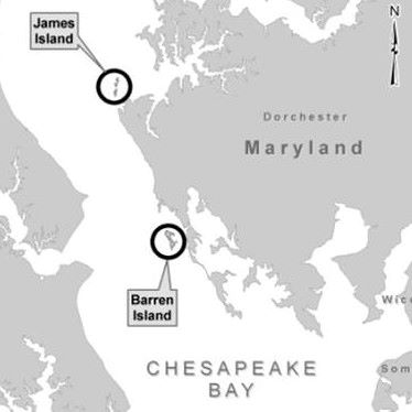
A massive environmental restoration effort is underway in the Chesapeake Bay, where federal engineers are working to rebuild thousands of acres of lost island habitat using an innovative approach that pairs shipping channel maintenance with ecosystem recovery.
The ambitious Mid-Chesapeake Bay Island Ecosystem Restoration Project aims to restore over 2,100 acres of remote island habitat by recycling between 90 and 95 million cubic yards of material dredged from Baltimore’s port approach channels and other federal waterways.
The initiative focuses on two key locations: James Island, where crews will rebuild 2,072 acres of habitat, and Barren Island, which will see 72 acres restored. Both sites are located in western Dorchester County.
Construction crews are making significant headway at Barren Island, where the U.S. Army Corps of Engineers awarded a $39.9 million contract to Seacoast Marine Construction Inc. in October 2024. The first phase of work wrapped up that same month, with workers completing installation of protective stone barriers and breakwaters designed to guard the island against wave damage.
Phase II operations at Barren Island kicked off in early 2025 and continue to progress. Workers have finished building the southwest wetland containment area and completed filling one of two planned bird islands. Engineers expect to finish foundation work and construction of the northeast barrier by summer’s end in 2026.
The second bird island, along with its protective reef structures and shell covering, should be completed by late 2026. Crews will install the southern spillway sometime in 2026 before beginning placement of dredged materials.
Dredging operations in the Honga River channel are scheduled to run from late 2026 through early 2027, with that material being placed at the restoration site.
James Island represents the largest component of the restoration effort. The site will be rebuilt to span 2,072 acres, with roughly 45% designated as uplands and 55% as wetlands. This portion will use sediment from deep-water channels that lead to the Patapsco River.
Engineers expect to award the Phase I construction contract for James Island by the end of March 2026, with work starting in late spring or early summer on a large contained sand stockpile that will support future barrier construction.
James Island won’t receive dredged material until around 2030, after crews complete construction of barriers and containment structures needed to hold the sediment at each location. The Honga River channel hasn’t been dredged by the Army Corps since 2009.
Funding for the project came through multiple sources, including more than $80 million from the Bipartisan Infrastructure Law in 2022 to complete design work and pre-construction activities for the Barren Island component.
In October 2025, the Army Corps issued safety warnings for boaters in the Chesapeake Bay, urging them to avoid ongoing construction activities near the Mid-Bay Island Project sites adjacent to James and Barren Islands.
The restored areas will feature diverse habitats including mudflats, low and high marsh areas, islands, ponds, channels, and upland zones. By combining navigation maintenance with environmental restoration, the project keeps shipping channels clear while rebuilding critical Bay habitat.
The entire Mid-Bay project is expected to reach completion in 2067, providing more than three decades of capacity to place nearly 95 million cubic yards of dredged material while restoring vital Chesapeake Bay ecosystems.
Drivers on Interstate 495 northbound are facing traffic delays this morning after a vehicle collision near the Philadelphia Pike interchange.
According to Delaware Department of Transportation officials, the left lane of I-495 north remains shut down while emergency crews respond to the crash scene. The lane closure is causing backups for commuters in the area.
Motorists are advised to use caution when traveling through the area and to expect delays until the roadway can be fully reopened. Drivers may want to consider alternate routes if possible.
DelDOT has not yet provided an estimated time for when the lane will reopen to traffic.
A traffic accident has resulted in sporadic lane blockages on Route 299 in the westbound direction near the US-13 intersection, according to Delaware Department of Transportation officials.
The crash is causing intermittent lane restrictions as emergency responders and cleanup crews work at the scene. Drivers traveling through the area should anticipate potential delays and may want to seek alternative routes if possible.
DelDOT has not yet provided details about the severity of the accident or an estimated timeline for when normal traffic flow will resume. Motorists are advised to exercise caution when passing through the affected area.
Delaware transportation authorities have implemented a temporary speed reduction on Interstate 495, lowering the maximum allowable speed to 55 miles per hour as rainfall creates potentially dangerous driving conditions.
The speed restriction has been put in place as a safety precaution while wet weather affects road conditions along the interstate corridor. Officials are urging motorists to exercise additional caution and reduce their travel speeds to account for decreased visibility and slippery pavement.
Drivers using I-495 should expect the lower speed limit to remain in effect until weather conditions improve and normal driving conditions are restored. Transportation officials will continue monitoring the situation and will lift the restriction when it is safe to do so.
Good morning, Delmarva! We’re dealing with a soggy Sunday as a weather system moves through our region. Expect showers and thunderstorms throughout the day with temperatures starting near 72°F this morning, then dropping to around 61°F this afternoon as cooler air filters in behind the front.
We’re looking at gusty southwest winds of 10-15 mph with gusts up to 30 mph, so secure any loose outdoor items. The good news? This won’t be a washout – we’re expecting between a quarter to half inch of rain, which our spring gardens will appreciate.
Tonight brings much better conditions as skies begin to clear and temperatures drop to a crisp 42°F under partly cloudy skies. Monday looks absolutely beautiful with sunny skies and pleasant temperatures reaching 59°F – perfect weather to get outside after today’s storms move out.
Monday night stays comfortable with partly cloudy conditions and lows around 43°F. So hang in there through today’s weather – gorgeous spring conditions are just around the corner!
Stay safe and dry, Delmarva!
Delaware Department of Transportation officials have implemented a temporary speed reduction on Interstate 495, lowering the limit to 55 miles per hour as weather conditions create potentially dangerous driving situations.
The speed restriction has been put in place as a safety precaution for motorists using the heavily traveled highway. DelDOT regularly adjusts speed limits during periods of inclement weather to help prevent accidents and protect drivers.
Drivers are advised to exercise additional caution while traveling I-495 and to allow extra time for their commutes. The speed limit will remain at the reduced level until weather conditions improve and normal driving safety is restored.
Motorists can check current traffic conditions and speed restrictions by visiting DelDOT’s website or following their social media channels for real-time updates.
Delaware drivers are being urged to exercise extreme caution as dense fog has enveloped communities across the First State, creating hazardous driving conditions with severely reduced visibility.
The Delaware Department of Transportation reports that fog of varying thickness has been spotted throughout all three counties, prompting safety concerns for morning and evening commuters.
Transportation officials recommend that motorists reduce their speed, increase following distance, and use low-beam headlights when navigating through the foggy conditions. Drivers should avoid using high beams, which can reflect off the fog and further reduce visibility.
The weather phenomenon has created particularly dangerous situations on major roadways where visibility can drop to just a few hundred feet or less in the heaviest fog banks.
A vehicle collision has forced authorities to shut down all northbound lanes of Interstate 495 at East 12th Street, according to the Delaware Department of Transportation.
The complete closure is affecting all traffic heading north on the major highway, with DelDOT reporting the incident through their traffic monitoring system.
No details about the severity of the crash, number of vehicles involved, or potential injuries have been released at this time.
Motorists are advised to seek alternate routes and expect significant delays in the area until the roadway can be cleared and reopened.
FAIRFAX, Va. – Salisbury University’s track and field athletes delivered an outstanding performance during the second day of competition at the George Mason Dalton Ebanks Invitational, establishing three additional school records while competing against universities from multiple NCAA divisions.
The Sea Gulls faced tough competition from Division I, Division II, and Division III programs throughout the meet held in Fairfax, Virginia. The record-breaking performances capped off an impressive showing for the Salisbury University track and field program at the prestigious invitational event.
The Delaware State University Hornets softball team completed a series sweep against Morgan State with a 6-4 victory, showcasing strong pitching and timely hitting throughout the contest.
The Hornets managed to control the game despite a competitive effort from the Bears, maintaining their lead to secure the important conference win and sweep the entire series.
Delaware State’s pitching staff delivered a stellar performance, recording eight strikeouts during the game while limiting Morgan State’s offensive opportunities at crucial moments.
The victory adds to the Hornets’ conference record as they continue their season campaign, with the team demonstrating both offensive production and defensive reliability in the win.
Delaware State will look to build on this momentum as they prepare for their next series, having shown the ability to close out games and complete series sweeps against conference opponents.
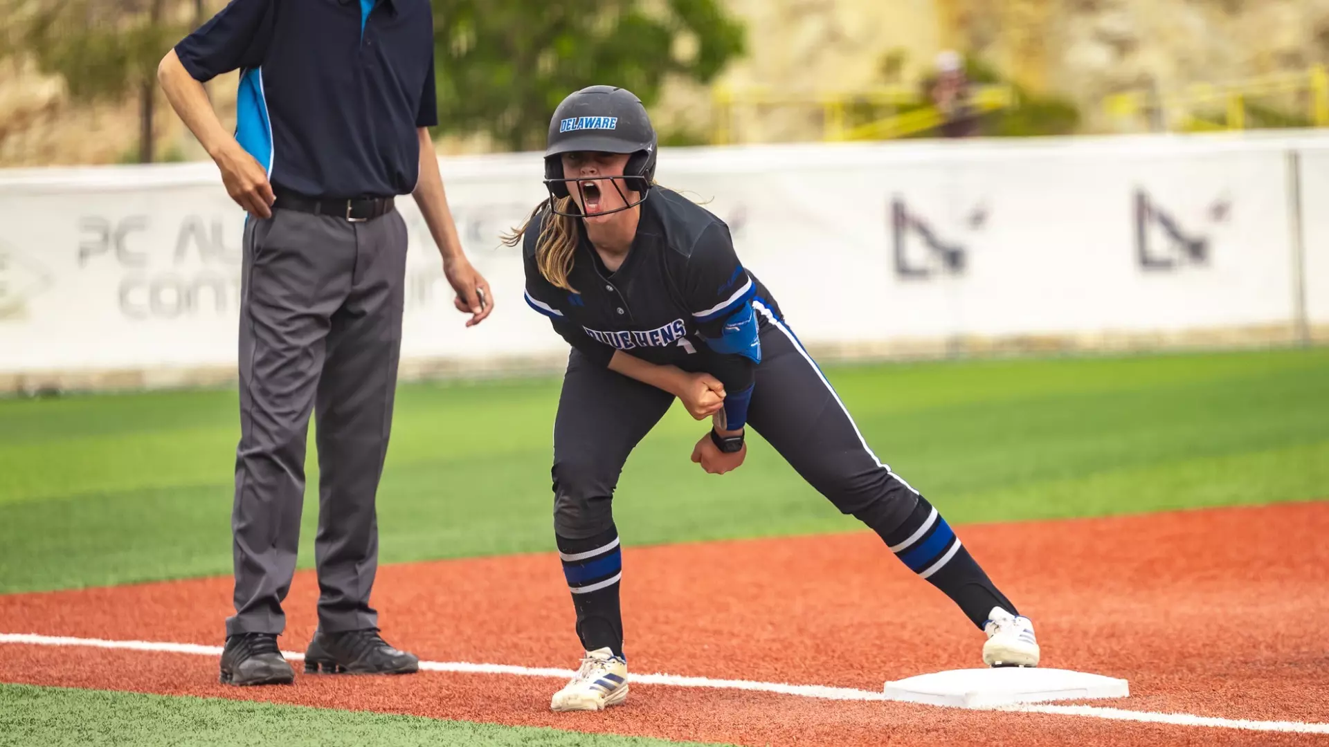
The University of Delaware softball squad made program history this weekend by completing their first-ever Conference USA series sweep with a 6-3 victory over UTEP in Sunday’s concluding matchup.
The Blue Hens dominated throughout the three-game series against the Miners, capping off the weekend with the decisive win that secured the milestone sweep in conference competition.
This achievement represents a significant step forward for Delaware’s softball program as they continue to establish themselves within Conference USA play.
The Goldey-Beacom Lightning softball squad delivered an impressive performance at the Jackson Athletic Complex, capturing both contests in their doubleheader matchup against Bowie State University.
The Lightning controlled the first game, defeating the Bulldogs 8-4 to set the tone for the afternoon. The second contest proved more dramatic, with Goldey-Beacom pulling off a nail-biting 9-8 walk-off victory to complete the sweep.
The doubleheader sweep showcased the Lightning’s ability to perform under pressure, particularly in the second game where they managed to score the winning run in their final at-bat. The home crowd at Jackson Athletic Complex witnessed an exciting day of collegiate softball as Goldey-Beacom demonstrated both offensive power and clutch hitting when it mattered most.
A missing person alert for a New Castle man has been lifted after he was safely found.
The Gold Alert that had been issued for Charles Chard was canceled after authorities confirmed he had been located. Gold Alerts are typically issued for missing adults who may be suffering from dementia or other cognitive impairments.
Officials have not provided additional details about the circumstances surrounding Chard’s disappearance or where he was found.
PRINCETON, N.J. – A trio of University of Delaware track and field throwing specialists took part in Saturday’s Sam Howell Invitational at Princeton University on April 4th.
The Blue Hens athletes traveled to New Jersey to compete in the throwing events at the Princeton-hosted meet, representing Delaware in the specialized competition.
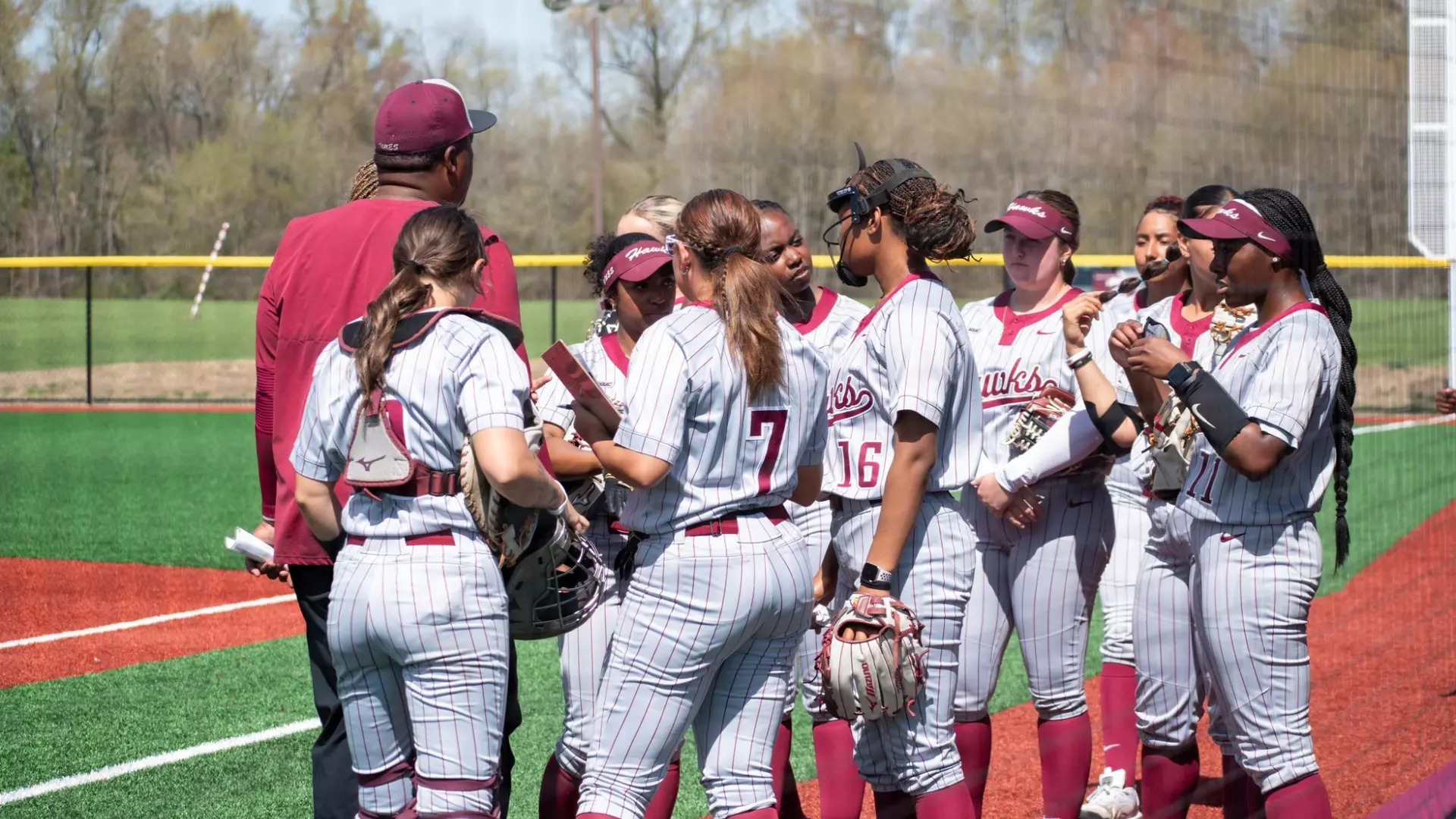
The University of Maryland Eastern Shore baseball team suffered a 13-9 defeat to first-place Fairleigh Dickinson University on Saturday, despite a standout offensive performance from Jonathan Gonzalez Perez.
Gonzalez Perez powered the Hawks’ offense with five runs batted in during the series finale, including his seventh home run of the 2026 season. The strong individual showing, however, wasn’t enough to prevent UMES from dropping the final game of their weekend series against the conference-leading Knights.
The loss concludes what proved to be a challenging series for the Hawks against FDU, who maintained their position atop the conference standings with the victory. Despite falling short in the high-scoring affair, the Hawks demonstrated offensive firepower throughout the contest.
Gonzalez Perez continues to be a key contributor for UMES this season, with his latest home run adding to an impressive power display that has made him one of the team’s most reliable offensive threats.
University of Delaware men’s tennis player Tobey Lock reached a significant personal milestone during his team’s recent match against UNC Wilmington, even as the Blue Hens fell short in a close 4-3 defeat.
Lock’s performance in the match allowed him to equal the university’s all-time record for career individual doubles victories, marking a notable achievement in his collegiate tennis career.
The narrow loss to UNCW demonstrated the competitive nature of the match, with the outcome decided by just a single point difference between the two teams.
While the team result was disappointing for the Blue Hens, Lock’s historic accomplishment provided a bright spot for the Delaware program as he continues to make his mark in the university’s tennis record books.
Good evening, Delmarva! We’re looking at a pleasant Saturday evening with temperatures starting around 56 degrees, but don’t let that fool you – we’ll actually see a warming trend overnight as temps climb to around 64 degrees. Keep an eye on the sky after 8pm tonight, as we have a 40% chance of light rain showers moving through. With southeast winds at 10-15 mph and partly cloudy skies, any rainfall should be minimal – less than a tenth of an inch.
Sunday brings more active weather as showers and thunderstorms develop, pushing our high up to 72 degrees. It’s a great day to have indoor backup plans for any outdoor activities. The good news? This system moves through quickly, leaving us with partly cloudy skies Sunday night as temperatures drop to a crisp 41 degrees.
Monday looks absolutely gorgeous with sunny skies and a comfortable high near 60 degrees – perfect spring weather to start your week! Stay dry tonight, and we’ll see you tomorrow. This is your Delmarva weather team keeping you informed!
SALISBURY, Md. – Salisbury University’s nationally-ranked men’s lacrosse team delivered a crushing performance against Mary Washington, overwhelming the Eagles 22-3 in their second Coastal Lacrosse Conference matchup of the season.
The Sea Gulls, currently ranked seventh in the nation, established complete control early in the contest, building a commanding 12-goal advantage by the intermission before cruising to the lopsided victory.
Following the impressive win, Salisbury University hosted its annual Youth Day celebration, sponsored by SeaSide Smiles, giving young fans a chance to interact with the team and celebrate the dominant performance.
The victory continues the Sea Gulls’ strong conference play as they maintain their position among the top programs in Division III lacrosse.
NEWARK, Del. – A significant milestone was reached Saturday for University of Delaware women’s tennis as head coach Pablo Montana celebrated his 100th career victory at the helm of the program.
The Blue Hens secured Montana’s centennial win with a commanding 6-1 victory against Johns Hopkins University at the DFH Outdoor Courts on the Newark campus.
The achievement marks a notable accomplishment for Montana during his tenure leading the Delaware women’s tennis program. The decisive win over Johns Hopkins helped the team continue building momentum in their season while providing their coach with a memorable career landmark.
Saturday’s match showcased the program’s strength as the Blue Hens dominated play against their visiting opponents, winning six of seven total matches contested during the afternoon competition.
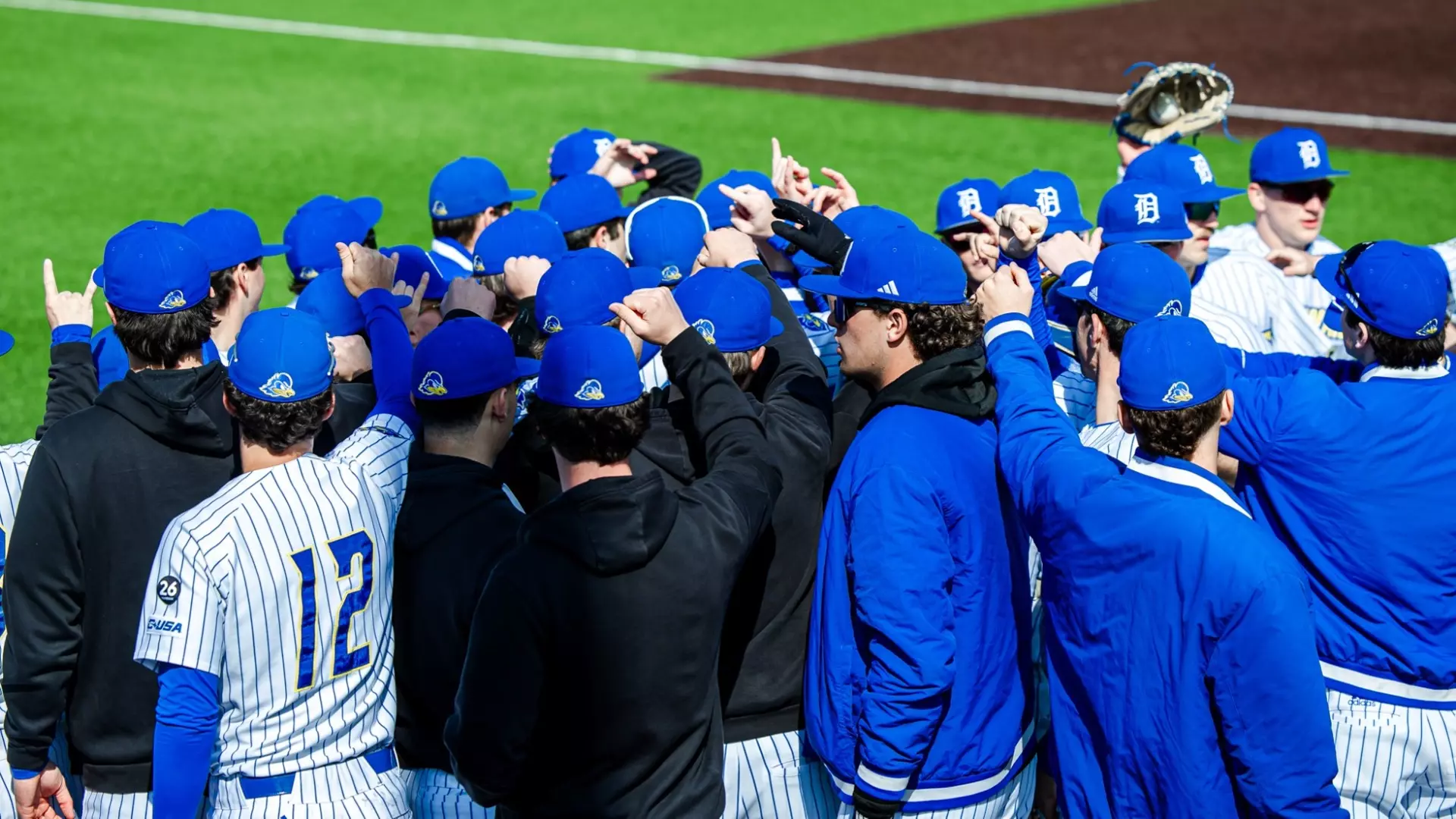
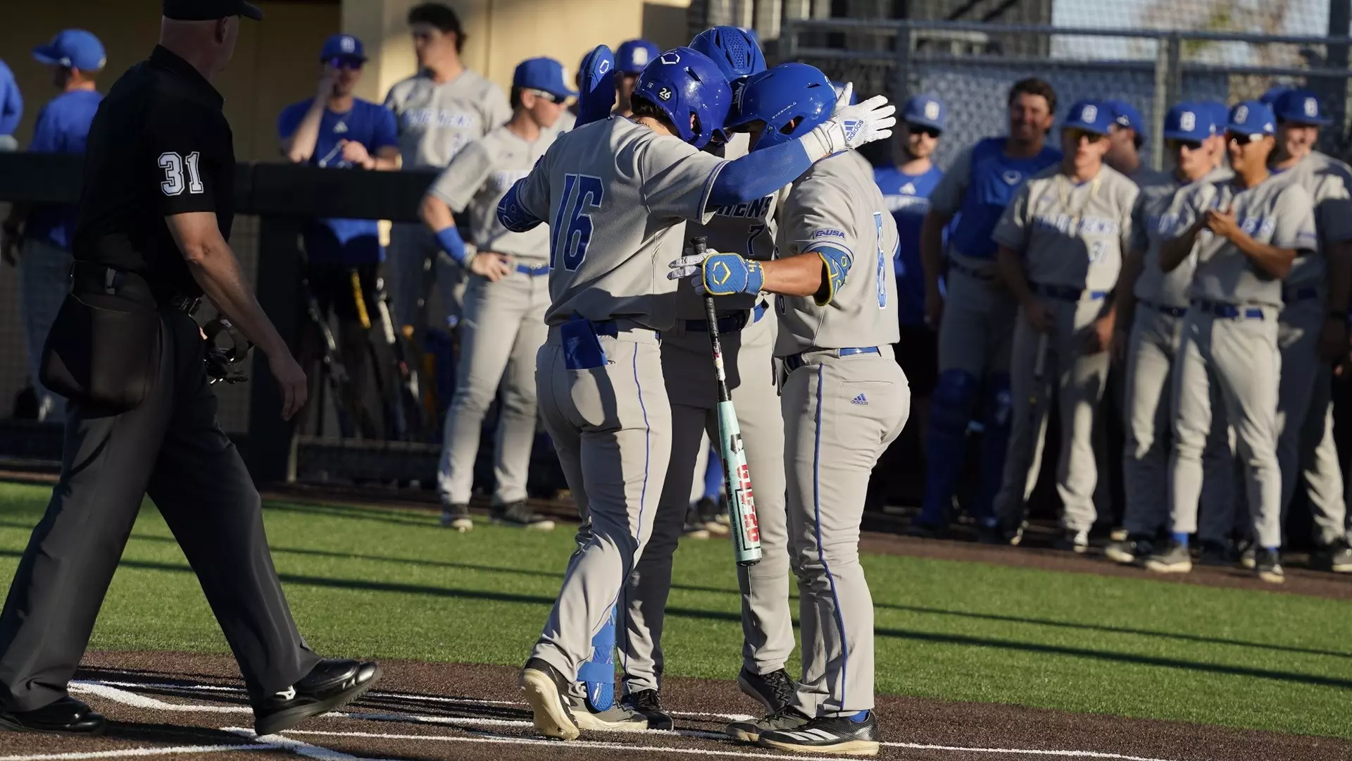
The University of Delaware baseball team wrapped up their Conference USA road series against New Mexico State this week in Las Cruces.
The Blue Hens completed their multi-game series against the Aggies as part of their ongoing conference schedule. The series marked another chapter in Delaware’s Conference USA campaign this season.
The road trip to New Mexico State represents part of the Blue Hens’ conference obligations as they continue their spring baseball season in Conference USA play.
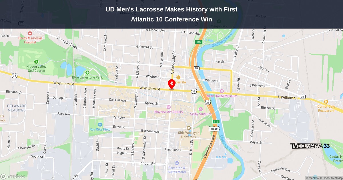
The University of Delaware men’s lacrosse team made program history Saturday afternoon, capturing their inaugural Atlantic 10 Conference win with a commanding 12-6 victory over the Hobart Statesmen at Delaware Stadium in Newark.
Leading the charge for the Blue Hens was Keegan Lathrop, who delivered a standout performance by netting four goals – the most he’s scored in a single game during his collegiate career. The milestone victory moves Delaware’s record to 3-7 overall and 1-2 in Atlantic 10 play.
The Fightin’ Blue Hens dominated throughout the contest against Hobart, which saw their record fall to 2-8 overall and 0-3 in conference competition. Saturday’s triumph represents a significant breakthrough for Delaware’s lacrosse program as they continue building their presence in the Atlantic 10.
The decisive win at home gives the Blue Hens momentum as they work to establish themselves as competitors in their relatively new conference affiliation. Lathrop’s explosive offensive showing proved to be the difference-maker in what became a historic afternoon for Delaware athletics.
Delaware State Police have taken a 60-year-old Bethel man into custody on felony charges after he crashed his motorcycle outside a Laurel restaurant while allegedly under the influence for the sixth time.
Officers responded to Tacos Chabelita on Sussex Highway around 9 p.m. Friday evening after receiving reports of a collision in the restaurant’s parking lot. According to investigators, Wade Bowersox was riding a Harley-Davidson when he collided with the passenger side of a parked Ford Explorer.
After the impact, authorities say Bowersox lifted his motorcycle and relocated it behind the restaurant before going inside and sitting down to eat. When troopers found him in the establishment, they noticed indicators that he was impaired.
While officers were escorting Bowersox outside, he tried to hide a small package containing what appeared to be cocaine in one of his motorcycle’s storage compartments, according to police. He was taken into custody without resistance.
A thorough examination of the motorcycle uncovered several items of concern to investigators:
• About 1.68 grams of what is believed to be cocaine • A digital scale • More alcoholic beverages
Police records show Bowersox has been convicted of DUI-related offenses five times previously and was operating the motorcycle despite having a suspended license.
Authorities transported Bowersox to Troop 5, where they secured a court order to collect a blood sample. Following his arraignment at Justice of the Peace Court 3, he was sent to Sussex Correctional Institution with bail set at $30,602 cash.
The charges against Bowersox include:
• Felony sixth offense driving under the influence • Possession of a controlled substance • Possession of drug paraphernalia • Driving with a suspended license • Additional traffic violations
SALISBURY, Md. – Salisbury University’s baseball squad struggled offensively during Saturday’s Coast-to-Coast Athletic Conference matchup, falling 2-0 to visiting Christopher Newport University at Donnie Williams Sea Gull Baseball Stadium.
The Sea Gulls, currently ranked ninth nationally, were held scoreless by the 16th-ranked Captains in what proved to be a defensive battle between the two conference opponents.
The loss marks a setback for Salisbury as they continue their campaign in C2C play, with Christopher Newport managing to secure the victory on the road in Maryland’s Eastern Shore region.
FREDERICKSBURG, Va. – Salisbury University’s women’s lacrosse squad continued their perfect season on Saturday, defeating the Mary Washington Eagles 14-7 in Fredericksburg.
The Sea Gulls, currently ranked fourth nationally, dominated their opening conference game of the year with a strong performance that kept their undefeated streak alive.
The victory marks an important milestone for Salisbury as they begin conference play, showcasing the team’s ability to maintain their high level of performance against league opponents.
With this win, the Sea Gulls demonstrate why they’ve earned their top-five national ranking and position themselves well for continued success in conference competition.
The University of Maryland Eastern Shore men’s volleyball team delivered a commanding performance against Long Island University, securing a straight-sets victory that extended their impressive home court dominance.
The Hawks swept the Sharks 3-0, marking their ninth consecutive triumph on their home court. The victory brings UMES to an even 4-4 record in Northeast Conference competition this season.
The dominant home performance continues a strong trend for the Hawks, who have turned their home venue into a fortress for visiting opponents. The team’s ability to maintain this level of success at home has been a key factor in their conference play this year.
With the sweep complete, UMES moves forward with momentum as they work to climb above .500 in NEC standings. The Hawks will look to build on this successful outing as conference play continues.
The University of Maryland Eastern Shore softball team struggled at the plate in their season series finale, managing only two hits while being shut out by Coppin State.
The Hawks were unable to generate any offensive momentum against the Eagles’ pitching staff, resulting in a scoreless performance that ended their series on a disappointing note.
UMES will look to regroup and refocus as they continue their season following this challenging outing against their conference rivals.
Motorists traveling on southbound Interstate 95 are experiencing significant delays this morning after a vehicle fire forced authorities to close four left lanes just before Exit 5.
The Delaware Department of Transportation reports that only the right lanes remain open to traffic as emergency crews respond to the incident. Drivers are advised to expect delays and consider alternate routes if possible.
Officials have not yet released information about the cause of the vehicle fire or whether anyone was injured in the incident. The timeline for reopening the closed lanes has not been announced.
The Goldey-Beacom Lightning baseball team continued their impressive winning streak, capturing their ninth consecutive victory with a commanding 13-3 road triumph over Georgian Court University.
The Central Atlantic Collegiate Conference matchup took place in Jackson, New Jersey, where the Lightning dominated their opponents to maintain their perfect record over the past nine games.
The decisive victory showcases the team’s strong momentum as they continue their conference play this season.
Authorities have successfully located Colin Byrd, the New Castle teenager who had been reported missing, and have officially canceled the Gold Alert that was issued in connection with his disappearance.
The teen has been found safe, bringing relief to his family and the community members who were concerned about his welfare.
Goldey-Beacom’s women’s tennis squad delivered a dominant performance on the road, blanking Kutztown University 7-0 in Pennsylvania.
The Lightning secured victories across all seven matches in what marked their second-to-last competition of the season. The team traveled to Kutztown, PA for the matchup that resulted in a complete shutout of their opponents.
The decisive win showcases the strength of Goldey-Beacom’s tennis program as they near the conclusion of their current campaign.
New Castle County police are actively searching for a missing 14-year-old boy and have activated a Gold Alert to help locate him.
Colin Byrd vanished Friday evening, April 3, 2026, from the 500 block of Frank Orchards Lane in New Castle around 10:00 p.m., according to the New Castle County Division of Police.
Law enforcement officials report they have conducted thorough search efforts but have been unsuccessful in finding or making contact with the teenager.
The University of Delaware Blue Hens baseball team encountered another setback in their ongoing series against New Mexico State, falling short in the second contest between the two programs.
The loss marks another disappointing result for the Blue Hens as they continue to face challenges in their matchup against the Aggies. Delaware was unable to capitalize on opportunities to even the series after dropping the opening game.
The Blue Hens will need to regroup quickly as they look to salvage at least one victory from their remaining games in the series. The team’s performance in this series will be crucial as they work to build momentum for the remainder of their season.
A former University of Delaware basketball standout has achieved one of the sport’s highest honors. Elena Delle Donne will join the Naismith Basketball Hall of Fame’s Class of 2026, officials announced this past Saturday from Springfield, Massachusetts.
This recognition marks a historic milestone for the Blue Hens athletic program, as Delle Donne becomes the inaugural Fightin’ Blue Hen to earn induction into basketball’s most prestigious hall of fame.
The announcement establishes Delle Donne’s place among basketball’s elite performers and brings national recognition to the University of Delaware’s women’s basketball program.
Traffic is being diverted around a section of Washington Street Extension following a motor vehicle collision that occurred in the westbound lanes.
The roadway has been completely blocked at the intersection with Marsh Road as emergency responders work at the crash site. Delaware Department of Transportation officials are directing drivers to use alternative routes until the roadway can be safely reopened.
No details have been released regarding the cause of the accident or whether any injuries occurred. Authorities have not provided an estimated time for when normal traffic flow will resume on this stretch of roadway.
Drivers who regularly travel this route should plan for delays and consider using parallel roads to reach their destinations.
A vehicle accident has resulted in lane restrictions on westbound Scarborough Road at its intersection with US-13, according to Delaware Department of Transportation officials.
The right lane remains blocked to traffic as emergency crews respond to the collision scene. DelDOT is advising drivers to expect potential delays in the area and to use caution when traveling through the affected zone.
Motorists are encouraged to seek alternative routes if possible while authorities work to clear the roadway and restore normal traffic flow. No additional details about the crash or any potential injuries have been released at this time.
Motorists traveling on northbound Interstate 95 should expect delays near Exit 5, where construction crews have shut down the right shoulder lane.
The Delaware Department of Transportation reports that the shoulder closure is part of ongoing construction work in the area. Traffic restrictions are expected to continue until 2 PM this afternoon.
Drivers are advised to use caution when passing through the work zone and allow extra travel time for potential backups during the construction period.
Drivers traveling on Foulk Road should plan for potential delays as construction activity has forced the closure of the right lane at the Bedford Road intersection.
According to DelDOT traffic officials, the lane restriction will remain in place until 3 PM today while work crews complete their operations in the area.
Motorists are advised to use caution when traveling through the construction zone and allow extra time for their commute. Traffic may be moving more slowly than usual as vehicles merge from the closed lane.
The Goldey-Beacom College Lightning esports squad added another championship trophy to their collection, claiming their third Central Atlantic Collegiate Conference title this season with a narrow 4-3 victory against Holy Family University in Marvel Rivals.
This marks the Lightning’s second championship win in the Marvel Rivals gaming competition this season, demonstrating their continued dominance in collegiate esports within the conference.
The close match against Holy Family showcased the competitive level of collegiate gaming, with Goldey-Beacom ultimately prevailing in what proved to be a hard-fought contest between the two teams.
Delaware Department of Transportation crews are conducting litter removal operations along Route 40 eastbound this afternoon, according to DelDOT traffic officials.
The cleanup work is happening on the eastbound shoulder of Pulaski Highway between the Maryland border and New Castle, with crews expected to complete their work by 5 PM today.
Motorists traveling eastbound on Route 40 in the affected area should expect to see DelDOT vehicles and personnel working along the roadside during the cleanup operation.
ANNAPOLIS, MD – Maryland’s Department of Agriculture announced Thursday the lifting of quarantine restrictions across a control zone in Cecil County following an agricultural disease outbreak.
While the farm where the infection originally occurred continues to face quarantine measures, all other agricultural properties within the previously restricted area have been cleared to return to normal operations, according to the April 4th announcement from state officials.
Farms located outside any remaining active control zones are now free from the movement and operational restrictions that were put in place during the outbreak response.
Drivers using South College Avenue should expect delays this afternoon as construction crews have closed the left lane of southbound Route 896.
The Delaware Department of Transportation reports that the left lane closure extends from East Chestnut Hill Road to the Interstate 95 interchange. Officials indicate the lane restriction will remain active until 5:00 PM today.
Motorists are advised to allow extra travel time and use caution when navigating through the work zone area.
Motorists traveling on South College Avenue, also known as Delaware Route 896, should expect traffic delays due to ongoing construction work at the intersection with Welsh Tract Road.
The Delaware Department of Transportation reports that lanes are being closed intermittently throughout the day as crews complete their work. These traffic restrictions are expected to remain in effect until 5:00 PM today.
Drivers are advised to plan for extra travel time and consider alternate routes if possible to avoid potential delays in the area.
Delaware Department of Transportation officials have shut down all traffic on US Route 13 following a vehicle accident that occurred between Greenwood Road and Hickory Lane.
Both northbound and southbound lanes remain completely blocked as emergency crews respond to the crash scene. Motorists are advised to seek alternate routes and expect significant delays in the area.
DelDOT has not yet provided information about when the roadway might reopen or the extent of any injuries from the collision. Drivers should monitor traffic updates and plan accordingly for their commutes.
Delaware State University’s softball squad delivered an impressive performance in their series opener against Morgan State, claiming victory in both games of Thursday’s doubleheader.
The Hornets demonstrated exceptional play on both sides of the ball, shutting down Morgan State’s offensive efforts while generating solid run production of their own throughout the twin bill.
The commanding wins give Delaware State early momentum as they continue their series against the Bears. The strong showing reflects the team’s preparation and execution during crucial conference matchups.
Delaware State will look to maintain this level of performance as the series continues, with the Hornets seeking to build on their successful start against Morgan State.
The University of Maryland Eastern Shore Hawks baseball squad suffered a 12-7 setback against Fairleigh Dickinson University despite putting together a solid offensive showing that included a pair of home runs.
Darrius Brown and Gonzalez Perez each launched balls over the fence for the Hawks, who managed to rack up 10 hits during the contest but couldn’t overcome FDU’s offensive attack.
The loss continues a challenging stretch for the UMES baseball program as they work to find consistency both at the plate and on the mound. While the Hawks showed they could generate offense with their double-digit hit total, defensive struggles and pitching issues allowed FDU to pull away for the five-run victory.
The Hawks will look to bounce back from this high-scoring affair as they continue their season, hoping to build on the positive offensive production shown by Brown, Gonzalez Perez and the rest of the lineup.
The University of Delaware Blue Hens softball squad captured their weekend series against the UTEP Miners following a 6-4 triumph on Sunday.
The victory marked the second consecutive win for Delaware over the visiting Miners, allowing the Blue Hens to take the series. With this latest success, Delaware’s conference standing improved to 7-7, evening their record in league play.
The Blue Hens demonstrated strong performance throughout the matchup, building on momentum from their previous day’s victory to secure the series win at home.
The University of Maryland Eastern Shore softball team dropped both ends of a doubleheader to Coppin State on Thursday, despite an impressive offensive showing from player Beltran who connected for two home runs during the games.
The Hawks were unable to capitalize on Beltran’s power hitting performance as they fell in both contests of the twin bill. The losses add to UMES’s challenging season as they continue conference play.
Beltran’s pair of home runs provided the highlight for the Hawks in what was otherwise a difficult day at the ballpark. The team will look to regroup and bounce back from the doubleheader sweep as they prepare for upcoming conference matchups.
The Hawks will need to build on the positive offensive contributions from players like Beltran while addressing the areas that led to the losses against Coppin State.
FAIRFAX, Va. – Salisbury University’s track and field athletes made their mark against tough competition from multiple collegiate divisions during the opening day of the George Mason Dalton Ebanks Invitational in Virginia.
The Sea Gulls competed alongside teams from Division I, Division II, and Division III programs, with two athletes achieving historic milestones for their university.
Kai Smith established a new school record in the 200-meter event, while Justin Freeman broke the university’s longstanding record in the 800-meter race.
The record-breaking performances highlight the strength of Salisbury University’s track and field program as they continue competition against high-level collegiate opponents.
RIVERSIDE, Calif. — Strong winds are fueling a rapidly expanding wildfire in Southern California that has forced residents from their homes and filled the air with thick smoke.
The Springs Fire ignited around 11 a.m. on Friday and had consumed approximately 5.47 square miles by evening, though firefighters began making progress on containment. Officials are still investigating what sparked the blaze in an area east of Moreno Valley within Riverside County. Authorities have not released the exact number of homes affected by evacuation notices.
The flames are moving through a moderately populated unincorporated section of Riverside County, specifically in a recreation zone adjacent to Moreno Valley. The city houses about 200,000 residents and sits 10 miles southeast of Riverside and 64 miles east of Los Angeles.
“It’s windy out there,” explained Maggie Cline De La Rosa, who serves as a public information officer for the California Department of Forestry and Fire Protection in Riverside County.
Cal Fire Riverside County spokesperson Alex Izaguirre noted that the wind is “spreading the smoke,” which has generated worried phone calls from people in surrounding communities who can both see and smell the haze.
Weather officials have issued a wind advisory covering San Bernardino and Riverside County valleys that remains in effect through Saturday afternoon, warning of gusts reaching up to 50 mph.
“Tree limbs could be blown down and a few power outages may result,” the advisory stated.
The University of Maryland Eastern Shore Hawks volleyball team extended their perfect home record Thursday night, defeating the LIU Sharks 3-2 in a hard-fought five-set battle.
The victory improved the Hawks to an impressive 8-0 record when playing on their home court this season. Four UMES players reached double digits in kills during the match, with Rowley, Hightower, Valentine, and Mills all contributing significantly to the offensive attack.
The match went the distance as both teams battled through five competitive sets before the Hawks ultimately prevailed over the visiting Sharks. The win demonstrates UMES’s continued dominance when playing in front of their home crowd.
With this latest victory, the Hawks have established themselves as a formidable force on their home court, maintaining their unblemished record at home while adding another quality win to their season resume.
The Goldey-Beacom Lightning baseball team continued their impressive run Thursday, capturing both ends of a doubleheader against Georgian Court University to push their winning streak to eight consecutive games.
Playing at Doyle Field in Hockessin, the Lightning claimed the opening game in dramatic fashion, prevailing 8-7 in an 11-inning marathon. Sophomore Jake Macey from Smyrna delivered the decisive blow with a clutch single that brought home the winning run in extra innings.
The Lightning followed up their thrilling opener by taking the second contest 4-3, completing the Central Atlantic Collegiate Conference sweep over the visiting Cougars.
The doubleheader victories showcase the team’s resilience and depth as they continue building momentum in conference play. With eight straight wins now under their belt, Goldey-Beacom has established themselves as a formidable force in the CACC standings.
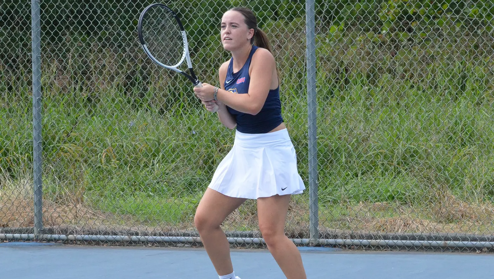
NEWARK, Del. – The Blue Hens women’s tennis team earned a hard-fought 4-2 win against Virginia Commonwealth University during Friday afternoon competition at the Elkton Indoor Tennis facility.
The University of Delaware squad demonstrated resilience throughout the challenging matchup, securing the victory in what proved to be an intense contest between the two programs.
The win adds another successful result to the Blue Hens’ season as they continue their campaign on the courts.
Motorists traveling eastbound on Pulaski Highway should expect delays and plan alternate routes as two lanes remain blocked at Eden Circle due to a traffic accident.
The Delaware Department of Transportation is reporting the lane closures are necessary while emergency crews respond to and clear the crash scene. The incident is affecting traffic flow in the eastbound direction at the Eden Circle intersection.
Drivers are advised to use caution in the area and consider taking alternate routes to avoid potential delays. DelDOT has not yet provided an estimated time for when the lanes will reopen to normal traffic.
Drivers using Robinsonville Road southbound should expect delays today as construction crews conduct flagging operations in the area.
The traffic control measures are affecting the stretch of roadway between Harts Road and Conley Church Road, also known as Route 280B, according to DelDOT officials.
The flagging operations are scheduled to continue until 3 PM today, with crews directing vehicles through the construction zone.
Motorists are advised to allow extra travel time and consider alternate routes if possible to avoid potential delays in the area.
New Castle County police have activated a Gold Alert as they search for a missing 40-year-old resident who vanished from his neighborhood earlier this week.
Charles Chard disappeared from the unit block of Kellys Trailer Park on Tuesday afternoon, March 31, 2026, with his last confirmed sighting occurring around 4:00 p.m., according to the New Castle County Division of Police.
Law enforcement officials report that their search efforts have not yet yielded any leads, and they have been unable to make contact with Chard or determine his whereabouts.
The convenience store chain Wawa has initiated a voluntary recall of four beverage products due to concerns about potential undeclared milk allergens, according to an announcement made on April 3, 2026.
The recall affects 16-ounce containers of Wawa Iced Tea Lemon, Wawa Iced Tea Diet Lemon, Wawa Diet Lemonade, and Wawa Fruit Punch. These beverages were manufactured by the Wawa Beverage Company and distributed to select Wawa locations throughout Pennsylvania, Delaware, Maryland, New Jersey, and the Virgin Islands.
The Media, Pennsylvania-based company took the precautionary step after discovering that the affected products might contain milk allergens that are not listed on the product labels. This poses a significant health risk for individuals with milk allergies or lactose intolerance.
Customers who have purchased any of these beverages are advised to check their products and avoid consumption if they have milk allergies. Those with questions about the recall can contact Wawa directly for more information about returns or refunds.
The recall demonstrates the company’s commitment to customer safety and follows standard food safety protocols when potential allergen contamination is identified in retail products.
Drivers traveling north on Route 1 near Milton should expect delays this afternoon due to ongoing roadwork.
The Delaware Department of Transportation has closed the left lane on northbound Coastal Highway between Paynter Road and Broadkill Road (Route 16) for construction activities.
Traffic control personnel are on scene directing vehicles through the work zone, with the lane restriction scheduled to remain in place until 3 PM today.
Motorists are advised to allow extra travel time and exercise caution when approaching the construction area.
Motorists traveling along Pike Creek Road should expect traffic delays today as construction crews continue work that requires intermittent lane restrictions.
The affected area spans the stretch of Pike Creek Road from Abbey Lane to Abbey Drive, where drivers may encounter temporary lane closures throughout the day.
According to DelDOT, the construction-related traffic pattern changes will remain active until 5 PM this evening. Drivers are advised to allow extra travel time and use alternate routes when possible to avoid potential delays in the area.
Motorists traveling through northern New Castle County should plan for potential delays this afternoon as road crews continue paving operations on a busy stretch of Loveville Road.
The Delaware Department of Transportation reports that northbound lanes of Loveville Road are being affected by the construction work, specifically the section running from Newport Gap Pike (Route 41) to Lancaster Pike (Route 48).
Officials indicate the paving project is expected to wrap up by 5 PM today. Drivers are advised to seek alternate routes or allow extra travel time when passing through the work zone.
The ongoing road improvements are part of DelDOT’s regular maintenance efforts to keep state roadways in good condition for motorists.
Drivers traveling on Old Orchard Road are facing lane restrictions today due to ongoing construction work in the area.
The Delaware Department of Transportation reports that the southbound lane remains closed between Peach Tree Lane and Edgemoor Street as crews continue their work.
The lane closure is expected to remain in effect until 5:00 PM today, and motorists should plan for potential delays or consider alternate routes during this time.
DelDOT advises drivers to use caution when traveling through the construction zone and to be aware of workers and equipment in the area.
The University of Delaware’s student-athletes have earned impressive academic recognition, with 126 Blue Hens making Conference USA’s Academic Medal List for 2025-26, placing them second among all conference institutions.
Conference USA Commissioner Judy MacLeod made the announcement on Friday from Dallas, highlighting the academic achievements of student-athletes across the league.
This recognition demonstrates the strong commitment to academic excellence among Delaware’s athletic programs, as student-athletes balanced their sports responsibilities with classroom success throughout the academic year.
The Academic Medal List honors student-athletes who have excelled in their studies while competing at the collegiate level, representing a significant achievement for both individual students and their universities.
Delaware State Police have taken the second teenager into custody in connection with an armed robbery that took place last month at Christiana Mall in Newark.
The 17-year-old male from Wilmington was arrested after investigators determined he was the accomplice in the March 21, 2026 incident that occurred around 6:45 p.m. near the JCPenney entrance at 606 Christiana Mall.
According to police reports, officers initially responded to the parking area following reports of an armed holdup. Law enforcement spotted one suspect matching witness descriptions – a 17-year-old who fled on foot. Officers pursued the teenager across several lanes of Route 1 before apprehending him. Authorities discovered a loaded firearm tucked in his waistband.
The Delaware State Police Criminal Investigations Unit assumed control of the case. Initial findings showed that two victims were about to get into their car when both teenage suspects confronted them and ordered the first victim to hand over personal items. One teen brandished a gun while his partner took the victim’s belongings and fled. The armed teenager then hit the victim in the head with the weapon before pursuing the second victim while pointing the firearm at them. The second victim managed to escape without injury.
The victim who was assaulted, a 47-year-old Bridgeville resident, refused medical attention at the scene.
Investigators later found clothing that the second suspect had thrown away after the robbery.
In a separate development, New Castle County Police were simultaneously at the mall conducting their own investigation into a vehicle theft case. Though initially treated as unrelated incidents, detectives eventually discovered that the 17-year-old in New Castle County custody possessed items belonging to the robbery victim.
Additional investigation confirmed this teenager was indeed the second participant in the armed robbery. Detectives then secured an arrest warrant for him.
On April 1, 2026, the second teen, who was already being held at the Department of Services for Children, Youth, and Their Families, faced formal charges. He was processed through New Castle County Family Court and is being held on $115,000 cash bond.
The charges include First Degree Robbery (Felony), Wearing a Disguise During the Commission of a Felony (Felony), and Second Degree Conspiracy (Felony).
Delaware Department of Transportation officials have shut down Shingle Point Road at the Lewes Georgetown Highway intersection following a traffic incident.
The roadway closure is currently in effect as authorities respond to the scene. DelDOT has not provided details about the nature of the incident or an estimated time for reopening the roadway.
Drivers traveling in the area are advised to find alternative routes and expect delays while the situation is resolved. Updates on the road closure status can be found on DelDOT’s traffic incident website.
Delaware State Police have taken a 31-year-old Claymont resident into custody following allegations that he brandished a firearm and made threats against two students near Claymont Elementary School on Wednesday morning.
Anthony Dejesus was arrested after the incident that occurred on April 1, 2026, around 9:30 a.m. outside the elementary school on Green Street. According to investigators, Dejesus arrived at the school in a red Nissan sedan while wearing a face covering just before classes were set to begin. A female passenger got out of the car to walk students into the building, while Dejesus drove to a parking spot on Green Street.
Two students approached Dejesus’s vehicle while he waited, leading to a confrontation where he allegedly showed what appeared to be a handgun and made threats to shoot the children. The frightened students fled the scene and immediately informed school personnel, who contacted emergency services and notified the school constable. School staff members attempted to speak with Dejesus, but he departed before law enforcement officers arrived.
Detectives later identified Dejesus as the suspect and discovered he was legally barred from owning firearms due to a previous misdemeanor conviction related to domestic violence.
Dejesus voluntarily came to Troop 2, where he faced multiple charges and was processed by Justice of the Peace 2. He is currently being held at Howard R. Young Correctional Institution with bail set at $41,000 cash.
The charges against Dejesus include:
Possession of a Deadly Weapon During the Commission of a Felony (Felony)
Carrying a Concealed Deadly Weapon (Felony)
Possession of a Firearm by a Person Prohibited Convicted of a Misdemeanor Crime of Domestic Violence (Felony)
Aggravated Menacing (Felony) – 2 counts
Wearing a Disguise During the Commission of a Felony (Felony)
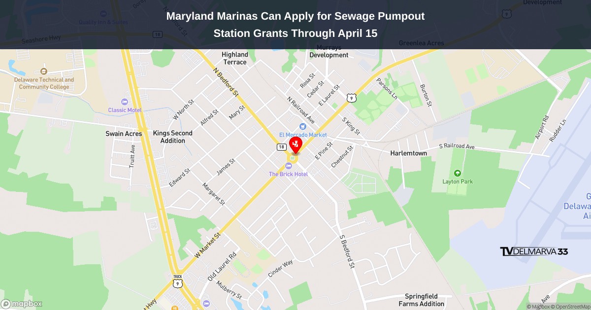
Maryland marinas have until April 15, 2026 to submit applications for state grants designed to help cover the costs of operating and maintaining sewage pumpout facilities for recreational boats. The Maryland Department of Natural Resources announced the availability of funding through their Marine Sewage Pumpout Grant program.
These grants reimburse marina operators for various expenses related to pumpout station upkeep, including equipment repairs, replacement parts, and labor costs. The facilities serve a crucial environmental purpose by giving boat owners a proper way to dispose of waste from their vessels, which helps keep harmful pollutants out of Maryland’s waters and supports broader efforts to improve Chesapeake Bay water quality.
The grant program receives its funding through a combination of federal and state sources. Three-quarters of the money comes from the U.S. Fish and Wildlife Service via the Clean Vessel Act, while the remaining 25% is supplied by Maryland’s Waterway Improvement Fund. Recreational boaters themselves generate this funding through federal taxes on fishing gear, boat fuel, and small engine fuel, as well as import fees. Maryland boat owners also contribute when they pay excise taxes during the vessel titling process.
Marina owners interested in applying can access application materials through the Department of Natural Resources website or reach out directly to the program coordinator at [email protected] or by calling 410-260-8772.
The University of Delaware men’s lacrosse squad is preparing to celebrate Senior Day as they face off against Hobart College at home.
The Blue Hens will take time to honor their graduating players before the game begins, recognizing the contributions of the senior class throughout their collegiate careers.
The matchup against Hobart represents an important moment for the Delaware program as they pay tribute to the veterans who have helped shape the team’s identity over their years in the program.
Senior Day ceremonies traditionally provide an emotional sendoff for departing players while giving fans an opportunity to show appreciation for their dedication to Blue Hens lacrosse.
NEW CASTLE COUNTY, Del. – A routine traffic enforcement action by New Castle County police resulted in felony arrests Wednesday afternoon in the Governor Printz Boulevard area.
Police officers conducting patrol operations in the vicinity spotted a black Ford Crown Victoria traveling without any registration plates near the intersection with Prospect Drive around 3:03 p.m. on April 1, 2026.
The vehicle was pulled over by officers from the New Castle County Division of Police, leading to what authorities describe as felony charges being filed.
Additional details regarding the nature of the felony charges and the identities of those arrested have not yet been made available by police officials.
The incident occurred in the 19808 area of Wilmington during what police characterized as proactive patrol activities.
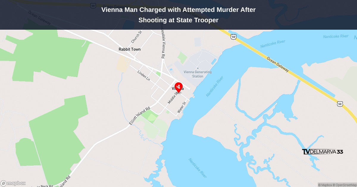
A Vienna, Maryland resident is facing attempted first-degree murder charges after authorities say he opened fire on a Maryland State Trooper who was responding to a disturbance call late last night.
Armond Darel Jolley, 46, was taken into custody and transported to the Easton Barrack for processing before being moved to the Dorchester County Detention Center, where he remains without bond. The charges were filed following discussions with the Dorchester County State’s Attorney’s Office.
The incident unfolded around 10:20 p.m. when a trooper from the Easton Barrack arrived at a home on the 100 block of Middle Street in Vienna to investigate reports of a disturbance. The officer found the front door open and encountered a man inside what looked like the living room area.
When the trooper asked to speak with the individual, the man retreated deeper into the house before returning armed with a firearm. The suspect then discharged several rounds in the direction of the officer and escaped from the residence.
The trooper chose not to return gunfire and instead took cover while calling for backup units. Officials report the officer sustained no injuries during the shooting incident.
Law enforcement personnel from the Easton Barrack quickly established a security perimeter around the area and began searching the neighborhood. Within approximately 20 minutes of the shooting, officers discovered the suspect on Water Street, located directly behind the residence where the incident occurred. After a brief pursuit on foot, Jolley was apprehended without additional complications.
Multiple agencies responded to assist with the investigation, including Maryland State Police from the Easton Barrack, Criminal Enforcement Division officers, the Underwater Recovery Team, Office of the State Fire Marshal personnel, and Dorchester County Sheriff’s deputies. Evidence collection at the scene was handled by crime scene specialists from the Maryland State Police Forensic Sciences Division, working alongside investigators and the Dorchester County State’s Attorney’s Office.
The Maryland State Police Homicide Unit has taken the lead role in the ongoing investigation.
Motorists traveling westbound on Hollymount Road are experiencing lane restrictions today as construction crews work in the area between Anna Drive and Joseph Lane.
The Delaware Department of Transportation reports that the right lane is currently blocked to traffic due to the ongoing construction activity. The lane closure is expected to remain in effect until 4 PM this afternoon.
Drivers are advised to use caution when traveling through the work zone and may want to consider alternate routes to avoid potential delays during the construction period.
Drivers using Hollymount Road should expect delays today as construction crews have closed the right lane of westbound traffic between Anna Drive and Joseph Lane.
According to DelDOT, the lane closure is related to ongoing construction activities in the area. The restriction affects westbound traffic only, with the closure expected to be lifted by 4 PM this afternoon.
Motorists are advised to use caution when traveling through the work zone and allow extra time for their commute. Traffic may be reduced to a single lane in the affected area during construction hours.
Motorists traveling north on Kenton Road should expect delays this afternoon as construction crews have closed one lane of traffic.
The Delaware Department of Transportation reports that the northbound lane restriction is in effect between Turnberry Drive and West Carnoustie Road. The closure is scheduled to remain in place until 4:30 PM today.
Drivers are advised to allow extra travel time and consider alternate routes if possible while the construction work continues in the area.
SALISBURY, Md. – Salisbury University continues its “Nest to Nest” feature series, which highlights student-athletes who have traveled the greatest distances to join their respective Sea Gulls teams. The ongoing series focuses on the remarkable journeys and personal stories behind these long-distance commitments to the university.
This week’s spotlight falls on Cooper Keesee, a member of the men’s lacrosse squad, whose path to Maryland’s Eastern Shore began in the Pacific Northwest region, located just south of Portland. The area is renowned as one of the region’s most beautiful lakeside destinations.
The “Nest to Nest” series showcases not only the significant miles these student-athletes have covered to reach Salisbury University, but also the compelling personal narratives that brought them to compete for the Sea Gulls athletic programs.
Weather officials have issued a dense fog advisory for the region this morning, warning residents of significantly reduced visibility conditions.
The National Weather Service office in Mount Holly, New Jersey issued the advisory at 8:11 AM on April 3rd, with the warning set to remain active until 11:00 AM the same day.
Dense fog can create hazardous driving conditions by dramatically limiting visibility on roadways. Motorists are advised to use extra caution during morning commutes and allow additional travel time.
The weather service typically issues these advisories when fog reduces visibility to one-quarter mile or less over a widespread area.
Drivers traveling through the intersection of South Central Avenue and East Market Street will encounter lane restrictions due to ongoing construction work.
According to DelDOT traffic reports, one lane at this busy intersection has been temporarily closed to accommodate construction activities. The lane closure is scheduled to remain in place until 3 PM today.
Motorists are advised to plan for potential delays and consider alternate routes if possible. Traffic may be moving slower than usual through the affected area as vehicles merge around the construction zone.
Delaware Department of Transportation crews are actively removing litter from the median area along southbound Route 1 today, affecting the stretch between two major exits.
The cleanup operation is underway in the median strip from Exit 119A in Smyrna down to Exit 95 in Dover. DelDOT officials say the litter removal work will continue until 4 p.m. this afternoon.
Motorists traveling southbound on Route 1 through this corridor may encounter DelDOT vehicles and work crews during the cleanup effort.
Good morning, Delmarva! We’re starting this Friday with some patchy fog across the peninsula, but don’t let that fool you – it’s going to shape up to be a really nice day! That fog should lift by midday, giving way to partly sunny skies and pleasant temperatures reaching 77 degrees. You’ll feel a gentle south breeze picking up between 5 to 15 mph, making it perfect weather for any outdoor plans you might have.
Tonight looks comfortable with partly cloudy skies and temperatures dropping to a mild 62 degrees – ideal for keeping those windows open!
Looking ahead to your Saturday, we’re watching a slight chance for some light rain showers as temperatures warm up to 82 degrees. It’s not looking like a washout by any means, but you might want to keep an umbrella handy just in case. Those shower chances continue into Saturday night with lows around 61.
Overall, it’s shaping up to be a beautiful spring weekend here on Delmarva! I’m your meteorologist reminding you to enjoy this lovely weather, and I’ll see you back here tomorrow morning!
Motorists traveling on southbound Interstate 495 should expect delays near Exit 4 as construction crews have shut down the left lane for overnight work.
The Delaware Department of Transportation announced the lane closure, which will remain in place until 2 AM. Drivers are advised to use caution in the construction zone and allow extra travel time.
No additional details about the nature of the construction work or potential future lane restrictions were immediately available.
University of Delaware’s Maddie Diamond showcased her power at the plate, launching a pair of home runs to lead the Blue Hens softball team to a commanding 9-3 victory over UTEP.
Diamond went 2-for-3 in the contest, with both of her hits leaving the yard as Delaware dominated their opponents. The impressive offensive display helped propel the Blue Hens to the decisive win.
The victory demonstrates the continued strength of Delaware’s softball program as they build momentum through their season.
A vehicle collision has resulted in multiple lane closures on Seven Hickories Road at the intersection with Whitetail Run, according to Delaware Department of Transportation officials.
The crash has impacted traffic flow in the area, with DelDOT monitoring the situation through their incident tracking system. Motorists are advised to expect delays and consider alternate routes while emergency crews work to clear the scene.
DelDOT has not yet provided details about the severity of the accident or an estimated time for lane reopening. The department continues to track the incident as cleanup efforts are underway.
Drivers using US Route 40 eastbound should expect delays this morning as construction crews have shut down the right lane near Wellington Drive.
According to DelDOT traffic information, the lane restriction is in effect due to ongoing construction work in the area. The closure is expected to last until 6:00 AM.
Motorists are advised to use caution when traveling through the work zone and allow extra time for their commute. Traffic may be slower than usual as vehicles merge from the closed right lane into the remaining open lanes.
Motorists traveling on southbound US Route 13 should expect delays due to ongoing construction work that has closed the right lane between New Sweden Street and Interstate 495.
The lane restriction is scheduled to remain in place until 5:00 AM, according to Delaware Department of Transportation officials.
Drivers are advised to use caution when traveling through the work zone and allow extra time for their commute during the overnight hours.
Motorists traveling through a key intersection should plan for possible delays as construction crews continue work that requires periodic lane restrictions.
The intersection of Delaware Street and Ferry Cutoff Street is experiencing intermittent lane closures as part of ongoing construction activities. These temporary traffic restrictions are expected to remain in effect until 5 AM.
Drivers are advised to allow extra travel time and consider alternate routes if possible while crews complete the necessary work in the area.
Drivers traveling on US Route 13 should expect delays overnight due to construction activities affecting southbound traffic lanes.
The Delaware Department of Transportation is conducting work along a stretch of the highway between Bayview Road and Shannon Boulevard that will result in periodic lane restrictions.
According to DelDOT, the construction-related lane closures will remain in effect until 4:00 AM, with traffic patterns returning to normal after that time.
Motorists are advised to allow extra travel time and exercise caution when driving through the work zone area.
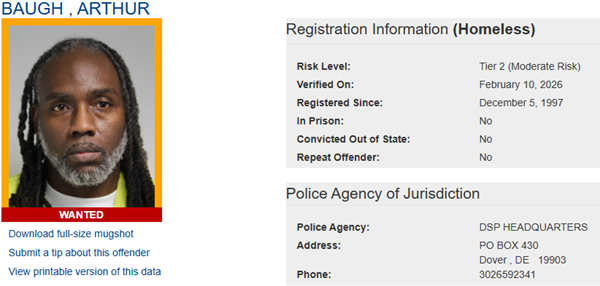
Delaware State Police are reaching out to the community for assistance in tracking down multiple sex offenders who have violated registration requirements.
The Sex Offender Apprehension and Registration Unit (SOAR) has released public notifications regarding both wanted and homeless sex offenders throughout the state.
Authorities are actively searching for several individuals who have either failed to register or update their current address information as required by law. The wanted sex offenders include Arthur Baugh, Stefan Ewell, Charles A. Fulton, Deangelo Hoskins, and John A. Martz.
Anyone with information about the whereabouts of these individuals is urged to contact authorities at (302) 739-5882. Tips can also be submitted anonymously through Delaware Crime Stoppers at (800) 847-3333.
Police emphasize that the individuals listed represent only a partial list of currently wanted sex offenders. The complete registry can be accessed through the Delaware Sex Offender Registry website.
Additionally, SOAR has issued notifications about homeless sex offenders, including Samuel Bishop, Eric Green, and Jesse Kincaid. These individuals are not wanted for registration violations but have recently reported being homeless.
If community members have information indicating that any of the listed homeless individuals are residing at a specific address, they should contact the same phone numbers provided for wanted offenders.
The homeless sex offender notifications are part of ongoing public safety efforts to keep communities informed about registered offenders in their area.
The Salisbury University men’s golf squad delivered another strong performance Thursday, earning a bronze medal finish at the Elizabethtown Spring Invitational held at Hershey Country Club in Pennsylvania.
The Sea Gulls tied for third place at the tournament, marking yet another podium appearance for the team this season. The competition took place on Thursday afternoon at the prestigious Hershey venue.
This latest achievement continues Salisbury’s successful run in collegiate golf tournaments, demonstrating the team’s consistent competitive performance throughout the spring season.
CHESTERTOWN, Md. – Salisbury University’s women’s tennis squad started strong but ultimately succumbed to Washington College’s superior roster depth, losing 4-3 to the Shorewomen during Thursday’s competition at the Johnson Fitness Center.
The Sea Gulls jumped ahead early in the match but were unable to sustain their momentum against Washington College’s well-rounded team performance throughout the afternoon contest.