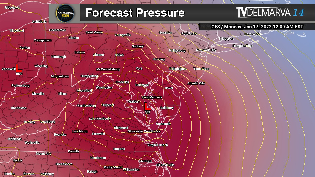

Seems like every weekend this past month we are talking about another snow threat one after another. The only difference is that this one could become a powerful low off our coasts going into Friday and Saturday. With this being the end of the active weather pattern and signs showing for the persistent eastern trough will come to close with a more zonal flow (west to east parallel motion of the jet stream). Ensembles have been very persistent about a coastal low about 200 miles offshore with explosive development (aka bombcyclone) scenario with a rapidly intensifying oceanic storm that moves across the Gulf Stream. And some of these low placement strengths are nothing to take for granted. A good 80% of them are below 986mb pressure levels when its off our coast. By the time it’s off the coast of Cape Cod we are talking down into the 970s.


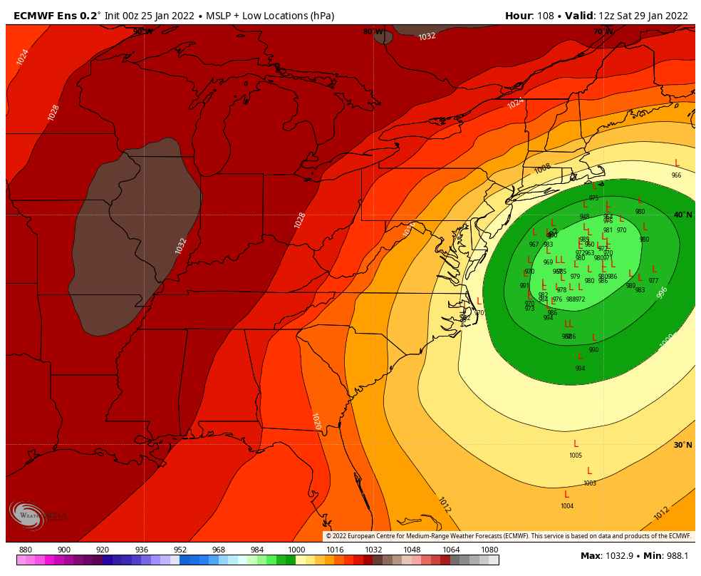
With a bit of surprise, there is actually some good agreement between the 3 major global models regarding this storm. ECMWF/GFS/CMC/ICON are on the table for a rapidly intensifying storm off our coasts this coming weekend. The biggest difference is how far offshore will it actually be. Every model without a doubt has a round of snow to the region but how close that low is will make a major difference. CMC/ICON are the most offshore out of the bunch with some light precipitation to the region and then dumping over coastal New England. GFS model coming in at 12z is a little bit westward giving Delmarva a good hit with snow. And then the big elephant of the group the ECMWF and the ensembles being very aggressive with a the furthest west solution giving all of Delmarva a major winter storm. And the ECMWF has been very consistent with that. Some of the ensembles give historic levels of snow but that’s extremely far fetched in my opinion.
Overall do I think we have a explosive developing oceanic storm? That’s on the increase for sure to close out the weather pattern. It’s going to be a matter of how close will this get to our coast will make the big difference. We have the cold air in place ahead of this system to begin with. It’s something that we will be keeping an eye on this week.