A fallen tree has created a traffic headache for New Castle County drivers after it came down across power lines, forcing officials to completely block off a busy roadway.
Delaware Department of Transportation crews have shut down Ebenezer Church Road between Route 15 and Vandyke Greenspring Road while they work to clear the obstruction safely.
The tree became entangled in electrical wires when it fell, creating a potentially dangerous situation that requires coordination between DelDOT workers and utility crews to resolve.
Motorists are being advised to find alternate routes while the cleanup operation continues. Officials have not provided an estimated time for when the roadway will reopen to traffic.
Motorists will need to find alternate routes as a portion of Centerville Road remains blocked off at Turnstone Drive while utility crews perform necessary maintenance work.
The Delaware Department of Transportation has issued the road closure notice to alert drivers of the temporary traffic disruption in the area.
No timeline has been provided for when the roadway will reopen to normal traffic flow. Drivers are advised to plan accordingly and seek alternative routes until the utility work is completed.
Traffic is being rerouted around a section of Rockland Road after a fallen tree created dangerous conditions by bringing down power lines.
Delaware Department of Transportation officials have shut down the roadway in both directions between Montchanin Court and Montchanin Road while crews work to clear the obstruction.
The tree collapse has left electrical wires across the roadway, prompting the complete closure as a safety precaution for motorists.
Drivers are advised to seek alternate routes while utility crews and road maintenance teams work to restore normal traffic flow to the area.
Traffic is being rerouted around a section of Adams Dam Road after a fallen tree became entangled in electrical wires, prompting officials to close the roadway completely.
The road closure affects both lanes of traffic between Brandywine Creek State Park and West Rockland Road while utility crews work to safely remove the tree and address any power line damage.
Motorists are advised to seek alternate routes until the obstruction can be cleared and the roadway reopened to normal traffic flow.
Motorists in Sussex County are facing travel delays as utility crews have shut down a key intersection for infrastructure work.
The closure affects Dairy Farm Road at its intersection with both Lewes Georgetown Highway and Beaver Dam Road, creating detours for drivers in the area.
Delaware Department of Transportation officials have not provided an estimated timeline for when the roadway will reopen to normal traffic flow.
Drivers are advised to seek alternate routes and expect additional travel time when navigating through the affected area.
Traffic is being rerouted around a section of Marsh Road after a tree toppled into electrical wires, forcing authorities to close the roadway completely.
The Delaware Department of Transportation reports that both lanes of Marsh Road are blocked between Afton Drive and Hettering Road while crews work to clear the fallen tree and address the downed power lines.
Motorists are advised to find alternate routes while utility workers and road crews address the situation. No timeline has been provided for when the roadway will reopen to traffic.
A stretch of Peterkins Road has been shut down to all traffic after trees and electrical wires came down across the roadway, according to Delaware Department of Transportation officials.
The road closure affects the section between Evergreen Drive and Haven Drive, forcing motorists to find alternate routes until cleanup crews can safely remove the debris.
DelDOT has not provided an estimated time for when the roadway will reopen to normal traffic flow. Drivers are advised to avoid the area and use alternative routes until further notice.
Delaware State University’s softball team experienced a challenging outing on the diamond, falling to Norfolk State University by a score of 9-3 in recent action.
While the final score reflected a decisive victory for Norfolk State, the contest featured notable individual contributions from Hornets players Terrell and Lopez, who provided bright spots during an otherwise difficult game for Delaware State.
The loss adds to Delaware State’s season record as the team continues to work through their competitive schedule. The Hornets will look to bounce back from this setback and build on the positive individual performances demonstrated in the matchup against Norfolk State.
PANAMA CITY BEACH, Fl. – Fourth-ranked Salisbury University’s women’s lacrosse squad defeated eighth-ranked William Smith College 17-11 Monday evening, with Audrey Harrington delivering a standout performance during the SpringFling tournament.
The Sea Gulls secured the victory over the Herons at Publix Park during the 28th edition of the annual SpringFling event. The win showcased Salisbury’s offensive prowess in the high-scoring matchup between two top-ten ranked programs.
Harrington’s exceptional play helped propel the Sea Gulls to their commanding six-goal margin of victory in the nationally significant contest held in Florida.
Weather officials from the National Weather Service’s Mount Holly, New Jersey office issued a severe thunderstorm warning on March 16th, alerting residents to dangerous weather conditions.
The warning took effect at 10:13 PM EDT on March 16th and remained in place until 11:15 PM EDT the same evening, covering just over one hour of severe weather activity.
The alert was distributed through the National Weather Service’s emergency notification system to keep the public informed of potentially hazardous storm conditions in the area.
Weather officials from the National Weather Service Mount Holly office in New Jersey issued a severe thunderstorm warning on March 16th, alerting residents to dangerous conditions in the area.
The warning went into effect at 10:07 PM EDT and remained active until 11:00 PM EDT on the same evening, giving residents nearly an hour to prepare for severe weather conditions.
The alert was part of the National Weather Service’s ongoing efforts to keep communities informed about potentially hazardous weather events that could impact public safety.
Weather officials from the National Weather Service Mount Holly office in New Jersey issued a tornado warning on March 16th at 10:45 PM EDT.
The severe weather alert remained active until 11:00 PM EDT on the same date.
The warning was part of the National Weather Service’s emergency notification system to alert residents of potentially dangerous tornado conditions in the area.
Local residents received a severe thunderstorm warning from the National Weather Service’s Mount Holly, New Jersey office on the evening of March 16th.
The weather alert was issued at 10:44 PM EDT and remained active until 11:15 PM EDT on the same date.
The warning originated from the National Weather Service facility in Mount Holly, which monitors weather conditions for the region and issues alerts when dangerous conditions develop.
Weather officials from the National Weather Service’s Mount Holly, New Jersey office issued a severe thunderstorm warning on the evening of March 16th.
The weather alert went into effect at 11:10 PM EDT on March 16th and remained active until 11:45 PM EDT that same night, lasting approximately 35 minutes.
The warning was part of the National Weather Service’s ongoing efforts to alert residents about potentially dangerous weather conditions in the region.
Weather officials have issued a severe thunderstorm watch for the region, warning residents to prepare for potentially dangerous storm conditions.
The National Weather Service office in Mount Holly, New Jersey issued the alert on March 16th at 11:03 PM Eastern Daylight Time. The watch will remain active until 12:00 AM EDT on March 17th.
Residents should monitor weather conditions closely and be prepared to take shelter if severe thunderstorms develop in their area during the watch period.
Delaware Department of Transportation crews are responding to a tree that has fallen across Interstate 95 southbound at Exit 7B, forcing officials to close the exit ramp.
The obstruction is blocking traffic from accessing the exit, creating potential delays for motorists traveling through the area.
DelDOT has not provided an estimated time for when the exit will reopen to normal traffic flow. Drivers are advised to seek alternate routes until the tree can be removed and the roadway cleared.
No additional details about what caused the tree to fall or whether any vehicles were involved have been released at this time.
Delaware State University’s softball squad kicked off their series against Norfolk State with mixed results, claiming one win while suffering one loss on the opening day of competition.
The Hornets managed to secure a narrow 7-6 triumph over Norfolk State after taking command early in the matchup. DSU established their advantage during the second inning and successfully held onto their lead for the remainder of the game.
The victory showcased the team’s ability to maintain pressure once they gained momentum, demonstrating solid execution when it mattered most against their conference rivals.
The split result sets up an intriguing continuation of the series as both teams look to gain the upper hand in upcoming games.
Weather officials from the National Weather Service’s Mount Holly, New Jersey office issued a severe thunderstorm warning on the evening of March 16th.
The weather alert went into effect at 10:56 PM EDT and remained active until 11:15 PM EDT on the same date.
The warning was distributed through the agency’s official alert system to notify residents of potentially dangerous weather conditions in the area.
Weather officials issued a tornado warning on the evening of March 16th, alerting residents to take immediate precautions.
The National Weather Service office in Mount Holly, New Jersey, issued the warning at 10:55 PM on March 16th. The alert remained active until 11:15 PM that same night.
Tornado warnings are issued when a tornado has been spotted or indicated by weather radar, requiring immediate protective action from residents in the affected area.
Weather officials from the National Weather Service’s Mount Holly, New Jersey office issued a severe thunderstorm warning on March 16th, alerting residents to dangerous weather conditions.
The warning took effect at 10:52 PM EDT on March 16th and remained active until 11:45 PM EDT the same evening, lasting nearly an hour.
The alert was designated with the official identifier urn:oid:2.49.0.1.840.0.55ddedb57186f4fb72b27a043eadd2e2feed881f.002.1.cap in the National Weather Service alert system.
The National Weather Service office in Mount Holly, New Jersey issued a tornado warning on March 16th that remained in effect for approximately 31 minutes during the evening hours.
The warning was activated at 10:44 PM Eastern Daylight Time and continued until 11:15 PM on the same date, according to official weather service records.
The alert was distributed through the National Weather Service’s emergency notification system as part of their severe weather monitoring and public safety protocols.
Weather officials from the National Weather Service’s Mount Holly, New Jersey office issued a severe thunderstorm warning on the evening of March 16th, alerting residents to dangerous storm conditions in the area.
The warning went into effect at 10:39 PM on March 16th and remained active until 11:30 PM the same evening, giving residents nearly an hour of advance notice about the approaching severe weather.
The alert was distributed through the National Weather Service’s official warning system, which uses a standardized identification protocol to track and manage weather advisories across the region.
Residents were advised to monitor local conditions and take appropriate safety precautions during the warning period as the severe thunderstorm moved through the area.
Weather officials from the National Weather Service’s Mount Holly, New Jersey office issued a severe thunderstorm warning on March 16th, beginning at 10:34 PM Eastern Daylight Time.
The warning remained active until 11:45 PM EDT on the same date, providing residents with over an hour of advance notice about potentially dangerous weather conditions.
The alert was distributed through the official National Weather Service alert system, which provides critical weather information to communities across the region.
Weather officials from the National Weather Service office in Mount Holly, New Jersey activated a tornado warning on March 16th during the evening hours.
The warning went into effect at 10:37 PM Eastern Daylight Time and remained active until 11:00 PM EDT on the same date.
The Mount Holly National Weather Service office, which provides weather forecasts and warnings for portions of New Jersey, issued the alert as part of their severe weather monitoring responsibilities.
Tornado warnings are issued when weather radar indicates rotation in thunderstorms or when trained spotters report tornado activity in the area.
Weather officials issued a severe thunderstorm warning for the region on March 16th, alerting residents to dangerous weather conditions moving through the area.
The National Weather Service office located in Mount Holly, New Jersey released the warning at 10:32 PM on March 16th, with the alert scheduled to remain active until 11:00 PM that same evening.
The 28-minute warning window provided residents with advance notice of the approaching severe weather system that posed potential threats to the region during the late evening hours.
Weather officials issued a tornado warning for a brief period on the evening of March 16th, alerting residents to potentially dangerous conditions.
The National Weather Service facility in Mount Holly, New Jersey activated the tornado warning at 10:30 PM Eastern Daylight Time on March 16th. The emergency weather alert remained active until 11:00 PM EDT the same night, spanning a 30-minute timeframe.
The warning was distributed through the official weather alert system, providing residents with advance notice of the severe weather threat in the affected area.
Weather officials from the National Weather Service’s Mount Holly, New Jersey office issued a severe thunderstorm warning on the evening of March 16th.
The warning went into effect at 10:24 PM EDT and remained active until 11:45 PM EDT on the same date.
The alert was distributed through the National Weather Service’s official alert system to notify residents of potentially dangerous weather conditions in the affected areas.
The National Weather Service office in Mount Holly, New Jersey has issued a severe thunderstorm watch beginning at 8:23 PM on March 16 and continuing until midnight on March 17.
The weather alert warns residents to remain vigilant for dangerous storm conditions that could develop during the overnight hours. Severe thunderstorms can produce damaging winds, large hail, and heavy rainfall that may lead to flooding.
Residents should monitor local weather conditions closely and be prepared to take shelter if severe weather develops in their area. The watch remains in effect until 12:00 AM EDT on March 17.
Delaware residents will have the opportunity to learn about flood preparedness next week as the state observes its annual flood awareness initiative.
Governor Matt Meyer has officially designated March 16 through 20 as Delaware Flood Awareness Week, working in partnership with the Delaware Department of Natural Resources and Environmental Control (DNREC) and the Delaware Emergency Management Agency (DEMA).
As part of the week-long educational campaign, state officials will host a special webinar on Wednesday, March 19, 2026, focused on helping Delawareans prepare for potential flooding situations.
The collaborative effort between DNREC and DEMA aims to increase public awareness about flood risks and provide residents with essential information on how to protect themselves and their property during flood events.
A Goldey-Beacom College baseball player has earned recognition from the Central Atlantic Collegiate Conference this week.
Sophomore infielder Zach Smethers, who hails from Nazareth, Pennsylvania, was selected for the CACC Weekly Honor Roll for Baseball. Smethers plays for the Lightning baseball team at the Wilmington-based college.
The conference honor recognizes outstanding performance by student-athletes in collegiate baseball across the CACC member institutions.
Delaware’s coastal communities should prepare for minor flooding tonight as the National Weather Service has issued a Coastal Flood Advisory for Delaware Beaches and Inland Sussex County until 2:00 AM Tuesday.
Up to one foot of water above ground level is expected in low-lying areas near shorelines and tidal waterways. The flooding will primarily impact lots, parks, and roads, with isolated road closures possible.
The culprit is increasing south winds that are preventing water from draining properly from Rehoboth Bay and Little Assawoman Bay during low tide. Areas along the northern ends of these bays are especially vulnerable to minor tidal flooding impacts.
Residents and visitors should avoid parking vehicles in flood-prone locations and never attempt to drive through flood waters, which may be deeper than they appear. The most vulnerable roadways typically flood first during these events.
This is considered minor flooding, but it can still create hazardous driving conditions and costly vehicle damage. The advisory remains in effect through the overnight hours, with conditions expected to improve by Tuesday morning.
For real-time water level information and local tide gauge data, residents can visit the National Water Prediction Service website at water.noaa.gov.
A traffic accident has shut down multiple lanes on southbound Interstate 495 near Edgemoor Road, causing significant delays for commuters.
According to Delaware Department of Transportation officials, the three leftmost lanes are currently blocked due to the crash. The right lane remains open to traffic, but drivers should expect heavy congestion in the area.
DelDOT has not provided an estimated time for when the lanes will reopen. Motorists are advised to seek alternate routes or allow extra travel time if they must use this section of highway.
Traffic crews are on scene working to clear the accident and restore normal traffic flow.
University of Maryland Eastern Shore softball standout Dani Brown has received recognition from the Mid-Eastern Athletic Conference, earning the title of Pitcher of the Week.
The Hawks player’s exceptional mound performance caught the attention of conference officials, leading to this weekly honor. Brown’s achievement adds to the growing list of accolades for the UMES softball program.
This recognition comes as the Hawks continue their competitive season in MEAC play, with Brown serving as a key contributor to the team’s pitching rotation.
TACOMA, Wash. – Salisbury University’s men’s tennis squad delivered a dominant performance against the University of Puget Sound Loggers on Monday, securing a commanding 6-1 victory at the indoor Tennis Pavilion.
The decisive win launched the Sea Gulls’ three-match spring break journey across the Pacific Northwest, giving the team strong momentum as they continue their West Coast swing.
Playing indoors in Tacoma, Washington, the Sea Gulls controlled the match from start to finish, capturing six of seven total points against their hosts to begin the road trip on a high note.
TACOMA, Wash. – Salisbury University’s women’s tennis squad began their four-match Pacific Northwest road swing on a high note, dominating the Puget Sound Loggers with an impressive 6-1 victory on Monday.
The Sea Gulls secured the decisive win at Tacoma’s indoor Tennis Pavilion, showcasing strong performance across the lineup in their season opener on the West Coast.
The commanding victory sets a positive tone for Salisbury as they continue their multi-match journey through the Pacific Northwest region.
Weather officials have put a coastal flood advisory into effect for the Delmarva Peninsula, beginning Saturday, March 16th at 3:15 PM and continuing through 2:00 AM on Sunday, March 17th.
The National Weather Service office in Mount Holly, New Jersey issued the advisory to alert residents of potential minor coastal flooding conditions along shoreline areas.
Residents in coastal communities should remain aware of possible flooding in low-lying areas near the water during this time period.
Delaware transportation officials are warning drivers about significant flooding that has made Airport Road impassable in both directions.
According to the Delaware Department of Transportation, standing water has covered the roadway between Exit 5A and Meadow Road, creating hazardous driving conditions.
Motorists are advised to find alternate routes and avoid the flooded area until conditions improve and the water recedes.
DelDOT continues to monitor the situation and will provide updates as road conditions change.
Motorists should expect delays and seek alternate routes as a vehicle collision has shut down several lanes at the intersection of US Route 13 and Carter Road.
The crash has caused significant traffic disruptions with multiple lanes currently blocked at the busy intersection. Authorities are on scene managing the incident.
Drivers are advised to use caution in the area and consider alternative routes until the roadway can be fully reopened. The Delaware Department of Transportation is monitoring the situation.
Weather officials have issued a tornado watch for the region, urging residents to remain vigilant for dangerous weather conditions through early evening hours.
The National Weather Service office located in Mount Holly, New Jersey activated the tornado watch at 4:41 PM on March 16th, with the alert remaining in effect until 7:00 PM the same day.
A tornado watch indicates that atmospheric conditions are favorable for the development of severe thunderstorms capable of producing tornadoes. Residents should monitor weather conditions closely and be prepared to take shelter if warnings are upgraded or tornado activity is spotted in their area.
The weather service recommends having a safety plan in place and staying tuned to local weather updates throughout the duration of the watch period.
SELBYVILLE — Delaware transportation officials have scheduled a two-day road closure in Sussex County to remove dangerous trees that pose a safety threat.
According to the Delaware Department of Transportation, a portion of Cypress Road will be shut down to traffic from March 21st through March 22nd while crews work to eliminate hazardous trees from the area.
The closure will affect the section of Cypress Road running from Daisey Road to Cliff Road, with work scheduled from 7 a.m. until 6 p.m. each day, assuming weather conditions allow the operation to proceed as planned.
Transportation officials are advising drivers to reduce their speed when passing through active work zones and to plan for possible delays when traveling through the surrounding area during the closure period.
Additional details about this and other transportation projects can be found on DelDOT’s official website at www.deldot.gov.
Salisbury city officials have called off tonight’s City Council session that was set to begin at 6 p.m. on Monday, March 16th.
Deputy City Clerk Hannah Long announced the cancellation in a public notice, citing anticipated weather conditions and concerns for resident safety as the reasons for postponing the meeting.
City officials stated they will reveal the rescheduled date for the council session in the coming days.
The notice also indicated that council members maintain their authority to modify meeting agendas when needed and may enter closed executive sessions as allowed under Maryland state law section 3-305(b).
Delaware’s Division of the Public Advocate has announced the appointment of Samantha Hajek to the position of Deputy Public Advocate, marking a significant step in strengthening consumer protection services across the state.
In her new role, Hajek will work to enhance the DPA’s ability to serve utility customers throughout Delaware. Her responsibilities will include supervising investigations into consumer complaints, broadening community engagement efforts, and working more closely with lawmakers and stakeholders.
The appointment represents the division’s commitment to expanding its advocacy work on behalf of Delaware residents who need assistance with utility-related issues.
The University of Maryland Eastern Shore women’s basketball team has reached a significant milestone in program history by earning their very first postseason tournament invitation.
The Hawks will take the court Thursday in the Women’s National Invitation Tournament (WNIT), representing a breakthrough achievement for the university’s athletic department.
This historic postseason berth marks a new chapter for UMES women’s basketball, as the team prepares to compete on the national stage for the first time in the program’s existence.
The milestone appearance in the WNIT demonstrates the growth and development of the Hawks’ women’s basketball program under current leadership.
SALISBURY, Md. – Three student-athletes from Salisbury University earned recognition as Jersey Mike’s A Sub Above Player of the Week recipients following outstanding performances that caught the attention of conference officials.
The honors came from two different athletic conferences, with the Coastal Lacrosse Conference (CLC) and Coast-to-Coast Athletic Conference (C2C) selecting the Sea Gulls athletes for their exceptional play during the March 9-15 period.
Men’s lacrosse dominated the CLC weekly awards, with Connor Herraiz and Blake Malamphy claiming both available honors from their conference. The pair’s performances helped sweep the weekly recognition for Salisbury’s men’s lacrosse program.
Meanwhile, women’s lacrosse player Reagan Davis achieved a personal milestone by earning C2C Defensive Player of the Week honors for the first time in her collegiate career, marking a significant achievement for the defensive standout.
Salisbury University’s men’s golf team saw their tournament come to an abrupt end when severe weather conditions forced organizers to cancel the competition entirely.
The Marymount Bernie Shootout, taking place in Virginia’s capital region, was shut down after torrential rainfall created unsafe playing conditions during the early portion of the event.
Tournament officials made the decision to call off the remainder of the competition rather than attempt to continue play or reschedule for later in the day.
The Sea Gulls golf squad will now look ahead to their next scheduled competition as they continue their season.
Residents and visitors along Delaware’s coast should prepare for minor flooding tonight as a Coastal Flood Advisory remains in effect until 2 AM Tuesday morning.
The National Weather Service warns that up to one foot of water could inundate low-lying areas near shorelines and tidal waterways across inland Sussex County and Delaware beach communities. Strengthening south winds this evening will prevent water from properly draining out of Rehoboth Bay and Little Assawoman Bay during low tide, leading to elevated water levels.
Expected impacts include flooding of parking lots, parks, and roadways, with some isolated road closures possible. The northern sections of Rehoboth Bay and Little Assawoman Bay are particularly vulnerable to these minor tidal flooding conditions.
Officials urge drivers to avoid parking in flood-prone areas and never attempt to drive through standing water, which may be deeper than it appears. Such decisions can lead to vehicle damage and put lives at risk.
The advisory, issued by the National Weather Service Mount Holly office at 3:15 PM today, affects popular destinations including Rehoboth Beach, Bethany Beach, and surrounding coastal communities. Conditions should improve after 2 AM as winds shift and waters recede.
Residents living in select neighborhoods of Ocean Pines should prepare for a temporary interruption to their water service scheduled for Monday, March 17.
The planned service disruption will impact certain areas within the Ocean Pines community, though specific streets and timeframes for the outage have not been detailed in the official notice.
Local officials issued the advance warning to give residents time to make necessary preparations for the temporary loss of water service.
Community members are advised to store water for essential needs during the planned maintenance period.
Drivers in New Castle County should plan for delays on a busy stretch of Baynard Boulevard as road crews begin repair work next week.
State transportation officials say one lane will be closed on Baynard Boulevard from Shipley Road to Marsh Road beginning Tuesday, March 24th. The Delaware Department of Transportation expects the warm mix patching project to wrap up around Friday, April 3rd.
Construction crews will work during daytime hours from 8:00 a.m. to 4:00 p.m., with flaggers on site to direct vehicles through the work zone. Motorists should expect delays and consider alternate routes during peak travel times.
NEWARK, Del. – Weather conditions have forced the cancellation of Tuesday’s scheduled tennis matchup between the University of Delaware Blue Hens men’s team and Temple University.
The contest, which was slated to begin at 12:00 p.m. on March 17th in Philadelphia, Pennsylvania, has been called off due to poor weather conditions affecting the area.
Officials have not yet announced when the postponed match will be rescheduled. The Blue Hens will now await word on a new date to take on the Temple Owls.
Drivers in New Castle County should prepare for overnight disruptions on Route 896 this week as state transportation officials implement final adjustments to traffic flow patterns.
Delaware’s Department of Transportation has announced that northbound Route 896 will be completely shut down during overnight hours on both Monday, March 23rd and Tuesday, March 24th. The affected section runs from Old Baltimore Pike to Welsh Tract Road.
The temporary closures are necessary for crews to put the finishing touches on new traffic configurations along the corridor. DelDOT officials noted that all construction activities depend on favorable weather conditions.
Motorists who regularly travel this route during late evening or early morning hours should plan alternate routes for both nights to avoid delays.
SALISBURY, Md. – Salisbury University’s highly-ranked baseball squad encountered a rough outing Monday morning, falling 10-2 to Oswego State at their home venue, Donnie Williams Sea Gull Baseball Stadium.
The Sea Gulls, who entered the contest ranked second nationally, struggled throughout the matchup against the visiting Lakers. The lopsided defeat marked a significant stumble for the typically dominant Salisbury program on their own turf.
The loss represents a setback for the Sea Gulls as they continue their season, with the team looking to bounce back from this challenging performance against Oswego State.
A traffic incident has forced authorities to completely shut down Choptank Road in both directions at its intersection with Armstrong Corner Road.
The road closure is currently in effect as officials respond to the incident. Drivers traveling through the area should seek alternative routes to avoid delays.
No additional details about the nature of the incident or expected duration of the closure have been released at this time.
Motorists in the Newark area should expect delays as emergency utility repairs have forced the closure of one westbound left turn lane on Route 72 at its intersection with Route 4.
The Delaware Department of Transportation reports that crews are currently working to address urgent utility infrastructure issues at this location. The lane restriction remains in place while repair work continues.
Drivers are advised to use alternate routes or allow extra travel time when navigating through this area. Officials have not provided an estimated timeline for when the lane will reopen to traffic.
Delaware Department of Transportation officials report that emergency utility repairs have forced the closure of one eastbound left turn lane on Route 72 at the Old Baltimore Pike intersection.
The lane restriction affects eastbound traffic attempting to make left turns at this location. DelDOT has not provided an estimated timeline for when the emergency utility work will be completed and the lane reopened to traffic.
Drivers are advised to expect delays and consider alternate routes if possible while crews work to address the utility issue. The closure remains in effect until further notice.
Drivers using DE-72 near Old Baltimore Pike should expect traffic delays as emergency utility repairs force the closure of one eastbound left turn lane.
The Delaware Department of Transportation reports that crews are currently working to address utility infrastructure issues at the intersection, requiring the temporary lane restriction.
Motorists are advised to use alternate routes when possible or allow extra travel time when navigating through the affected area. The duration of the emergency repairs has not been specified.
Traffic officials recommend exercising caution when approaching the work zone and following posted signs and flagging personnel directions.
Sussex County drivers should prepare for construction-related delays on a busy stretch of Robinsonville Road this week.
The Delaware Department of Transportation has scheduled milling and paving work along Robinsonville Road from Harts Road to Conleys Chapel Road, beginning Monday, March 23rd and continuing through Friday, March 28th.
DelDOT officials say the project will require intermittent lane closures throughout the work period, with completion dependent on favorable weather conditions.
Transportation officials are urging drivers to reduce speeds when traveling through the construction zone and to plan for potential delays while crews complete the roadway improvements.
Additional details about this and other DelDOT projects can be found on the department’s website at www.deldot.gov.
Weather officials have issued a wind advisory for the Delmarva region that will remain in effect from Saturday afternoon through the early morning hours of Sunday.
The National Weather Service office in Mount Holly, New Jersey announced the advisory at 11:39 AM on Saturday, March 16th, with the warning period extending until 2:00 AM on Sunday, March 17th.
Residents across Delaware and the Eastern Shore should prepare for strong wind conditions that may impact outdoor activities and travel plans throughout the advisory period.
Local authorities encourage people to secure loose outdoor items and exercise caution when driving, especially in high-profile vehicles that may be more susceptible to wind effects.
Dover police are seeking information about three suspects who broke into a local tobacco shop early Monday morning.
The break-in occurred at M&N Smoke Shop located at 1160 White Oak Road in Dover around 5:59 a.m. on March 16th, according to Dover Police Department officials.
Law enforcement officers were dispatched to the scene after receiving an alarm notification. When they arrived, police discovered the store’s front window had been broken.
Video surveillance from the business revealed that three unidentified individuals had forced their way inside the shop. The suspects proceeded to break a display case and steal an unknown quantity of products before fleeing the scene.
The Dover Police Department has assigned incident number 50-26-8596 to this case and continues to investigate the break-in.
Authorities are requesting anyone with information about this incident to reach out to the Dover Police Department by calling (302) 736-7145. Those who wish to provide tips can do so anonymously.
Additionally, information can be submitted through Delaware Crime Stoppers by calling 800-TIP-3333 or visiting their website at www.delaware.crimestoppersweb.com. A monetary reward may be available for tips that result in an arrest.
For additional information about this case, contact Lieutenant Mark Hoffman, Dover Police Department Public Information Officer, at [email protected].
Weather officials have issued a tornado watch for Delaware and surrounding areas, alerting residents to potentially dangerous conditions developing this afternoon.
The National Weather Service office located in Mount Holly, New Jersey activated the tornado watch at 11:30 AM on March 16th, with the alert scheduled to remain active until 7:00 PM the same day.
A tornado watch indicates that atmospheric conditions are favorable for tornado development in the specified region. Residents should monitor weather conditions closely and be prepared to take shelter if a tornado warning is issued.
Local emergency management officials encourage Delaware residents to stay informed about changing weather conditions throughout the day and have a safety plan ready in case severe weather develops.
Two Delaware men have been found guilty in connection with the fatal shooting of a 19-year-old Wilmington victim in 2022, according to the Delaware Department of Justice.
Jhaivon Carter, 22, from Wilmington, and Xavier Carter-Baird from Milford were both convicted in New Castle County Superior Court for their involvement in the death of Marell Lowe.
Following a jury trial on March 12, Carter was found guilty on charges of first-degree murder and possession of a firearm during the commission of a felony.
The convictions represent the conclusion of a case that has been working its way through the court system since the 2022 killing of the teenage victim.
Details about Carter-Baird’s specific charges and conviction were not immediately available from court records.
Rehoboth Beach officials are closely tracking dangerous weather conditions expected to hit the coastal community this afternoon through tonight. The approaching storm system threatens to bring destructive winds, hail, and potentially tornado activity to the area.
City leaders are urging everyone in the community to take immediate safety precautions:
Residents and businesses should bring in or tie down any loose items including patio umbrellas, outdoor seating, and garbage containers. Those away from home are encouraged to ask neighbors to move trash bins away from curbside areas.
Officials recommend charging electronic devices now and gathering flashlights in preparation for potential electrical outages.
All beach and water recreational activities have been banned due to expected dangerous surf conditions created by the high winds.
People should stay away from the shoreline entirely, as the rough waters may cause significant beach erosion.
Drivers are advised to exercise extreme caution on roadways and never attempt to cross flooded streets.
Should electrical service be disrupted in Rehoboth Beach, the Convention Center will serve as a public shelter on Tuesday from 8:30am to 4:30pm, offering device charging stations and warmth for residents. While the Emmert Auction will proceed as scheduled, conference rooms will be available for community members who need them.
City maintenance teams are actively preparing for the storm’s impact:
Beyond today’s regular trash collection on the south side of town, three additional trucks are working to clear branches and debris from streets before the winds arrive. Residents worried about loose branches can secure them until the scheduled yard waste pickup on Wednesday.
Tuesday’s planned trash collection for the north side remains on schedule, though officials will notify residents of any changes.
City officials promise to provide updates as weather conditions develop.
For detailed weather information, residents can check the Philadelphia/Mt Holly National Weather Service. Delmarva’s power outage tracking map is available online for monitoring electrical service disruptions.
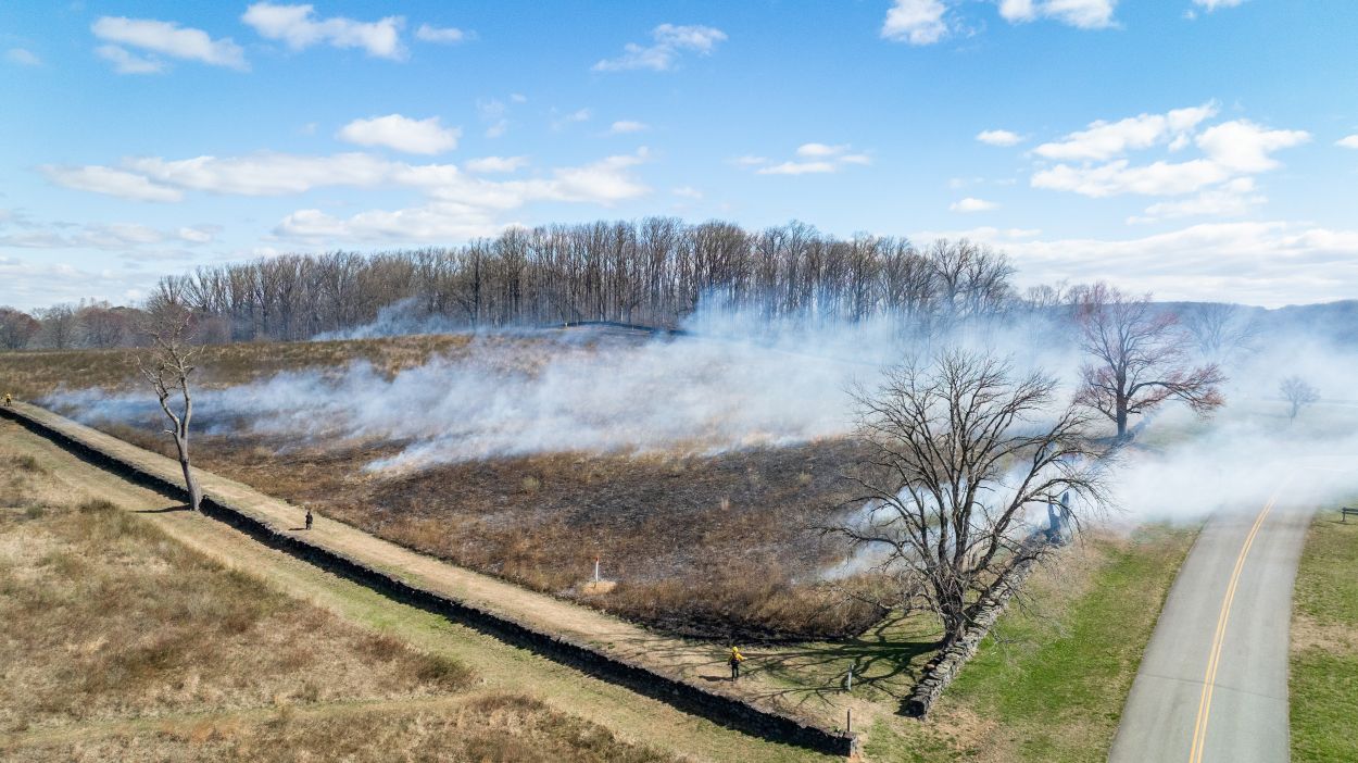
Park officials at Brandywine Creek State Park have announced plans to conduct a prescribed fire operation next month as part of ongoing habitat restoration efforts.
The planned burn, scheduled for March, will target meadow areas within the park to remove accumulated vegetation and promote the establishment of native wildflower species and seasonal grasses.
According to park management, the fire treatment serves multiple ecological purposes, including creating improved nesting and foraging areas for grassland bird species while also supporting pollinator populations that depend on native flowering plants.
The controlled burning technique is a widely-used land management practice that mimics natural fire cycles, helping to maintain healthy ecosystems and prevent the encroachment of invasive plant species in open meadow habitats.
Motorists traveling along US Route 13 are encountering non-functioning traffic lights between Old State Road and Paddock Road due to an electrical power disruption.
The Delaware Department of Transportation reports that multiple traffic signals in this corridor have lost power, leaving intersections without working traffic control devices.
Drivers should treat any dark traffic signals as four-way stops and exercise extra caution when navigating through the affected intersections until power is restored and normal signal operations resume.
The Ocean City Museum Society has unveiled plans to offer their beautifully renovated facility for private bookings, transforming the historic building into a rental venue for community events.
Located at 217 South Baltimore Avenue in the heart of downtown Ocean City, Maryland, the Museum of Ocean City now welcomes inquiries for private functions following its recent restoration work.
The organization announced that the distinctive historic location provides an ideal backdrop for a variety of occasions, including business meetings, celebratory events, and other special occasions requiring a memorable venue.
The museum’s transformation into an event space represents a new chapter for the cultural institution, allowing the community to experience the restored building in an intimate setting while supporting the museum’s mission.
Delaware transportation officials have announced temporary lane restrictions coming to a stretch of Route 299 in Odessa as crews prepare to conduct soil testing operations.
The Delaware Department of Transportation says drivers should prepare for intermittent lane restrictions along Route 299 from Front Street to Old Corbitt Road beginning Monday, March 23rd and continuing through Friday, April 3rd.
Work crews will be drilling to collect soil samples during weekday hours from 9 a.m. until 4 p.m., with operations dependent on favorable weather conditions.
Transportation officials are advising drivers to reduce speeds when traveling through the construction zone and to plan for possible minor delays during the two-week period.
Additional details about the project can be found on DelDOT’s official website at www.deldot.gov.
Delaware Department of Transportation officials report that a traffic accident has resulted in the closure of two lanes on Interstate 95 northbound in the vicinity of Naamans Road.
The incident is causing significant delays for commuters traveling through the area. DelDOT crews are currently on scene managing the situation.
Motorists are advised to expect delays and consider alternate routes when possible. The department has not yet provided an estimated time for when the affected lanes will reopen to traffic.
This is a developing situation and updates will be provided as more information becomes available from transportation officials.
A traffic accident has resulted in significant lane restrictions on US Route 13 at Beeson Road, with left lanes blocked in both northbound and southbound directions.
The collision is causing delays for commuters traveling along this busy corridor. Drivers are advised to use caution when approaching the area and allow extra time for their commute.
Traffic is being directed around the incident scene while emergency responders and cleanup crews work to clear the roadway. Motorists may want to consider using alternative routes until normal traffic flow is restored.
The Delaware Department of Transportation is monitoring the situation and working to reopen all lanes as quickly and safely as possible.
Motorists traveling on northbound Interstate 95 should expect to see cleanup crews working in the median today as Delaware Department of Transportation teams conduct litter removal operations.
The cleanup activity is taking place along the northbound lanes from Exit 5B at Route 202 and extends all the way to the Pennsylvania state line. DelDOT officials say the litter removal work is scheduled to conclude by 4:30 PM this afternoon.
Drivers are advised to use caution when passing through the work zone and may experience minor delays as crews complete their operations in the median area.
Traffic is being rerouted around a section of Cedar Lane Road after a utility pole toppled over, bringing down power lines across the roadway.
Delaware Department of Transportation officials report the road remains impassable in both directions between Marl Pit Road and Coverdale Lane while utility crews work to remove the fallen infrastructure.
Motorists are advised to seek alternate routes until the roadway can be safely reopened. No timeline has been provided for when the cleanup will be completed.
Delaware Department of Transportation crews are currently conducting debris removal activities along the southbound lanes of Route 1, also known as Korean War Veterans Memorial Highway.
The litter cleanup operation is taking place between exit 93 and exit 98, with work expected to wrap up by 12:30 PM this afternoon.
Motorists traveling through the area should expect possible delays and are advised to use caution when passing through the work zone.
Fallen electrical wires have prompted officials to close the right lane of Delaware Route 72 at Dawson Drive, according to DelDOT traffic reports.
The lane closure is currently in effect as crews work to address the downed power lines. Drivers traveling through the area should expect delays and exercise caution while navigating around the closure.
Authorities have not provided an estimated time for when the lane will reopen to traffic. Motorists are advised to seek alternate routes if possible or allow extra travel time when passing through the affected area.
Young people interested in careers in public safety now have the opportunity to apply for New Castle County’s summer youth initiative focusing on police work and emergency medical services.
The no-cost program will take place from July 6 through July 17, 2026, running Monday through Friday from 8:00 AM to 4:00 PM each day.
New Castle County Police and Paramedic departments are welcoming applications for this career-exploration opportunity that provides participants with an exclusive behind-the-scenes experience in both law enforcement operations and emergency medical response.
The program aims to give young participants direct exposure to the daily responsibilities and challenges faced by police officers and paramedics serving the community.
Interested applicants can find more information about the application process and program requirements through New Castle County’s official channels.
Contact: Dover Police Department Public Information Officer Lieutenant Mark Hoffman Email: [email protected]
UPDATE: Dover police have called off the Gold Alert for Eliseyah Morales after the teenager was found unharmed on Sunday evening (March 15th).
Background: Dover Police had activated a Gold Alert for 15-year-old Eliseyah Morales after she disappeared from her Dover neighborhood. The teen was last spotted around 5:32 p.m. on Friday in the 400 block of Harmony Lane in Dover, Delaware. Police efforts to reach or find Morales were unsuccessful, prompting officials to express concern for her safety and welfare. Authorities described Morales as an African American female standing 5 feet 6 inches tall and weighing 110 pounds. When last seen, she was dressed entirely in black clothing and carried a leopard print bag. She was also wearing Jordan brand sneakers and had long braided hair. Morales lives in the Dover area. Police had asked anyone with information about her location to contact them at 302-736-7111.
Good morning, Delmarva! We’re tracking an active weather day across the peninsula with storms and significant temperature changes ahead.
Today brings a 90% chance of showers and thunderstorms, with the most intense activity expected between 1pm and 5pm. Some storms could turn severe with heavy downpours, so keep those umbrellas handy! We’re looking at a high of 69°F, but don’t let that fool you – gusty south winds will reach 15-20 mph with gusts up to 45 mph. Expect a quarter to half inch of rainfall.
The big story is tonight’s dramatic temperature drop! As storms continue this evening, temperatures will plummet to a chilly 32°F – that’s a 37-degree swing from today’s high.
Tuesday brings much better news with mostly sunny skies and a high of 43°F. Tuesday night stays mostly clear but cold at 25°F, so you’ll definitely want to protect any sensitive plants.
Stay weather-aware today, folks, and bundle up tonight! I’m tracking your complete seven-day outlook coming up at noon.
Dense fog has settled across Delaware, creating hazardous visibility conditions for motorists throughout the state, according to transportation officials.
The fog has developed with different levels of thickness in various locations across Delaware, prompting concerns about driving safety during the reduced visibility conditions.
Drivers are advised to exercise extreme caution when traveling and to reduce speeds when encountering areas where the fog has significantly limited visibility on roadways.
Residents and visitors along Delaware’s coast should prepare for minor flooding starting this afternoon, as the National Weather Service has issued a Coastal Flood Advisory effective from 2 PM today through 2 AM Tuesday.
Up to one foot of water above ground level is expected in low-lying areas near shorelines and tidal waterways, particularly around Rehoboth Bay and Little Assawoman Bay in Inland Sussex and Delaware Beach communities.
Gale force southerly winds developing this afternoon will prevent water from properly draining during low tide, causing elevated water levels especially along the northern ends of both bays. The flooding will primarily impact lots, parks, and vulnerable roadways, with isolated road closures possible.
Officials urge drivers to avoid parking in flood-prone locations and never attempt to drive through standing water, which may be deeper than it appears. The most vulnerable roadways are expected to flood first.
While this is considered minor flooding, residents should stay alert and avoid unnecessary travel in affected low-lying coastal areas during the advisory period. The advisory expires at 2 AM Tuesday morning.
For real-time water level information, visit the National Water Prediction Service online.
Residents and visitors along Delaware’s coast should prepare for minor flooding as a Coastal Flood Advisory remains in effect from 2 PM today through 2 AM Tuesday morning.
The National Weather Service expects up to one foot of water above ground level in low-lying areas near shorelines and tidal waterways, particularly around Rehoboth Bay and Little Assawoman Bay in Inland Sussex and Delaware Beaches areas.
Gale force southerly winds developing this afternoon will prevent water from properly draining from the bays during low tide, leading to elevated water levels. The northern ends of both bays are expected to see the most significant impacts.
While flooding will primarily affect lots, parks, and roads with only isolated closures expected, officials urge caution. Motorists should avoid parking in flood-prone areas and never attempt to drive through standing water, which may be deeper than it appears.
The most vulnerable roadways typically flood first during these events, potentially causing travel delays for evening commuters and those traveling early Tuesday morning.
The advisory expires at 2 AM Tuesday. Residents can monitor current water levels and additional flood information at the National Water Prediction Service website. TV Delmarva will continue monitoring conditions and provide updates as needed.
The National Weather Service office in Mount Holly, New Jersey has issued a coastal flood advisory affecting Delaware’s coastal regions, beginning Saturday, March 16 at 4:20 AM and continuing until Sunday, March 17 at 2:00 AM.
Weather forecasters are warning residents and visitors in coastal Delaware to prepare for potential minor flooding in vulnerable low-lying areas during this timeframe.
The advisory covers shoreline communities where tidal conditions and weather patterns may combine to create flooding concerns over the weekend period.
Residents in affected coastal zones should monitor conditions closely and take appropriate precautions during the advisory period.
Delaware State University’s women’s tennis squad broke through for their season-opening victory Wednesday, defeating Rider University in a closely contested 4-3 match on March 11.
The triumph marked a significant milestone for the Hornets, who had been searching for their first win of the campaign. The narrow margin of victory demonstrated the competitive nature of the contest between the two programs.
The hard-fought victory provides momentum for Delaware State’s tennis program as they continue their season schedule.
The National Weather Service office in Mount Holly, New Jersey has issued a wind advisory that went into effect at 2:27 AM on Saturday, March 16th and will remain active until 2:00 AM on Sunday, March 17th.
Local residents should prepare for strong wind conditions throughout the advisory period. The weather service is warning of potentially hazardous winds that could impact outdoor activities and travel plans.
Those with weekend outdoor plans should monitor conditions closely and take appropriate precautions. Loose objects should be secured, and drivers should exercise extra caution, especially in high-profile vehicles.
The advisory covers the region under the Mount Holly forecast office jurisdiction. Residents are encouraged to stay updated on current conditions as the weather situation develops.
The National Weather Service office in Mount Holly, New Jersey has issued a wind advisory for the region that took effect at 2:27 AM on Saturday, March 16th and will remain in place until 2:00 AM on Sunday, March 17th.
Meteorologists are warning residents to prepare for strong wind conditions that could impact outdoor activities and travel throughout the weekend. The advisory covers areas under the jurisdiction of the Mount Holly forecast office.
Residents are advised to secure any loose outdoor items and exercise caution when driving, especially in high-profile vehicles. The windy conditions are expected to persist for approximately 24 hours before subsiding early Sunday morning.
Delaware Department of Transportation officials have implemented temporary speed reductions along Interstate 495 as rainfall creates potentially hazardous driving conditions throughout the area.
The speed limit has been lowered to 55 miles per hour on the major highway as a safety precaution while wet weather persists. Transportation authorities routinely adjust speed limits during adverse weather events to help prevent accidents and protect motorists.
Drivers traveling on I-495 should expect the reduced speed limits to remain in effect until weather conditions improve and roadways are deemed safe for normal traffic speeds.
DelDOT encourages all motorists to exercise extra caution when driving in wet conditions, maintain safe following distances, and adjust their speed according to road conditions regardless of posted limits.
A dangerous weather system continued its march across the eastern United States Monday, bringing the threat of tornadoes and destructive winds to Mid-Atlantic communities while dumping heavy snow across the Upper Midwest.
Weather officials identified the Mid-Atlantic region and the nation’s capital as facing the highest risk for powerful winds and tornado activity. The weather front is forecast to clear the East Coast by Tuesday, ushering in much colder temperatures behind it.
This winter weather event occurs while Hawaii deals with ongoing impacts from a different storm system that brought devastating floods over the weekend.
The National Weather Service issued warnings about a line of dangerous storms carrying destructive winds moving across the eastern portion of the country. After developing Sunday, the weather system moved through the Mississippi, Tennessee and Ohio river valleys.
The storm danger was forecast to reach the Appalachian Mountains before advancing toward coastal areas, where meteorologists predicted “severe thunderstorms with widespread damaging winds and several tornadoes.”
A corridor extending from portions of South Carolina northward to Maryland faced the highest probability of experiencing the most destructive winds Monday afternoon, according to the weather service. Major cities including Raleigh, North Carolina, Richmond, Virginia, and Washington D.C. fell within this zone.
Authorities announced that schools in Raleigh and Chapel Hill, North Carolina, would remain closed Monday. Governor Josh Stein encouraged residents to activate emergency notifications on their mobile devices in advance of anticipated wind gusts reaching 74 mph.
In addition to risks to human safety and property damage, “whether it’s wind gusts from a squall line, blizzard or snow, or just wind because of the storm, you’re looking at several major airports being impacted,” explained AccuWeather senior meteorologist Tyler Roys.
A region stretching from central Wisconsin through Michigan’s Upper Peninsula was projected to receive more than 2 feet of snow, with some isolated areas on the peninsula potentially seeing even higher totals, Roys noted. Smaller snow amounts in cities like Chicago and Milwaukee were still expected to create significant problems for Monday commuters, he said.
Jim Allen, 45, a resident of the Upper Peninsula, explained that his family purchased essential supplies and he prepared to remove snow multiple times Sunday using both a shovel and snowblower.
“We’re basically prepared to just kind of hunker down for a few days if we need to,” Allen said.
Over 600 flights faced cancellation at Minneapolis-Saint Paul International Airport, based on data from FlightAware, which monitors air travel disruptions. Additional dozens of flights through Detroit were also cancelled. Chicago’s O’Hare and Midway international airports reported more than 850 cancellations combined.
More than 210,000 electricity customers across six Great Lakes states lost power Sunday, according to PowerOutage.us. Some outages began Friday when wind gusts in the area reached 85 mph. Extensive power failures were also documented in sections of Pennsylvania and Arkansas.
In Nebraska, approximately 30 National Guard personnel were sent to fight multiple wildfires burning across extensive rangeland and grassland areas, state authorities reported. Officials confirmed one fire-related death.
Rainfall persisted Sunday in Hawaii, where extensive farmland and residential areas have experienced flooding, roadways have been shut down and emergency shelters have opened. Certain areas of Maui recorded over 20 inches of rain, Maui County Mayor Richard Bissen reported through social media.
Maui County subsequently reduced an evacuation order Sunday and announced that crews were operating pumps to remove water from retention basins to maintain safe water levels.
Local resident and real estate professional Jesse Wald, who captured video footage of a coastal road collapsing Saturday, noted that other sections of the roadway were blocked by flooding, mud and debris.
“In the 20 years I’ve been here I’ve never seen this much rain,” he said.
A massive and unpredictable weather system unleashed chaos across the United States on Sunday, bringing heavy snowfall that made travel impossible in the Upper Midwest while destructive winds swept through the Plains states.
Hawaii remained under siege from dangerous flooding conditions.
Areas across the mid-South braced for powerful thunderstorms expected later in the day.
Weather experts predicted the storm system would move eastward by Monday, putting mid-Atlantic regions and the nation’s capital at highest risk for powerful winds and tornado activity.
Multiple waves of snow, wind and dangerous weather were positioned to strike the eastern United States, according to AccuWeather senior meteorologist Tyler Roys.
In addition to threats to human safety and property damage, “whether it’s wind gusts from a squall line, blizzard or snow, or just wind because of the storm, you’re looking at several major airports being impacted,” Roys explained.
Heavy Snow Blankets Minnesota, Wisconsin, Michigan
A region stretching from central Wisconsin to Michigan’s Upper Peninsula was forecast to receive more than 2 feet of snow, with even higher amounts possible in isolated areas of the peninsula, Roys noted. Smaller snow totals in cities like Chicago and Milwaukee were still expected to cause significant problems for Monday morning commuters, he said.
More than 20 inches of snow had already accumulated in parts of southeastern Minnesota and western Wisconsin by Sunday afternoon, based on National Weather Service data. Transportation authorities issued warnings about deteriorating conditions with poor visibility and snow-covered roads.
Wisconsin snowplow operator Aaron Haas described it as among the most severe storms he had witnessed in years. Working around Marshfield on Sunday, Haas was creating snow piles as tall as his truck.
“You can’t see anything when you’re on the highways outside of the city,” he stated.
Jim Allen, a 45-year-old Upper Peninsula resident, said his family gathered essential supplies and he prepared to clear snow multiple times Sunday using both a shovel and snowblower.
“We’re basically prepared to just kind of hunker down for a few days if we need to,” Allen explained.
FlightAware, which monitors flight disruptions, reported over 600 canceled flights at Minneapolis-Saint Paul International Airport on Sunday. Detroit also saw dozens of additional cancellations. Chicago’s O’Hare and Midway international airports, where rain and snow were forecast overnight into Monday, experienced more than 850 flight cancellations.
Landslides, Rescues, Home Collapse on Maui
Rainfall persisted Sunday in Hawaii, where vast areas of farmland and residential properties have been inundated, roadways have been shut down and emergency shelters established. PowerOutage.us, which monitors nationwide electrical disruptions, showed nearly 40,000 Hawaii customers without power by midday Sunday.
Flash flooding has created major challenges recently across Maui, Molokai and the Big Island, where precipitation was falling at rates of 1 to 2 inches per hour overnight, the Hawaii Emergency Management Agency reported.
Certain areas of Maui recorded over 20 inches of rainfall, Maui County Mayor Richard Bissen announced in a late Saturday social media update.
“We’re seeing flooding, landslides, sinkholes, debris and downed power lines across the county,” he stated. Using Hawaiian language to express appreciation, the mayor added, “mahalo for continuing to look out for one another.”
Video content accompanying Bissen’s message displayed washed-out or collapsed roadways, a vehicle trapped by floodwaters and raging waterways. National Guard personnel and fire department crews conducted numerous floodwater rescues, Bissen reported.
Tom and Carrie Bashaw said they were powerless to stop part of their Maui home in Iao Valley from collapsing under rising waters. On Friday, the water’s strength began overwhelming nearby trees.
“When we lost the mango and monkey pod, we started throwing stuff in bags and packing up,” Tom Bashaw told HawaiiNewsNow. They returned Saturday morning and “the whole backside of the house” was gone, he said.
Maui resident and real estate professional Jesse Wald, who captured video of a coastal road’s collapse Saturday, said other road sections were flooded with mud and sediment.
“In the 20 years I’ve been here I’ve never seen this much rain,” Wald said. “I’m from Wisconsin and we get thunderstorms, you know pretty often in the summer, so it felt like a Wisconsin thunderstorm but times 10.”
Maui County later Sunday reduced an evacuation notice and reported crews were removing water from retention basins to maintain safe levels.
Power Outages Continue, Some From Earlier High Winds
Over 210,000 utility customers across six Great Lakes states remained without power Sunday afternoon, PowerOutage.us data showed. Some outages began Friday when regional wind gusts reached 85 mph.
In Nebraska, approximately 30 National Guard personnel were deployed to fight multiple wildfires burning across extensive rangeland and grassland areas, state officials announced.
The three largest wildfires had affected more than 900 square miles by Saturday, officials reported. One fire-related death occurred Friday. Nebraska Governor Jim Pillen encouraged residents to follow local evacuation orders, noting that winds were “supposed to be extraordinary.”
The weather service issued high-wind warnings for most of Nebraska, with gusts up to 60 mph possible alongside falling snow. Roys said strong winds would impact an area from the U.S.-Mexico border to the Great Lakes, and from Denver east to the Appalachian Mountains.
Forecasters Issue Storm Line, Tornado Warnings
The weather service cautioned that a line of severe storms with destructive winds would cross much of the Eastern United States by late Monday. The system was set to begin Sunday afternoon and move through the Mississippi, Tennessee and Ohio valleys.
The storm threat was expected to reach the Appalachians early Monday, then advance toward the East Coast, where “severe thunderstorms with widespread damaging winds and several tornadoes” were forecast for Monday, the service stated.
An area from parts of South Carolina to Maryland appeared most likely to experience the strongest damaging winds Monday afternoon, the weather service indicated. This could affect Raleigh, North Carolina; Richmond, Virginia, and Washington D.C. An elevated but lower risk extended north to New York and south to Florida, with thunderstorms possible in New England.
Officials announced that schools in Raleigh and Chapel Hill, North Carolina would remain closed Monday and the state’s governor encouraged residents to activate emergency alerts on their phones ahead of expected wind gusts of 74 mph.
Nebraska officials are confronting an unprecedented wildfire crisis as multiple blazes have consumed over 600,000 acres statewide, marking the most destructive fire season in the state’s recorded history.
The devastating Morrill Fire, which stands as Nebraska’s largest wildfire on record, has claimed one life while destroying 460,000 acres as of Saturday, according to Governor Jim Pillen. This massive blaze, along with three additional major fires burning across central and western portions of the state, remains completely uncontained, state authorities reported.
Firefighting operations have faced significant challenges due to harsh weather conditions stemming from a powerful winter storm system affecting the Midwest. The federal National Interagency Fire Center announced Sunday it has taken control of managing the two most extensive fires – the Morrill Fire and the Cottonwood Fire.
The Cottonwood blaze has consumed over 100,000 acres according to Saturday’s joint statement from the governor’s office, Nebraska National Guard, and Nebraska Emergency Management Agency.
Governor Pillen issued an emergency declaration Friday, deploying National Guard troops and aviation resources to combat the fires. The blazes ignited Thursday amid dangerous conditions including strong winds, minimal humidity, and drought-like circumstances. By Friday, the fires had overwhelmed local firefighting capabilities, prompting the emergency response.
Collaborative firefighting efforts now include federal personnel working alongside local and state teams from Nebraska, plus additional crews from Colorado, South Dakota, and Wyoming. Fire departments from Nebraska’s largest metropolitan areas, Omaha and Lincoln, have also deployed crews following the governor’s request for assistance.
Weather forecasters predict wind speeds exceeding 50 miles per hour on Sunday, which will keep firefighting aircraft grounded. Despite snowfall from the winter storm system, officials warn the powerful winds may prevent the precipitation from providing meaningful relief to the fire zones.
As a precautionary measure, Governor Pillen has implemented a statewide prohibition on outdoor burning that will remain in effect through March 27.
The University of Delaware women’s tennis team delivered a commanding performance on Sunday, shutting out LIU in a dominant 7-0 victory at Wilmington Country Club in Newark.
The Blue Hens’ impressive showing extends their current winning streak to seven matches, demonstrating the team’s strong momentum as they continue their season. The complete sweep against LIU showcased Delaware’s depth and skill across all matches played.
Sunday’s match took place at the Wilmington Country Club, where the Blue Hens controlled play from start to finish to secure the shutout victory.
Good evening, Delmarva! We’re tracking an active weather pattern moving through the peninsula tonight and into Monday.
Tonight will be quite eventful weather-wise. Rain is expected to begin around 10 PM, transitioning to thunderstorms between 2 and 4 AM before tapering to scattered showers. Temperatures will actually rise overnight from 49 to around 59 degrees – unusual but not uncommon during active storm systems. Winds will be gusty from the southeast at 15 mph with gusts up to 30 mph. We could see a quarter to half inch of rainfall.
Monday brings continued shower and thunderstorm activity with highs reaching 68 degrees. However, get ready for a dramatic change Monday night as a cold front pushes through, bringing more storms and sending temperatures plummeting to just 32 degrees by Tuesday morning.
Tuesday looks much better with mostly sunny skies and highs rebounding to 43 degrees – typical March weather returning to the region.
Stay weather-aware tonight and tomorrow, and keep that umbrella handy! This is your TV Delmarva weather team keeping you prepared.
SALISBURY, Md. – Salisbury University’s nationally second-ranked baseball squad caught fire with a massive eight-run explosion in the fourth inning, steamrolling past Oswego State 12-2 in a seven-inning contest Sunday afternoon at Donnie Williams Sea Gull Baseball Stadium.
The Sea Gulls used the dominant fourth-inning outburst to pull away from the visiting Lakers, ending the game early due to the mercy rule. The victory continues Salisbury’s strong season as they maintain their position among the nation’s elite college baseball programs.
Sunday’s commanding performance showcased the offensive firepower that has helped establish the Sea Gulls as one of the top teams in collegiate baseball this season.
The University of Maryland Eastern Shore Hawks defeated Stonehill 9-6 in a baseball matchup highlighted by outstanding individual performances from two key players.
Ansel Carson powered the Hawks’ offensive attack with a grand slam home run, contributing five runs batted in during the victory. His performance at the plate proved to be the difference-maker in the nine-run output for UME.
On the pitching side, Torres delivered a strong showing on the mound, throwing five innings without allowing a run. His scoreless performance helped establish the foundation for the Hawks’ win over their opponents.
The victory showcased the Hawks’ ability to combine effective pitching with timely hitting, as Carson’s five-RBI performance complemented Torres’ shutdown pitching to secure the three-run victory.
The University of Maryland Eastern Shore softball team completed a successful comeback against Howard University, winning 8-3 to close out their Mid-Eastern Athletic Conference opening series.
The Hawks demonstrated resilience by mounting a significant rally in the later innings to secure the victory over their conference rivals. The win marks a strong start to MEAC play for the UMES squad.
The eight-run offensive performance helped the Hawks overcome an early deficit and establish control of the game. The team’s ability to generate runs when needed proved to be the difference maker in the conference matchup.
This victory gives UMES momentum as they continue their conference schedule, having successfully navigated their first MEAC series of the season with a win over Howard.
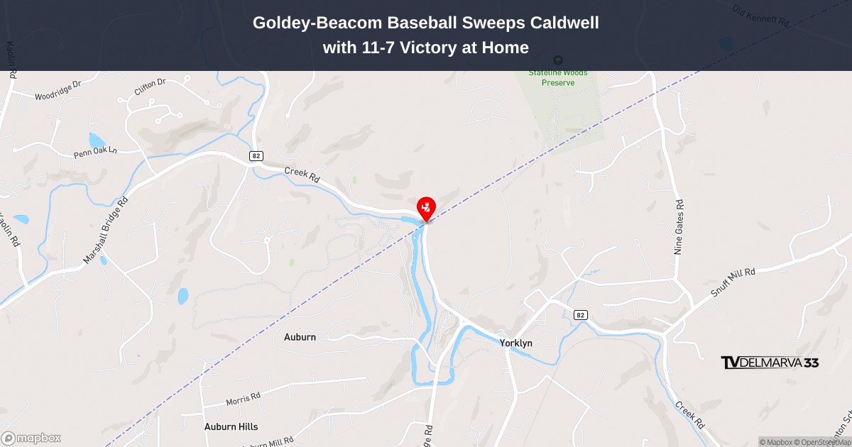
The Goldey-Beacom Lightning capped off a dominant series performance by defeating Caldwell University 11-7 in Central Atlantic Collegiate Conference action at their home field in Hockessin on Saturday.
The Lightning established their advantage early in the contest and successfully protected their lead to secure the victory at Doyle Field. The win completed a clean sweep of the three-game series against the visiting Cougars.
With the conference victory, Goldey-Beacom continues to build momentum in CACC play as they look ahead to upcoming matchups in their spring schedule.
Motorists traveling on southbound Interstate 95 are experiencing significant delays after a vehicle accident resulted in the closure of two traffic lanes near the Welcome Center.
Delaware Department of Transportation officials report that the collision has blocked multiple lanes, creating a bottleneck for drivers heading south on the major interstate corridor.
Traffic is being directed around the crash scene while emergency crews work to clear the roadway. Drivers are advised to expect delays and consider alternate routes if possible.
The duration of the lane closures has not yet been determined as authorities continue to manage the incident and investigate the circumstances surrounding the crash.
SALISBURY, Md. – Salisbury University’s softball team capped off an impressive performance on the concluding day of the Margie Knight Classic tournament held at Henry S. Parker Athletic Complex.
The Sea Gulls secured victories in both of their Sunday matchups, first defeating Carnegie Mellon University 7-6 in dramatic walk-off fashion, followed by a 6-4 triumph over SUNY New Paltz.
The double-header success concluded what proved to be a strong showing for the university’s softball program in the tournament competition.
The University of Delaware baseball team wrapped up their Conference USA series against Louisiana Tech this weekend, marking the end of their road trip to Louisiana.
The Blue Hens completed their three-game set with the Bulldogs as part of their ongoing Conference USA competition schedule.
Delaware continues to work through their conference slate as they compete in their inaugural season in Conference USA after joining the league this academic year.
The team will return home to continue their conference schedule in the coming weeks.
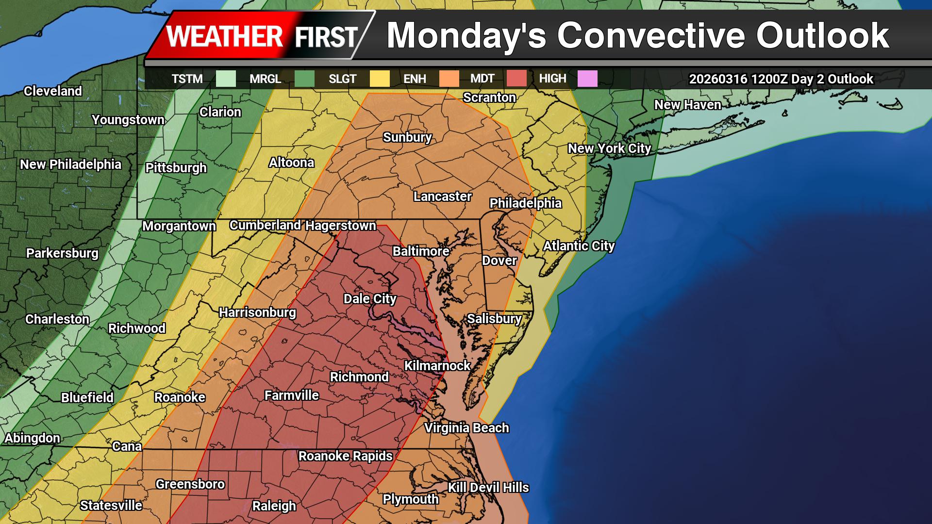
A potentially dangerous severe weather outbreak is expected to unfold Monday across parts of the Southeast and Mid-Atlantic, including Virginia, Maryland, and the Delmarva Peninsula. Forecasters warn that conditions may support widespread severe thunderstorms capable of producing destructive winds and tornadoes, some of which could be strong.
The Storm Prediction Center has placed portions of the region in a Moderate Risk (Level 4 of 5) for severe thunderstorms. This level of risk is relatively uncommon and indicates a higher likelihood of significant severe weather, including the potential for strong tornadoes and widespread damaging wind events.
Powerful Storm System Moving Into the East
The severe threat will be driven by a powerful storm system developing over the central United States. An expansive upper-level trough stretching from the Midwest into the southern Plains will rapidly intensify as it moves northeast toward the Appalachian Mountains. At the surface, a deep area of low pressure over the Great Lakes will track into eastern Canada while dragging a sharp cold front across the eastern United States.
Ahead of this cold front, warm and humid air will surge northward along the East Coast. Dew points climbing into the mid to upper 60s will provide ample moisture for thunderstorm development, while strong winds throughout the atmosphere will create an environment favorable for organized severe storms.
Tornadoes and Damaging Winds Possible
Across the Southeast and Mid-Atlantic, thunderstorms are expected to develop along and ahead of the advancing cold front during the day Monday. Some storms may initially form as discrete supercells, which are capable of producing large hail and tornadoes, including the potential for strong tornadoes.
As the afternoon progresses, storms are expected to organize into a line of thunderstorms, often referred to as a quasi-linear convective system (QLCS). This type of storm structure can produce widespread damaging wind gusts, while still maintaining the potential for embedded tornadoes within the line.
Strong winds just above the surface will enhance the rotation potential within storms. Even with only modest instability, these strong wind fields could allow storms to intensify quickly and produce severe weather across a large portion of the region.
Mid-Atlantic Threat Developing During the Afternoon
Farther north into Virginia, Maryland, and nearby areas, the amount of instability remains somewhat uncertain due to possible cloud cover and earlier precipitation. However, even relatively weak instability combined with very strong wind shear may still be sufficient to support severe thunderstorms.
Storms are expected to organize into a broad line extending from parts of New York and Pennsylvania southward through Virginia and North Carolina during the midday and afternoon hours. Within this line, embedded rotating storms could produce tornadoes and pockets of intense wind damage.
Severe Threat May Diminish Near the Coast by Evening
As the line of storms pushes east toward the Atlantic coastline Monday evening, the severe threat may gradually weaken as storms interact with cooler marine air near the coast. However, damaging winds and isolated tornadoes could still occur before the storms move offshore around sunset.
Preparedness Encouraged
With the potential for widespread severe weather, residents across the region should remain alert to changing conditions Monday. Multiple rounds of storms may occur, and warnings could be issued with little lead time if tornadoes develop.
Make sure you have multiple ways to receive weather alerts and be prepared to take shelter quickly if severe thunderstorms or tornado warnings are issued.
Dangerous weather conditions created havoc across multiple regions of the United States on Sunday, as heavy snowfall blanketed areas of the Upper Midwest and destructive winds caused damage throughout the Plains states.
The unpredictable weather pattern brought a mix of hazardous conditions to different parts of the country, creating challenges for residents and emergency responders dealing with the varied threats.
A massive weather system unleashed chaos across the United States on Sunday, blanketing the Upper Midwest with heavy snowfall while powerful winds tore through the Plains states. The severe conditions even reached Hawaii, where significant flooding struck multiple areas.
Weather forecasters warned that dangerous thunderstorms developing Sunday evening in the mid-South will move eastward, creating a serious tornado and high wind threat for much of the Eastern United States by Monday. The mid-Atlantic region, particularly around Washington D.C., faces the greatest danger.
“This system is going to impact the eastern half of the United States,” explained Tyler Roys, a senior meteorologist with AccuWeather. He warned that beyond risks to people and property, “whether it’s wind gusts from a squall line, blizzard or snow, or just wind because of the storm, you’re looking at several major airports being impacted.”
By Sunday morning, snowfall exceeded 12 inches across parts of Minnesota and Wisconsin, with the National Weather Service predicting several additional inches for the Minneapolis region under active blizzard warnings.
Travel became treacherous throughout Minnesota, Michigan, and Wisconsin as transportation authorities issued alerts about dangerous road conditions, poor visibility, and snow-covered highways.
“Roads are becoming impassable in many of Wisconsin’s northern counties,” the Wisconsin Department of Transportation posted on social media. “Please stay off the roads to keep yourself and others safe.”
Air travel suffered major disruptions, with FlightAware reporting over 600 flight cancellations at Minneapolis-Saint Paul International Airport on Sunday. Detroit’s airport also saw dozens of flights scrapped.
Central Wisconsin and Michigan’s Upper Peninsula could receive more than 24 inches of snow, with some isolated areas seeing even higher totals, according to Roys. He noted that even lighter accumulations expected in Chicago and Milwaukee through Monday will likely cause significant commuter problems.
Power outages from the weekend storm remained limited as of Sunday, but approximately 150,000 customers across Ohio, Pennsylvania, and Michigan were still without electricity following Friday’s winds that reached 85 mph, according to PowerOutage.us.
In Nebraska, about 30 National Guard members were activated to battle multiple wildfires spreading across rangeland and grasslands, the state’s Emergency Management Agency announced.
The three largest fires have scorched more than 900 square miles, including the Morrill County fire that has consumed over 700 square miles, officials reported.
One fire-related death occurred Friday, prompting Nebraska Governor Jim Pillen to urge residents to heed evacuation orders. He warned that Sunday’s winds were “supposed to be extraordinary.”
The National Weather Service issued high wind warnings for most of Nebraska Sunday, with gusts potentially reaching 60 mph combined with falling snow. Roys indicated that strong winds would affect areas from the U.S.-Mexico border to the Great Lakes, stretching from Denver east to the Appalachian Mountains.
Forecasters predicted a line of severe storms with destructive winds would sweep across much of the Eastern United States by late Monday, beginning Sunday afternoon in the Mississippi, Tennessee, and Ohio river valleys.
The storm system was expected to reach the Appalachians late Sunday and early Monday before advancing toward the East Coast, where “severe thunderstorms with widespread damaging winds and several tornadoes” were forecast for Monday daytime hours.
The National Weather Service identified a zone from parts of South Carolina to Maryland as most likely to experience particularly destructive winds Monday afternoon, potentially affecting Raleigh, North Carolina; Richmond, Virginia; and Washington D.C. An elevated but lower risk extended north into portions of New York and south to northern Florida.
Meanwhile, rain continued falling across Hawaii, where flooding has inundated farmland and homes, forced road closures, and opened emergency shelters.
Flash flooding has plagued Maui, Molokai, and the Big Island in recent days, with rainfall rates of 1 to 2 inches per hour overnight, the Hawaii Emergency Management Agency reported.
Approximately 48,000 electrical customers in Hawaii remained without power as of early Sunday, PowerOutage.us data showed.
The National Weather Service office in Mount Holly, New Jersey has issued a wind advisory affecting the region, beginning Friday, March 15 at 12:47 PM and remaining in effect until Sunday, March 17 at 2:00 AM.
This extended wind advisory spans nearly 38 hours, indicating sustained periods of strong winds that could impact outdoor activities and potentially cause property damage.
Residents are advised to secure loose outdoor items and exercise caution when driving, particularly in high-profile vehicles. The advisory suggests winds will be strong enough to warrant official notification from meteorologists.
The weather service typically issues wind advisories when sustained winds or frequent gusts pose a threat to people and property, though conditions are not expected to reach warning levels.