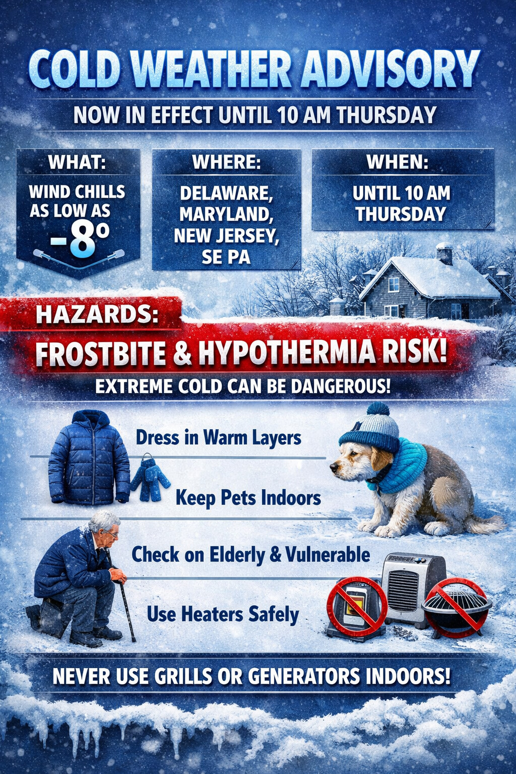
...COLD WEATHER ADVISORY NOW IN EFFECT UNTIL 10 AM EST THURSDAY...

* WHAT...Very cold wind chills as low as 8 below.

* WHERE...Portions of central, northern, and southern Delaware,
  northeast Maryland, central and southern New Jersey, and southeast
  Pennsylvania.

* WHEN...Until 10 AM EST Thursday.

* IMPACTS...The cold wind chills as low as 10 below zero could
  result in hypothermia if precautions are not taken. Frostbite and
  hypothermia will occur if unprotected skin is exposed to these
  temperatures.

PRECAUTIONARY/PREPAREDNESS ACTIONS...

Use caution while traveling outside. Wear appropriate clothing, a
hat, and gloves.

Keep pets indoors as much as possible.

Make frequent checks on older family, friends, and neighbors. Ensure
portable heaters are used correctly. Do not use generators or grills
inside.
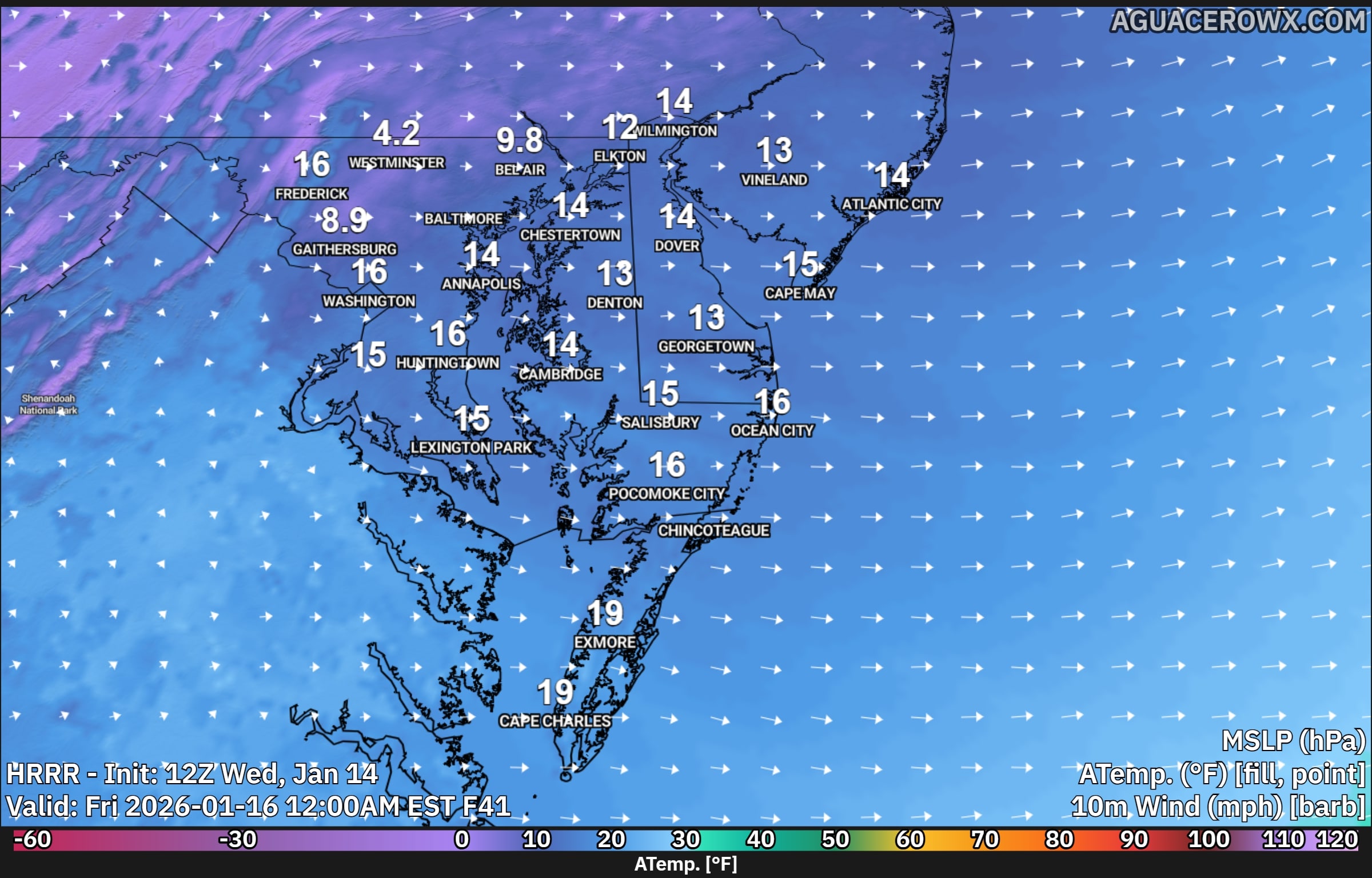
A surge of colder air behind a cold front will bring sharply colder temperatures and strong winds to the region late Thursday into Friday, creating dangerously cold wind chills.
After the cold front moves through Thursday morning, strong cold air will continue to pour into the area through Friday morning. Afternoon temperatures on Thursday are expected to remain stuck in the low to mid 30s, while west winds increase to 15 to 20 mph with gusts reaching 30 to 35 mph. These gusty winds will make it feel much colder, with wind chills struggling to climb out of the upper teens and lower 20s during the day.
As temperatures fall Thursday night, most locations will drop into the mid teens to near 20 degrees by early Friday morning. Although winds will ease slightly overnight, steady west winds of 10 to 15 mph will persist. This combination of cold air and lingering wind will cause wind chills to fall into the single digits across much of the area by daybreak Friday, with below zero wind chills possible in the higher elevations of the southern Poconos.
By Friday morning, the strongest push of cold air will begin to ease, allowing winds to turn more southwesterly and temperatures to slowly recover. Afternoon highs on Friday will range from the upper 20s to the mid 30s. However, continued breezy conditions will keep wind chills in the 20s for much of the day, making it feel colder than the actual temperatures suggest.
Residents are encouraged to dress in layers, limit prolonged exposure to the cold, and take precautions to protect pets, pipes, and vulnerable populations during this stretch of cold and windy weather.