Tag: trough

  • Storm Signal Jan 16-17th / Winter Storm Looming?

    Storm Signal Jan 16-17th / Winter Storm Looming?

    GFS Model Showing Major Snowstorm

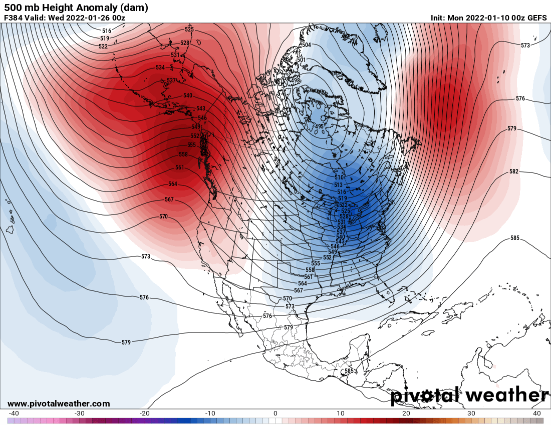
    Like I was mentioning yesterday, we are heading into a fairly volatile pattern to finish out the month of January. With the Polar vortex anchoring around the Hudson Bay, this will allow a persistent long wave trough across the Eastern half of the nation. And boy these long range models are showing a train of them to say the least. As of now there is no one solution in this matter. In fact there is two scenarios in which this system will go.

    Vorticity Forecast

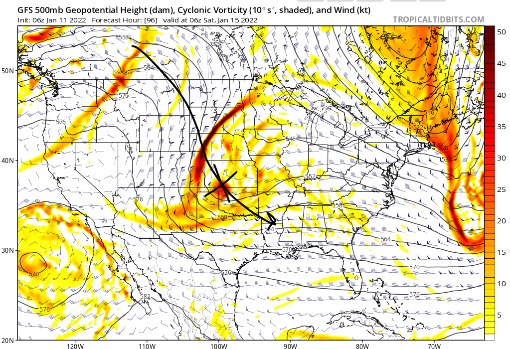
    First off, This piece of energy will be associated with the northern stream jet-stream coming down from Canada. Which normally our coastal storms like to be coming from the sub-tropical jets stream from the south. But being this is diving deep down into the Gulf States, Its going to pay the southern stream a visit.

    Here’s the two scenarios we are looking at right now.

    ECMWF showing a suppressed solution

    Here’s the two possible outcomes I am seeing so far. All depends on two factors, one with the energy diving southward and becomes very suppressed by a strong area of high pressure over the Northeastern United States (Option 1). This will keep the storm very far south delivering some light snow to areas of the deep south. And a much weaker solution.

    GFS showing a major storm with scenario 2

    Option two would be a large snowstorm to start back over towards Missouri, plowing for the deep south and then intensify rapidly as a sub 980mb low off of our coasts. The high pressure system suppress the storm to the south and a very steep ridge over the western US allowing this piece of energy to become “negative tilted”.

    Both options are possible at this time, we just need to see more consistency in either direction to know that this is a false alarm or we got another big storm on our hands down the road.

  • Polar Plunge To Finish Out January

    Polar Plunge To Finish Out January

    Large Trough Across The Eastern US

    We went from a extremely warm month of December, to now a January with a vengeance. With 2 snow events in our books and one being the biggest snowstorm in 4 years. We are not going to be done with those snow chances to finish out the month of January. The tropospheric polar vortex will remain quite dominate across Canada with a constant serious of troughs throughout the eastern half of the nation. With the polar vortex hanging around the Hudson Bay, this will allow several short waves to dip down from the Northern Plains all the way to the East Coast.

    ECMWF EPS 500mb Heights

    We are looking at a text book setup for cold and stormy across the eastern half of the nation. Strong ridging across the Pacific Northwest. Ridging over Greenland to act as a block for the persistent troughing across the Eastern US. This created the perfect Rossby Wave pattern for those who love the cold and snow. What is a Rossby Wave anyway? Rossby waves, also known as planetary waves, naturally occur in rotating fluids. Within the Earth’s ocean and atmosphere, these waves form as a result of the rotation of the planet.

    Two sets of Omega Blocks across the Northern Hemisphere pattern. (Omega blocks get their name because the upper air pattern looks like the Greek letter omega (Ω). Omega blocks are a combination of two cutoff lows with one blocking high sandwiched between them.) This keeps these patterns locked in for an extended period of time. Like in this instance for the rest of the month. Get ready to see more arctic outbreaks and snow chances this month going forward. Several storm signals are becoming apparent beginning the 15th through the 26th.