Tag: snowfall

  • Accumulating Snow On The Way For Sunday; Followed By Arctic Blast

    Accumulating Snow On The Way For Sunday; Followed By Arctic Blast

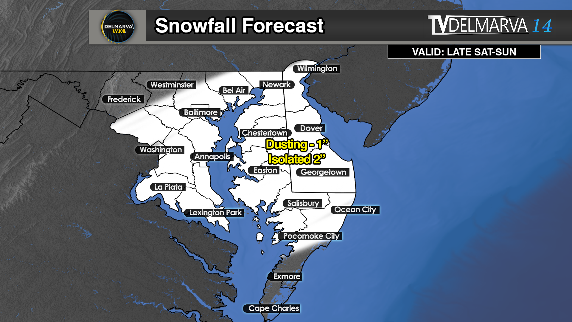
    Another round of accumulating snowfall is on tap for this weekend during the early morning hours Sunday through the late morning hours. A Clipper system approaching from the Mid-west will begin to redevelop a coastal low will bring a band of light to moderate snowfall to the region on Sunday as a arctic frontal boundary moves through bring severely cold temperatures throughout the Eastern US.

    Looks like right now areas across Northern Maryland, Northern Delmarva, and South Jersey will be in the hot seat for seeing the most accumulating snow when the coastal low begins to take over. A widespread swaft of 2-4 inches of snow seems probable with areas further south will have lighter precipitation to deal with overall. Making for Sunday morning travel a bit slick with temperatures in the upper 20s and the winds begin to pick up later in the day for some blowing and drifting.

    An Arctic air mass is moving southward, bringing dangerously low temperatures and life-threatening wind chills across a broad swath of the central US, from the Northern Plains towards the Mid-Atlantic

    Temperatures are forecasted to plunge 20 to 30 degrees below normal, with wind chills dropping below -30°F in some areas. This extreme cold poses serious risks to human health, pets, and infrastructure, including the potential for frozen pipes.

    Residents in the affected regions are urged to prepare immediately by taking steps to protect themselves, their animals, and their homes. The agencies emphasize the importance of readiness to mitigate the harsh impacts of this severe weather event.

  • Snowfall Forecast Regrading Thursday & Friday

    Snowfall Forecast Regrading Thursday & Friday

    Another light to moderate snow event is on the table going into later Thursday and Friday all thanks to a Clipper system sliding to our south. And then redeveloping off of our coastlines bringing back a inverted trough through northern Delmarva and Southern New Jersey. Enough to make for a plowable snow event for the region.

    Snow could become heavy at times north of Dover once the energy begins to transfer off the coastal of New Jersey. When this happens, a potential inverted trough or “trowal” develops with a corridor of enhanced moisture pointing back towards the coast.

    What is a trowal exactly? (warning it’s term heavy) A trowal is a trough of warm air aloft. Typically used during winter weather, it is a “tongue” of relatively warm/moist air aloft that wraps around to the north and west of a mature cyclone. It is best analyzed between 750-550 millibars using equivalent potential temperature (theta-e). Areas of intense lift and frontogenesis are commonly associated with TROWALs, hence they are favored regions for heavy and/or prolonged precipitation. During a winter storm, the heaviest snowfall amounts frequently occur along and north of the TROWAL axis.

    This area will have the greatest shot of getting near that 5 inch mark throughout the day on Friday. Snow will move in during the predawn hours Friday and continue into the evening hours.

    Still will be seen across much of the region before a big warm up trend will be arriving towards next week. Heaviest amounts of 2-5″ will be likely across Northern Maryland, Northern Delmarva, and most of Southern New Jersey. Further south will be dealing with less precipitation overall with the primary axis of moisture will be positioned just to north. Subsequently with lesser amounts over all but that can change depending on the track of this TROWAL and low placement in later outlooks.

  • Wintry Valentines Day Weekend Ahead

    Wintry Valentines Day Weekend Ahead

    Get ready for another extreme weather day here on Delmarva where we are going from spring like warmth straight back to winter in a matter of 12-24 hours. Although snow is in the forecast, we are not expecting anything substantial at all to ruin those holiday plans on Sunday.

    With temperatures rising into the mid 60’s on Saturday, a strong arctic front will be moving into the region during the overnight hours allowing temperatures to plummet down to sub-freezing by 7am Sunday. With the interaction of the front, a strong jet stream, and an area of low pressure developing well off the coast will cause a round of snow to develop in the Mid-Atlantic. Depending on the speed and intensity of the precipitation, a Dusting to an inch isn’t out of the question. Now some areas may get 2 inches if they are lucky. By the afternoon hours, snow will move out of the picture with even colder conditions that night.

    Surprisingly, we have decent agreement among the model guidance showing rain transitioning over to a period of snow Sunday morning. Some a little heavier solutions but given the warmer ground we will see a little bit of melting. Regardless, we will keep adding to our above average snowfall totals for the season.