Tag: satellite

  • NOAA’s SWFO-L1 Space Weather Observatory Nears Final Orbital Position, Systems Reported Healthy

    NOAA’s SWFO-L1 Space Weather Observatory Nears Final Orbital Position, Systems Reported Healthy

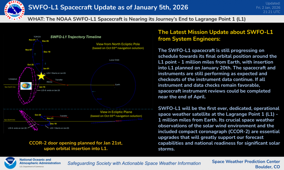
    January 6, 2026 — NOAA’s Space Weather Follow On-L1 (SWFO-L1) spacecraft is nearing the final stages of its journey to Lagrange Point 1 (L1), with orbital insertion scheduled for January 20, 2026. According to a NOAA Space Weather Prediction Center update, the mission’s instrumentation is performing as expected, and engineers report that the spacecraft continues to meet operational milestones as it approaches its final orbit.

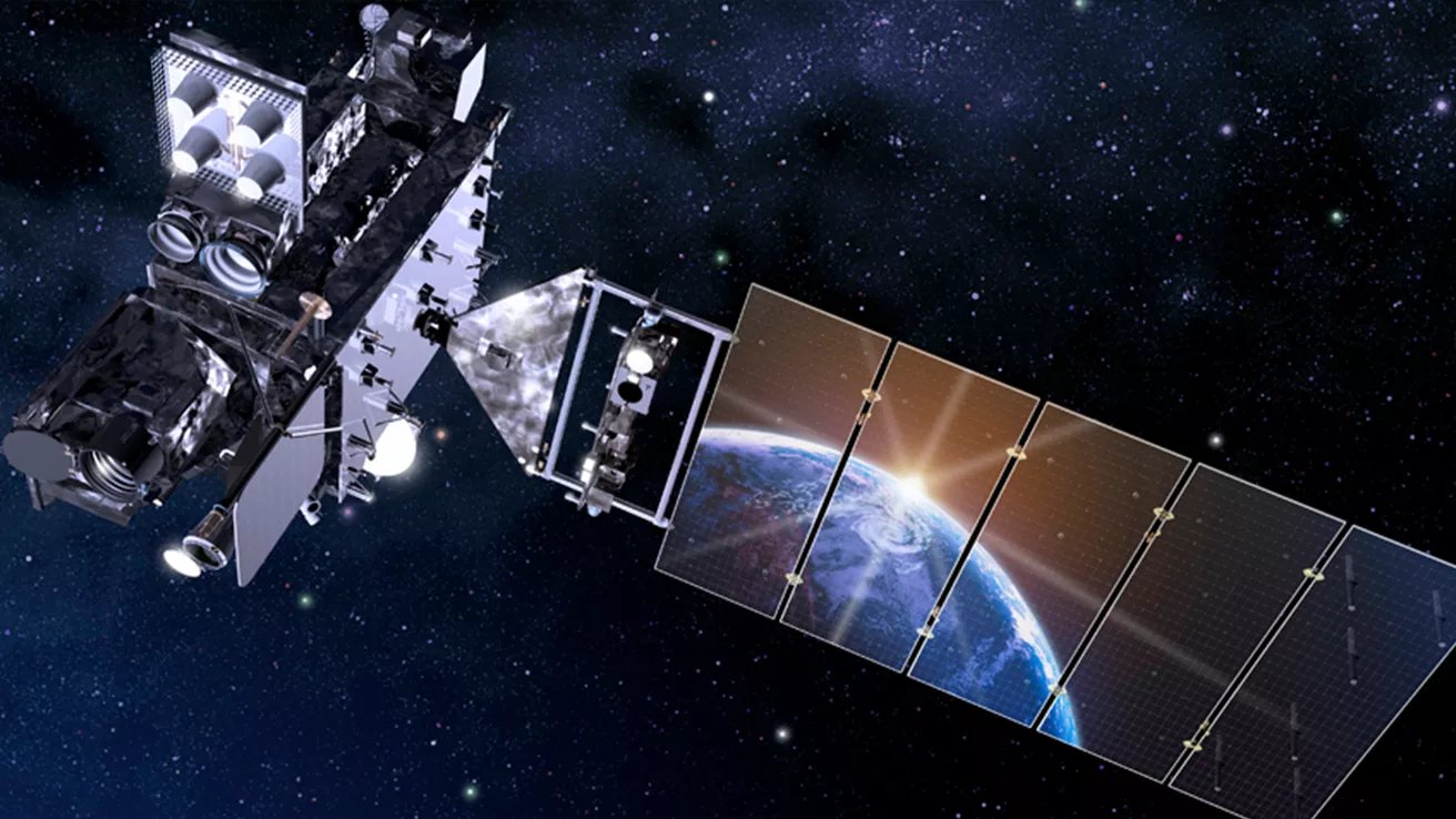
    SWFO-L1 was launched on September 24, 2025 aboard a SpaceX Falcon 9 rocket and is designed to provide continuous, real-time monitoring of the solar environment upstream of Earth. Upon reaching the gravitationally stable L1 point—approximately 1 million miles from Earth—it will be renamed SOLAR-1 (Space weather Observations at L1 to Advance Readiness-1).

    Mission engineers are preparing to open the compact coronagraph (CCOR-2) door on January 21, the day after insertion, which will allow NOAA to begin evaluating imagery performance from this key instrument. Early tests of other sensor suites have already shown promising results.

    SWFO-L1 carries several advanced instruments, including a magnetometer, solar wind plasma sensor (SWiPS), and a supra-thermal ion sensor (STIS). These instruments will provide vital measurements of solar wind speed, density, and magnetic field characteristics that drive space weather disturbances. Previous early data from these sensors have already contributed to improved monitoring of solar wind and geomagnetic conditions during space weather events.

    Once commissioned in spring 2026, SOLAR-1’s data is expected to significantly enhance NOAA’s ability to forecast and issue warnings for geomagnetic storms, solar flares, and interplanetary shocks that can impact critical infrastructure such as power grids, communications, navigation systems, and satellites.

    With more accurate and timely space weather data, NOAA officials say the mission will help protect both space-based and ground-based technological systems that are increasingly vulnerable to solar activity—ensuring better preparedness for potentially disruptive solar events.

  • GOES-19 Goes Operational Across The US

    GOES-19 Goes Operational Across The US

    A very exciting day in the weather world. Welcome to GOES-19, the brand new updated satellite covering the United States is now in operation!

    GOES-19, formerly known as GOES-U, introduces significant enhancements over its predecessor, GOES-16, particularly in space weather monitoring. A notable addition is the Compact Coronagraph-1 (CCOR-1), the nation’s first operational coronagraph, designed to observe the solar corona and detect coronal mass ejections (CMEs). This instrument provides imagery within 30 minutes of acquisition, a substantial improvement over the previous system’s eight-hour delay, thereby enhancing space weather forecasting capabilities.

    GOES-19 continues the high-temporal resolution imaging capabilities introduced with the GOES-R series but maintains and enhances rapid updates for weather monitoring.

    • Full-Disk Updates Every 5 Minutes: GOES-19 can scan the entire Earth every five minutes, providing near-real-time global coverage to track weather systems, storms, and environmental changes. This allows meteorologists to monitor rapidly developing weather patterns with high-frequency updates.
    • Mesoscale Region Updates Every 30 Seconds: In high-impact weather events, GOES-19 can focus on two mesoscale sectors simultaneously, delivering images every 30 seconds per region. This is crucial for tracking severe thunderstorms, hurricanes, wildfires, and other rapidly evolving atmospheric phenomena, offering nearly real-time updates for forecasters.

    These rapid update capabilities, combined with its advanced instruments like the Advanced Baseline Imager (ABI) and Geostationary Lightning Mapper (GLM), allow GOES-19 to provide even more detailed and timely data, improving short-term forecasting, severe weather warnings, and disaster response efforts.

    ​GOES-19, previously known as GOES-U, introduces several advanced features over its predecessor, GOES-16, enhancing both Earth and space weather monitoring capabilities.​

    Enhanced Magnetometer (GMAG): GOES-19 is equipped with an upgraded magnetometer that offers improved measurements of Earth’s magnetic field compared to earlier GOES-R series satellites.

    These advancements position GOES-19 as a critical asset in NOAA’s mission to provide timely and accurate environmental data, ensuring improved forecasting and preparedness for both terrestrial and space weather phenomena.