Tag: New Castle County

  • An Icy Boxing Day On The Way For The Mid-Atlantic States

    An Icy Boxing Day On The Way For The Mid-Atlantic States

    Its shaping up to be a fairly icy day after Christmas for many across the Mid-Atlantic states Friday into Saturday. A classic “Overrunning Event” to unfold as a warm front moves into arctic air that’s trapped across New England forced by northeast winds ahead of the precip.

    An overrunning event in winter meteorology occurs when warm, moist air is lifted up and over a shallow layer of cold air at the surface. This setup is common ahead of winter storms and often develops north of a warm front. Because cold air is denser, it remains trapped near the ground while warmer air flows over it along sloping isentropic surfaces.

    As the rising warm air cools, clouds and precipitation develop well in advance of the main storm system. In winter, this frequently leads to widespread, long-duration precipitation, often falling as snow, sleet, or freezing rain, depending on the temperature profile of the atmosphere. Overrunning events are typically associated with stratiform precipitation, lower visibility, and steady rather than convective rainfall or snowfall.

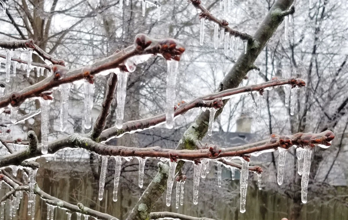
    These events can produce significant winter weather impacts, including heavy snow accumulations, ice accretion, and hazardous travel conditions, especially when cold air is reinforced at the surface by high pressure to the north. Overrunning precipitation often marks the initial phase of a winter storm before stronger dynamics and surface low pressure move in.

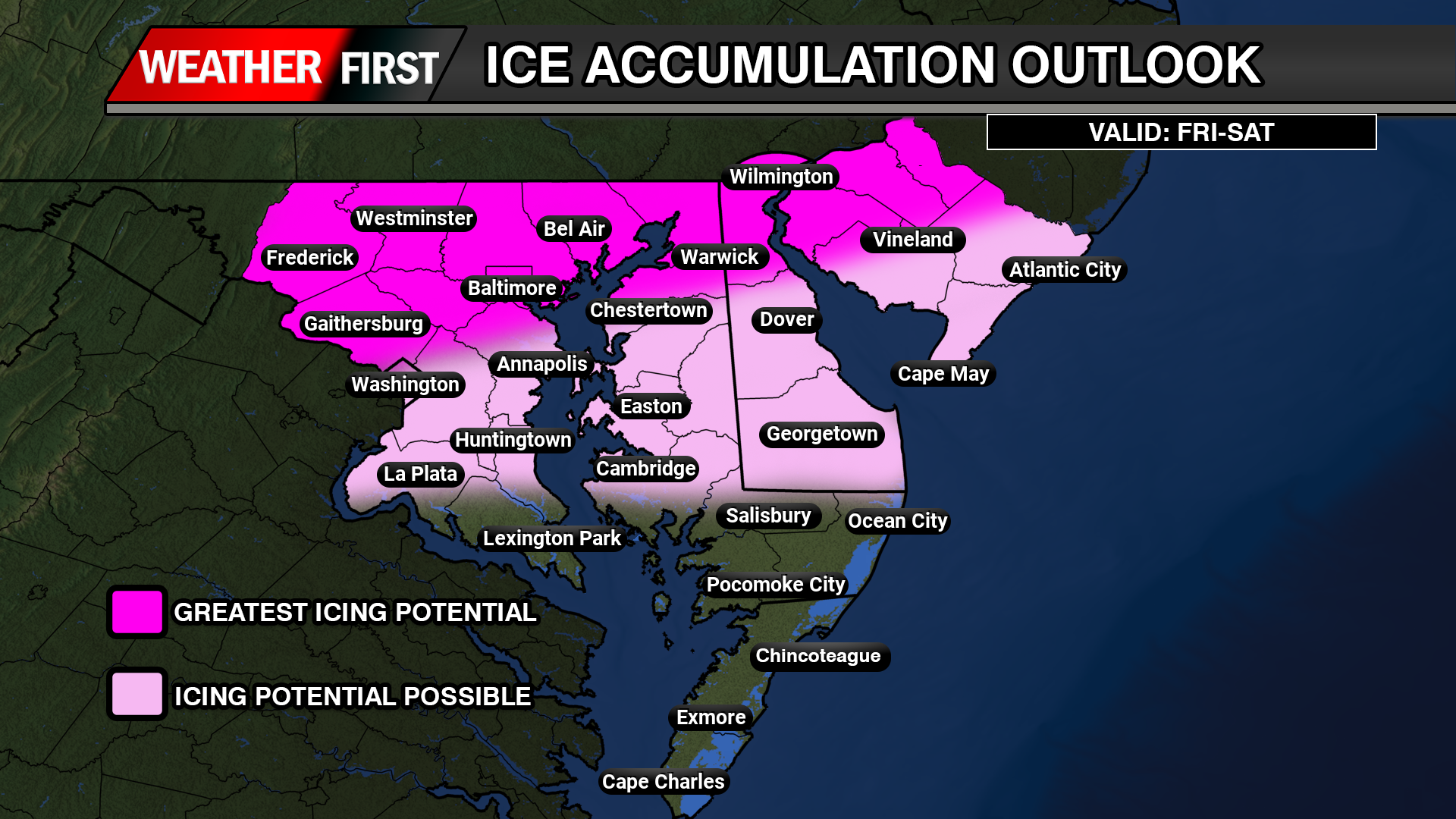
    With the latest guidance at this time, areas closer towards the Mason-Dixon have the greatest threat for looking at snow and ice accumulations as the cold air will be locked up better in those regions. totals wise at this time is not for certain the amount of snow/ice is expected with this system as we get a bit closer in time. Areas across Central Delmarva will start off with that wintry mix but eventually change over to plain rain as the winds turn a bit more easterly which will bring in that warmer Atlantic air across the region.

  • Wintry Mix Threatens Central and Northern Delmarva Again with Ice Accretion and Slick Travel This Weekend

    Wintry Mix Threatens Central and Northern Delmarva Again with Ice Accretion and Slick Travel This Weekend

    A complex winter weather system is set to impact portions of central and northern Delmarva, bringing a mix of snow, sleet, and freezing rain as temperatures hover near the freezing mark towards early Saturday afternoon. This system will create hazardous travel conditions, especially in areas where freezing rain leads to ice accretion.

    Weather Setup and Model Guidance

    Latest guidance from the ICON, GFS, and ECMWF suggests that cold air at the surface will remain entrenched across northern Delmarva, allowing for a prolonged period of wintry precipitation before a gradual changeover to rain. Meanwhile, high-resolution CAMS guidance, including the HRW-WRF & NAM12KM, continues to highlight higher localized areas of ice accumulation, particularly in northern regions where cold air remains stubborn.

    As the system moves through, precipitation is expected to start as a wintry mix of snow, sleet, and freezing rain across northern and central Delmarva, with surface temperatures struggling to rise above 32°F. By early afternoon, warmer air aloft will cause much of central Delmarva to transition to plain rain, while northern Delmarva may see continued ice accretion before the system exits early Sunday.

    Potential Ice Accretion and Travel Hazards

    • Ice Accumulation: Up to 0.10” of ice is possible across northern & central Delmarva, with localized higher amounts in areas where freezing rain persists.
    • Travel Impacts: Slick roadways and hazardous conditions are expected, particularly on bridges and overpasses. Untreated surfaces may become icy and dangerous.
    • Timing: The wintry mix will continue through early afternoon, with a gradual transition to rain in central Delmarva through the evening hours. Northern areas may hold onto freezing rain longer before precipitation moves out early Sunday morning.

    Stay Weather Aware

    Residents across central and northern Delmarva should stay updated with the latest forecasts, as even small changes in temperature could impact precipitation type and ice accumulation. If traveling, exercise caution and allow extra time, especially in areas where freezing rain may linger.

  • DHSS Providing Warming Stations Across The State During The Arctic Outbreak

    DHSS Providing Warming Stations Across The State During The Arctic Outbreak

    ❄️ As we brace ourselves for the frigid days ahead, the Department of Health and Social Services (DHSS) is here to support our beloved community during this harsh winter season. We understand how challenging it can be to face the biting cold, which is why we are taking proactive steps by opening warming stations. These stations are designed to provide warmth and comfort to everyone in need, ensuring that no one feels isolated or uncomfortable during this season.

    📅 We invite you to join us on Tuesday, January 21, from 9 a.m. to 3:30 p.m., and Wednesday through Friday, January 22-24, from 8 a.m. to 4:30 p.m. Our warming stations will be available at various designated locations throughout the county. These spaces have been created to ensure a secure, inviting environment where anyone can find refuge from the chilly conditions.

    ❗ Remember, no one should have to face this frigid weather alone. Together, let’s ensure that everyone in our community can stay safe, warm, and cared for during these cold days. Every bit of support makes a difference!

    🗺️ Be sure to check the accompanying graphic for the specific locations of the warming stations available in your county. This important information will help you or someone you know find shelter from the cold.

    ❤️ Let’s come together to spread the word and keep an eye out for one another. If you or someone you know could benefit from a warm place to go, please don’t hesitate to visit us. Your safety and comfort are our utmost priority this winter!

  • Newark Road Closures To Affect Several Neighborhoods

    Newark Road Closures To Affect Several Neighborhoods

    On Saturday, 3/26/2022, the First State Half Marathon will be taking place, in the City of Newark, with approximately 350-400 runners expected to participate. The course begins and ends on Orchard Road in the area of Amstel Avenue and will effect traffic in the following neighborhoods: Devon Binns, Oaklands, and Nottingham Green, as well as effecting traffic along West Park Place, East Park Place, Chrysler Avenue, Apple Road, Hillside Road, Casho Mill Road, and Barksdale Road. The race is scheduled to begin at 8:00 AM, with all roads being open and free of runners by approximately 12:00 PM. Please drive cautiously and watch for runners if you are in any of the effected areas.

  • Gold Alert Issued For Mother and Newborn Child

    Gold Alert Issued For Mother and Newborn Child

    Delaware State Police Troop 6 is issuing a Gold Alert for Nina Leona Caulk, 40, of New Castle County. Nina was last seen on March 19, 2022, at approximately 1:00 p.m., in the area of Ogletown Stanton Rd., Newark, with her newborn daughter. Attempts to locate Nina have been unsuccessful and there is a concern for Nina and her newborn daughter’s safety.

    Nina is described as a light skin black female, black hair, brown eyes, 123 lbs., and approximately 5’06” tall.

    The only descriptive information available regarding the infant is she is a black female that is approximately 1 week old. (No photograph is available).

    Nina and the infant are possibly traveling in an unknown vehicle in Virginia.