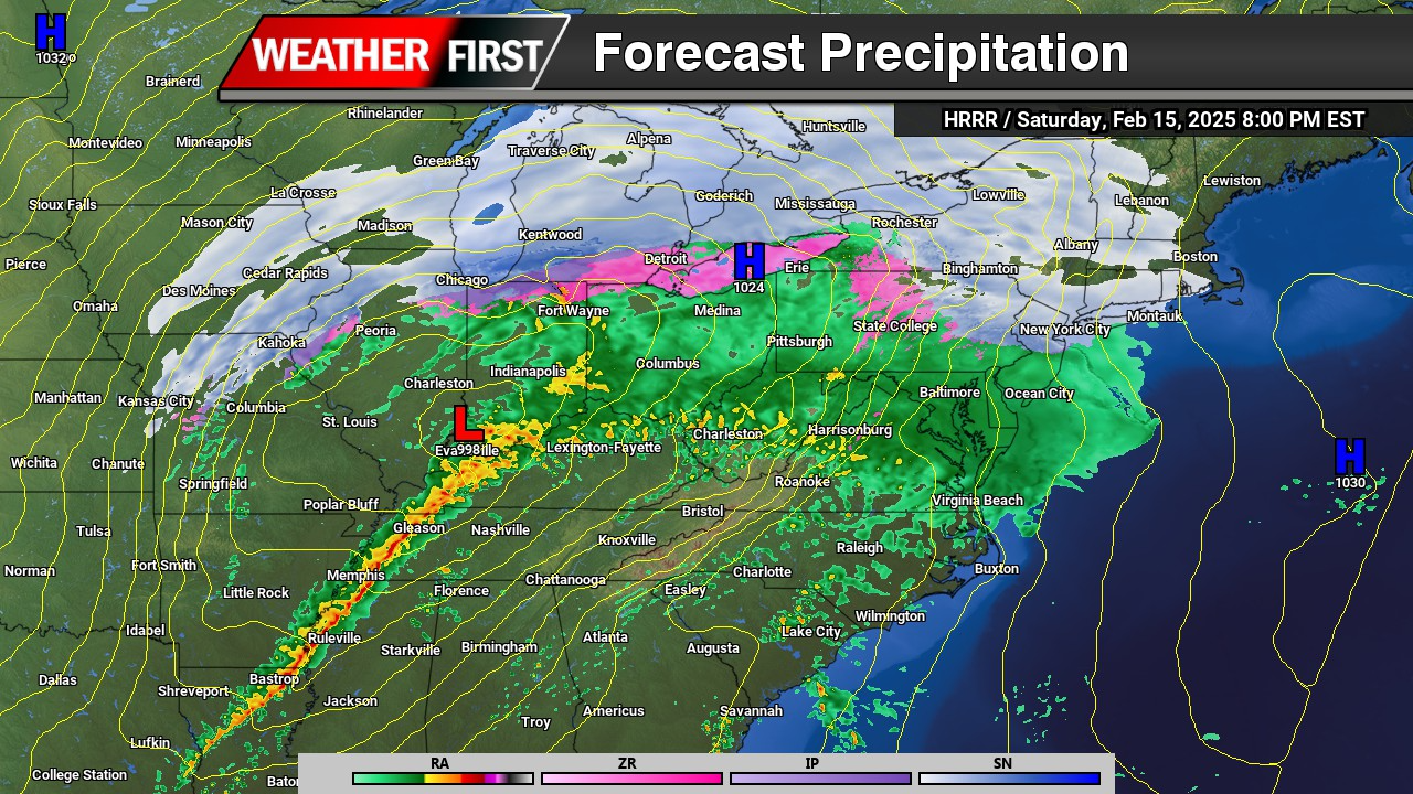


If you were hoping to have a nice weekend ahead with good weather, this is not the weekend for it. Although the rain is welcomed and very beneficial for the ongoing extreme drought we are in, makes for plans to be remaining indoors. Rain will begin to move into the region during the afternoon hours on Saturday as a warm front lifts through. Rain will be heavy at times after dark through the morning hours.


There will be a lull in the precipitation heading into the later morning hours on Sunday but we will see a noticeable increase in temperatures surging into the mid 60s. A cold front will be arriving later in the after hours bringing back the heavy rainfall and maybe even a few gusty thunderstorms are possible.

The Storm Prediction center already highlighting a “Marginal” risk of severe weather for the afternoon hours on Sunday as a potential thing line of storms may form along the cold front. Although not expecting widespread thunderstorm development, a few rogue storms are not out of the question.

Rainfall on the order of 1-2 inches is very plausible before tapering off Sunday night across the region. Might be some low lying area flooding with the recent rainfall events and the major snow melt from a few days ago.
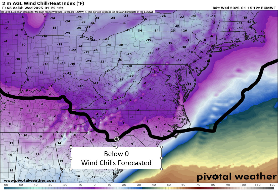

 Severe Cold Weather Alert: An Arctic air mass is forecasted to sweep across a significant portion of the United States this weekend!
  From the Rockies to the Great Plains, this frigid air will reach the Gulf Coast by Saturday night and move towards the Eastern Seaboard by Sunday evening.
 Extremely Low Wind Chills: The Rockies, northern Plains, and Upper Midwest are expected to experience dangerous wind chills as low as -30°F or even lower from Saturday through Tuesday. This extreme cold poses serious risks of hypothermia and frostbite for individuals exposed to these conditions. If you plan to travel, ensure you have a cold weather survival kit prepared for your safety.
 Furthermore, below-zero wind chills are anticipated to extend into the southern Plains and the Ohio Valley from Sunday night through Tuesday. The hazardous cold is likely to persist along the Gulf Coast and across the Southeast U.S. for much of the following week. Stay warm and take all necessary precautions during this severe cold snap!