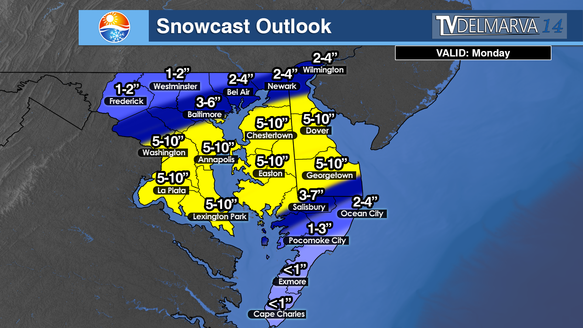

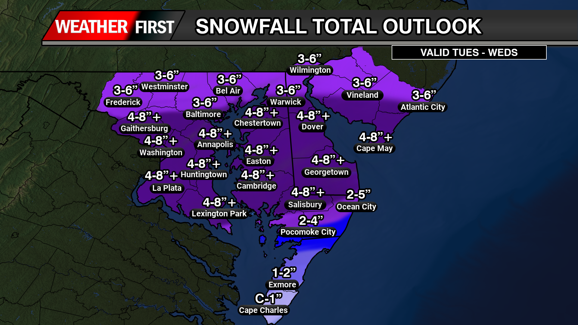
Forecast confidence is increasing that a potentially impactful winter storm could affect the Delmarva region late Saturday through Sunday, though important details regarding track and snowfall amounts remain uncertain at this time.

Weather patterns aloft are becoming increasingly active as we head toward the weekend, with interactions expected between northern and southern jet stream systems. The energy driving this setup is currently located over the Arctic and the Pacific Ocean, meaning it will take several more days for forecasts to fully resolve how this system evolves. Even so, most forecast guidance now consistently shows an area of low pressure developing near Texas on Friday before moving east along the Gulf Coast into Saturday.

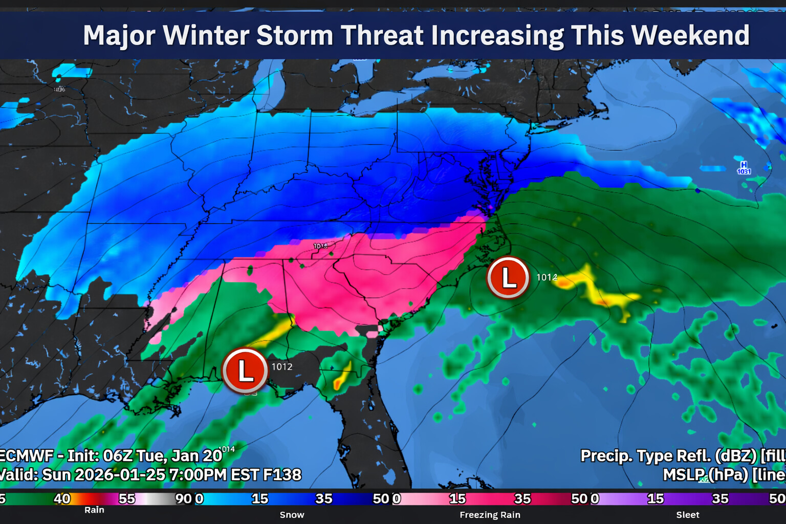
As the system approaches the East Coast, guidance generally favors the low tracking northeast toward the North Carolina coast before moving offshore late Sunday into early Monday. This type of track would place Delmarva on the colder, northern side of the storm, increasing the potential for winter weather impacts across the region. A key question remains how close the storm tracks to the coastline, as even small shifts could have a major influence on snowfall totals.
A strong arctic high pressure system will be positioned to the north, supplying cold air into the Mid Atlantic. Earlier forecast guidance suggested this high might suppress the storm farther south, limiting impacts locally. However, trends over the past 12 to 24 hours show the storm track edging farther north, increasing the likelihood that precipitation spreads into Delmarva.

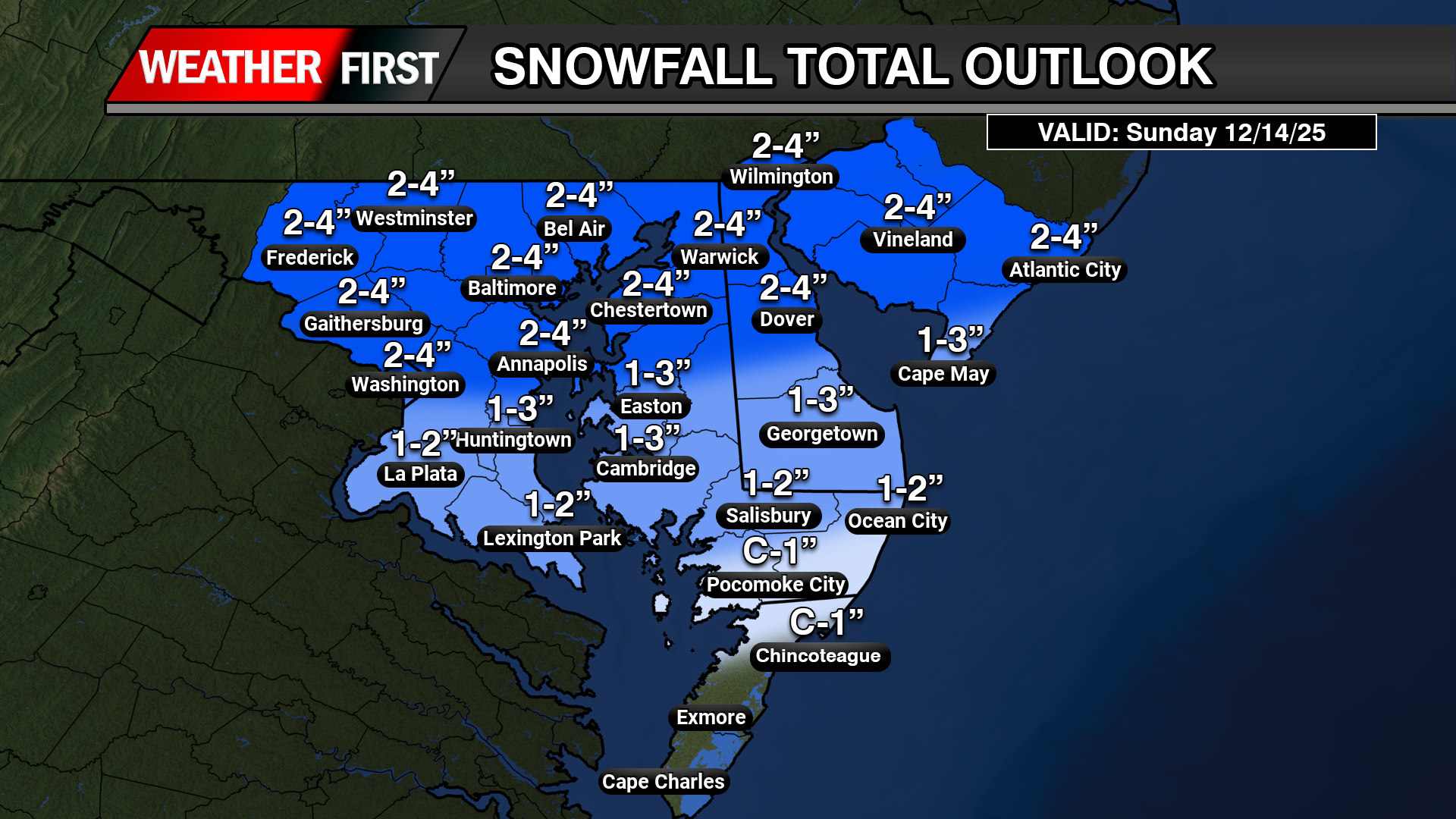
Snow probabilities have responded accordingly. Current guidance now indicates a 75 to 95 percent chance of at least 2 inches of snow and a 70 to 85 percent chance of 6 inches or more for areas along and south of the Interstate 95 corridor, with probabilities decreasing farther north.

Even more impressive with NBM blends of >12 inches of snow are between 50-60% as of this morning. These numbers are notably higher than those from previous forecast cycles and point toward a growing signal for a meaningful winter weather event.
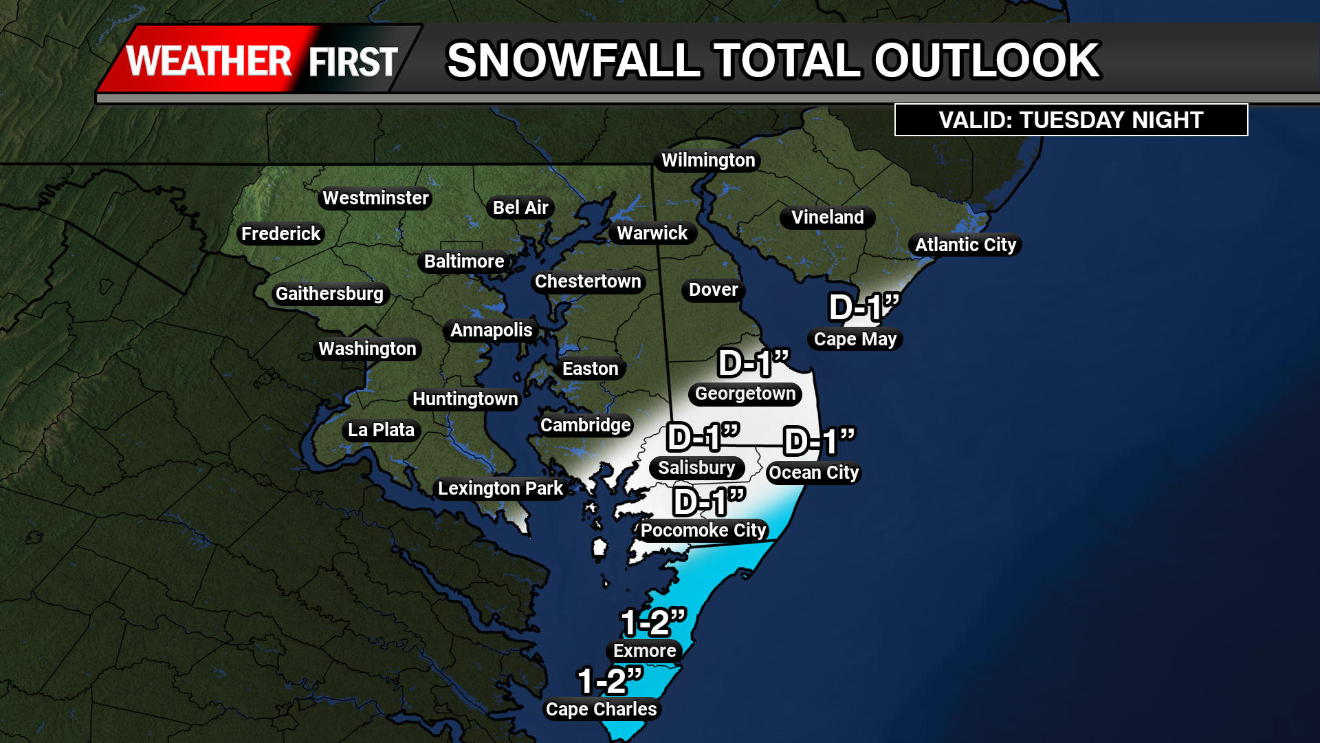
If this storm materializes, snowfall could begin late Saturday and continue through Sunday, with the potential for lingering impacts into Monday depending on how quickly the system moves away. While confidence in exact snowfall totals remains low, the overall signal for a winter storm affecting at least part of Delmarva is stronger than typically seen at this lead time.
It is important to note that East Coast winter storms often produce narrow bands of heavy snow, sometimes only 50 to 100 miles wide. With the storm’s key ingredients still thousands of miles away, it is far too early to determine which specific locations will see the highest accumulations. Residents across Delmarva should continue to monitor forecast updates closely over the coming days as details become clearer.
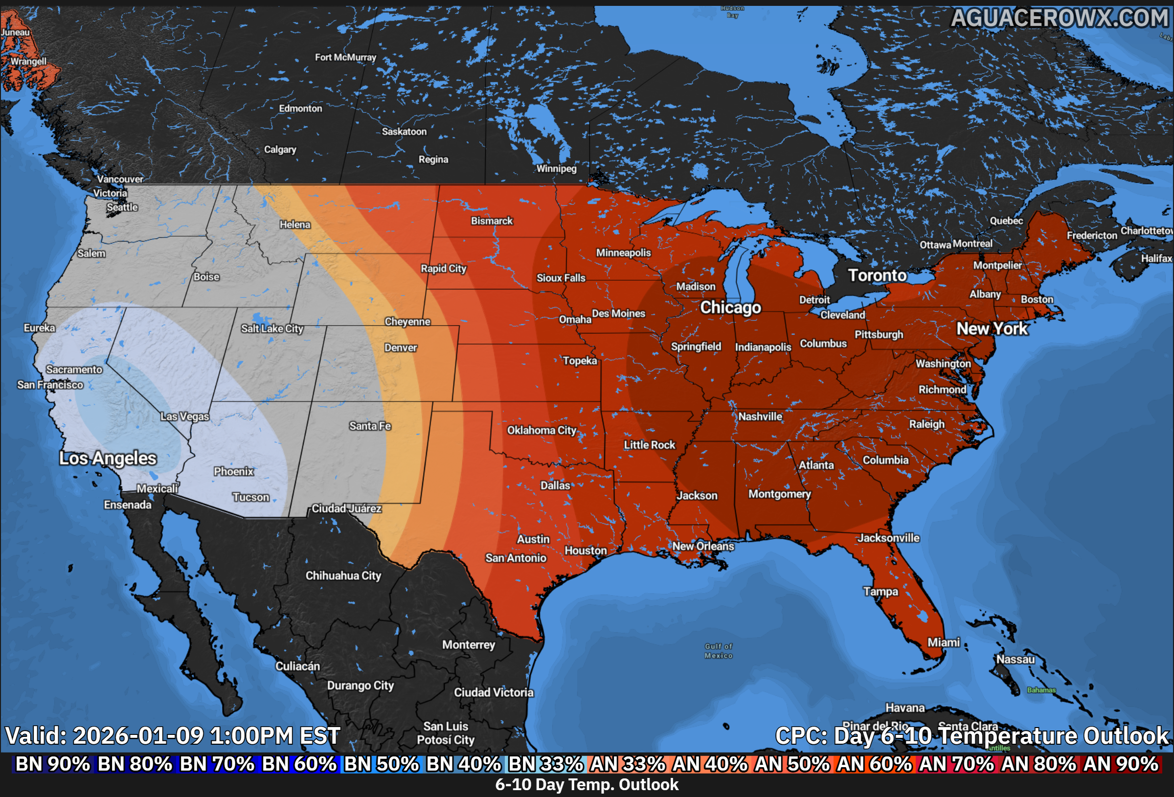


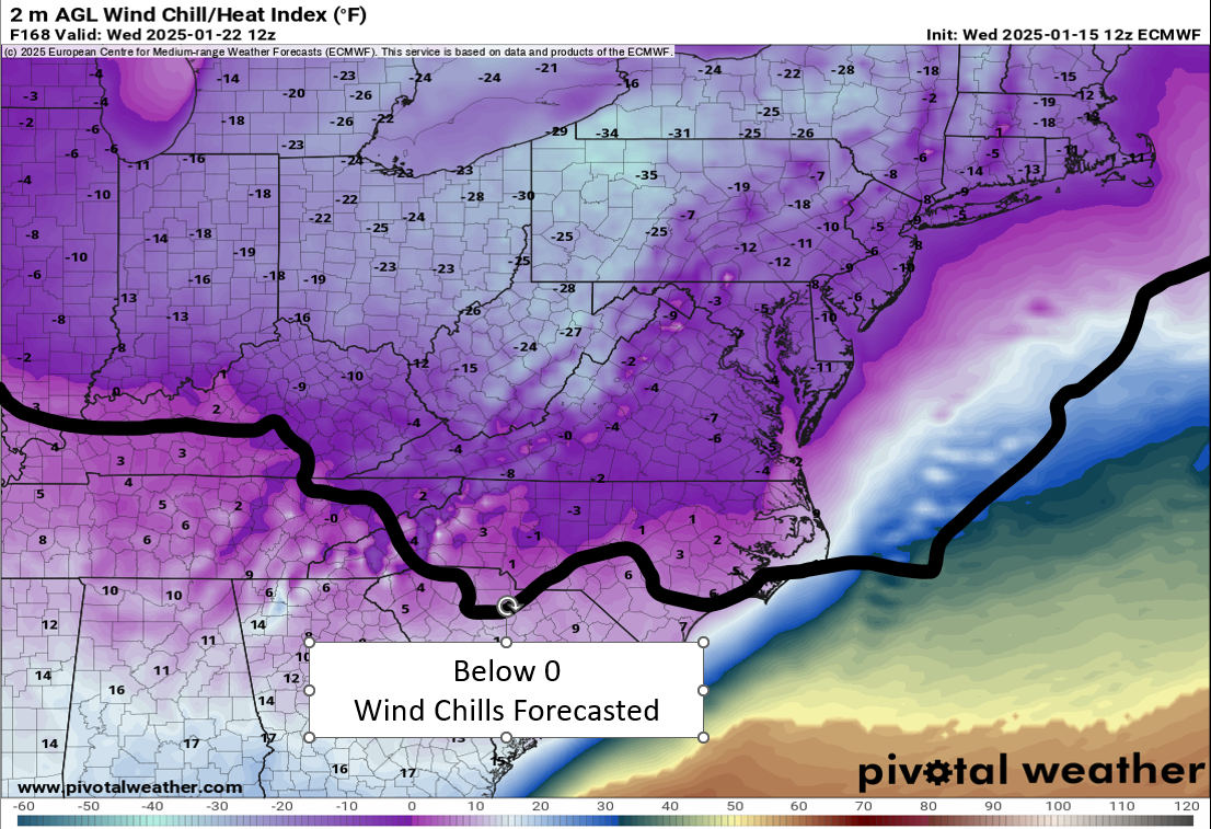

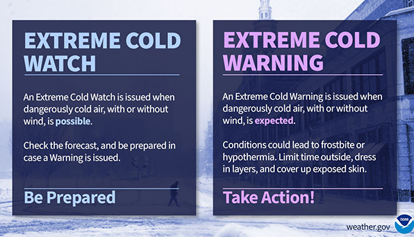
 Severe Cold Weather Alert: An Arctic air mass is forecasted to sweep across a significant portion of the United States this weekend!
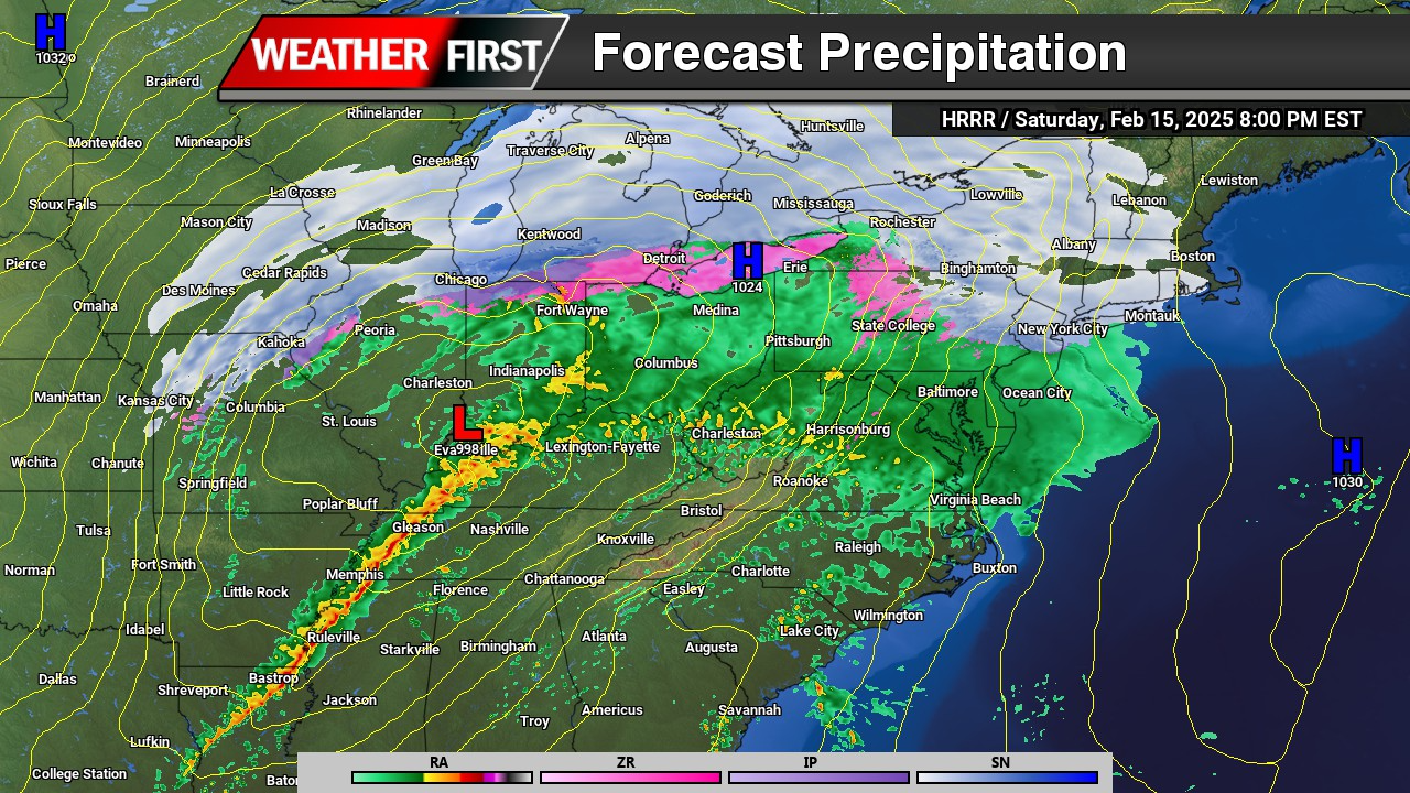
  From the Rockies to the Great Plains, this frigid air will reach the Gulf Coast by Saturday night and move towards the Eastern Seaboard by Sunday evening.
 Extremely Low Wind Chills: The Rockies, northern Plains, and Upper Midwest are expected to experience dangerous wind chills as low as -30°F or even lower from Saturday through Tuesday. This extreme cold poses serious risks of hypothermia and frostbite for individuals exposed to these conditions. If you plan to travel, ensure you have a cold weather survival kit prepared for your safety.
 Furthermore, below-zero wind chills are anticipated to extend into the southern Plains and the Ohio Valley from Sunday night through Tuesday. The hazardous cold is likely to persist along the Gulf Coast and across the Southeast U.S. for much of the following week. Stay warm and take all necessary precautions during this severe cold snap!