
A prolonged stretch of below normal temperatures is expected to grip the Delmarva region beginning Sunday and lasting through the middle of next week, with the most dangerous cold arriving Monday night into Tuesday.
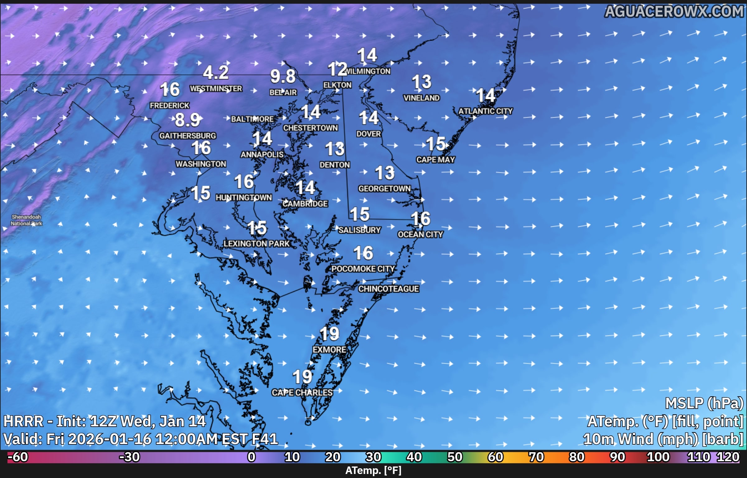
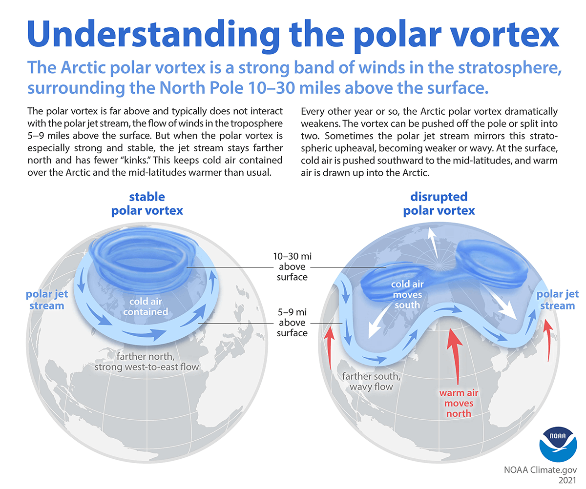
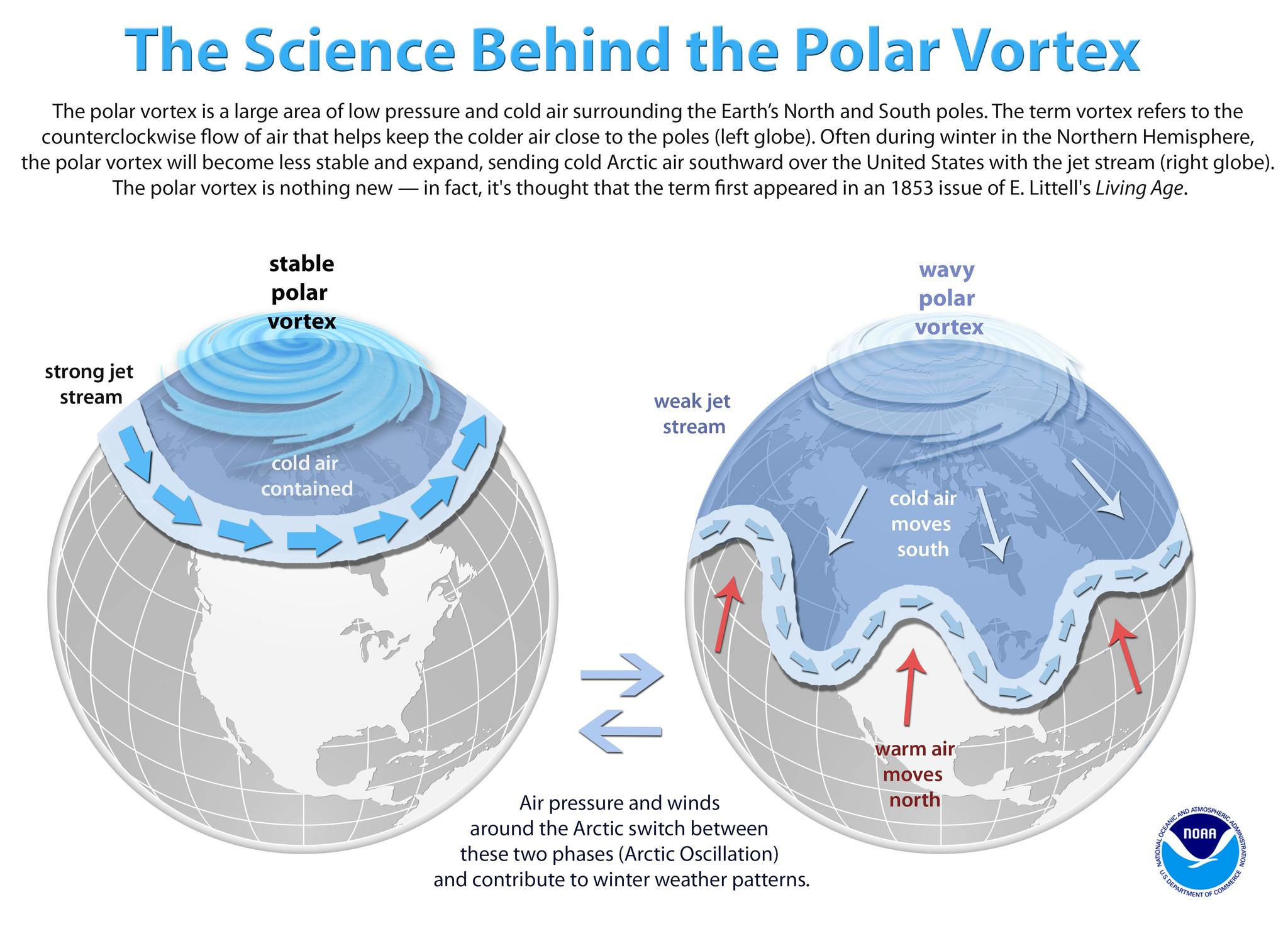
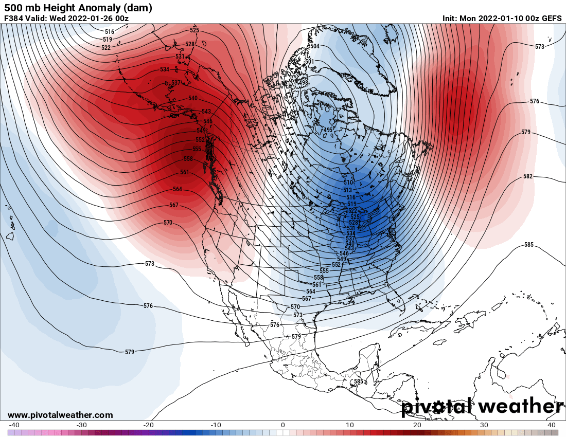
A deep upper level trough will settle over the eastern United States, allowing an arctic air mass to surge southward into the Mid Atlantic. At the surface, strong high pressure will dominate the region, keeping conditions dry but doing little to prevent temperatures from falling sharply.

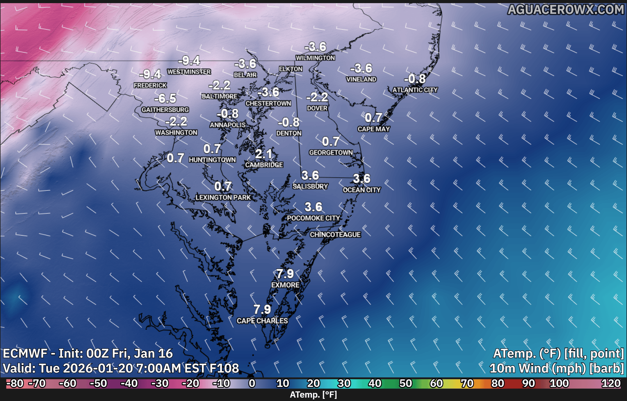
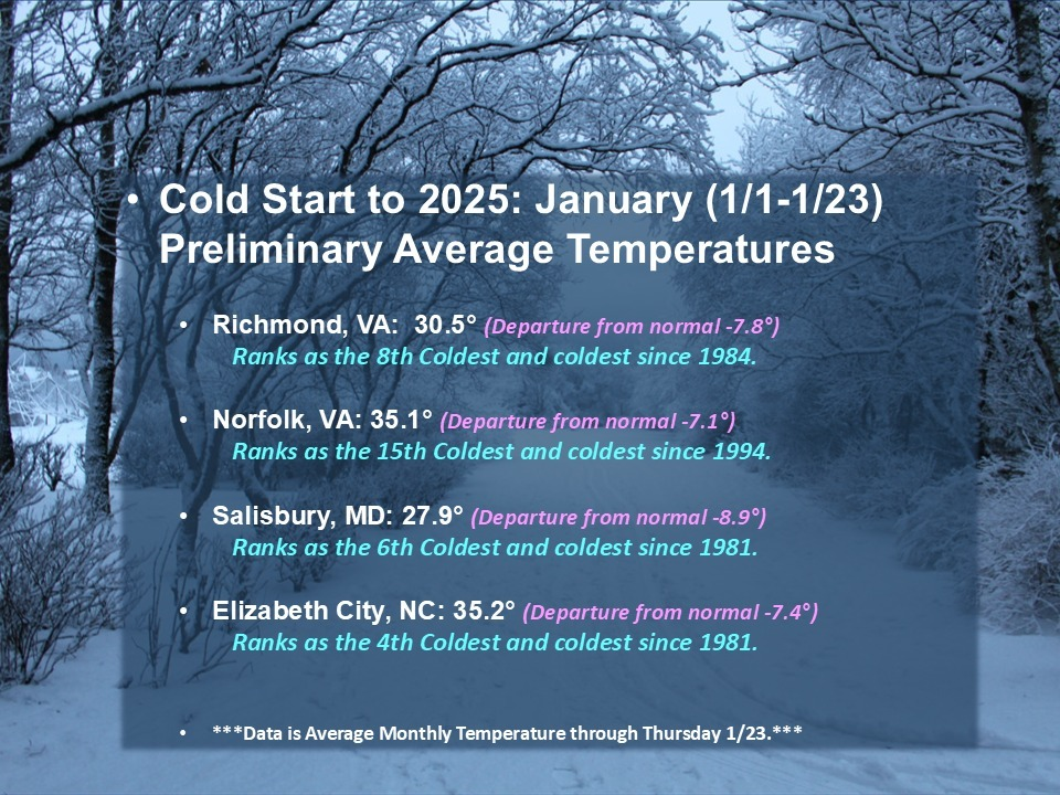
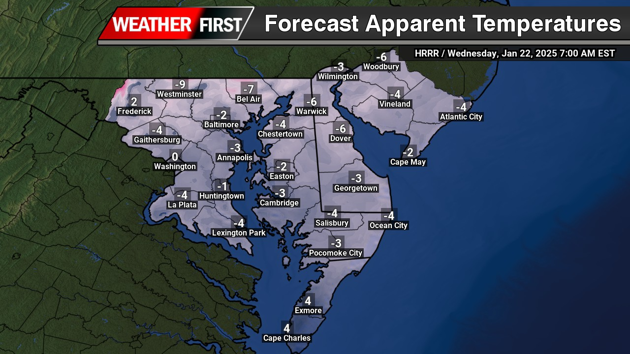
Cold air will steadily build into the region starting Sunday, with daytime temperatures remaining well below average through at least Wednesday. The core of the arctic air mass is expected to be centered over Delmarva Monday night through Tuesday night, when the cold will be at its most intense.

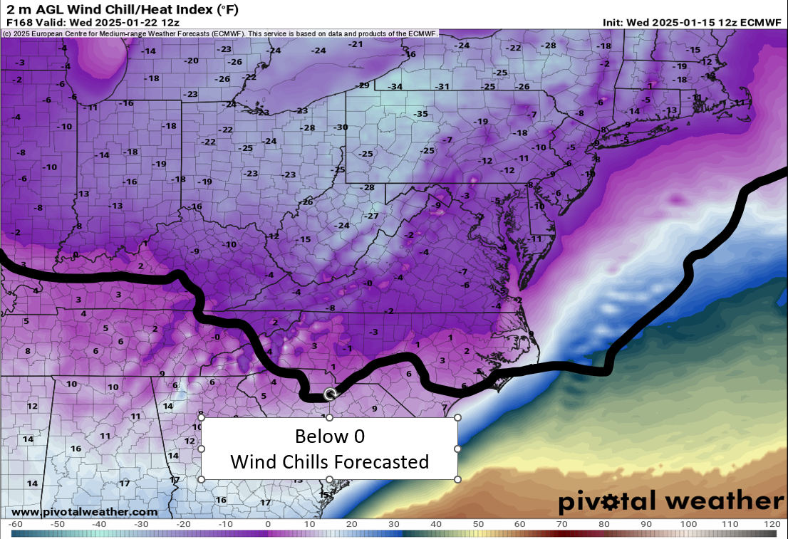
During this time, overnight wind chill values are expected to fall into the single digits and potentially below zero, especially during the overnight and early morning hours. Current indications suggest Monday night will be the coldest period, with slightly less extreme conditions expected Tuesday night.
Daytime temperatures on Tuesday are also trending colder, with highs forecast to struggle into the upper teens to low 20s across much of Delmarva. These values are well below normal for mid January and could pose risks to anyone spending extended time outdoors.

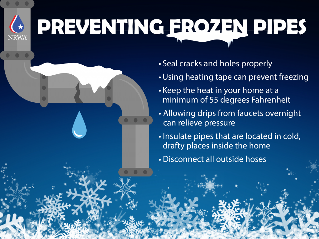
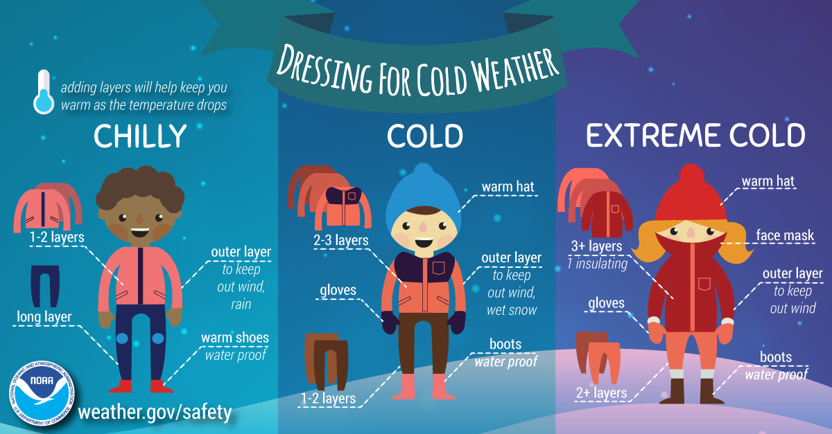
Given the severity of the cold, cold weather advisories or warnings may be issued for one or both nights. Residents are encouraged to prepare now by limiting outdoor exposure, protecting pets, and ensuring vulnerable pipes and plumbing are properly insulated.
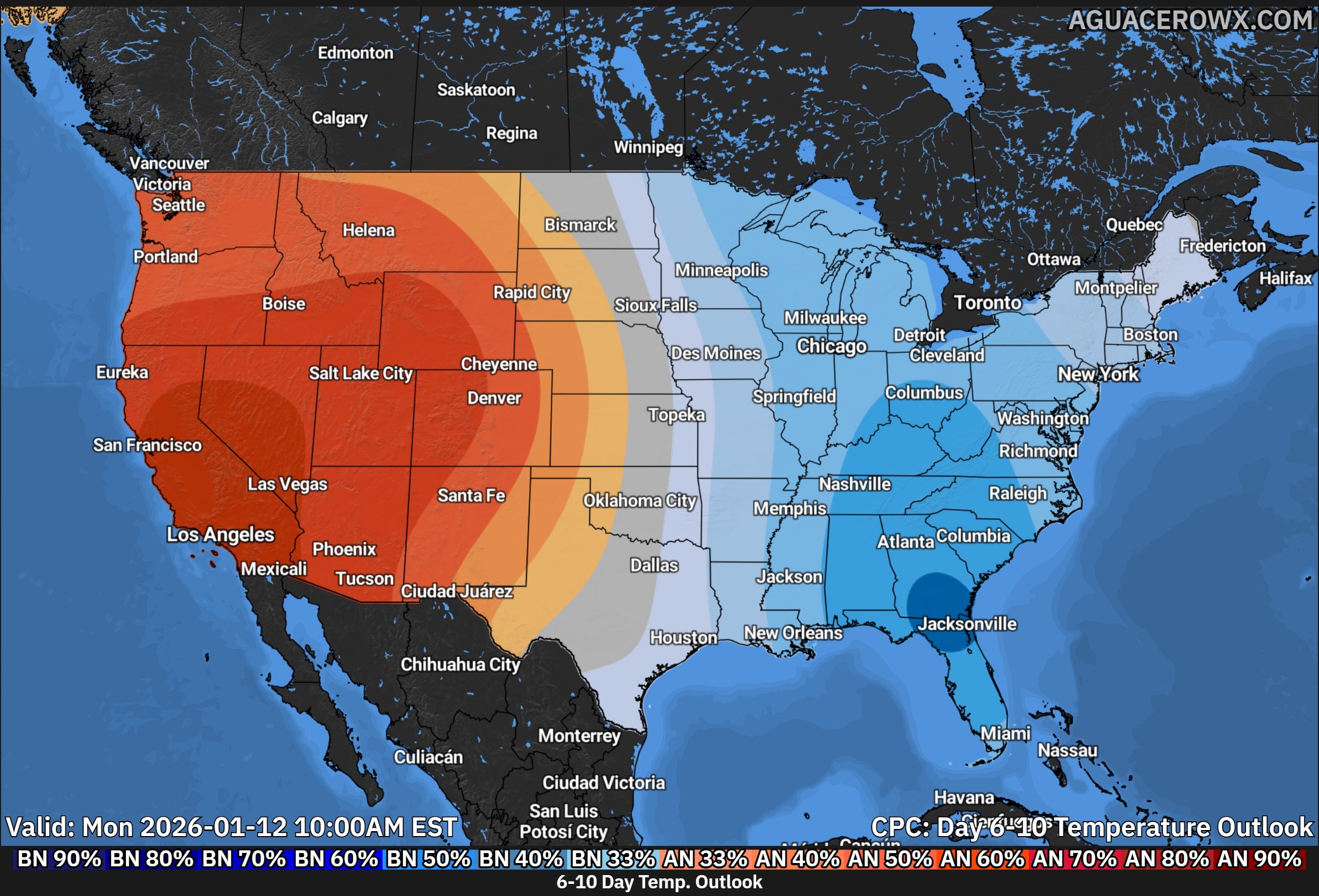
Temperatures are expected to gradually moderate later in the week as the upper level trough begins to lift, allowing readings to trend closer to seasonal averages by Thursday.


 Severe Cold Weather Alert: An Arctic air mass is forecasted to sweep across a significant portion of the United States this weekend!
  From the Rockies to the Great Plains, this frigid air will reach the Gulf Coast by Saturday night and move towards the Eastern Seaboard by Sunday evening.
 Extremely Low Wind Chills: The Rockies, northern Plains, and Upper Midwest are expected to experience dangerous wind chills as low as -30°F or even lower from Saturday through Tuesday. This extreme cold poses serious risks of hypothermia and frostbite for individuals exposed to these conditions. If you plan to travel, ensure you have a cold weather survival kit prepared for your safety.
 Furthermore, below-zero wind chills are anticipated to extend into the southern Plains and the Ohio Valley from Sunday night through Tuesday. The hazardous cold is likely to persist along the Gulf Coast and across the Southeast U.S. for much of the following week. Stay warm and take all necessary precautions during this severe cold snap!


