Tag: coastal flooding

  • Major Winter Storm Becoming Likely Across Southern Delmarva; Blizzard Conditions Possible

    Major Winter Storm Becoming Likely Across Southern Delmarva; Blizzard Conditions Possible

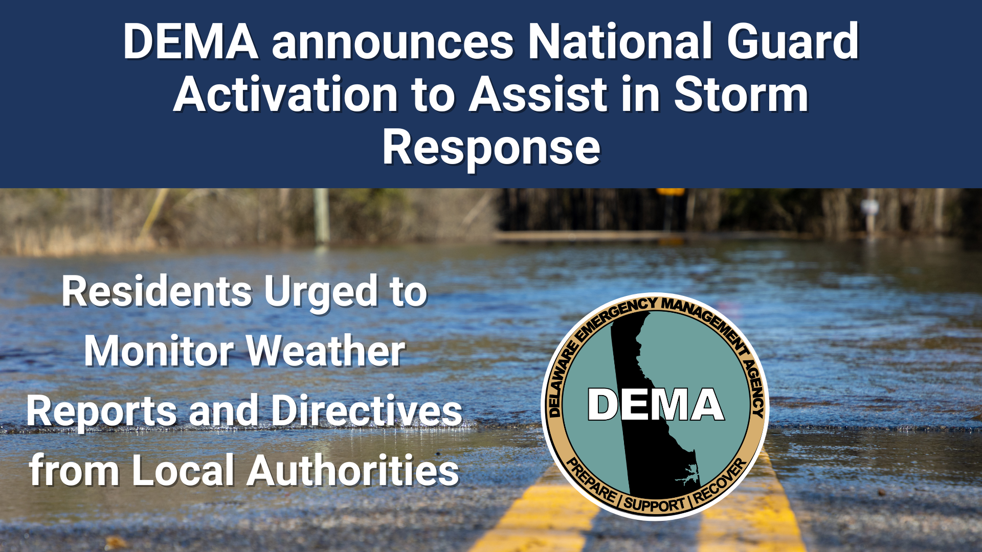
    A rapidly intensifying coastal storm is expected to develop off the East Coast this weekend, and while confidence in exact impacts remains limited, portions of the Delmarva Peninsula could see effects ranging from snowfall and strong winds to coastal flooding.

    Forecast guidance continues to show cyclogenesis beginning Saturday off the southeastern United States coast. As low pressure rapidly deepens, the system is expected to track north and east Saturday night into Sunday. This development is being driven by a potent upper-level disturbance rotating around the base of a longwave trough over the eastern United States, interacting with a sharp temperature contrast along the coast.

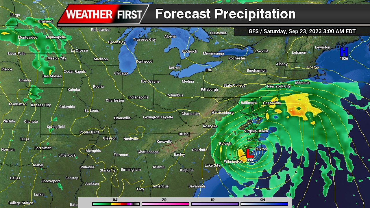
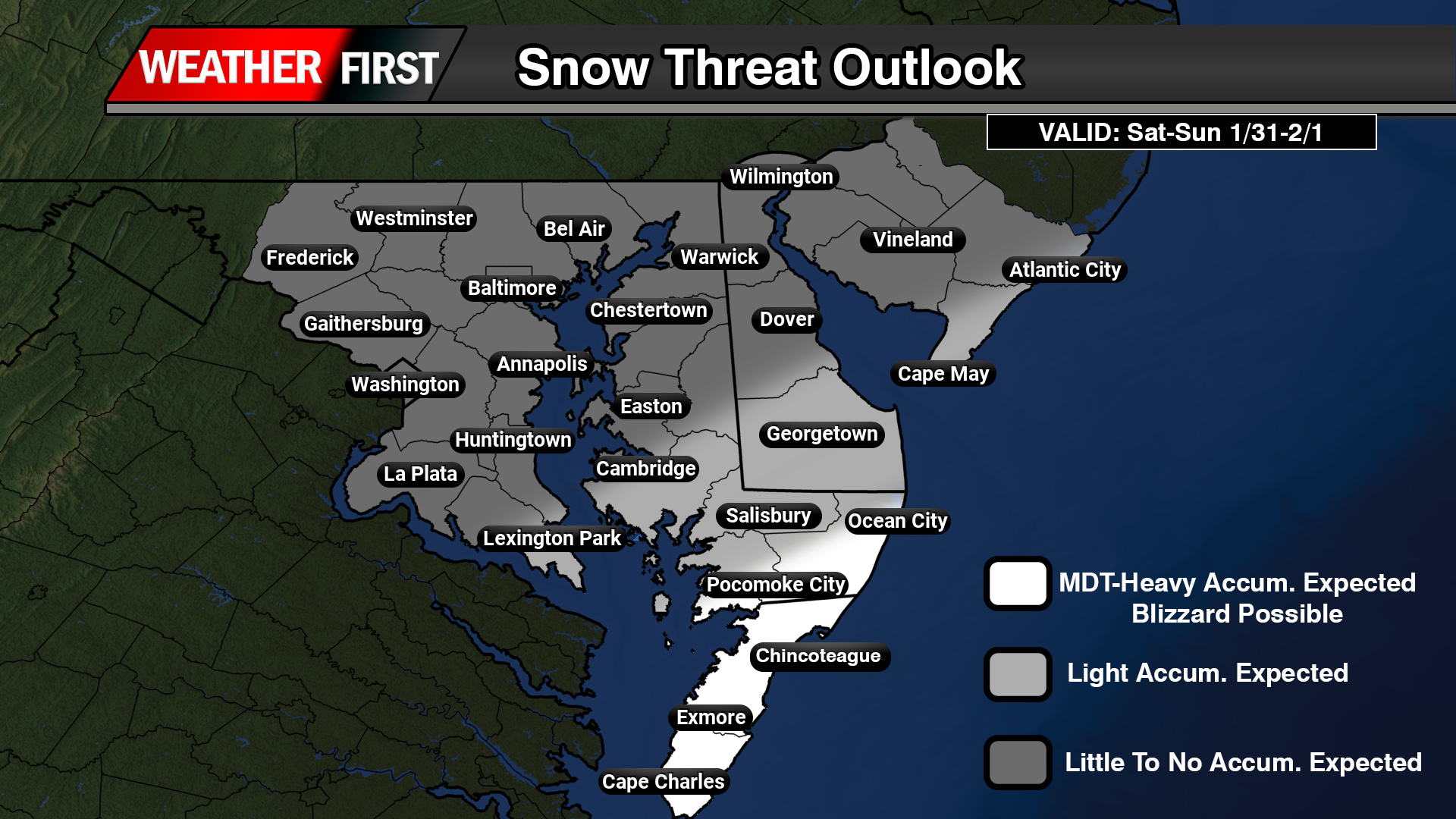
    For Delmarva, impacts will depend heavily on the exact track of the storm, which remains uncertain. Current guidance places much of the region on the northwest fringe of the precipitation shield. Small shifts in the storm’s path could make the difference between limited impacts and a more impactful winter weather event, particularly for southern and coastal Delaware.

    Among the latest forecast models, solutions remain mixed. Some guidance continues to suggest light snowfall for parts of Delaware, while others are more suppressed and keep meaningful precipitation offshore. At this time, forecast confidence supports the possibility of light to moderate snow accumulations in southern Delaware, with lesser amounts farther north. Additional snow could fall beyond early Sunday depending on how quickly the system departs.

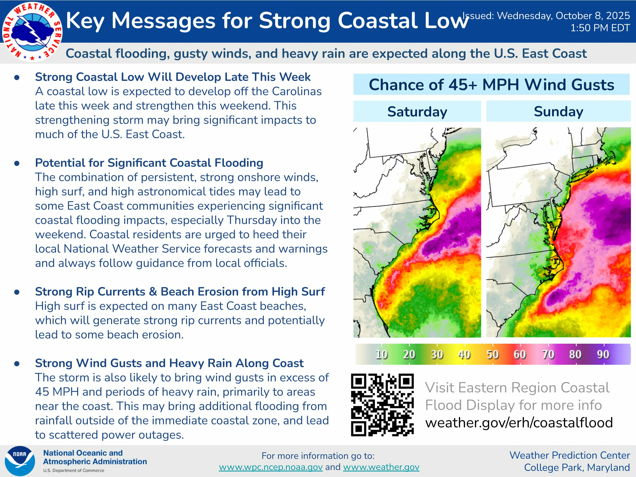
    Snowfall probabilities remain highest closer to the coast. Current probabilistic guidance shows a 60 to 70 percent chance for more than 2 inches of snow near coastal areas, decreasing to 25 to 35 percent near the I-95 corridor. The probability of 6 inches or more remains lower, but remains notable near the coast where probabilities range from 35 to 50 percent.

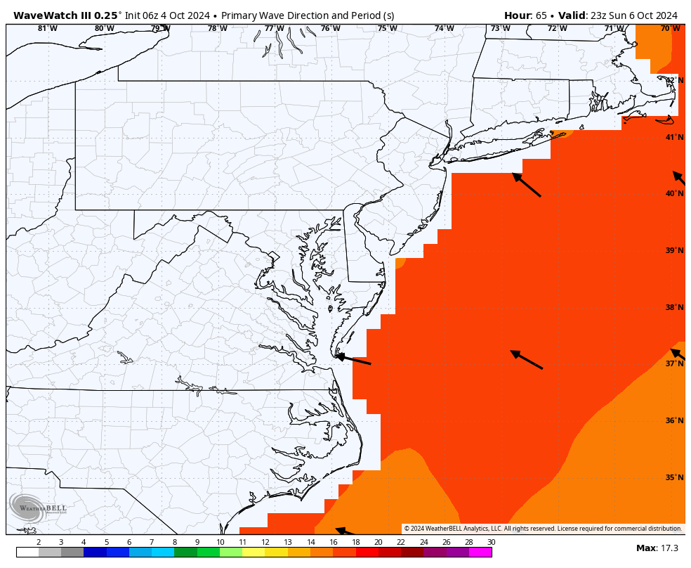
    Regardless of snowfall totals, confidence is increasing that strong winds will affect the region Saturday night into Sunday. Northerly to northeasterly winds are expected to increase inland to 15 to 25 mph with gusts up to 35 mph. Along the coast, winds could reach 25 to 35 mph with gusts approaching 50 mph. If the storm tracks closer to the coast, winds could be stronger than currently forecast.

    Given the combination of strong winds and falling or blowing snow, there is a conditional risk for blizzard conditions in portions of southern Delmarva, especially near coastal areas. While confidence is not yet high enough for blizzard headlines, blizzard warnings could become necessary if the storm track shifts closer and snowfall rates increase alongside the strongest winds.

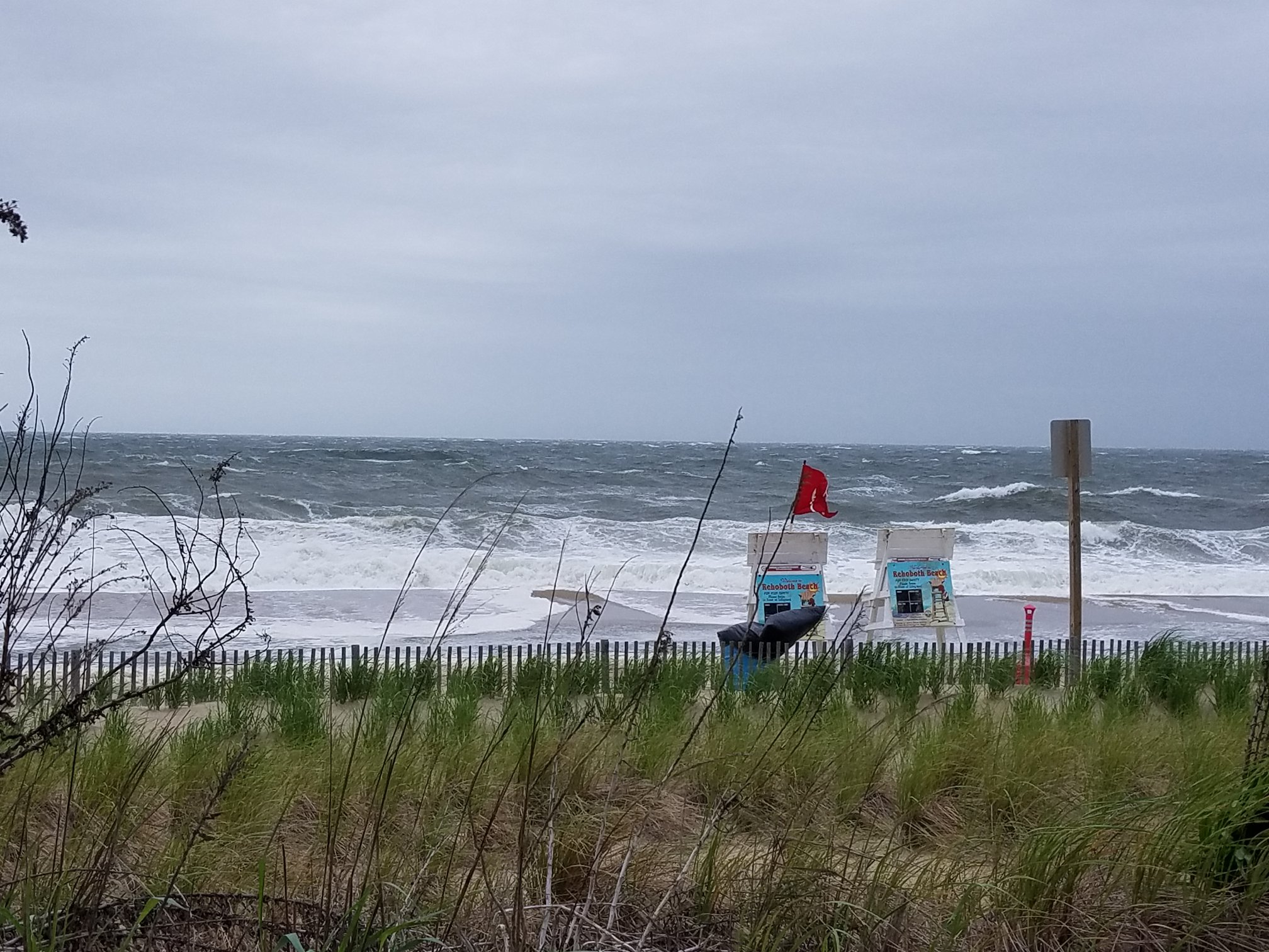
    Strong onshore winds will also increase the risk for coastal flooding, particularly during times of high tide. This threat is further heightened by the presence of a full moon, which will result in astronomical high tides. If strong northeasterly winds persist during peak tidal cycles, water levels could rise more quickly and lead to minor to locally moderate coastal flooding in vulnerable coastal communities.

    Temperatures throughout the event will be well below freezing, strongly favoring all snow across Delmarva should precipitation occur. Any snowfall that does develop would accumulate efficiently on untreated roads and elevated surfaces.

    The storm is expected to pull rapidly away to the northeast by Sunday evening, allowing quieter but cold conditions to return for the start of the new week.

    Overall, this remains a challenging forecast. While many model solutions currently suggest a near miss for Delmarva, even a subtle shift in the storm track could bring more substantial impacts. Residents are encouraged to stay informed, review winter weather safety plans, and monitor future forecasts as confidence improves over the coming days.

  • DEMA Mobilizes Delaware National Guard in Preparation for Coastal Storm Effects

    DEMA Mobilizes Delaware National Guard in Preparation for Coastal Storm Effects

    (SMYRNA, DE) — The Delaware Emergency Management Agency (DEMA) has announced the activation of the Delaware National Guard to support preparations and response efforts as the state faces threats from coastal flooding and strong winds expected to persist through tomorrow.

    Having coordinated with state and local officials since Friday, DEMA said it is strategically deploying Guard resources to where they will be needed most. Reception centers are already open across Kent and Sussex counties, with sheltering plans in place should demand increase. Agencies including the Delaware Department of Health and Social Services, DelDOT, and the American Red Cross are working closely with local authorities to facilitate access to these resources.

    In Bowers Beach, the mayor has issued a voluntary evacuation order for residents east of Whitwells Delight Road. Individuals needing shelter are guided to the Magnolia Fire Company or to contact the Kent County Emergency Operations Center at 302-735-3465 for further guidance.

    Reception Center Locations

    • Kent County: Magnolia Fire Hall, 2 North Main Street, Magnolia, DE
    • Sussex County: Millsboro Fire Hall, 109 E State St, Millsboro, DE

    DelDOT continues to monitor road conditions and post closures through its website and mobile app. Meanwhile, DNREC has closed beaches, surf crossings, and campgrounds at Delaware Seashore State Park and Cape Henlopen State Park until further notice.

    DEMA Director A.J. Schall commented, “We’re monitoring the situation and proactively positioning additional resources to support counties and municipalities in safeguarding residents. DEMA will continue to issue Watches, Warnings, and other directives as needed.”

    Officials warn that moderate-to-major coastal flooding, damaging wind gusts, tree damage, power outages, and roadway flooding remain possible. Additional local evacuations may be ordered if conditions worsen.


    Safety Guidelines for Residents

    1. Enroll in DENS – Sign up for the Delaware Emergency Notification System to receive alerts via phone or email.
    2. Know your zone – Use the Know Your Zone tool to determine whether your address falls within an evacuation zone. Stay alert even if you are outside a designated zone.
    3. Plan your evacuation – Outline a route, inform family members, and carry hard copies of important documents.
    4. Assemble an emergency kit – Include essentials such as medications, food, water, batteries, flashlights, and supplies for pets for 3–7 days.
    5. Stay informed – Monitor trusted media, state agencies’ social accounts, and radio stations for updates.
    6. Turn Around, Don’t Drown – Never drive through floodwaters.

    Emergency Alert Radio Stations: WDEL-AM 1150, WDEL-FM 101.7, WCHK-FM 101.3, WWTX-AM 1290, WRDX-FM 92.9, WJWL-AM 900, WDOV-AM 1410, WSTW-FM 93.7, WDDE-FM 91.1, WILM-AM 1450, WDSD-FM 94.7. Boaters should monitor Marine Channel 16

  • Strong Coastal Low Could Bring Major Impacts to Delmarva This Weekend

    Strong Coastal Low Could Bring Major Impacts to Delmarva This Weekend

    A powerful coastal low is forecast to develop off the Carolina coast late this week before strengthening and tracking northward this weekend. The system is expected to bring gusty winds, heavy rain, and coastal flooding to much of the East Coast — including the Delmarva Peninsula.

    The combination of strong onshore winds, high surf, and high astronomical tides could lead to significant coastal flooding across parts of Delaware, Maryland, and Virginia. The most widespread impacts are expected from Friday night through Sunday, with the highest risk during periods of high tide.

    Persistent onshore winds will also generate dangerous rip currents and high surf, likely leading to beach erosion along the Atlantic coastline and the lower Delaware and Chesapeake Bays. Coastal residents should closely monitor updates and follow any advisories issued by local emergency management or the National Weather Service.

    In addition to flooding, the storm could bring wind gusts over 45 mph, especially along coastal areas, which may result in scattered power outages and tree damage. Heavy rainfall could also lead to localized flooding inland, particularly in poor drainage areas.

    The Weather Prediction Center highlights the Delmarva coast as an area of elevated concern for strong wind gusts and coastal flooding potential this weekend.

    Residents are urged to stay alert as the system approaches and to secure outdoor items ahead of the storm.

  • Ignoring Warnings Of Hurricane Erin Puts Lives at Risk: Experts Urge Public to Follow Safety Alerts

    Ignoring Warnings Of Hurricane Erin Puts Lives at Risk: Experts Urge Public to Follow Safety Alerts

    — Hurricane Erin is currently off the coast of the Delmarva Pennisula. Beaches along the Eastern Seaboard have raised red flags, warning the public about dangerous surf and rip currents. Public officials, meteorologists, and emergency responders have all strongly advised against entering the water or engaging in beach recreation during this time. Despite this, too many people ignore these warnings. They dismiss the threat by comparing the storm to past hurricanes or by calling official alerts “fake news.” This attitude is not just reckless; it endangers lives. Public weather alerts are issued for one fundamental reason: to save lives and protect communities. These warnings are based on complex meteorological data, satellite tracking, and sophisticated computer forecasting models that take into account storms’ wind speeds, rainfall potential, storm surge, and other hazards. They reflect expert analysis designed to help residents prepare for events that could cause flooding, property damage, injury, or loss of life. The forecasts are never perfect, but they are the single best guide available for decision-making during severe weather. The Delmarva Peninsula is especially vulnerable to the effects of hurricanes and tropical storms. Its low-lying geography makes it prone to flooding and storm surge.

    History confirms the risks. In 2003, Hurricane Isabel caused major flooding on Maryland’s Eastern Shore. Many residents underestimated the danger, leading to costly damages and some fatalities. These events are reminders that storms can rapidly shift in intensity and impact, and no storm can be judged solely by the name or category it carries. Rip currents provide another deadly danger lurking near coastal waters. Even when skies seem clear, distant hurricanes create powerful currents that sweep swimmers away. Each year, lifeguards on Delmarva rescue dozens of people caught in rip currents, and fatalities occur when warnings are ignored. These dangers are not theoretical. Emergency responders put their lives at risk when they respond to people who disregard official advice. Ignoring safety warnings during high surf does not just risk one person’s life; it endangers entire communities and stretches local emergency resources. Social media complicates matters further. While it enables rapid sharing of information, it can also spread false or misleading messages.

    Photo: James Spann

    Posts claiming that storms are “no big deal” or that warnings are exaggerated encourage complacency. This undermines trust in professional meteorologists and emergency officials who spend countless hours ensuring their forecasts are as accurate as possible. Public confidence is essential in emergency management, and misinformation erodes that trust. People often compare new storms to past events, assuming they can “handle it better” or that it “won’t be as bad.” This oversimplifies the complex nature of severe weather. No two storms are exactly alike. Factors like storm speed, rainfall distribution, and coastal geography combine in unique ways each time, making every event different. Dismissing warnings by relying on past experience is dangerous. Sometimes, storms do weaken or shift course, leading some to say the forecasts were wrong. That perception fails to acknowledge the purpose of advance warnings: to give people time to take precautions against worst-case scenarios. It is better to prepare and have a storm pass with minor impacts than to ignore warnings and face disaster unprepared. In summary, public weather alerts exist to protect every member of the community.

    They are developed through rigorous science and decades of storm data. When officials issue beach closures, evacuation orders, or high surf warnings, they do so with public safety as their priority. Ignoring these alerts is not a harmless act of skepticism; it endangers lives, burdens first responders, and threatens entire communities. The best way to protect yourself and those around you is to listen to professional forecasts, respect warnings, and prepare accordingly. Share accurate information and encourage others to do the same. Storms do not negotiate with opinions or social media posts. They follow the rules of nature. Our safety depends on understanding that truth and acting on it.

  • Hurricane Milton Aiming For The West Coast Florida Next Week

    Hurricane Milton Aiming For The West Coast Florida Next Week

    The west coast of Florida is bracing for the potential landfall of Hurricane Milton, a rapidly intensifying storm expected to impact the Tampa Bay region and surrounding areas. With projections showing the storm strengthening significantly over the next few days, Florida residents are preparing for what could be another major hurricane following the devastation caused by Hurricane Helene.

    Rapid Intensification Expected

    Forecasters warn that Hurricane Milton is set to undergo rapid intensification, potentially reaching Category 3 or higher before making landfall. Warm Gulf waters and favorable atmospheric conditions are contributing to the storm’s swift development, raising concerns for communities along the west coast of Florida.

    The National Hurricane Center has advised residents in the projected path of Milton to begin preparations now, as the storm may bring life-threatening storm surges, heavy rainfall, and damaging winds. Evacuation orders could be issued in the coming days as the storm’s path becomes clearer.

    Tampa Bay Region at Risk

    The Tampa Bay region, including major cities like Tampa, St. Petersburg, and Clearwater, is under the gun for a potential direct hit from Milton. This area, vulnerable to storm surges due to its coastal geography, faces significant risks if the hurricane continues on its current trajectory.

    Emergency services and local governments are urging residents to secure their properties and gather essential supplies in anticipation of power outages, flooding, and disruptions to daily life.

    Florida Braces for Another Major Impact

    If Hurricane Milton makes landfall as a major hurricane, it will mark Florida’s constant strike for Major Hurricanes here in the last several years in a row. The scars from Helene are still fresh for many, and Milton’s approach has heightened anxiety across the state. However, state and local officials are mobilizing resources and preparing emergency response plans to ensure a coordinated effort to protect lives and property.

  • Elevated Wave Action to Impact East Coast this Weekend as Major Hurricane Kirk Sends Swell to the Region

    Elevated Wave Action to Impact East Coast this Weekend as Major Hurricane Kirk Sends Swell to the Region

    Starting this Sunday, the East Coast, particularly the Delmarva region, will see increased wave activity as long-period swells from Major Hurricane Kirk arrive. Currently a powerful Category 4 storm, Kirk is churning in the central Atlantic, far from land. However, the hurricane’s strength is generating significant wave action that will reach coastal areas, with wave heights projected between 4 to 8 feet.

    These swells will bring more than just impressive waves. The combination of increased wave energy and prolonged exposure could result in some coastal erosion and minor flooding in vulnerable areas. The Delmarva coastline, known for its low-lying beaches, is particularly at risk. In addition, the elevated wave activity will heighten the risk of rip currents, making it dangerous for swimmers and beachgoers.

    While Kirk itself poses no direct threat to land, as it is expected to curve safely toward the north and east, its indirect impacts will still be felt. The National Weather Service has advised those along the coast to remain vigilant, especially for rip currents, which can easily catch even experienced swimmers off guard.

    Coastal communities are encouraged to prepare for potential minor flooding and erosion in sensitive areas as wave action intensifies through the weekend and into early next week.

    Beachgoers and surfers should also be aware of local warnings and avoid swimming in areas where rip currents are likely.

  • Wash, Rinse, Repeat. Another High Wind Event On The Way

    Wash, Rinse, Repeat. Another High Wind Event On The Way

    Although the next storm system is another big one moving through the same areas as the last one, this one will not have that extreme punch like this one will. Still will be a nuisance to say the least.

    Strong winds will be a issue once again but thankfully we will NOT see those hurricane force wind gusts like we did but still in the higher end of the advisory category. Winds during the later overnight hours Friday into Saturday morning will gust 40-50 MPH on average but at times could gust 55 or higher especially near the coastlines. Which once again can lead to sporadic power outages and tree damage.

    Rainfall will once again will be a problem but not a extreme problem. A lot less rain is expected with this storm. Most areas will see upwards to a inch of rain but with saturated grounds, sporadic flooding is possible.

    Coastal Flooding will be a issue yet again with the New Moon still in play creating higher than normal tide cycles. At this time most tidal gauge forecasts are showing minor to moderate levels of tidal flooding Friday Night. Main flooding concerns will once again be in the Chesapeake and the mouth of the Delaware River.

  • Powerful Storm System Aims For Delmarva Tuesday Into Wednesday

    Powerful Storm System Aims For Delmarva Tuesday Into Wednesday

    Buckle up ladies and gentleman, tomorrow is going to be a very bumpy ride for us. Flooding rainfall, significant coastal flooding, and a serious high wind threat. And all of this begins during the afternoon hours Tuesday.

    Now we have been dealing with flooding since last month but what has me the most concerned is the absurd strength of these winds moving in tomorrow. A intense pressure gradient from a rapidly deepening surface low and strong high pressure system will generate a scenario of very intense winds. Strengthening of the low level winds in the low level jet-stream is some of the strongest I have seen for this region. Winds at 850-925mb level (<5000ft) screaming at 80-100 kts (92-115mph) is on the extreme end of likes I have not seen before. Now granted as we head down to the surface we are looking at reductions due to mixing but these winds are going to be fierce and nothing to play around with. My biggest concerns are for the southern and central portions of Delmarva where I believe we have a great shot of hitting hurricane force winds gusts at or exceeding 74 mph where the High Wind products are in place. Many locations will be seeing winds gusting 60 mph or greater at times. Power outages, downed trees, structural damage are all possible with these kinds of winds.

    Of course more flooding concerns for the region with the extremely saturated grounds from last months dump of 10-12 inches of rainfall. Another 2-4 inches are possible prompting a MDT risk from the WPC on excessive rainfall through the western shore of Maryland and northern Delmarva. Flood watches are in place in response to the heavy amounts of rainfall.

    Moderate to Major Flood Stage is expected across the Chesapeake Bay and the mouth of the Delaware Bay with the upcoming high cycles Tuesday Night and Wednesday. Some of which forecasts at certain tidal gauges could hit record levels! Atlantic coastal regions even though will have extremely large swell, winds will be parallel to the coast to keep tide levels down but will be funneling in significantly through the Chesapeake and Delaware Bay regions. Those who live near these water ways, make preparations to evacuate or seek higher ground if flood waters becoming inundating in your areas. Also make preparations to help protect your property from flood waters.

  • Minor To Moderate Flood Stage Coastal Flooding On Tuesday Returns

    Minor To Moderate Flood Stage Coastal Flooding On Tuesday Returns

    1 – Moderate coastal flooding and beach erosion are expected with Tuesday evening’s high tide in the Delaware counties of Sussex and Kent, and in the New Jersey counties of Cape May and Atlantic. For the remaining tidal area in Delaware and New Jersey, and for the tidal Delaware River and its tidal tributaries, widespread minor tidal flooding is anticipated at that time. Those areas are under a Coastal Flood Advisory. Spotty minor tidal flooding is possible through early Tuesday afternoon leading up to the time of the warnings and advisories, with lingering minor tidal flooding possible from late Tuesday night into Wednesday.

    2 – A northeast wind may gust as high as 40 mph at times into Tuesday along the immediate coasts of New Jersey and Delaware.

    3 – Gale Warnings are in effect for the Atlantic coastal waters of New Jersey and Delaware into Tuesday. Waves are expected to build to 8 to 12 feet.

    4 – An enhanced rip current risk and dangerous surf conditions are likely through much of the week.

    …COASTAL FLOOD WARNING REMAINS IN EFFECT FROM 4 PM THIS AFTERNOON TO MIDNIGHT EDT TONIGHT…

    * WHAT…One to two feet of inundation above ground level expected in low-lying areas near shorelines and tidal waterways.

    * WHERE…Kent and Inland Sussex.

    * WHEN…From 4 PM this afternoon to midnight EDT tonight.

    * IMPACTS…At this level, widespread roadway flooding occurs in coastal and bayside communities and along inland tidal waterways. Many roads become impassable. Some damage to vulnerable structures may begin to occur.

    * ADDITIONAL DETAILS…Spotty minor tidal flooding may occur through early Tuesday afternoon, with additional lingering minor tidal flooding possible from late Tuesday night into Wednesday.

    PRECAUTIONARY/PREPAREDNESS ACTIONS… Take the necessary actions to protect flood-prone property. If travel is required, do not drive around barricades or through water of unknown depth. && Time of high total tides are approximate to the nearest hour.

    Murderkill River at Bowers Beach MLLW Categories – Minor 6.6 ft, Moderate 7.6 ft, Major 8.6 ft MHHW Categories – Minor 0.9 ft, Moderate 1.9 ft, Major 2.9 ft Total Total Departure Day/Time Tide Tide from Norm Flood ft MLLW ft MHHW ft Impact ——– ——— ——— ——— ——– 26/07 AM 6.7 1.0 2.3 Minor 26/08 PM 8.3 2.6 2.6 Moderate 27/08 AM 6.8 1.1 2.0 Minor 27/08 PM 7.3 1.6 1.6 Minor 28/09 AM 6.6 0.9 1.3 Minor 28/09 PM 7.1 1.4 1.4 Minor Delaware Bay at Lewes MLLW Categories – Minor 6.0 ft, Moderate 7.0 ft, Major 8.0 ft MHHW Categories – Minor 1.3 ft, Moderate 2.3 ft, Major 3.3 ft Total Total Departure Day/Time Tide Tide from Norm Flood ft MLLW ft MHHW ft Impact ——– ——— ——— ——— ——– 26/06 AM 6.3 1.7 2.2 Minor 26/07 PM 7.6 3.0 2.4 Moderate 27/07 AM 6.3 1.7 1.8 Minor 27/08 PM 6.6 2.0 1.3 Minor 28/08 AM 5.9 1.2 1.0 None 28/09 PM 6.4 1.8 1.1 Minor

  • *** Hybrid Storm Expected This Weekend / Wednesday Update ***

    *** Hybrid Storm Expected This Weekend / Wednesday Update ***

    Confidence continues to increase for some sort of sub-tropical in nature storm system to develop along a stalled out frontal boundary off the coast of Florida and Georgia. With a strong area of high pressure it place towards New England, this will allow this system to intensify and move in towards the Carolina coastlines late Friday through Sunday.

    Overspreading heavy rain, gusty winds, and coastal flooding are all expected this weekend. Especially on Saturday when the conditions are expected to be the worst out of this storm. Whether this storm will be tropical in nature or not, impacts are going to be felt like a stronger nor’easter we would see in the winter months.

    Rain will begin to overspread the region beginning during the overnight hours on Friday and picking up in intensity on Saturday. Rain will be heavy at times with many operational and ensemble mean totals of 2-5 inches are expected over the weekend. With an area of high pressure to north, a strong pressure gradient will setup with constant strong onshore winds from the east and northeast. Sustained winds of 20-30 MPH with gusts 40-50 mph at times, will help generate waves offshore 10-20 feet. Near the coast, we are looking at swells generating 7-12 feet.

    With some of the the tide gauge forecasts as of now showing areas along the Atlantic Ocean and Inland Bay regions for Minor to even Moderate coastal flooding during the high tide cycle Saturday afternoon. I worry for the Inland Bays a lot more with all the water being forced with no where to go given how big the swells will be with the strong long fetched onshore winds.

    It’s pretty definitive at this point that we have a coastal storm on the way, it’s just a matter of how much rain will be associated with this system, and if it happens to be tropical or not. Or even a combination of both being a hybrid sub-tropical system. More details will be provided as the week goes on.

  • Hybrid Coastal Storm Impacting Delmarva This Weekend

    Hybrid Coastal Storm Impacting Delmarva This Weekend

    With the potential hybrid storm coming this weekend, not only heavy rain and gusty onshore winds are a problem, these are going to be some big waves. Moderate coastal flooding is on the table for Saturday. With onshore winds of 40-50 mph wind gusts generating waves 10-20 feet offshore. That’s going to be driving water hard to the coastal locations. Inland bays will be the bigger issues where water will not have any place to go.

    We still have days to go to see the full extent of details but the consistency in model guidance is very good with this one so far. Whether this will be a tropical system or a nor’easter, this will be bringing heavy rains, gusty winds, and coastal flooding.

  • High Wind Event With Coastal Flooding Concerns Sunday Night

    High Wind Event With Coastal Flooding Concerns Sunday Night

    Not only we have to deal with some heavy rainfall, a little bit of snow for the northern areas of Delmarva and the Maryland Western Shore. There’s an event that is sleeping under the radar that has my full attention. When that low starts dropping below 990mb, that low level jet stream is very strong being pulled into this surface low.

    70-80kt Winds at 850mb ( Low Level Jet)

    Anytime I start seeing winds at 5000ft getting over 60kts, I get a bit uneasy in the damaging wind department. This is a long fetch stream of onshore winds we are talking about from the Gulf Stream. There is going to be a lot of wind energy pushing on the east side of this low. And it’s all onshore flow too. There’s more issues with this as well.

    Winds at the surface are showing widespread wind gusts of 40-60 mph from the east and southeast. Another problem surfaces as well. We have a high tide cycle that’s expected during the evening hours Sunday Night. To add more salt in the wound, this weekend is a full moon as well. So take 40-60mph surface winds, plus onshore flow, plus a high tide cycle, and a full moon, it’s not going to be a fun time for a coastal locations this weekend. Strongest winds appear to be in a window from 8pm Sunday until 4am Monday.

    Already a few tidal forecast in the region showing Moderate Flood Stage forecasts like this one in Crisfield. So we really got to watch our coastal regions Sunday night for flooding concerns.