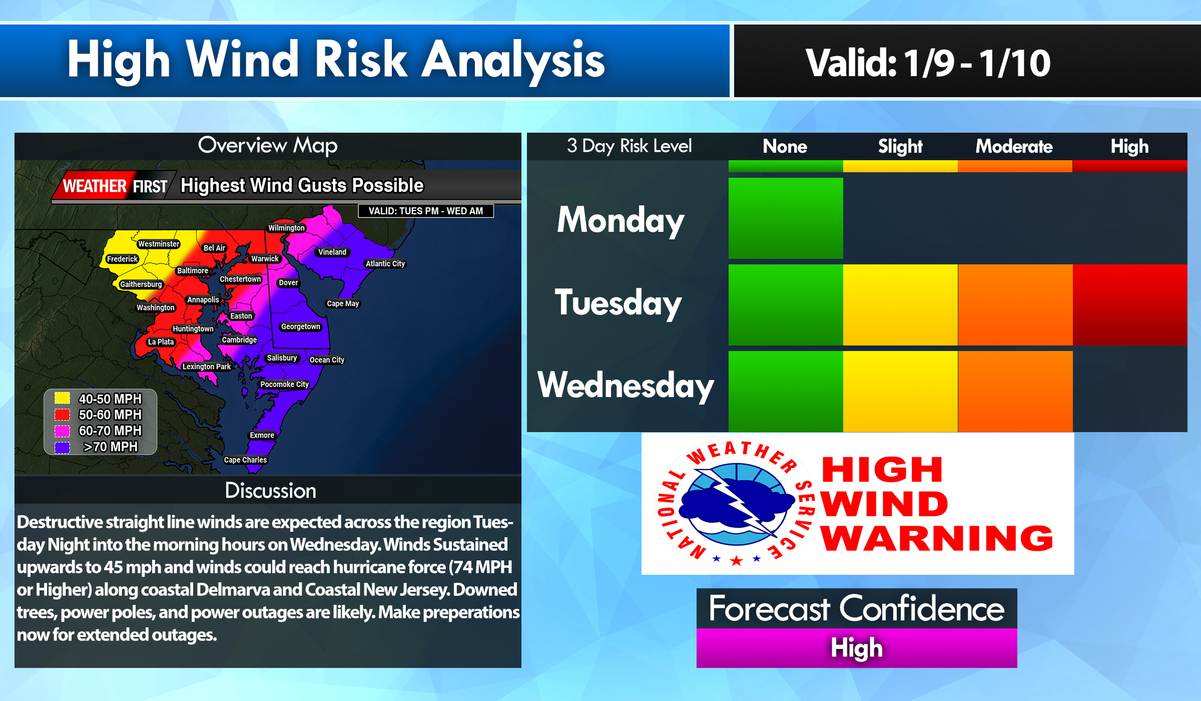
Buckle up ladies and gentleman, tomorrow is going to be a very bumpy ride for us. Flooding rainfall, significant coastal flooding, and a serious high wind threat. And all of this begins during the afternoon hours Tuesday. Now we have been dealing…
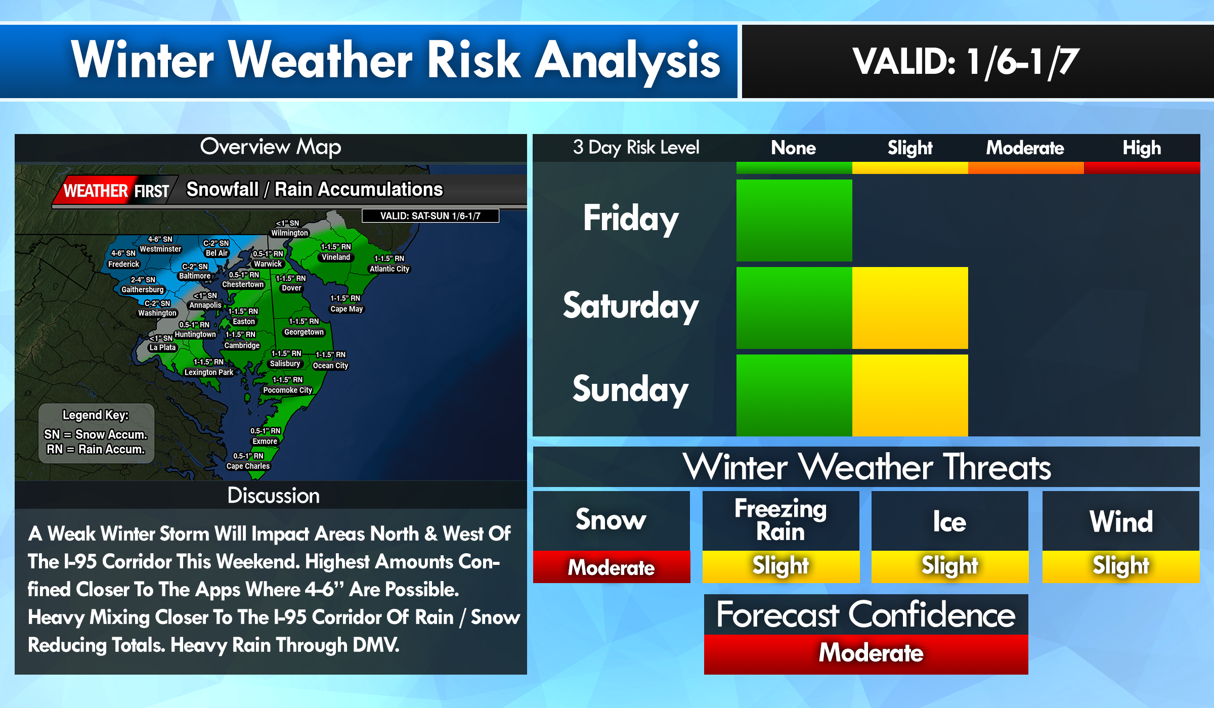
*** FIRST CALL SNOWFALL / RAINFALL OUTLOOK FOR SAT-SUN *** Been quite some time I’ve had to dust off this map but here we go ladies and gentlemen. North and West of the I-95 Corridor are in the zone for looking at…
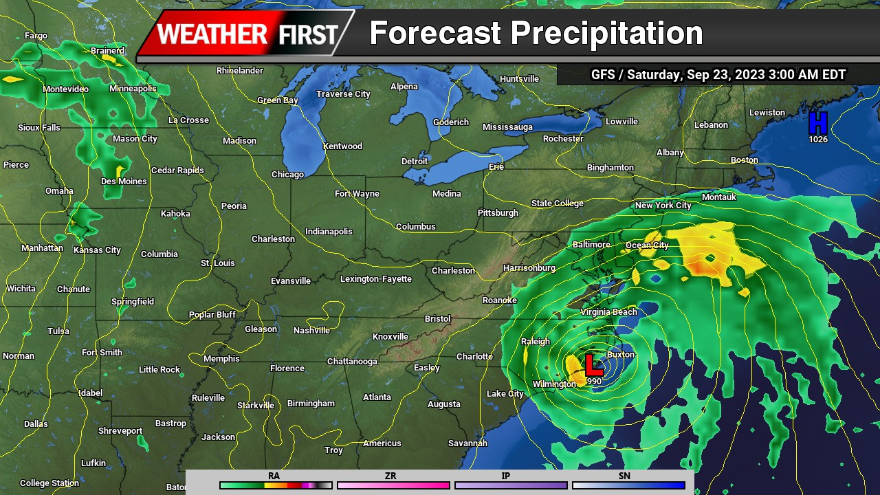
A big tone shift with the overnight model runs shows full speed ahead of a tropical system moving in from the Carolinas up into the Chesapeake Bay region. Which is the worst case scenario for any track of a storm system here…
Confidence continues to increase for some sort of sub-tropical in nature storm system to develop along a stalled out frontal boundary off the coast of Florida and Georgia. With a strong area of high pressure it place towards New England, this will…
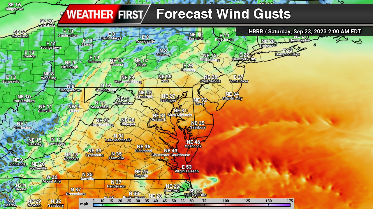
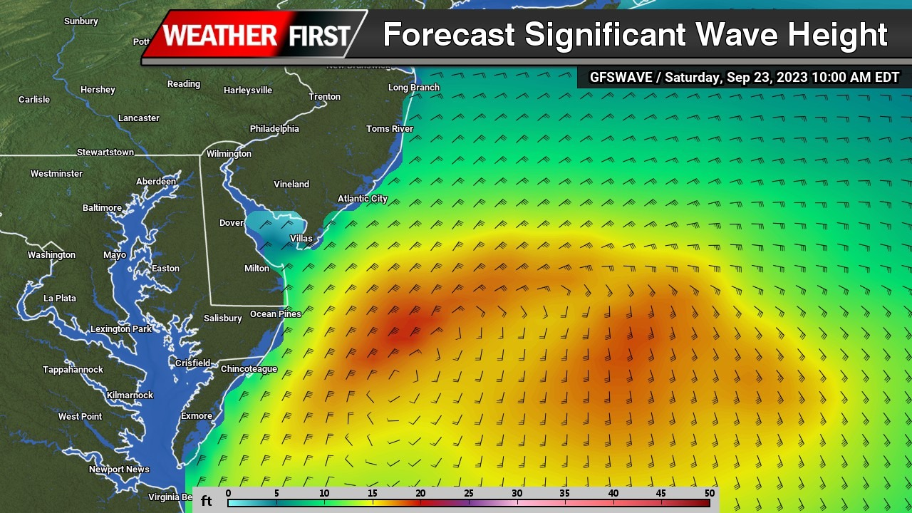
With the potential hybrid storm coming this weekend, not only heavy rain and gusty onshore winds are a problem, these are going to be some big waves. Moderate coastal flooding is on the table for Saturday. With onshore winds of 40-50 mph…
We have been talking about this scenario throughout the week about a major storm system will be developing in the Eastern half of the nation. An area of low pressure will be rapidly developing from the Gulf States and runs parallel through…
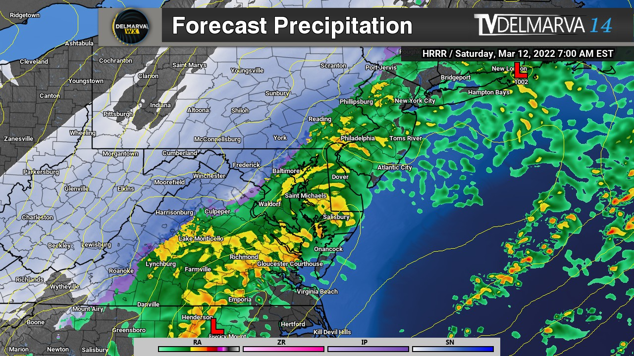
This is going to be the week for heavy rain that is for sure here on Delmarva. Once again we are in the sights of another storm system coming in from the south during the morning hours of Wednesday. An area of…
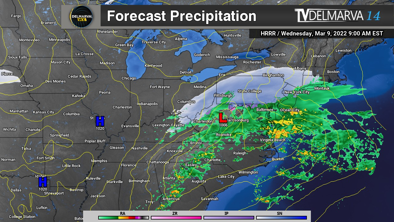
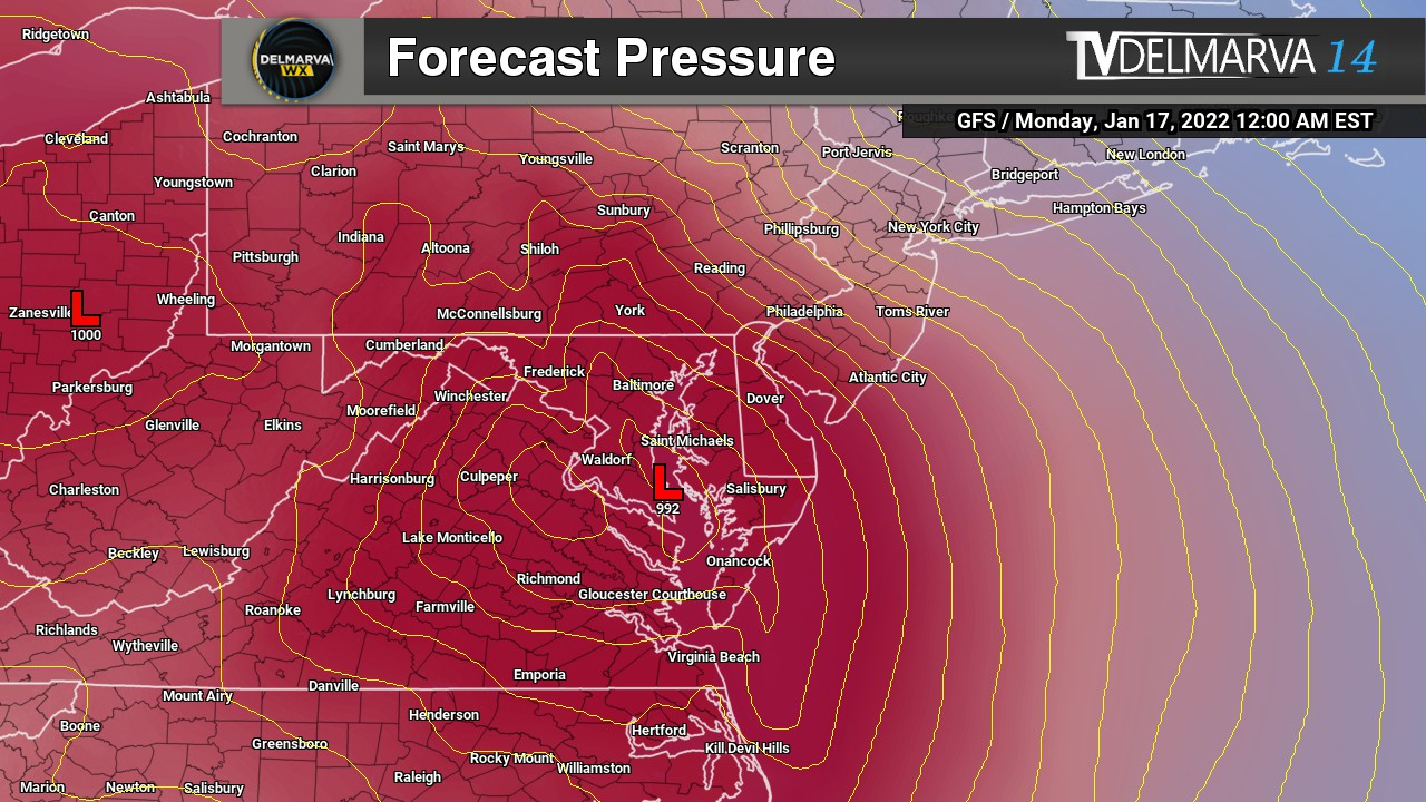
Not only we have to deal with some heavy rainfall, a little bit of snow for the northern areas of Delmarva and the Maryland Western Shore. There’s an event that is sleeping under the radar that has my full attention. When that…
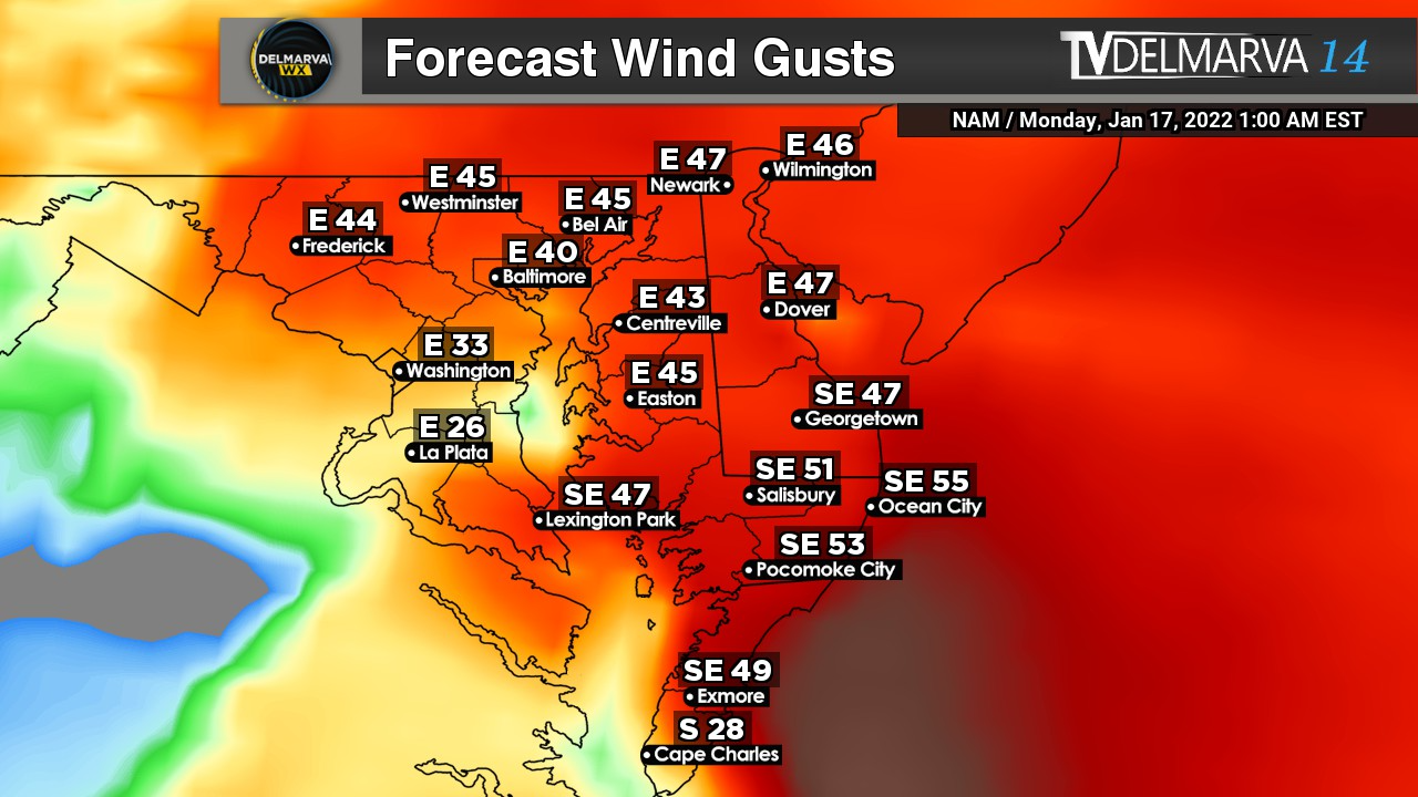
We gave out two different solution tracks in yesterday’s update but now we have a agreement on which one it would be. If you guessed number 1? You are right (sort of). For reference to yesterday’s post –> https://tvdelmarva.com/storm-signal-jan-16-17th-winter-storm-looming/ Many models have…