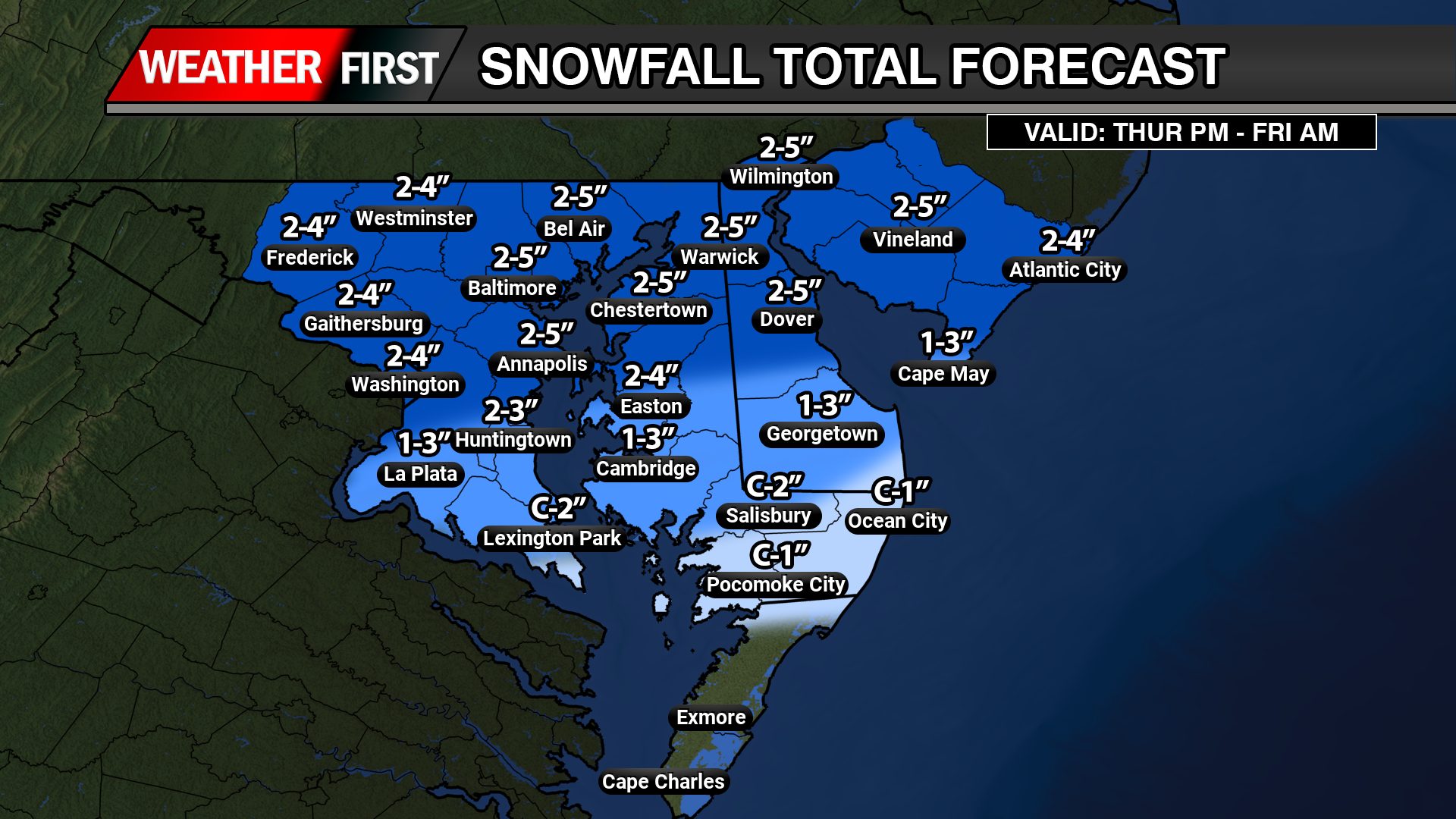
Another light to moderate snow event is on the table going into later Thursday and Friday all thanks to a Clipper system sliding to our south. And then redeveloping off of our coastlines bringing back a inverted trough through northern Delmarva and…
To most of you this just looks like a bunch of lines on a graph. To me this is a pure (Mwah Chef’s Kiss) for someone who is a fan of cold and stormy going into the New Year. And right now…
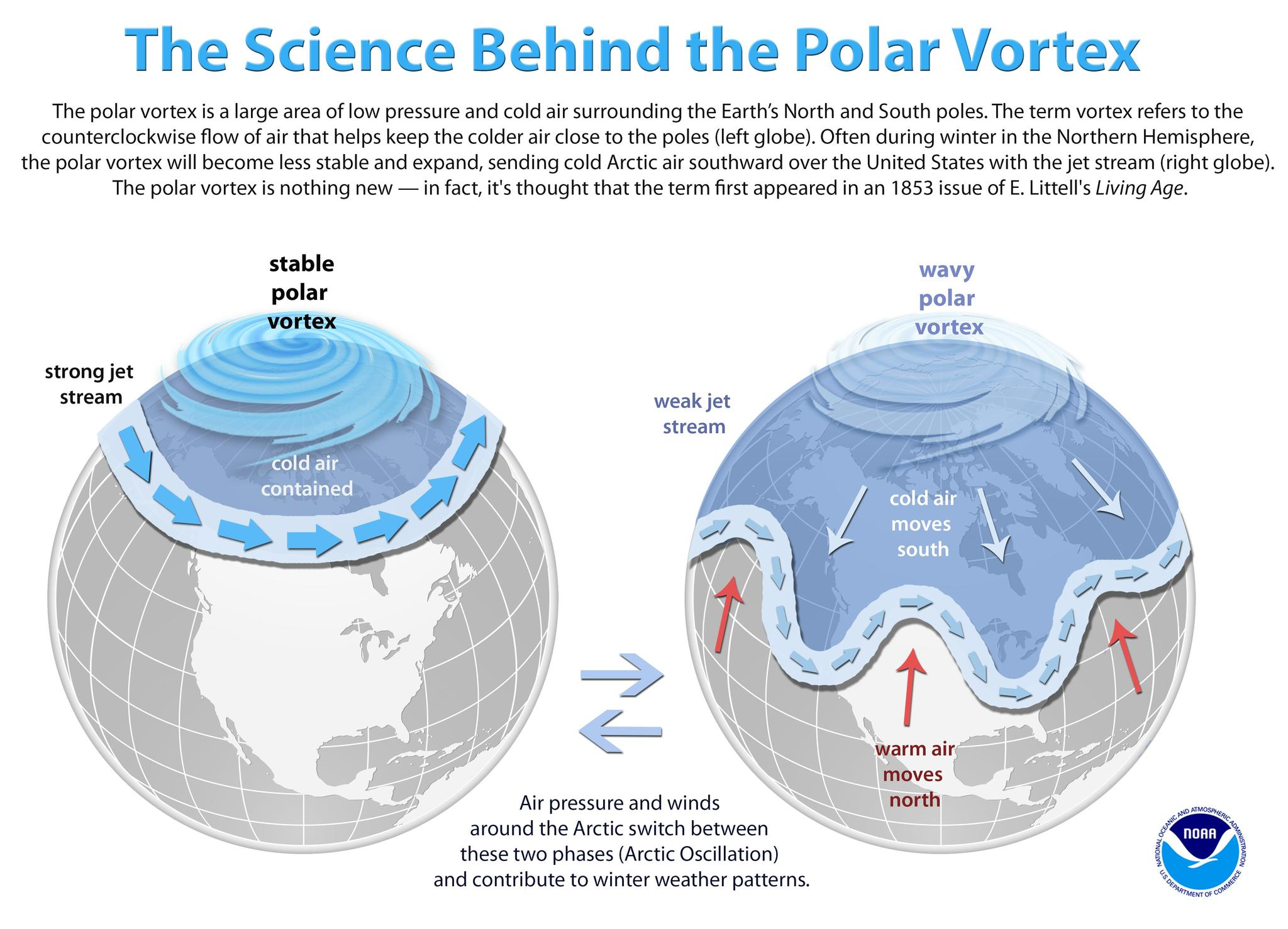
Second half of winter just keeps looking better and better. El Nino winter’s alone are notorious for second half winter fun for the country. And now we have another parameter to throw into place. Welcome to Polar Vortex! “The polar vortex is…
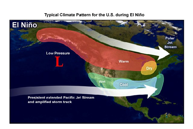
As we approach closer to the winter months here on Delmarva, we are already looking at the signs ahead for what kind of winter could we have been looking at. The last several years we have been stuck in a La Nina…
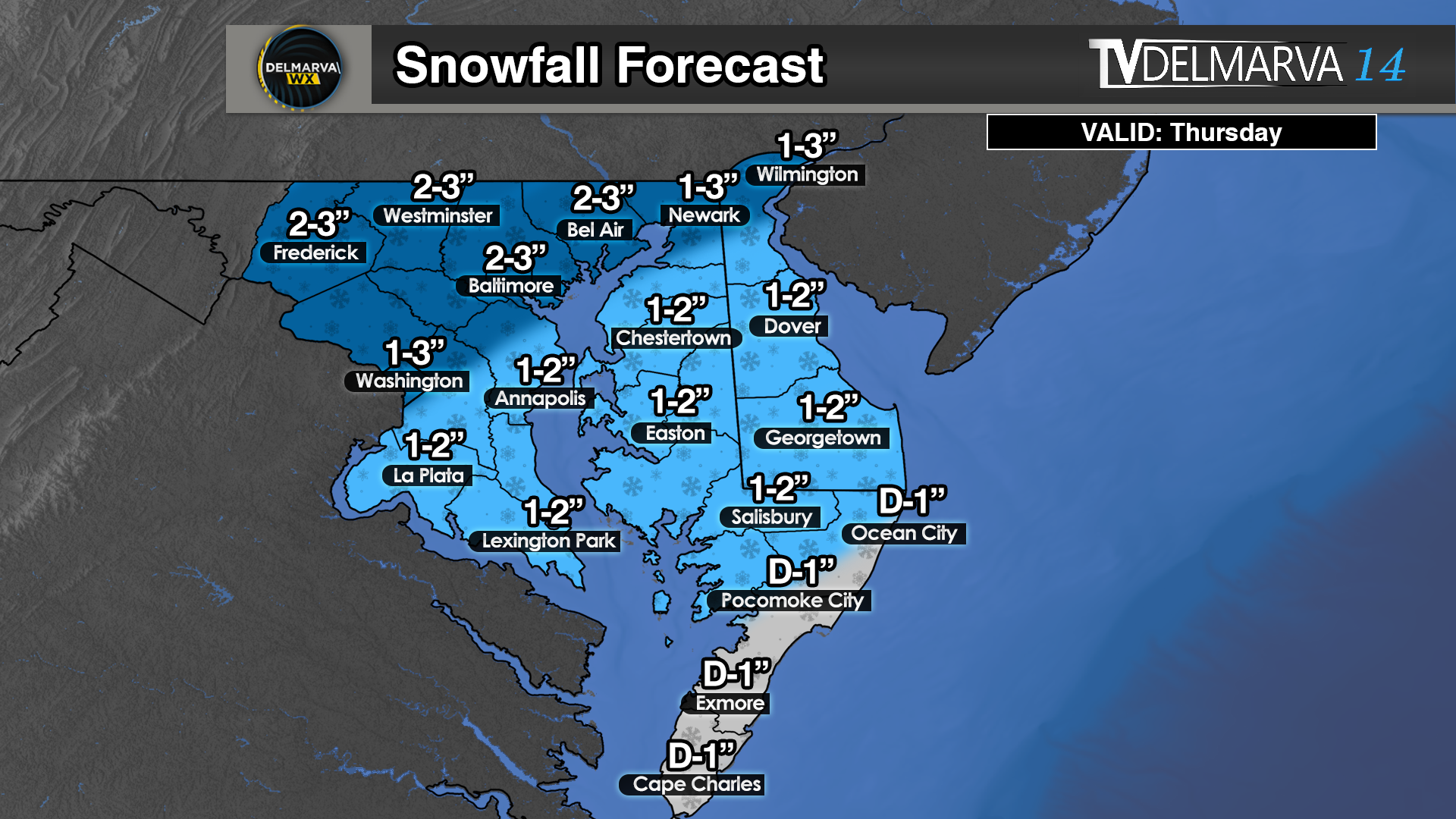
We are looking at a light snow event right along a arctic frontal boundary during the daytime hours on Thursday. We will begin the morning with temperatures well into the 30’s to near 40 degrees but will be quickly dropping throughout the…
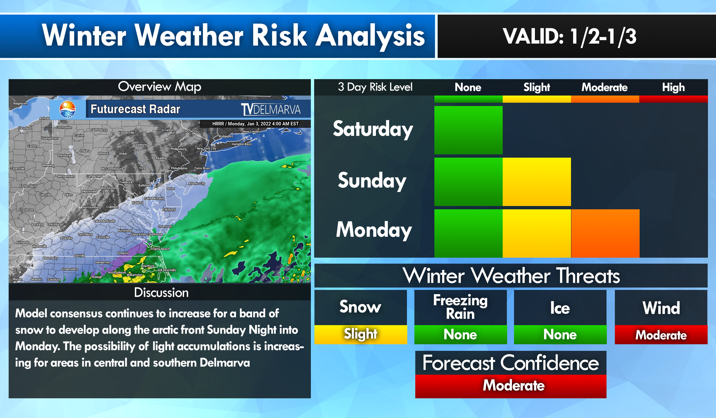
Let’s first begin with the snow threat going into Thursday morning. We will be having a arctic front that will be slowing sinking southward across the Mid-Atlantic taking temperatures in the 40’s down to subfreezing. In addition with a transition of rain…
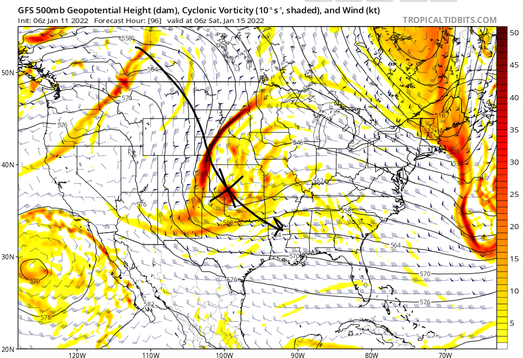
Like I was mentioning yesterday, we are heading into a fairly volatile pattern to finish out the month of January. With the Polar vortex anchoring around the Hudson Bay, this will allow a persistent long wave trough across the Eastern half of…
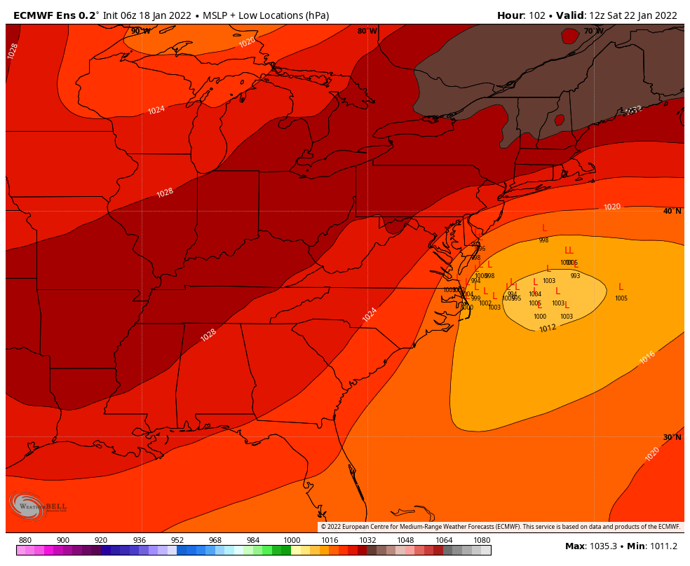
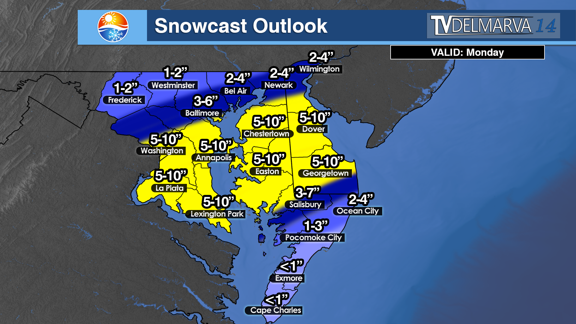
Do not let these warm conditions fool you of the arctic snap that’s on our doorsteps today. With a very significant shift in the forecast trending towards the potential biggest storm in the region since 2019. Around this time in 24 hours,…
Going to be in for some wacky weather over the next 36-48 hours. First off off we are dealing with very mild temperatures in the 60’s before a arctic front passage pushing through Sunday evening. The arctic front will push through dropping…