Today marks the 12th anniversary of Superstorm Sandy, one of the most destructive and unique storms to ever impact the eastern United States. Known for its unparalleled size and intensity, Sandy left a trail of devastation, particularly in the Mid-Atlantic and Delmarva…
Georgetown’s 30-Day Rainfall Absence Marks Unprecedented Drought Conditions For 30 consecutive days, Georgetown and surrounding areas across Delmarva have gone without measurable rainfall, plunging the region into severe drought. The consequences of this prolonged dry spell are mounting rapidly: in just the…
Farmers across Delaware are facing severe challenges as a prolonged drought continues to devastate agriculture, leaving crops parched and harvests in jeopardy. With no significant rainfall in the forecast, the risk to both crops and the environment is escalating. In addition to…
The Orionid meteor shower is an exciting annual event, and in 2024, the peak is expected on October 20 at 18:14 UTC. If you’re planning to watch, the best times are the early mornings of October 20 and 21, from after midnight…
The Delmarva Peninsula is currently experiencing one of its driest periods on record, with no measurable rainfall for several weeks. Unfortunately, according to the latest outlook, this dry spell is expected to persist for at least another two weeks, potentially placing Delmarva…
A fast-moving coronal mass ejection (CME) erupted from the Sun on the evening of October 8, 2024, and is projected to reach Earth by October 10. This CME, associated with a long-duration X1.8 solar flare, is moving at an estimated speed of…
Astronomy enthusiasts and casual stargazers alike are gearing up for a celestial treat as Comet C/2023 A3 (Tsuchinshan-ATLAS) makes its grand appearance in the evening skies of the Northern Hemisphere following the 12th of October. Brightening steadily, C/2023 A3 is already captivating…
Starting this Sunday, the East Coast, particularly the Delmarva region, will see increased wave activity as long-period swells from Major Hurricane Kirk arrive. Currently a powerful Category 4 storm, Kirk is churning in the central Atlantic, far from land. However, the hurricane’s…
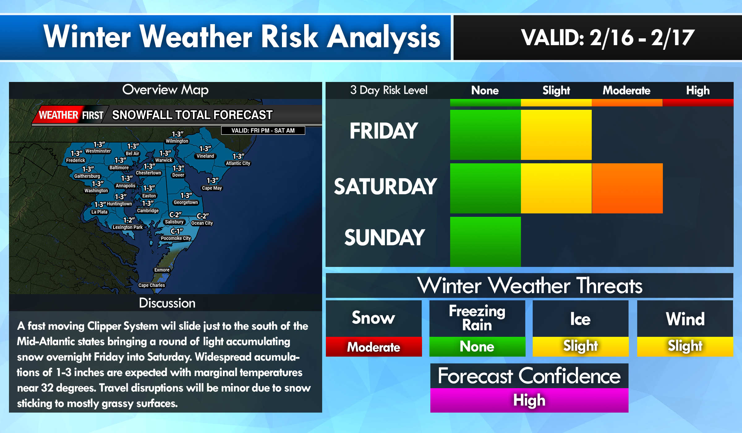
A period of light snow from a clipper system will arrive during the late overnight hours on Friday through the early morning hours Saturday. A fast moving area of low pressure from the Northern Plains will race just to the south of…
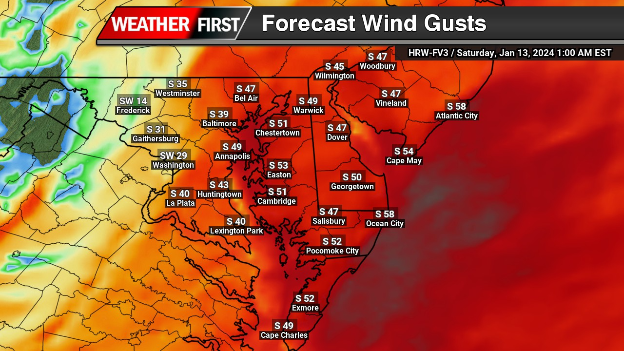
Although the next storm system is another big one moving through the same areas as the last one, this one will not have that extreme punch like this one will. Still will be a nuisance to say the least. Strong winds will…